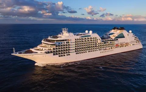
سيبورن7731A
رحلة 14 يومًا إلى الأنهار الجليدية، الفجوردات والممر الداخلي في ألاسكا
Date
2027-05-28
Duration
14 nights
Departure Port
فانكوفر
كندا
Arrival Port
فانكوفر
كندا
Rating
Luxury
Theme
—
Date
2027-05-28
Duration
14 nights
Departure Port
فانكوفر
كندا
Arrival Port
فانكوفر
كندا
Rating
Luxury
Theme
—

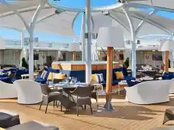




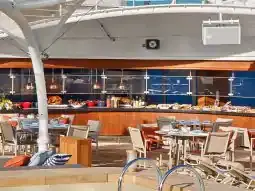
سيبورن
2016
—
40,350 GT
600
266
330
690 m
28 m
19 knots
No
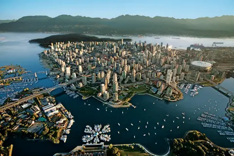
مضغوط بين المحيط الهادئ وجبال الساحل، فانكوفر هي البوابة الطبيعية إلى ممر ألاسكا الداخلي — مدينة حيث يلتقي الغابات المطيرة المعتدلة مع الأبراج الزجاجية وحيث يحدد سرطان البحر دنجينس وسالمون السوكاي البري مطبخ المحيط الهادئ الذي ينافس أي مطبخ في أمريكا الشمالية. امشِ على جدار البحر في حديقة ستانلي بطول 22 كيلومترًا، واغمر نفسك في سوق جزيرة غرانويل، ثم استقل العبارة إلى روعة إدواردية في فيكتوريا. موسم الرحلات البحرية إلى ألاسكا يصل ذروته من مايو إلى سبتمبر، مما يجعل فانكوفر نقطة انطلاق مثالية لأحد أعظم الرحلات البحرية في العالم.
The Seymour Narrows is a 3-mile/5 km stretch of the Discovery Channel north of Vancouver Island, British Columbia that is notorious for the strength of the tidal currents flowing through it. The average width of the narrows is just 750 meters. During extreme tides, the current through the narrows is subject to severe Venturi effect, resulting in an increased velocity that can reach 15 knots. For much of its modern history, there was an additional hazard in the narrows called Ripple Rock, a shallow obstruction that claimed no fewer than 119 ships and 114 lives. In 1958, after months of tunneling and preparation, Ripple Rock was blown up in the largest commercial, non-nuclear explosion ever recorded in North America. Still, the navigation of Seymour Narrows is dependent on tidal and other conditions, and requires skill and technical accomplishment.
The Queen Charlotte Sound lies between the Queen Charlotte Strait, which winds between Vancouver Island and the British Columbia mainland in the south, and Hecate Strait, which is northward, adjacent to the Haida Gwaii Islands off the Pacific coast of British Columbia. It is a broad reach in the long shipping route called the Inside Passage threading the myriad islands stretching from Washington’s Puget Sound to Alaska.
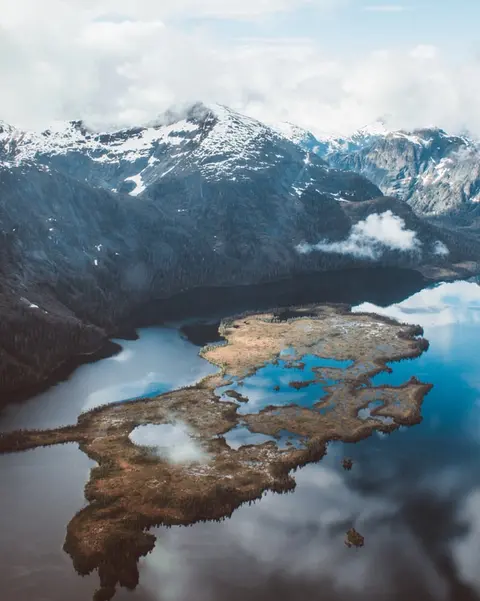
كيشكان تتشبث بالشاطئ المشجر لجزيرة ريفيلاجيغيدو في الطرف الجنوبي الشرقي من ألاسكا - مدينة ضيقة لدرجة أن السكان المحليين يمزحون بأنها تمتد لثلاثة أميال وطولها ثلاثة شوارع. تعتبرها قبيلة التلينغيت مكانًا مقدسًا لصيد السلمون منذ آلاف السنين، وهي اليوم مشهورة كعاصمة الأعمدة الطوطمية في العالم: المجموعات في قرية ساكسمن الأصلية وحديقة توتم بايت التاريخية تحافظ على أكبر تركيز لهذه الأعمال الفنية الضخمة في أي مكان. يجب عدم تفويت شارع كريك، وهو ممشى من منازل تاريخية ملونة مبنية فوق كريك كيشكان. يجلب الصيف (مايو - سبتمبر) أفضل الطقس، مع تدفق السلمون في الأنهار أدناه.
In the passage between Sumner Strait and Clarence Strait in Southeast Alaska’s Alexander Archipelago, midway between Price of Wales Island on the west and Zarembo Island on the east, is a small cluster of islands with a picturesque passageway between them called Snow Pass. It makes a scenic up-close route for your Seabourn ship during the transit.
Decision Passage is the western end of the Sumner Strait, which runs through the Alexander Archipelago into the Pacific Ocean in Southeastern Alaska, bounded on the north by Kuiu Island and Cape Decision, the location of a 1932 lighthouse. This is the route your ship takes when coming from or going to the colorful historic community of Sitka on the west coast of Baranof Island, which was originally the Russian fortress town of New Archangel.
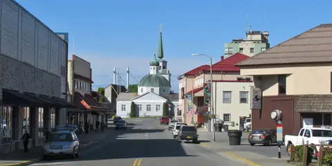
سيتكا، الواقعة على الساحل الغربي البري لجزيرة بارانوف في جنوب شرق ألاسكا، هي واحدة من أكثر الموانئ تاريخيًا في شمال غرب المحيط الهادئ — مكان ترتفع فيه قباب البصل الأرثوذكسية الروسية فوق الأعمدة الطوطمية والغابات المعتدلة الكبيرة تضغط نحو حافة الماء. يحافظ منتزه سيتكا الوطني التاريخي على موقع المعركة عام 1804 بين محاربي التلينغيت والمستعمرين الروس إلى جانب مجموعة رائعة من الأعمدة التذكارية. تشمل تجربة الهواء الطلق مشاهدة الحيتان، والتجديف في البحر بين ثعالب البحر، ومراقبة الدببة البنية في البرية المحيطة. يوفر مايو حتى سبتمبر أفضل الظروف للوصول والضوء الساطع.
Yakutat Bay is 18 miles wide at its entry, and cuts from the Gulf of Alaska into Disenchantment Bay, the entryway to the huge Hubbard Glacier, North America’s largest tidewater glacier. As the bay narrows and the shorelines draw closer, the 400-foot face of the glacier exerts a luminous, ghostly presence, often from as much as 30 miles away. More and more floating ice dimples the surface of the water, and seals bob up and disappear again. The chilled air from the glacier flows in a downdraft of cold that gives rise to mists and gray clouds, through which the vivid blue of the ice wall shimmers. It is an impressive sight of nature’s immense raw workplace, shaping the earth itself as part of an endless cycle of water from the sea evaporating to the sky, falling as snow on the heights and inching over centuries back again to the sea.
The Hubbard Glacier is the largest, and one of the most spectacular tidewater glaciers in North America. Its ice cliffs, some 400’ (121 m) tall, calve icebergs into the fjord, which may frequently be larger than a five-story building. The glacier’s surface is creased and contorted, resembling the wrinkled skin of a giant elephant. Records show it has been growing in thickness and advancing since 1895. This stands in stark contrast to other glaciers around the world, most of which have been receding during the past century. In 2002, the glacier blocked Russell Fjord for two and a half months, raising water levels 61’ (18 m) and threatening local communities with flooding. Nutrient-rich waters along the glacier face attract many species. Gulls and kittiwake colonies adorn smaller islands and harbor seals patrol the icy waters. In 1890, Israel Russell explored the area of Yakutat Bay and Hubbard Glacier, naming it after Gardiner G. Hubbard, a financier of his expedition and a founder and the first president of the National Geographic Society. VIEW CRUISES
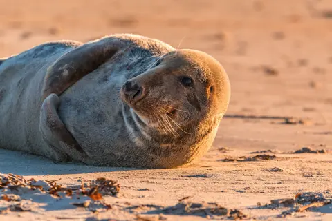
جزر إينيان هي مجموعة برية وغير مأهولة عند مدخل صوت كروس في ألاسكا، مشهورة بلقاءات الحياة البرية الاستثنائية بما في ذلك تغذية الحيتان الحدباء باستخدام فقاعات الشبكة ومستعمرات أسود البحر العملاقة. تشمل الأنشطة التي يجب القيام بها رحلات زودياك على طول الشواطئ الصخرية للجزر، ومشاهدة تغذية الحيتان التعاونية، واستكشاف برك المد والجزر المليئة بالحياة البحرية. يُفضل الزيارة في يوليو وأغسطس للحصول على أعلى نشاط للحيتان وأفضل ظروف البحر.
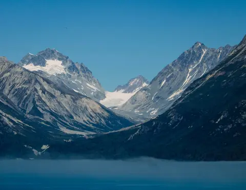
نقطة آيسي سترايت هي ميناء ألاسكي مذهل معروف بجماله الطبيعي الخلاب وثقافته الغنية من السكان الأصليين التلينغيت. تشمل التجارب التي يجب القيام بها تذوق المأكولات البحرية المحلية الطازجة والانطلاق في رحلات الحياة البرية في حديقة خليج الجليد الوطنية. أفضل موسم للزيارة هو خلال أشهر الصيف، عندما يكون الطقس معتدلاً والحياة البرية وفيرة.
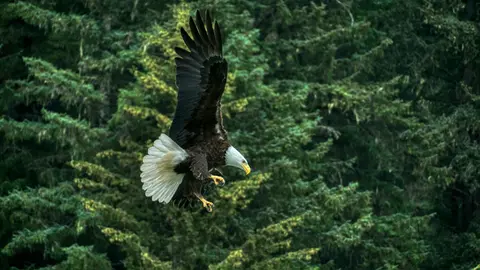
هاينس هي مدينة ألاسكية أصيلة تقع على أعمق فيورد في أمريكا الشمالية، وهي موطن لأكبر تجمع للنسور الصلعاء في العالم — يصل عددها إلى أربعة آلاف طائر على طول نهر تشيلكات — ومجتمع فني مزدهر يحافظ على تقاليد الثقافة التلينغيت. يمكن زيارة هاينس من يونيو إلى أغسطس عبر خطوط كوينارد أو ليندبلاد للهبوط بالمروحيات على الأنهار الجليدية والمشي على السواحل، أو من أكتوبر إلى فبراير لمشاهدة عرض النسور الاستثنائي الذي يجعل من هاينس أحد أسرار ألاسكا المحفوظة.
Lynn Canal is a 90-mile long inlet into Alaska’s coast running from the Chilkat River in the north to the Chatham Strait and Stephens Passage in the south. Because it connects the towns of Skagway and Haines to Juneau and the rest of the Inside Passage, it is an important shipping lane for ferries, cargo and cruise ships, and was a crucial passageway to the Klondike gold fields during the Gold Rush. It was discovered by Joseph Whidbey in 1794 and named by George Vancouver after his birthplace, King’s Lynn in Norfolk, England. More than 2,000 feet in depth, it is one of the deepest and longest fjords in the world, and the deepest in North America outside Greenland.
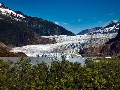
جونيو، عاصمة ولاية أمريكا الوحيدة التي لا يمكن الوصول إليها عبر الطرق، تكافئ الرحلة بعظمة برية لا يمكن لمثلها من المدن على وجه الأرض أن تنافسها. يقع نهر ميدنهال الجليدي — نهر حي من الجليد القديم — على بعد خمس عشرة دقيقة فقط من وسط المدينة، حيث تطير الطائرات العائمة فوق واجهة مائية محاطة بجبال مغطاة بالصنوبر تتدفق مباشرة إلى البحر. التجربة الأساسية هي الهبوط بالمروحية على قمة حقل الجليد أو رحلة لمشاهدة الحيتان في ممر ستيفنز، حيث تقفز الحيتان الحدباء بالقرب بشكل مذهل. يكون الجو في يونيو أكثر دفئًا حتى أغسطس، على الرغم من أن أيام الصيف قد تجلب الأمطار الشهيرة في جنوب شرق ألاسكا التي تحافظ على الغابات المطيرة مضيئة بشكل دائم.
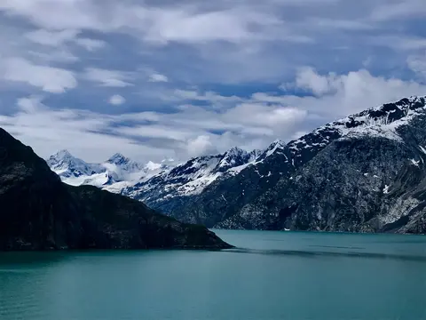
حديقة غلاسير باي الوطنية هي واحدة من أكثر المناظر الطبيعية عمقًا للتجلد النشط على وجه الأرض - 3.3 مليون فدان من جنوب شرق ألاسكا حيث تتفكك الأنهار الجليدية البحرية إلى كتل جليدية بحجم الكاتدرائيات في مضائق المياه الزرقاء المتلألئة، وحيث لا يزال اليابس يرتفع، محررًا من وزن الجليد الذي دفن هذه المنطقة بأكملها قبل قرنين فقط. الحديقة، التي يمكن الوصول إليها فقط عن طريق السفن أو الطائرات الصغيرة، تكافئ الزوار بلقاءات مع الحياة البرية - الحيتان الحدباء، والدببة البنية، وعناقيد البحر، والماعز الجبلي - في مشهد من العظمة الساحقة. تمتد الموسم من مايو إلى سبتمبر؛ حيث تقدم أواخر يونيو ويوليو أطول الأيام وأكثر أنشطة الحياة البرية موثوقية.
Decision Passage is the western end of the Sumner Strait, which runs through the Alexander Archipelago into the Pacific Ocean in Southeastern Alaska, bounded on the north by Kuiu Island and Cape Decision, the location of a 1932 lighthouse. This is the route your ship takes when coming from or going to the colorful historic community of Sitka on the west coast of Baranof Island, which was originally the Russian fortress town of New Archangel.
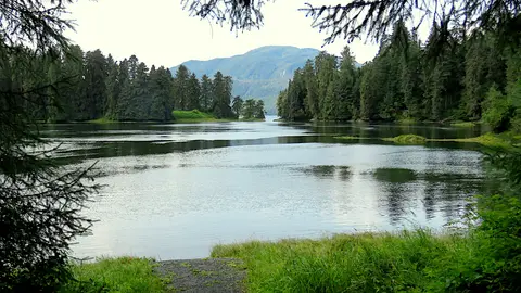
رانغيل هي واحدة من أكثر موانئ ألاسكا أصالة في ممر الداخل، حيث تتقاطع التراث التلينغيت، والنقوش الصخرية القديمة، والحياة البرية ذات المستوى العالمي عند مصب نهر ستكين القوي. تشمل التجارب الأساسية ركوب القوارب النفاثة إلى نهر ليكونتي الجليدي، ومشاهدة الدببة وهي تصطاد في مجرى نهر آنان، وتذوق سمك السلمون المدخن محليًا. توفر شهري يوليو وأغسطس ذروة هجرة السلمون ومشاهدة الدببة.
Stikine Strait is a picturesque channel in the Alexander Archipelago of Alaska between Zarembo Island and Woronkofski and Etolin Islands near the mouth of the Stikine River south of Wrangell. It first appears on an 1848 Russian chart as Stakhin Strait and has been spelled variously on many charts since that time.
The 108-mile Behm Canal runs from the Clarence Strait through the Alexander Archipelago of Southeast Alaska, and into the channel separating Revillagigedo Island from the mainland. It forms part Inside Passage on the route between Ketchikan and the Misty Fjords National Monument. The canal was named by George Vancouver during his surveying expedition in 1793, in honor of Magnus von Behm, who had been governor of Kamchatka in the Russian Far East when Vancouver called at Petropavlovsk with Captain Cook’s expedition following the Cook’s murder in Hawaii.
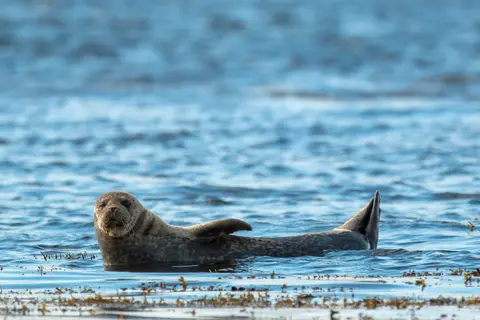
نصب فيوردس الوطني هو منطقة برية تبلغ مساحتها 930,000 هكتار في جنوب شرق ألاسكا، حيث ترتفع المنحدرات الجرانيتية الشاهقة من فيوردات هادئة عبر حجاب دائم من الضباب والسحب. يجب القيام به هو التجديف عبر أذرع الفيورد الصامتة، والإبحار في زودياك بجوار الشلالات وصخرة نيو إيدستون البركانية، ومراقبة الدببة، والنسور، والأوركا في القنوات البكر. من مايو إلى سبتمبر هو موسم الزيارة، مع إضافة الأمطار إلى الجو الأثيري للنصب.
Misty Fjords National Monument is a section of the Tongass National Forest in Alaska’s extreme southeastern Panhandle region. The monument consists of over two million acres of deeply cut fjords cradled in U-shaped valleys between mountain ranges rising 2,000 to 3,000 feet above sea level. The fjords themselves extend as much as 1,000 feet below the surface. These granite ranges are covered with virgin forest, and most of the monument is also a dedicated wilderness area. Misty Fjords inspired the explorer John Muir to proclaim them among the most beautiful places he had ever seen. Your ship will cruise among these spectacular forests, waterfalls and mountains. The onboard Ventures by Seabourn team will offer optional excursions including kayaking the fjords and a short sightseeing floatplane flight.
الأمير روبرت، محطة السكك الحديدية التاريخية على الساحل الشمالي لكولومبيا البريطانية، يسحر الزوار بإرثه العميق من تسيمشيان، وصيد الهلبوت من الطراز العالمي، ومناظر الغابات الممطرة الضبابية على طول الممر الداخلي. تذوق سمك السلمون المدخن حديثًا على الواجهة البحرية واستكشف مصنع الشحن الشمالي الهادئ، أقدم مصنع تعليب في كندا، لتجربة حيوية مع روح الميناء البحرية. أفضل وقت للزيارة هو من يونيو إلى أغسطس، عندما تخفف الأيام الأطول من الأمطار الشهيرة وتصل ذروة نشاط الحياة البرية على الساحل.
Grenville Channel is a long, well-protected channel along the northern British Columbia coast between the large Pitt Island and the mainland. It is an important shipping lane, and you are likely to see ships of many different types and sizes as you pass through. The shores are mountainous on both sides, with two notable peaks about halfway through, Mt. Batchellor on the east side and Mt. Saunders on Pitt Island to the west. There are a number of Indian Reserves and Marine Parks in the mountains and narrow waterways off the channel.
Whale Channel is a picturesque waterway separating Gil Island from Princess Royal Island in British Columbia’s Inside Passage. Surrounded by snow-capped mountain ranges and teeming with marine life, It is a diversion from the main shipping lane, located roughly halfway between Prince Rupert and the First Nations village of Klemtu. VIEW CRUISES Skip Footer Content About Us
The Princess Royal Channel separates the largest island along British Columbia’s coast from the mainland. It is located roughly halfway between Bella Bella in the south and Prince Rupert in the north, in one of the province’s most remote areas. Princess Royal island was named in 1788 by Captain Charles Duncan, in honor of his ship, the Princess Royal. The island is uninhabited, although there are two small villages in the channel, the First Nations community of Klemtu on Swindle Island and Hartley Bay on the mainland. Wildlife, by contrast, is plentiful, including Kermode, black and grizzly bears, deer, wolves and foxes. Golden and bald eagles nest in the region, as well as the endangered marbled murrelet. In the waters, there are abundant salmon, elephant seals, whales, orcas and dolphins.
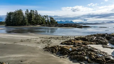
أليرت باي، كندا هي مدينة ميناء مميزة حيث يلتقي التراث الثقافي العميق مع الأجواء المحلية الأصيلة، وهي مدرجة في مسارات رحلات HX Expeditions. تشمل التجارب التي يجب القيام بها السير في المركز التاريخي لتجربة التراث المعماري المتعدد الطبقات، والبحث عن التقاليد الطهو الإقليمية في منشأة محلية مفضلة بعيدة عن منطقة الميناء. الوقت الأمثل للزيارة هو من يونيو إلى أغسطس، عندما تجلب أشهر الصيف أعلى درجات الحرارة وأطول الأيام.
Johnstone Strait is a well-protected shipping route passing 68 miles/110 km along the northeast shore of Vancouver Island between the island and the mainland of British Columbia. The strait is between 1 ½ miles and 3 miles wide, and leads from the broad Georgia Strait through a narrow channel called Discovery Passage. The strait was named by Vancouver in 1792 for James Johnstone, the master of one of his tenders during the survey expedition that revealed Vancouver Island to be an island. There are no cities or towns on the strait. The Johnstone Strait is the summer range of a large pod of seasonally resident orcas which are frequently seen in the area. VIEW CRUISES Skip Footer Content About Us Our Company News Careers Contact Us Video Gallery Accessibility Seabourn Club Seabourn Referral Program Travel Resources
The Seymour Narrows is a 3-mile/5 km stretch of the Discovery Channel north of Vancouver Island, British Columbia that is notorious for the strength of the tidal currents flowing through it. The average width of the narrows is just 750 meters. During extreme tides, the current through the narrows is subject to severe Venturi effect, resulting in an increased velocity that can reach 15 knots. For much of its modern history, there was an additional hazard in the narrows called Ripple Rock, a shallow obstruction that claimed no fewer than 119 ships and 114 lives. In 1958, after months of tunneling and preparation, Ripple Rock was blown up in the largest commercial, non-nuclear explosion ever recorded in North America. Still, the navigation of Seymour Narrows is dependent on tidal and other conditions, and requires skill and technical accomplishment.
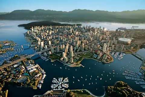
مضغوط بين المحيط الهادئ وجبال الساحل، فانكوفر هي البوابة الطبيعية إلى ممر ألاسكا الداخلي — مدينة حيث يلتقي الغابات المطيرة المعتدلة مع الأبراج الزجاجية وحيث يحدد سرطان البحر دنجينس وسالمون السوكاي البري مطبخ المحيط الهادئ الذي ينافس أي مطبخ في أمريكا الشمالية. امشِ على جدار البحر في حديقة ستانلي بطول 22 كيلومترًا، واغمر نفسك في سوق جزيرة غرانويل، ثم استقل العبارة إلى روعة إدواردية في فيكتوريا. موسم الرحلات البحرية إلى ألاسكا يصل ذروته من مايو إلى سبتمبر، مما يجعل فانكوفر نقطة انطلاق مثالية لأحد أعظم الرحلات البحرية في العالم.
Day 1
مضغوط بين المحيط الهادئ وجبال الساحل، فانكوفر هي البوابة الطبيعية إلى ممر ألاسكا الداخلي — مدينة حيث يلتقي الغابات المطيرة المعتدلة مع الأبراج الزجاجية وحيث يحدد سرطان البحر دنجينس وسالمون السوكاي البري مطبخ المحيط الهادئ الذي ينافس أي مطبخ في أمريكا الشمالية. امشِ على جدار البحر في حديقة ستانلي بطول 22 كيلومترًا، واغمر نفسك في سوق جزيرة غرانويل، ثم استقل العبارة إلى روعة إدواردية في فيكتوريا. موسم الرحلات البحرية إلى ألاسكا يصل ذروته من مايو إلى سبتمبر، مما يجعل فانكوفر نقطة انطلاق مثالية لأحد أعظم الرحلات البحرية في العالم.
The Seymour Narrows is a 3-mile/5 km stretch of the Discovery Channel north of Vancouver Island, British Columbia that is notorious for the strength of the tidal currents flowing through it. The average width of the narrows is just 750 meters. During extreme tides, the current through the narrows is subject to severe Venturi effect, resulting in an increased velocity that can reach 15 knots. For much of its modern history, there was an additional hazard in the narrows called Ripple Rock, a shallow obstruction that claimed no fewer than 119 ships and 114 lives. In 1958, after months of tunneling and preparation, Ripple Rock was blown up in the largest commercial, non-nuclear explosion ever recorded in North America. Still, the navigation of Seymour Narrows is dependent on tidal and other conditions, and requires skill and technical accomplishment.
Day 2
The Queen Charlotte Sound lies between the Queen Charlotte Strait, which winds between Vancouver Island and the British Columbia mainland in the south, and Hecate Strait, which is northward, adjacent to the Haida Gwaii Islands off the Pacific coast of British Columbia. It is a broad reach in the long shipping route called the Inside Passage threading the myriad islands stretching from Washington’s Puget Sound to Alaska.
Day 3
كيشكان تتشبث بالشاطئ المشجر لجزيرة ريفيلاجيغيدو في الطرف الجنوبي الشرقي من ألاسكا - مدينة ضيقة لدرجة أن السكان المحليين يمزحون بأنها تمتد لثلاثة أميال وطولها ثلاثة شوارع. تعتبرها قبيلة التلينغيت مكانًا مقدسًا لصيد السلمون منذ آلاف السنين، وهي اليوم مشهورة كعاصمة الأعمدة الطوطمية في العالم: المجموعات في قرية ساكسمن الأصلية وحديقة توتم بايت التاريخية تحافظ على أكبر تركيز لهذه الأعمال الفنية الضخمة في أي مكان. يجب عدم تفويت شارع كريك، وهو ممشى من منازل تاريخية ملونة مبنية فوق كريك كيشكان. يجلب الصيف (مايو - سبتمبر) أفضل الطقس، مع تدفق السلمون في الأنهار أدناه.
In the passage between Sumner Strait and Clarence Strait in Southeast Alaska’s Alexander Archipelago, midway between Price of Wales Island on the west and Zarembo Island on the east, is a small cluster of islands with a picturesque passageway between them called Snow Pass. It makes a scenic up-close route for your Seabourn ship during the transit.
Decision Passage is the western end of the Sumner Strait, which runs through the Alexander Archipelago into the Pacific Ocean in Southeastern Alaska, bounded on the north by Kuiu Island and Cape Decision, the location of a 1932 lighthouse. This is the route your ship takes when coming from or going to the colorful historic community of Sitka on the west coast of Baranof Island, which was originally the Russian fortress town of New Archangel.
Day 4
سيتكا، الواقعة على الساحل الغربي البري لجزيرة بارانوف في جنوب شرق ألاسكا، هي واحدة من أكثر الموانئ تاريخيًا في شمال غرب المحيط الهادئ — مكان ترتفع فيه قباب البصل الأرثوذكسية الروسية فوق الأعمدة الطوطمية والغابات المعتدلة الكبيرة تضغط نحو حافة الماء. يحافظ منتزه سيتكا الوطني التاريخي على موقع المعركة عام 1804 بين محاربي التلينغيت والمستعمرين الروس إلى جانب مجموعة رائعة من الأعمدة التذكارية. تشمل تجربة الهواء الطلق مشاهدة الحيتان، والتجديف في البحر بين ثعالب البحر، ومراقبة الدببة البنية في البرية المحيطة. يوفر مايو حتى سبتمبر أفضل الظروف للوصول والضوء الساطع.
Day 5
Yakutat Bay is 18 miles wide at its entry, and cuts from the Gulf of Alaska into Disenchantment Bay, the entryway to the huge Hubbard Glacier, North America’s largest tidewater glacier. As the bay narrows and the shorelines draw closer, the 400-foot face of the glacier exerts a luminous, ghostly presence, often from as much as 30 miles away. More and more floating ice dimples the surface of the water, and seals bob up and disappear again. The chilled air from the glacier flows in a downdraft of cold that gives rise to mists and gray clouds, through which the vivid blue of the ice wall shimmers. It is an impressive sight of nature’s immense raw workplace, shaping the earth itself as part of an endless cycle of water from the sea evaporating to the sky, falling as snow on the heights and inching over centuries back again to the sea.
The Hubbard Glacier is the largest, and one of the most spectacular tidewater glaciers in North America. Its ice cliffs, some 400’ (121 m) tall, calve icebergs into the fjord, which may frequently be larger than a five-story building. The glacier’s surface is creased and contorted, resembling the wrinkled skin of a giant elephant. Records show it has been growing in thickness and advancing since 1895. This stands in stark contrast to other glaciers around the world, most of which have been receding during the past century. In 2002, the glacier blocked Russell Fjord for two and a half months, raising water levels 61’ (18 m) and threatening local communities with flooding. Nutrient-rich waters along the glacier face attract many species. Gulls and kittiwake colonies adorn smaller islands and harbor seals patrol the icy waters. In 1890, Israel Russell explored the area of Yakutat Bay and Hubbard Glacier, naming it after Gardiner G. Hubbard, a financier of his expedition and a founder and the first president of the National Geographic Society. VIEW CRUISES
Day 6
جزر إينيان هي مجموعة برية وغير مأهولة عند مدخل صوت كروس في ألاسكا، مشهورة بلقاءات الحياة البرية الاستثنائية بما في ذلك تغذية الحيتان الحدباء باستخدام فقاعات الشبكة ومستعمرات أسود البحر العملاقة. تشمل الأنشطة التي يجب القيام بها رحلات زودياك على طول الشواطئ الصخرية للجزر، ومشاهدة تغذية الحيتان التعاونية، واستكشاف برك المد والجزر المليئة بالحياة البحرية. يُفضل الزيارة في يوليو وأغسطس للحصول على أعلى نشاط للحيتان وأفضل ظروف البحر.
نقطة آيسي سترايت هي ميناء ألاسكي مذهل معروف بجماله الطبيعي الخلاب وثقافته الغنية من السكان الأصليين التلينغيت. تشمل التجارب التي يجب القيام بها تذوق المأكولات البحرية المحلية الطازجة والانطلاق في رحلات الحياة البرية في حديقة خليج الجليد الوطنية. أفضل موسم للزيارة هو خلال أشهر الصيف، عندما يكون الطقس معتدلاً والحياة البرية وفيرة.
Day 7
هاينس هي مدينة ألاسكية أصيلة تقع على أعمق فيورد في أمريكا الشمالية، وهي موطن لأكبر تجمع للنسور الصلعاء في العالم — يصل عددها إلى أربعة آلاف طائر على طول نهر تشيلكات — ومجتمع فني مزدهر يحافظ على تقاليد الثقافة التلينغيت. يمكن زيارة هاينس من يونيو إلى أغسطس عبر خطوط كوينارد أو ليندبلاد للهبوط بالمروحيات على الأنهار الجليدية والمشي على السواحل، أو من أكتوبر إلى فبراير لمشاهدة عرض النسور الاستثنائي الذي يجعل من هاينس أحد أسرار ألاسكا المحفوظة.
Lynn Canal is a 90-mile long inlet into Alaska’s coast running from the Chilkat River in the north to the Chatham Strait and Stephens Passage in the south. Because it connects the towns of Skagway and Haines to Juneau and the rest of the Inside Passage, it is an important shipping lane for ferries, cargo and cruise ships, and was a crucial passageway to the Klondike gold fields during the Gold Rush. It was discovered by Joseph Whidbey in 1794 and named by George Vancouver after his birthplace, King’s Lynn in Norfolk, England. More than 2,000 feet in depth, it is one of the deepest and longest fjords in the world, and the deepest in North America outside Greenland.
Day 8
جونيو، عاصمة ولاية أمريكا الوحيدة التي لا يمكن الوصول إليها عبر الطرق، تكافئ الرحلة بعظمة برية لا يمكن لمثلها من المدن على وجه الأرض أن تنافسها. يقع نهر ميدنهال الجليدي — نهر حي من الجليد القديم — على بعد خمس عشرة دقيقة فقط من وسط المدينة، حيث تطير الطائرات العائمة فوق واجهة مائية محاطة بجبال مغطاة بالصنوبر تتدفق مباشرة إلى البحر. التجربة الأساسية هي الهبوط بالمروحية على قمة حقل الجليد أو رحلة لمشاهدة الحيتان في ممر ستيفنز، حيث تقفز الحيتان الحدباء بالقرب بشكل مذهل. يكون الجو في يونيو أكثر دفئًا حتى أغسطس، على الرغم من أن أيام الصيف قد تجلب الأمطار الشهيرة في جنوب شرق ألاسكا التي تحافظ على الغابات المطيرة مضيئة بشكل دائم.
Day 9
حديقة غلاسير باي الوطنية هي واحدة من أكثر المناظر الطبيعية عمقًا للتجلد النشط على وجه الأرض - 3.3 مليون فدان من جنوب شرق ألاسكا حيث تتفكك الأنهار الجليدية البحرية إلى كتل جليدية بحجم الكاتدرائيات في مضائق المياه الزرقاء المتلألئة، وحيث لا يزال اليابس يرتفع، محررًا من وزن الجليد الذي دفن هذه المنطقة بأكملها قبل قرنين فقط. الحديقة، التي يمكن الوصول إليها فقط عن طريق السفن أو الطائرات الصغيرة، تكافئ الزوار بلقاءات مع الحياة البرية - الحيتان الحدباء، والدببة البنية، وعناقيد البحر، والماعز الجبلي - في مشهد من العظمة الساحقة. تمتد الموسم من مايو إلى سبتمبر؛ حيث تقدم أواخر يونيو ويوليو أطول الأيام وأكثر أنشطة الحياة البرية موثوقية.
Day 10
Decision Passage is the western end of the Sumner Strait, which runs through the Alexander Archipelago into the Pacific Ocean in Southeastern Alaska, bounded on the north by Kuiu Island and Cape Decision, the location of a 1932 lighthouse. This is the route your ship takes when coming from or going to the colorful historic community of Sitka on the west coast of Baranof Island, which was originally the Russian fortress town of New Archangel.
رانغيل هي واحدة من أكثر موانئ ألاسكا أصالة في ممر الداخل، حيث تتقاطع التراث التلينغيت، والنقوش الصخرية القديمة، والحياة البرية ذات المستوى العالمي عند مصب نهر ستكين القوي. تشمل التجارب الأساسية ركوب القوارب النفاثة إلى نهر ليكونتي الجليدي، ومشاهدة الدببة وهي تصطاد في مجرى نهر آنان، وتذوق سمك السلمون المدخن محليًا. توفر شهري يوليو وأغسطس ذروة هجرة السلمون ومشاهدة الدببة.
Stikine Strait is a picturesque channel in the Alexander Archipelago of Alaska between Zarembo Island and Woronkofski and Etolin Islands near the mouth of the Stikine River south of Wrangell. It first appears on an 1848 Russian chart as Stakhin Strait and has been spelled variously on many charts since that time.
Day 11
The 108-mile Behm Canal runs from the Clarence Strait through the Alexander Archipelago of Southeast Alaska, and into the channel separating Revillagigedo Island from the mainland. It forms part Inside Passage on the route between Ketchikan and the Misty Fjords National Monument. The canal was named by George Vancouver during his surveying expedition in 1793, in honor of Magnus von Behm, who had been governor of Kamchatka in the Russian Far East when Vancouver called at Petropavlovsk with Captain Cook’s expedition following the Cook’s murder in Hawaii.
نصب فيوردس الوطني هو منطقة برية تبلغ مساحتها 930,000 هكتار في جنوب شرق ألاسكا، حيث ترتفع المنحدرات الجرانيتية الشاهقة من فيوردات هادئة عبر حجاب دائم من الضباب والسحب. يجب القيام به هو التجديف عبر أذرع الفيورد الصامتة، والإبحار في زودياك بجوار الشلالات وصخرة نيو إيدستون البركانية، ومراقبة الدببة، والنسور، والأوركا في القنوات البكر. من مايو إلى سبتمبر هو موسم الزيارة، مع إضافة الأمطار إلى الجو الأثيري للنصب.
Misty Fjords National Monument is a section of the Tongass National Forest in Alaska’s extreme southeastern Panhandle region. The monument consists of over two million acres of deeply cut fjords cradled in U-shaped valleys between mountain ranges rising 2,000 to 3,000 feet above sea level. The fjords themselves extend as much as 1,000 feet below the surface. These granite ranges are covered with virgin forest, and most of the monument is also a dedicated wilderness area. Misty Fjords inspired the explorer John Muir to proclaim them among the most beautiful places he had ever seen. Your ship will cruise among these spectacular forests, waterfalls and mountains. The onboard Ventures by Seabourn team will offer optional excursions including kayaking the fjords and a short sightseeing floatplane flight.
Day 12
الأمير روبرت، محطة السكك الحديدية التاريخية على الساحل الشمالي لكولومبيا البريطانية، يسحر الزوار بإرثه العميق من تسيمشيان، وصيد الهلبوت من الطراز العالمي، ومناظر الغابات الممطرة الضبابية على طول الممر الداخلي. تذوق سمك السلمون المدخن حديثًا على الواجهة البحرية واستكشف مصنع الشحن الشمالي الهادئ، أقدم مصنع تعليب في كندا، لتجربة حيوية مع روح الميناء البحرية. أفضل وقت للزيارة هو من يونيو إلى أغسطس، عندما تخفف الأيام الأطول من الأمطار الشهيرة وتصل ذروة نشاط الحياة البرية على الساحل.
Day 13
Grenville Channel is a long, well-protected channel along the northern British Columbia coast between the large Pitt Island and the mainland. It is an important shipping lane, and you are likely to see ships of many different types and sizes as you pass through. The shores are mountainous on both sides, with two notable peaks about halfway through, Mt. Batchellor on the east side and Mt. Saunders on Pitt Island to the west. There are a number of Indian Reserves and Marine Parks in the mountains and narrow waterways off the channel.
Whale Channel is a picturesque waterway separating Gil Island from Princess Royal Island in British Columbia’s Inside Passage. Surrounded by snow-capped mountain ranges and teeming with marine life, It is a diversion from the main shipping lane, located roughly halfway between Prince Rupert and the First Nations village of Klemtu. VIEW CRUISES Skip Footer Content About Us
The Princess Royal Channel separates the largest island along British Columbia’s coast from the mainland. It is located roughly halfway between Bella Bella in the south and Prince Rupert in the north, in one of the province’s most remote areas. Princess Royal island was named in 1788 by Captain Charles Duncan, in honor of his ship, the Princess Royal. The island is uninhabited, although there are two small villages in the channel, the First Nations community of Klemtu on Swindle Island and Hartley Bay on the mainland. Wildlife, by contrast, is plentiful, including Kermode, black and grizzly bears, deer, wolves and foxes. Golden and bald eagles nest in the region, as well as the endangered marbled murrelet. In the waters, there are abundant salmon, elephant seals, whales, orcas and dolphins.
Day 14
أليرت باي، كندا هي مدينة ميناء مميزة حيث يلتقي التراث الثقافي العميق مع الأجواء المحلية الأصيلة، وهي مدرجة في مسارات رحلات HX Expeditions. تشمل التجارب التي يجب القيام بها السير في المركز التاريخي لتجربة التراث المعماري المتعدد الطبقات، والبحث عن التقاليد الطهو الإقليمية في منشأة محلية مفضلة بعيدة عن منطقة الميناء. الوقت الأمثل للزيارة هو من يونيو إلى أغسطس، عندما تجلب أشهر الصيف أعلى درجات الحرارة وأطول الأيام.
Johnstone Strait is a well-protected shipping route passing 68 miles/110 km along the northeast shore of Vancouver Island between the island and the mainland of British Columbia. The strait is between 1 ½ miles and 3 miles wide, and leads from the broad Georgia Strait through a narrow channel called Discovery Passage. The strait was named by Vancouver in 1792 for James Johnstone, the master of one of his tenders during the survey expedition that revealed Vancouver Island to be an island. There are no cities or towns on the strait. The Johnstone Strait is the summer range of a large pod of seasonally resident orcas which are frequently seen in the area. VIEW CRUISES Skip Footer Content About Us Our Company News Careers Contact Us Video Gallery Accessibility Seabourn Club Seabourn Referral Program Travel Resources
The Seymour Narrows is a 3-mile/5 km stretch of the Discovery Channel north of Vancouver Island, British Columbia that is notorious for the strength of the tidal currents flowing through it. The average width of the narrows is just 750 meters. During extreme tides, the current through the narrows is subject to severe Venturi effect, resulting in an increased velocity that can reach 15 knots. For much of its modern history, there was an additional hazard in the narrows called Ripple Rock, a shallow obstruction that claimed no fewer than 119 ships and 114 lives. In 1958, after months of tunneling and preparation, Ripple Rock was blown up in the largest commercial, non-nuclear explosion ever recorded in North America. Still, the navigation of Seymour Narrows is dependent on tidal and other conditions, and requires skill and technical accomplishment.
Day 15
مضغوط بين المحيط الهادئ وجبال الساحل، فانكوفر هي البوابة الطبيعية إلى ممر ألاسكا الداخلي — مدينة حيث يلتقي الغابات المطيرة المعتدلة مع الأبراج الزجاجية وحيث يحدد سرطان البحر دنجينس وسالمون السوكاي البري مطبخ المحيط الهادئ الذي ينافس أي مطبخ في أمريكا الشمالية. امشِ على جدار البحر في حديقة ستانلي بطول 22 كيلومترًا، واغمر نفسك في سوق جزيرة غرانويل، ثم استقل العبارة إلى روعة إدواردية في فيكتوريا. موسم الرحلات البحرية إلى ألاسكا يصل ذروته من مايو إلى سبتمبر، مما يجعل فانكوفر نقطة انطلاق مثالية لأحد أعظم الرحلات البحرية في العالم.
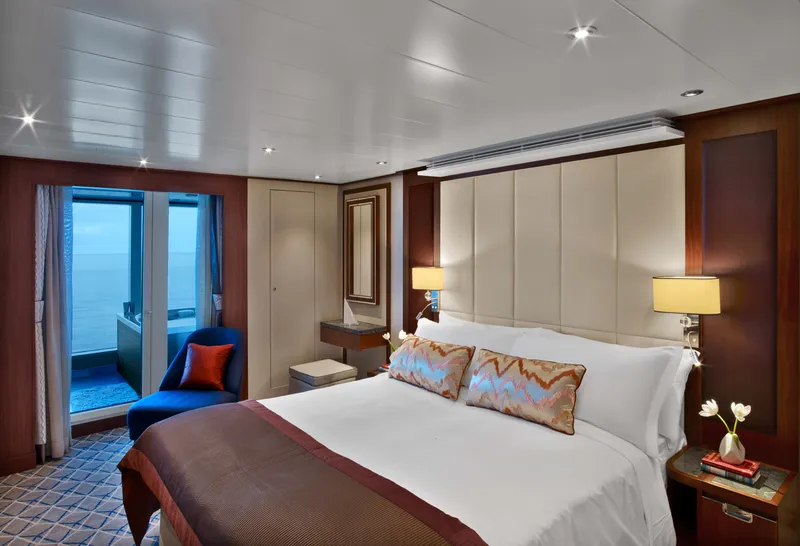
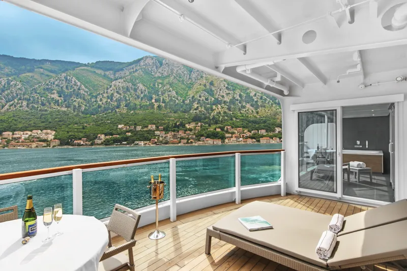
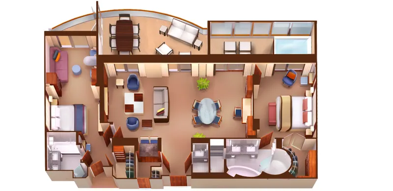
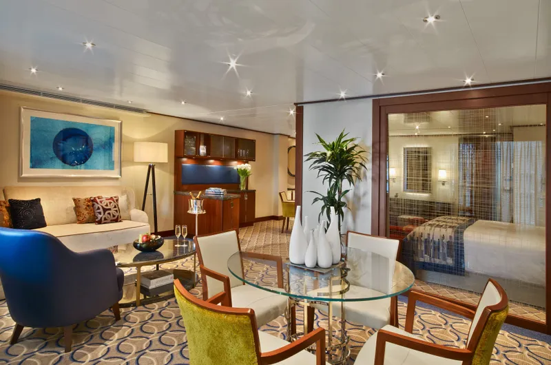
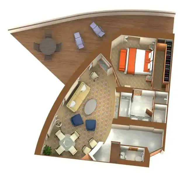
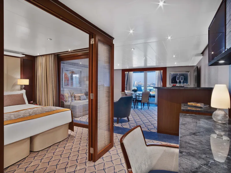
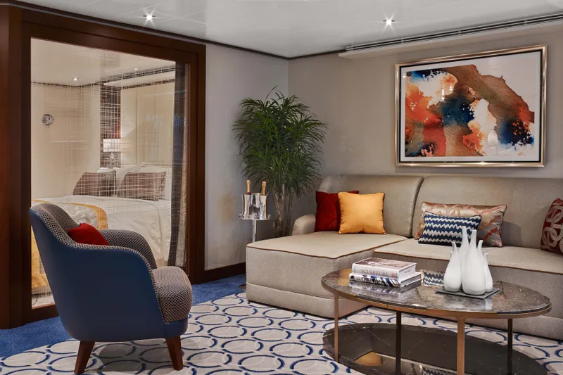
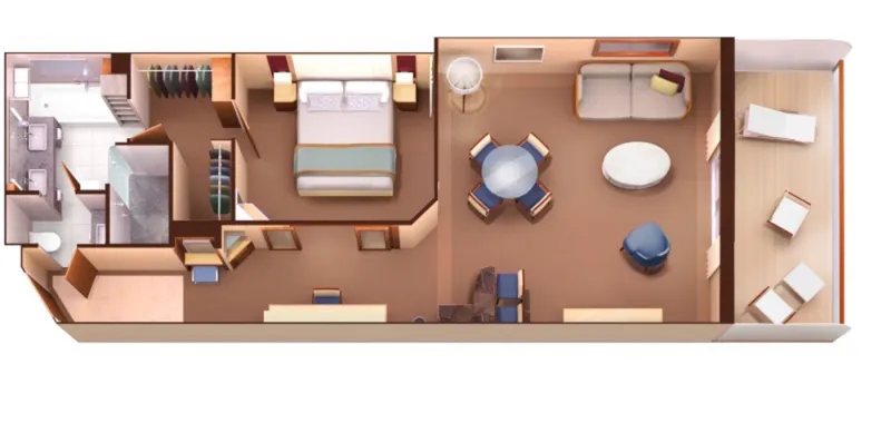
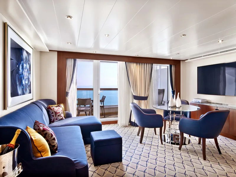

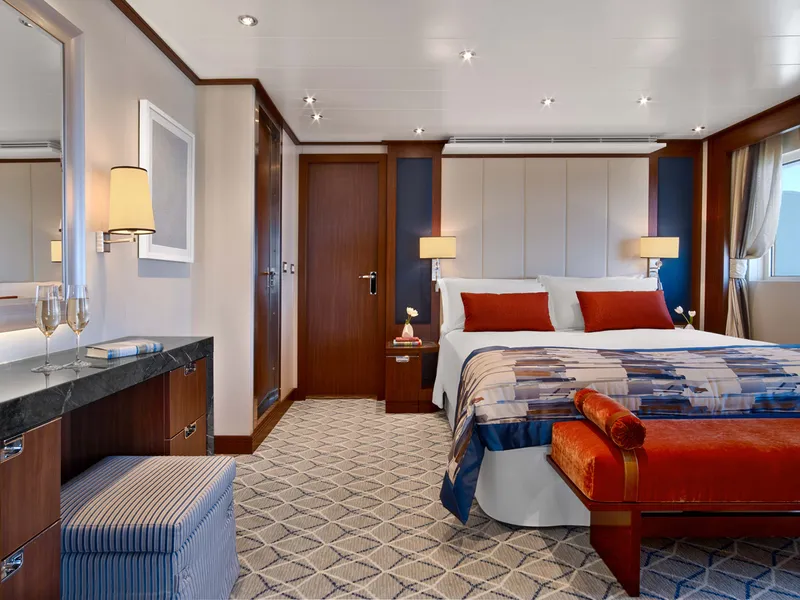
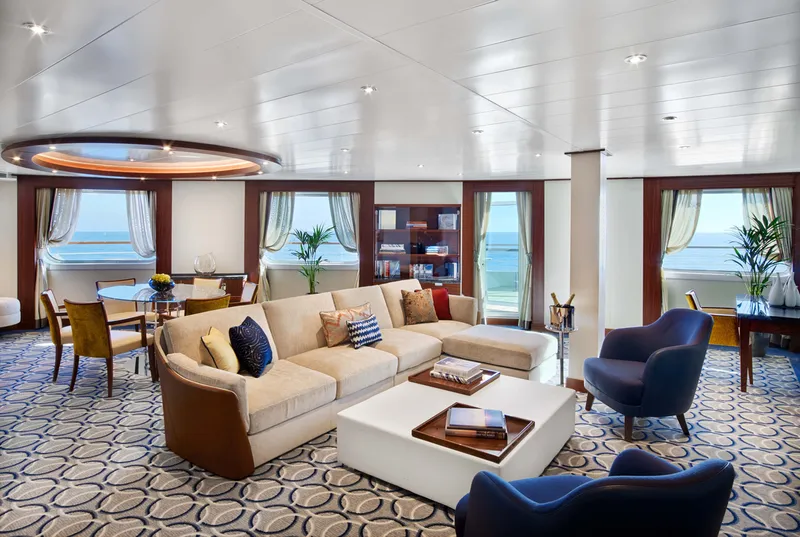
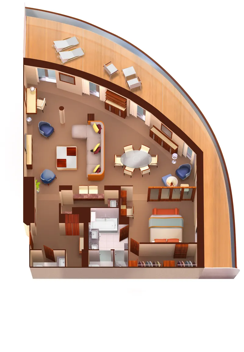
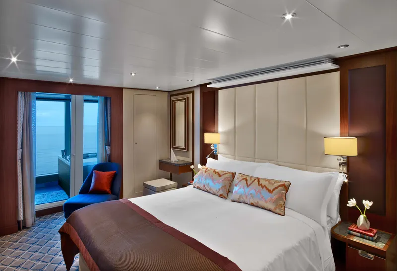

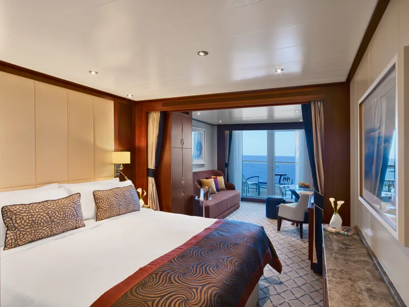
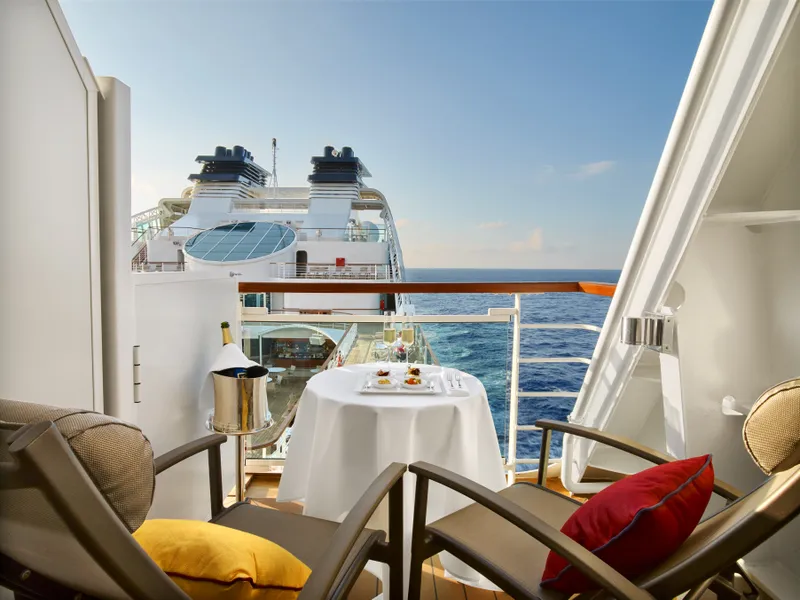

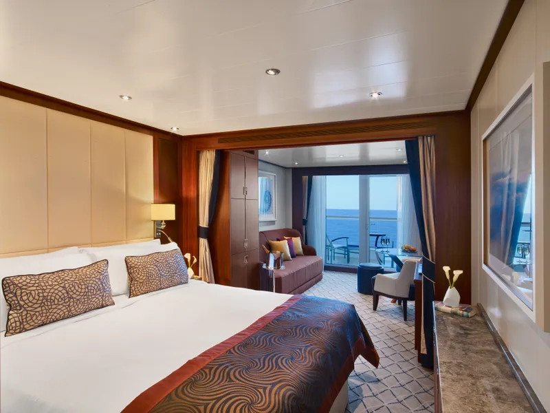
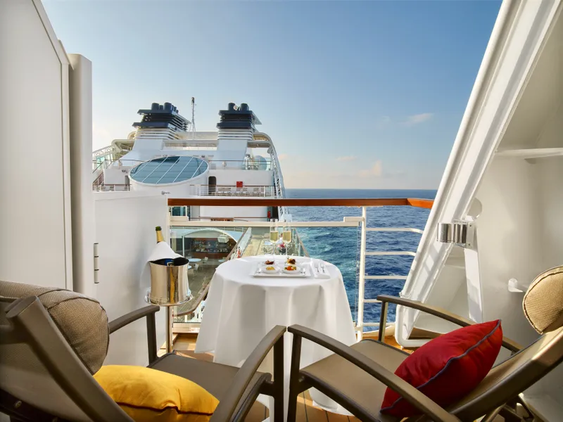

Our cruise specialists can help you find the perfect cabin and the best available pricing.
(+886) 02-2721-7300Contact Advisor