
Seabourn7747A
Alaska Glaciers, Fjords & Inside Passage
Date
July 23, 2027
Duration
14 nights
Departure Port
Vancouver · Canada
Arrival Port
Juneau · United States
Rating
Luxury
Theme
—
Date
July 23, 2027
Duration
14 nights
Departure Port
Vancouver · Canada
Arrival Port
Juneau · United States
Rating
Luxury
Theme
—
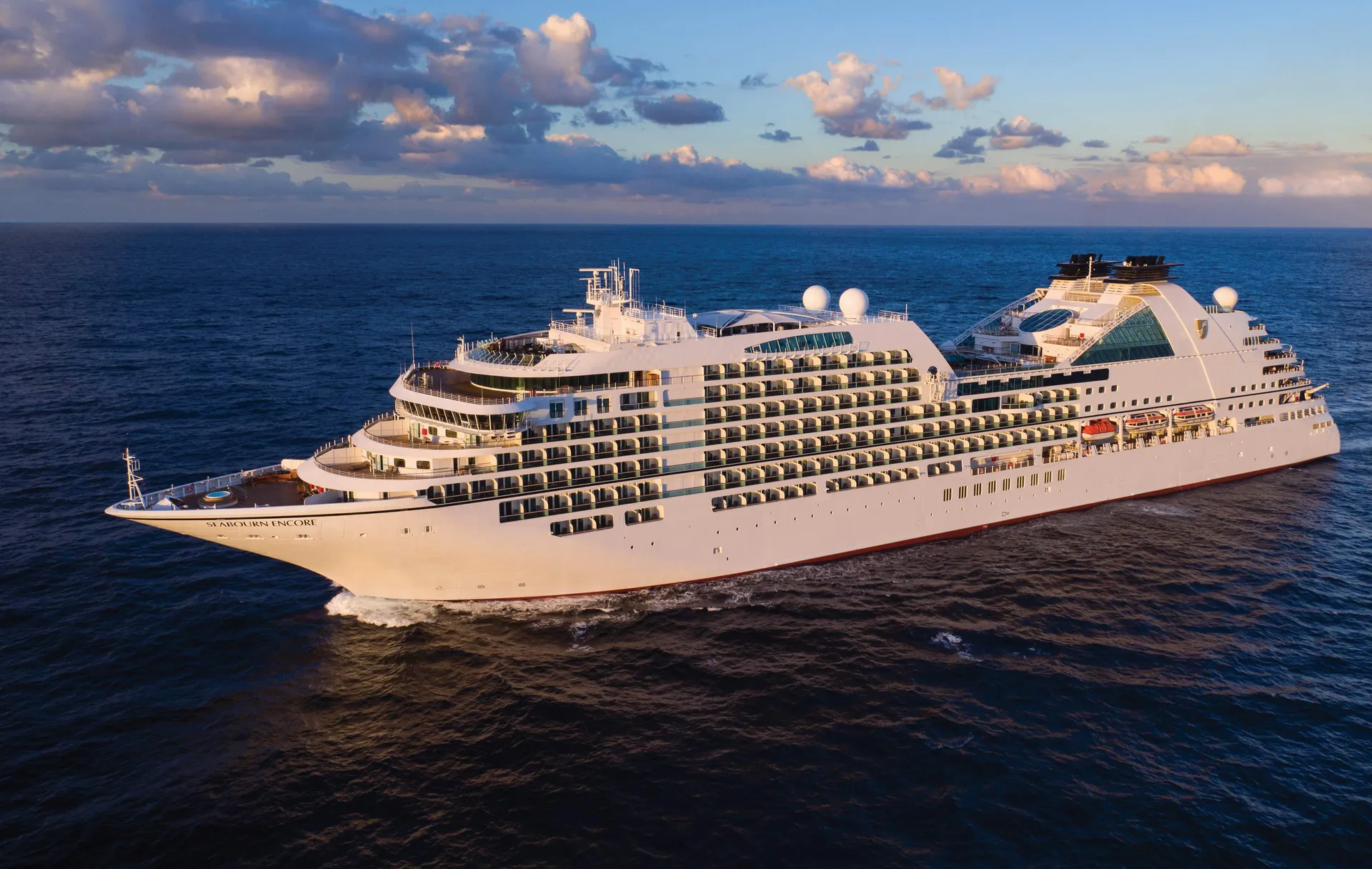


Seabourn
2016
—
40,350 GT
600
266
330
690 m
28 m
19 knots
No

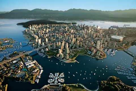
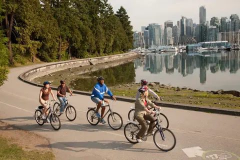
Boasting mountains, sea, culture, art and so much more, many cities claim to have it all, but few can back it up like Vancouver. Famously livable, just visiting this highrise city - surrounded by staggering natural beauty - is a thrill. Offering all of the creature comforts of an ultra-modern, worldly metropolis - even downtown has a hint of mountain-freshness to its air - and part of Vancouver's appeal is how easily you can swap the skyscrapers for whale-filled oceans and mountain-punctured skies. View less Head up to the Vancouver Lookout Tower for the ultimate 360-degree views of the city glistening, amid the beautiful embrace of the beckoning wilderness beyond. But what to see first? Art lovers might choose the Vancouver Art Gallery or the Contemporary Art Gallery. Nature lovers might rush for the ferry to visit Vancouver Island - where they can encounter grizzly bears, whales and orcas. Culture vultures, on the other hand, will probably head for the sights and sounds of Canada's biggest Chinatown. From steaming dim sum for lunch to Chinese apothecaries offering herbs to soothe any illness, it’s all here thanks to the migrant workers of the 19th century. The one-of-a-kind treasure of Stanley Park brings wild wonder and natural beauty to this cosmopolitan city's doorstep, and the pine-tree clad park offers isolated trails and amazing views. Wander the Seawall that encircles it - a 20-mile coastal path, full of joggers, whizzing skaters and wandering couples. Grab a bike and cycle between Coal Harbour and Kitsilano Beach. You can top up your tan on the shore, as you soak in the glorious views of the mountains and cityscape from the sands.
Boasting mountains, sea, culture, art and so much more, many cities claim to have it all, but few can back it up like Vancouver. Famously livable, just visiting this highrise city - surrounded by staggering natural beauty - is a thrill. Offering all of the creature comforts of an ultra-modern, worldly metropolis - even downtown has a hint of mountain-freshness to its air - and part of Vancouver's appeal is how easily you can swap the skyscrapers for whale-filled oceans and mountain-punctured skies. View less Head up to the Vancouver Lookout Tower for the ultimate 360-degree views of the city glistening, amid the beautiful embrace of the beckoning wilderness beyond. But what to see first? Art lovers might choose the Vancouver Art Gallery or the Contemporary Art Gallery. Nature lovers might rush for the ferry to visit Vancouver Island - where they can encounter grizzly bears, whales and orcas. Culture vultures, on the other hand, will probably head for the sights and sounds of Canada's biggest Chinatown. From steaming dim sum for lunch to Chinese apothecaries offering herbs to soothe any illness, it’s all here thanks to the migrant workers of the 19th century. The one-of-a-kind treasure of Stanley Park brings wild wonder and natural beauty to this cosmopolitan city's doorstep, and the pine-tree clad park offers isolated trails and amazing views. Wander the Seawall that encircles it - a 20-mile coastal path, full of joggers, whizzing skaters and wandering couples. Grab a bike and cycle between Coal Harbour and Kitsilano Beach. You can top up your tan on the shore, as you soak in the glorious views of the mountains and cityscape from the sands.
The Seymour Narrows is a 3-mile/5 km stretch of the Discovery Channel north of Vancouver Island, British Columbia that is notorious for the strength of the tidal currents flowing through it. The average width of the narrows is just 750 meters. During extreme tides, the current through the narrows is subject to severe Venturi effect, resulting in an increased velocity that can reach 15 knots. For much of its modern history, there was an additional hazard in the narrows called Ripple Rock, a shallow obstruction that claimed no fewer than 119 ships and 114 lives. In 1958, after months of tunneling and preparation, Ripple Rock was blown up in the largest commercial, non-nuclear explosion ever recorded in North America. Still, the navigation of Seymour Narrows is dependent on tidal and other conditions, and requires skill and technical accomplishment.
The Queen Charlotte Sound lies between the Queen Charlotte Strait, which winds between Vancouver Island and the British Columbia mainland in the south, and Hecate Strait, which is northward, adjacent to the Haida Gwaii Islands off the Pacific coast of British Columbia. It is a broad reach in the long shipping route called the Inside Passage threading the myriad islands stretching from Washington’s Puget Sound to Alaska.

The Salmon Capital of the World is a thrilling introduction to wild and wonderful Alaska, sitting at the southern gateway to the Inside Passage's famed route of larger than life scenery. Cruise through the waters, or soar just above in a sightseeing plane, to take in the full majesty of the magnificent Misty Fjords National Monument. Home to grizzly and black bears - as well as cruising whales and swimming seals - the wildlife spotting opportunities in this majestic corner of the world are nothing short of spectacular. View less Towered over by steep banks and valley walls, Ketchikan's ocean inlet is peppered with granite stacks, looming from the waters. Surrounded by glorious landscapes, head to the Alaska Rainforest Sanctuary, which is alive with bald eagles, black bears and remarkable, thick, yellow banana slugs - the squeamish are advised to keep well clear. Visit Ketchikan's Heritage Centre, where a collection of intricately carved totem poles rise up, preserving the heritage of the indigenous Tlingit and Haida people of these lands. Ketchikan has the world's largest collection, and some of the oldest and most precious totems in existence. This frontier city hasn’t always been so wholesome, however. See the colourful historic street that is built on crooked stilts over Ketchikan Creek, which has a crude history as the main red-light district in the city. The brothels closed in the 1950s, but you can explore this legendarily seedy past at Dolly’s House - a brothel turned museum. See the Married Man trail, a historical route used to enter Creek Street away from prying eyes.
The Salmon Capital of the World is a thrilling introduction to wild and wonderful Alaska, sitting at the southern gateway to the Inside Passage's famed route of larger than life scenery. Cruise through the waters, or soar just above in a sightseeing plane, to take in the full majesty of the magnificent Misty Fjords National Monument. Home to grizzly and black bears - as well as cruising whales and swimming seals - the wildlife spotting opportunities in this majestic corner of the world are nothing short of spectacular. View less Towered over by steep banks and valley walls, Ketchikan's ocean inlet is peppered with granite stacks, looming from the waters. Surrounded by glorious landscapes, head to the Alaska Rainforest Sanctuary, which is alive with bald eagles, black bears and remarkable, thick, yellow banana slugs - the squeamish are advised to keep well clear. Visit Ketchikan's Heritage Centre, where a collection of intricately carved totem poles rise up, preserving the heritage of the indigenous Tlingit and Haida people of these lands. Ketchikan has the world's largest collection, and some of the oldest and most precious totems in existence. This frontier city hasn’t always been so wholesome, however. See the colourful historic street that is built on crooked stilts over Ketchikan Creek, which has a crude history as the main red-light district in the city. The brothels closed in the 1950s, but you can explore this legendarily seedy past at Dolly’s House - a brothel turned museum. See the Married Man trail, a historical route used to enter Creek Street away from prying eyes.
In the passage between Sumner Strait and Clarence Strait in Southeast Alaska’s Alexander Archipelago, midway between Price of Wales Island on the west and Zarembo Island on the east, is a small cluster of islands with a picturesque passageway between them called Snow Pass. It makes a scenic up-close route for your Seabourn ship during the transit.
Decision Passage is the western end of the Sumner Strait, which runs through the Alexander Archipelago into the Pacific Ocean in Southeastern Alaska, bounded on the north by Kuiu Island and Cape Decision, the location of a 1932 lighthouse. This is the route your ship takes when coming from or going to the colorful historic community of Sitka on the west coast of Baranof Island, which was originally the Russian fortress town of New Archangel.

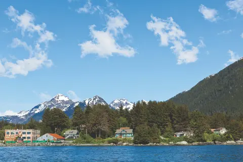
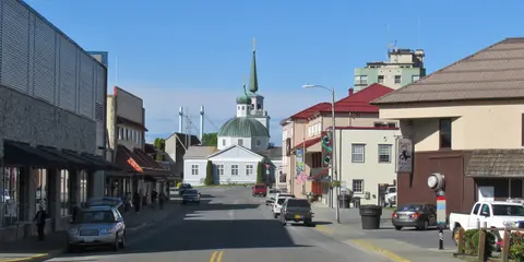
Sitka began as a major Tlingit Indian village and was called “Shee Atika,” which translates roughly as “settlement on the outside of Shee.” “Shee” is the Tlingit name of Baranof Island. In 1799, Alexander Baranof, the general manager of the Russian American Company, decided to move his base of operations from Kodiak and set up camp at what is now called Old Sitka, 7.5 miles north of the present-day town. He called the settlement St. Archangel Michael. The Tlingit Indians of the area resisted the occupation and, in 1802, with Baranof away, burned the fort and massacred the Russian settlers. Two years later, Baranof returned and besieged the Indian fort. The Tlingits withdrew and the area was once again in Russian hands. This time, the Russians built the new city on a different site and called it New Archangel. For over six decades, New Archangel was the capital of the Russian empire in Alaska. By 1867, the Alaska colony had become too much of a financial burden to Russia. William Seward, U.S. Secretary of State, negotiated with the Russian Czar to purchase the Territory of Alaska for $7.2 million. The American press scoffed at Seward and the U.S. government for purchasing what they called “Seward's Folly,” “Seward's Icebox,” and “Walrussia.” On October 18, 1867, the Russian flag was lowered at New Archangel and the Stars and Stripes were raised over newly renamed Sitka. The name comes from the Tlingit word “Sheetkah,” which means “in this place.” All Russian citizens living in the former colony were given the opportunity to become American citizens. Many went home, although a few stayed or migrated to California. Sitka remained the capital of the Territory of Alaska from 1867 to 1906, when it was moved to Juneau. The move was a direct result of the gold rush. In plain terms, Sitka did not have any and Juneau did. After the Japanese attack on Pearl Harbor, Sitka became a full-scale naval base. At one time during the war, Sitka had a total population of 37,000. With the end of World War II, however, the city settled into a quieter existence. The biggest boom in modern days for Sitka came in 1959 when the Alaska Lumber and Pulp Company built a pulp mill at Silver Bay, near the city. Today, picturesque Sitka is known for its fishing and of course its many historic attractions.
Sitka began as a major Tlingit Indian village and was called “Shee Atika,” which translates roughly as “settlement on the outside of Shee.” “Shee” is the Tlingit name of Baranof Island. In 1799, Alexander Baranof, the general manager of the Russian American Company, decided to move his base of operations from Kodiak and set up camp at what is now called Old Sitka, 7.5 miles north of the present-day town. He called the settlement St. Archangel Michael. The Tlingit Indians of the area resisted the occupation and, in 1802, with Baranof away, burned the fort and massacred the Russian settlers. Two years later, Baranof returned and besieged the Indian fort. The Tlingits withdrew and the area was once again in Russian hands. This time, the Russians built the new city on a different site and called it New Archangel. For over six decades, New Archangel was the capital of the Russian empire in Alaska. By 1867, the Alaska colony had become too much of a financial burden to Russia. William Seward, U.S. Secretary of State, negotiated with the Russian Czar to purchase the Territory of Alaska for $7.2 million. The American press scoffed at Seward and the U.S. government for purchasing what they called “Seward's Folly,” “Seward's Icebox,” and “Walrussia.” On October 18, 1867, the Russian flag was lowered at New Archangel and the Stars and Stripes were raised over newly renamed Sitka. The name comes from the Tlingit word “Sheetkah,” which means “in this place.” All Russian citizens living in the former colony were given the opportunity to become American citizens. Many went home, although a few stayed or migrated to California. Sitka remained the capital of the Territory of Alaska from 1867 to 1906, when it was moved to Juneau. The move was a direct result of the gold rush. In plain terms, Sitka did not have any and Juneau did. After the Japanese attack on Pearl Harbor, Sitka became a full-scale naval base. At one time during the war, Sitka had a total population of 37,000. With the end of World War II, however, the city settled into a quieter existence. The biggest boom in modern days for Sitka came in 1959 when the Alaska Lumber and Pulp Company built a pulp mill at Silver Bay, near the city. Today, picturesque Sitka is known for its fishing and of course its many historic attractions.
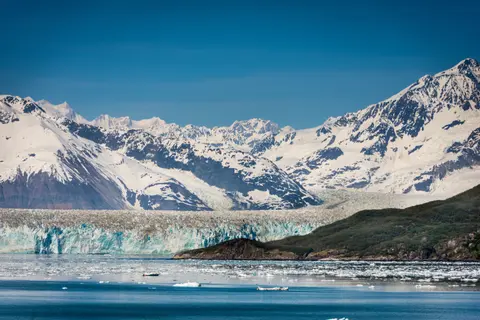

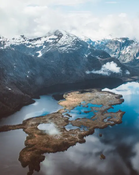
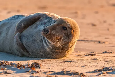
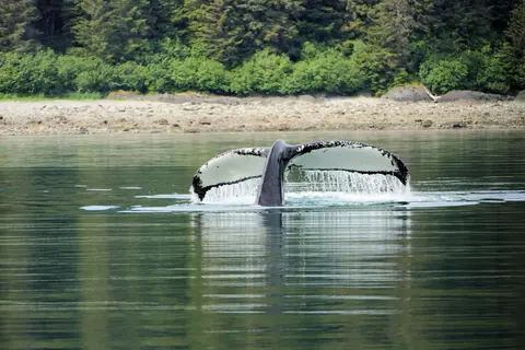
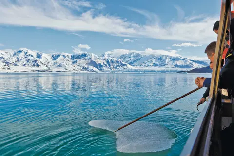
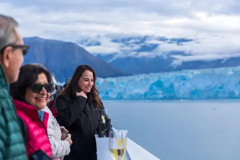
Nicknamed the "Galloping Glacier," this east Alaskan glacier is rapidly advancing toward the Gulf of Alaska into a pristine area known as Disenchantment Bay. In fact, its movement temporarily formed a natural dam that twice closed off nearby Russell Fjord from the bay, but the intense water pressure building within the fjord-turned-lake has thus far been enough to explode through the wall of ice. The largest tidewater glacier in North America, Hubbard Glacier measures 76 miles long and plunges 1,200 feet into the depths of the bay. Its immense beauty and phenomenal blue hues are enchanting, even from afar. But it's when your cruise ship draws closer that its towering surface really impresses, dwarfing even the uppermost deck on your ship at a whopping 40 stories high. There, with the snowcapped mountains serving as a glorious backdrop, you'll have a prime viewing spot from which to witness the glacier calving, as it often expels icebergs the size of 10-story buildings-imagine the splash! The area around Hubbard Glacier is also renowned for its wildlife, where whales, harbor seals and otters swim, brown bears, moose and black-tailed deer roam ashore, and a wide variety of seabirds soar gracefully across the sky.
Yakutat Bay is 18 miles wide at its entry, and cuts from the Gulf of Alaska into Disenchantment Bay, the entryway to the huge Hubbard Glacier, North America’s largest tidewater glacier. As the bay narrows and the shorelines draw closer, the 400-foot face of the glacier exerts a luminous, ghostly presence, often from as much as 30 miles away. More and more floating ice dimples the surface of the water, and seals bob up and disappear again. The chilled air from the glacier flows in a downdraft of cold that gives rise to mists and gray clouds, through which the vivid blue of the ice wall shimmers. It is an impressive sight of nature’s immense raw workplace, shaping the earth itself as part of an endless cycle of water from the sea evaporating to the sky, falling as snow on the heights and inching over centuries back again to the sea.
Nicknamed the "Galloping Glacier," this east Alaskan glacier is rapidly advancing toward the Gulf of Alaska into a pristine area known as Disenchantment Bay. In fact, its movement temporarily formed a natural dam that twice closed off nearby Russell Fjord from the bay, but the intense water pressure building within the fjord-turned-lake has thus far been enough to explode through the wall of ice. The largest tidewater glacier in North America, Hubbard Glacier measures 76 miles long and plunges 1,200 feet into the depths of the bay. Its immense beauty and phenomenal blue hues are enchanting, even from afar. But it's when your cruise ship draws closer that its towering surface really impresses, dwarfing even the uppermost deck on your ship at a whopping 40 stories high. There, with the snowcapped mountains serving as a glorious backdrop, you'll have a prime viewing spot from which to witness the glacier calving, as it often expels icebergs the size of 10-story buildings-imagine the splash! The area around Hubbard Glacier is also renowned for its wildlife, where whales, harbor seals and otters swim, brown bears, moose and black-tailed deer roam ashore, and a wide variety of seabirds soar gracefully across the sky.
As the gatekeepers to the northern entrance of the fabled Inside Passage, the remote Inian Islands stand between Cross Sound and Icy Strait, exposed to the high energy seas of the Pacific Ocean. Tidal currents surging through the narrow channels separating the islands can be severe. Nicknames like ‘The Laundry Chute’ justify their notorious reputations. For millennia, Tlingit people came here to hunt and fish in the rich bounty that these waters provided. Today, the Inian Islands Institute, located within the islands, provides access to the abundant and protected waters for scientific research. Sitka black-tailed deer and brown bears frequent their rugged and rocky shores, while sea lions fill their stomachs with salmon before hauling out to rest on the many rocky outcrops making up this island group. Sea otters, bald eagles, and humpback whales frequent the area in great numbers during the summer months. The Inian Islands were named by William Healey Dall, one of Alaska's earliest scientific explorers, in 1879.
If there is one word that sums up Alaska it is nature. Mile and miles of it. And Icy Strait Point – one of Alaska’s most unspoilt destinations has – nature in spades. To begin with, Icy Straight Point is stunningly beautiful. It is the Alaska of your imagination: eagles soaring overhead, whales breeching before your eyes. Moody, low-hanging clouds set the scene while velvety green mountains provide the backdrop. Sparklingly clear waters lap at pebbly shores. View less These are beaches of the adventure kind, you won’t find sun loungers and sombreros here, more like kayaks and canoes, ready for those who want to take their discovery off shore. The village prides itself on being home to “more brown bears than humans”, so expect immersive wilderness experiences, from ATV adventures to zip lining through a canopy of trees! Located on Chichagoff Island, 35 miles west of Juneau and right in the centre of Glacier Bay, Icy Strait Point began life as a salmon cannery business, providing employment for the residents of nearby Hoonah. The cannery has served the community in many ways, including proving housing for employees after a fire in 1944 destroyed many resident’s homes. It ceased to function entirely in 1999 and in 2001, the landing was repurposed as America’s only private cruise ship terminal. The Alaskan owned and operated terminal funnels all its profits back into the local environment and provides employment for around 85% of local residents, many of whom live in Alaska’s largest Native Tlingit village.
Unlike most cities of Southeast Alaska, Haines can be reached by road. With a population of 2,200, Haines lies in the upper northern reaches of the Inside Passage and is an important access point to the Yukon Territory and Interior Alaska. While cruising into Haines, see the Lynn Canal, the longest and deepest fjord in North America. Once in town, mountains seem to surround you on all sides while the jagged cathedral peaks of the Chilkat Mountains loom over Fort Seward. Haines has two distinct personalities. On the north side of the Haines Highway is the section of Haines that developed around the Presbyterian mission. After its missionary beginnings, it served as the trailhead for the Jack Dalton Trail into the Yukon during the 1897 gold rush to the Klondike. South of the highway, the town resembles a military post, which is exactly what it was for nearly half a century. In 1903 the U.S. Army established Fort William Henry Seward at Portage Cove just south of town. The post (renamed Chilkoot Barracks in 1922) was the only military base in the territory until World War II. In 1939, the army built the Alaska Highway and the Haines Highway to connect Alaska with the other states. Today, the community of Haines is recognized for the Native American dance and culture center at Fort Seward as well as for its superb fishing, camping and outdoor recreation.
Unlike most cities of Southeast Alaska, Haines can be reached by road. With a population of 2,200, Haines lies in the upper northern reaches of the Inside Passage and is an important access point to the Yukon Territory and Interior Alaska. While cruising into Haines, see the Lynn Canal, the longest and deepest fjord in North America. Once in town, mountains seem to surround you on all sides while the jagged cathedral peaks of the Chilkat Mountains loom over Fort Seward. Haines has two distinct personalities. On the north side of the Haines Highway is the section of Haines that developed around the Presbyterian mission. After its missionary beginnings, it served as the trailhead for the Jack Dalton Trail into the Yukon during the 1897 gold rush to the Klondike. South of the highway, the town resembles a military post, which is exactly what it was for nearly half a century. In 1903 the U.S. Army established Fort William Henry Seward at Portage Cove just south of town. The post (renamed Chilkoot Barracks in 1922) was the only military base in the territory until World War II. In 1939, the army built the Alaska Highway and the Haines Highway to connect Alaska with the other states. Today, the community of Haines is recognized for the Native American dance and culture center at Fort Seward as well as for its superb fishing, camping and outdoor recreation.
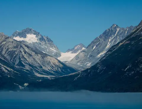
Lynn Canal is a 90-mile long inlet into Alaska’s coast running from the Chilkat River in the north to the Chatham Strait and Stephens Passage in the south. Because it connects the towns of Skagway and Haines to Juneau and the rest of the Inside Passage, it is an important shipping lane for ferries, cargo and cruise ships, and was a crucial passageway to the Klondike gold fields during the Gold Rush. It was discovered by Joseph Whidbey in 1794 and named by George Vancouver after his birthplace, King’s Lynn in Norfolk, England. More than 2,000 feet in depth, it is one of the deepest and longest fjords in the world, and the deepest in North America outside Greenland.
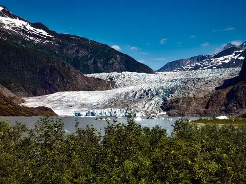
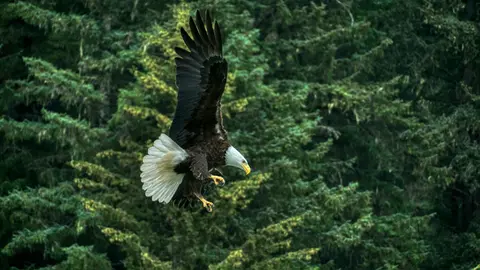
Extraordinary adventures amid nature's wildest staging await at Juneau. The majestic Mendenhall Glacier sprawls down from Juneau Icefield, which provides an icy cap to the area's rip-roaring scenery. State capitals simply don't get more dramatic than this isolated, remote city lost amid the Alaskan wilds. Even the roads eventually peter out, absorbed by forests and viewpoints, firmly underlining the isolated location, hidden behind an impenetrable wall of rigid mountains. Rise up to Mount Roberts Tramway's viewpoint, to see the city swallowed by this most colossal backdrop. View less This is glacier country, and no fewer than 38 ice flows branch off from the main Juneau Icefield, slowly carving out valleys in their wakes. Taku Glacier cuts deep into the mountain, forming a colossal sculpture that is one of the world's thickest - almost a mile deep. Mendenhall Glacier cascades down, just 12 miles away from downtown, terminating in its own lake and visitor centre. With 1,500 square miles of ice field to explore, one of the best ways to take in the magnitude and majesty of this epic ice sculpture is to hold on tight on as the propeller whirs, and you soar into the skies on an exhilarating sightseeing flight. Cruising up above the icy world that fills in these serrated mountain peaks is a once in a lifetime experience. The animals that inhabit the Southeast Alaskan wilds are just as inspiring as the landscapes – families of bears patrol the riverbanks, bald eagles survey the surroundings watchfully, and Pacific humpbacks migrate from Hawaii's waters to feast on the krill rich, icy waters. Fish for huge catches, power across the ice in a snow-sledge, or kayak just below glaciers. However you choose to immerse yourself in it, Juneau's incredible outdoor adventures never disappoint.
Extraordinary adventures amid nature's wildest staging await at Juneau. The majestic Mendenhall Glacier sprawls down from Juneau Icefield, which provides an icy cap to the area's rip-roaring scenery. State capitals simply don't get more dramatic than this isolated, remote city lost amid the Alaskan wilds. Even the roads eventually peter out, absorbed by forests and viewpoints, firmly underlining the isolated location, hidden behind an impenetrable wall of rigid mountains. Rise up to Mount Roberts Tramway's viewpoint, to see the city swallowed by this most colossal backdrop. View less This is glacier country, and no fewer than 38 ice flows branch off from the main Juneau Icefield, slowly carving out valleys in their wakes. Taku Glacier cuts deep into the mountain, forming a colossal sculpture that is one of the world's thickest - almost a mile deep. Mendenhall Glacier cascades down, just 12 miles away from downtown, terminating in its own lake and visitor centre. With 1,500 square miles of ice field to explore, one of the best ways to take in the magnitude and majesty of this epic ice sculpture is to hold on tight on as the propeller whirs, and you soar into the skies on an exhilarating sightseeing flight. Cruising up above the icy world that fills in these serrated mountain peaks is a once in a lifetime experience. The animals that inhabit the Southeast Alaskan wilds are just as inspiring as the landscapes – families of bears patrol the riverbanks, bald eagles survey the surroundings watchfully, and Pacific humpbacks migrate from Hawaii's waters to feast on the krill rich, icy waters. Fish for huge catches, power across the ice in a snow-sledge, or kayak just below glaciers. However you choose to immerse yourself in it, Juneau's incredible outdoor adventures never disappoint.


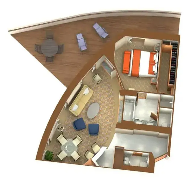
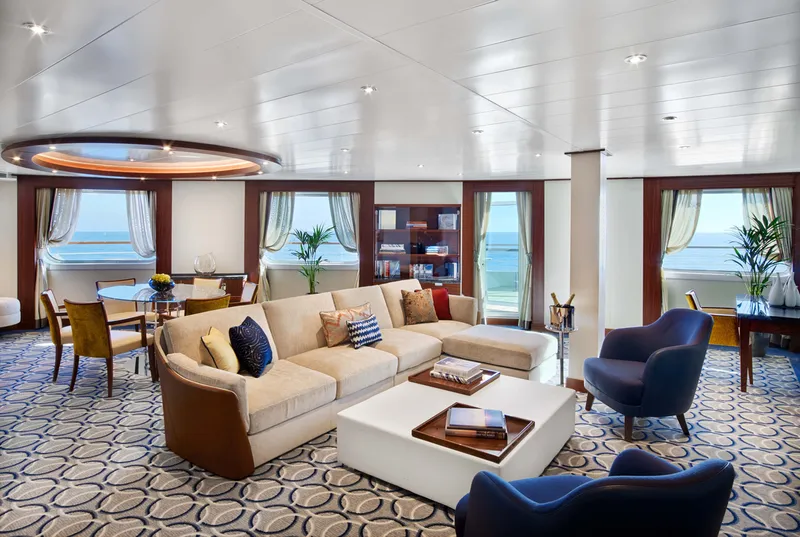
Located on Deck 8; Combine mid-ship suites 849 and 851 for suite 8491 or suites 846 and 848 for suite 8468 for a total inside space of 1,292 square feet (120 square meters) plus two verandas totaling 244 square feet (23 square meters)
Grand Wintergarden Suites feature
Large windows
Dining for six
Glass-enclosed solarium with tub and day bed
Two bedrooms
Two bathrooms (one whirlpool)
Convertible sofa bed for one
Pantry with wet bar
Two flat-screen TVs
Complimentary Internet/Wi-Fi service

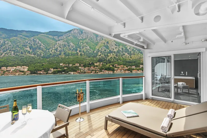
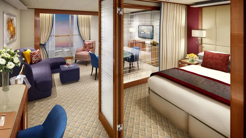
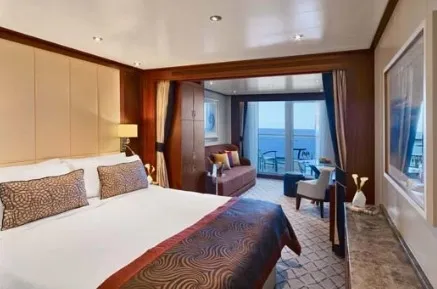
Located on Deck 7, 8, 9 and 10; total inside space of between 576 and 597 square feet (54 and 55 square meters) plus veranda of between 142 and 778 square feet (13 and 72 square meters).
Owner's Suites feature:
Expansive ocean views
Forward-facing windows
Dining for four to six
Bathroom with whirlpool bathtub
Guest bath
Pantry with wet bar
Two flat-screen TVs
Complimentary Internet/Wi-Fi service.

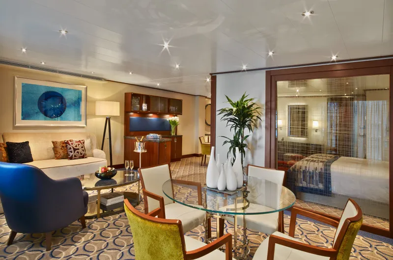
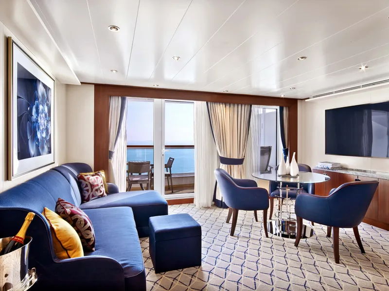
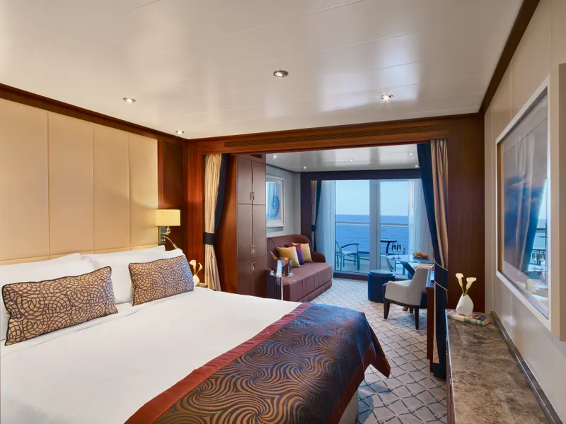
Penthouse Spa Suite
Located on Deck 11; total inside space of between 639 and 677 square feet (59 and 63 square meters) plus veranda of between 254 and 288 square feet (24 and 27 square meters)
All Penthouse Spa Suites feature
Dining table for two to four
Separate bedroom
Glass door to veranda
Two flat-screen TVs
Fully stocked bar
Spacious bathroom with tub, shower and large vanity

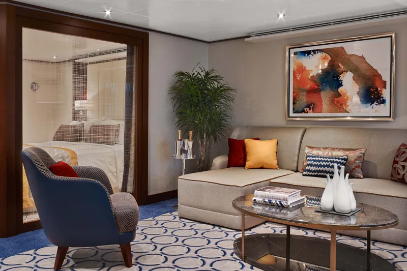
Located on Deck 10 and 11; total inside space of between 449 and 450 square feet (42 square meters) plus one veranda of between 93 and 103 square feet (9 and 10 square meters)
All Penthouse Suites feature:
Dining table for two to four
Separate bedroom
Glass door to veranda
Two flat-screen TVs
Fully stocked bar
Spacious bathroom with tub, shower and large vanity

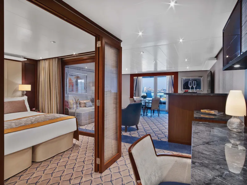
Located on Deck 8; forward suites 800 and 801 inside space of approximately 977 square feet of inside space (90 square meters), plus one veranda of 960 square feet (89 square meters).
Signature Suites feature
Expansive ocean views
Forward-facing windows
Dining for four to six
Bathroom with whirlpool bathtub
Guest bath
Pantry with wet bar
Two flat-screen TVs
Complimentary Internet/Wi-Fi service


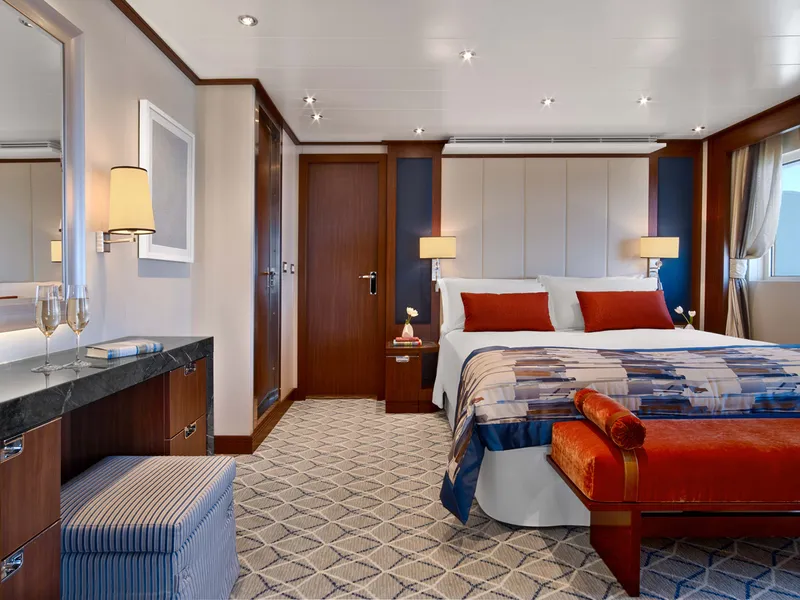
Located on Deck 8; mid-ship suites 846 and 849 inside space of 989 square feet (92 square meters) plus one veranda of 197 square feet (18 square meters)
Wintergarden Suites feature:
Large windows
Dining for six
Whirlpool bathtub
Guest bath
Convertible sofa bed for one
Pantry with wet bar
Glass-enclosed solarium with tub and day bed
Two closets
Two flat-screen TVs
Complimentary Internet/Wi-Fi service.
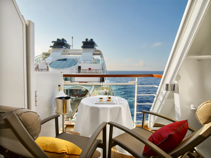
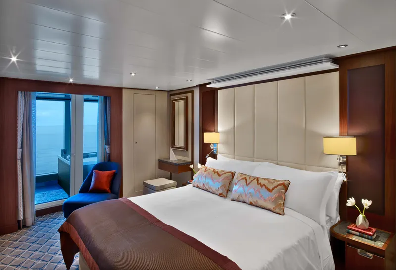
Single Veranda Suite Guarantee


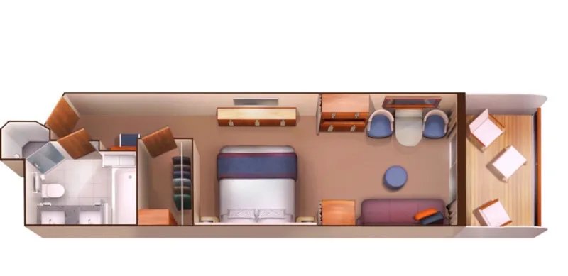
Located on Deck 6, Deck 7, Deck 8, Deck 9, total inside space of between 246 and 302 square feet (23 and 28 square meters) plus one veranda of between 68 and 83 square feet (6 and 7 square meters)
All Veranda Suites feature
A full-length window.
Glass door to private veranda.
Comfortable living area.
Queen-size bed or two twin beds.
Dining table for two.
Walk-in closet.
Interactive flat-screen television with music and movies.
Fully stocked bar and refrigerator.
Makeup vanity.
Spacious bathroom with separate tub and shower.


VERANDA SUITE GUARANTEE
Our cruise specialists can help you find the perfect cabin and the best available pricing.
(+886) 02-2721-7300Contact Advisor