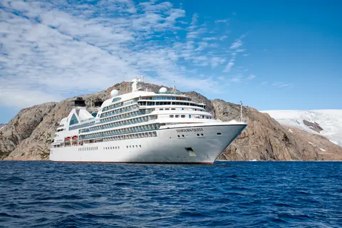
Seabourn6711C
62-Day World Cruise: Panama Canal, Polynesia & New Zealand
Date
2027-01-05
Duration
62 nights
Departure Port
Miami
United States
Arrival Port
Sydney
Canada
Rating
Luxury
Theme
—
Date
2027-01-05
Duration
62 nights
Departure Port
Miami
United States
Arrival Port
Sydney
Canada
Rating
Luxury
Theme
—


Seabourn
2011
—
32,000 GT
450
225
330
650 m
26 m
19 knots
No
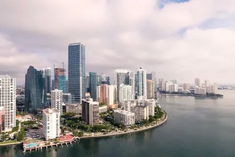
Miami is a city of perpetual reinvention — the Art Deco jewel of South Beach giving way to the street-art murals of Wynwood, the Cuban rhythms of Calle Ocho, and the glass-and-steel towers of a skyline that has redrawn itself every decade since Julia Tuttle convinced Henry Flagler to extend his railroad south in 1896. Must-dos include strolling the pastel-fronted Ocean Drive at dusk and exploring the world-class collections at the Pérez Art Museum Miami overlooking Biscayne Bay. November through April delivers idyllic weather — warm and dry — while summer brings heat, humidity, and hurricane risk. Miami handles cruise departures elegantly, with the Port of Miami a short taxi ride from the best neighbourhoods.
In the early morning, your ship joins the flotilla of hulls of every shape and purpose from the far corners of the globe. They gather in Limon Bay off the shoreline of Cristobal in the Caribbean Sea to form the day’s convoy. Soon you will parade in file into the mighty Gatun Locks, there to be lifted patiently by inrushing water through three steps and exit into Gatun Lake to begin your transit of the canal. In truth, your ship sails from west to east, threading the jungled Gaillard Cut and before arriving at the Pedro Miguel Locks to begin your descent to the Pacific Ocean. At the Miraflores Locks, your ship files through the three descending steps, lowered gracefully by the outrushing waters into the mouth of the canal, bidding farewell to your convoy, and sailing on into the largest ocean on earth.
After a thrilling day passing through the mighty, water-powered locks and jungled channels of the Panama Canal, reflect on the engineering marvel that you have experienced, as your ship glides majestically out of the canal and into your first night in the Pacific Ocean. As the first stars sparkle in the horizon, lift your glass to the bold visionaries who dreamt of such an accomplishment so long ago, and to the untold thousands who toiled to make it real. VIEW CRUISES
If you are a “pollywog,” who has never crossed the line at sea, you will be expected to undergo a mock trial by King Neptune and his court for the entertainment of the “shellbacks” who have already done so. Mild but hilarious indignities will be conjured, and in the end a good time will be had by most, if not all.
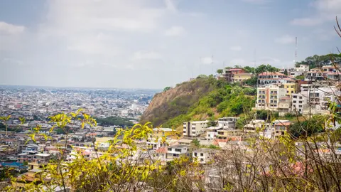
Ecuador's largest city and Pacific gateway, Guayaquil has reinvented its historic waterfront with the celebrated Malecón 2000, a sweeping riverside promenade where museums, gardens, and spectacular views of the Guayas River coexist with the energy of a genuinely ambitious city. The historic Las Peñas neighbourhood, its painted wooden houses climbing a hillside crowned by the Cerro Santa Ana lighthouse, offers the most atmospheric corner of the old city. As the embarkation point for most Galápagos expeditions, Guayaquil rewards a day or two of exploration before the archipelago's more famous wonders. The dry season — May through December — is the preferred window for visiting the coast.
Machala is Ecuador's "Banana Capital of the World," a working port city on the Pacific coast surrounded by vast plantations and mangrove-fringed islands of ecological richness. Must-dos include visiting a banana plantation, taking a boat through the Jambelí Archipelago mangroves, and tasting black clam ceviche. June through November offers the most comfortable weather, with excursions available to colonial Cuenca and the Puyango Petrified Forest.
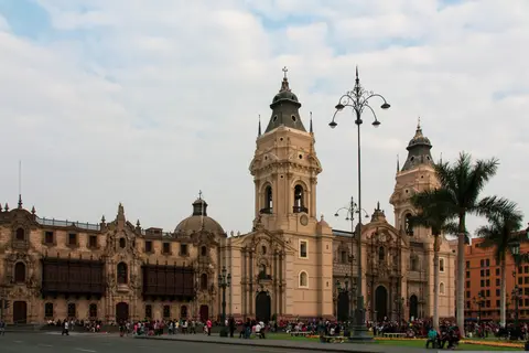
Callao, Peru, delivers South America's irresistible combination of dramatic landscapes, vibrant culture, and extraordinary biodiversity. Essential experiences include exploring local markets, tasting the distinctive regional cuisine, and venturing into the surrounding natural environments. Best visited May through September, when drier conditions prevail and temperatures remain pleasant. Cruise lines including Cunard feature this port on their most compelling itineraries. Whether you have a few hours or a full day, the port rewards exploration at every pace and in every direction.
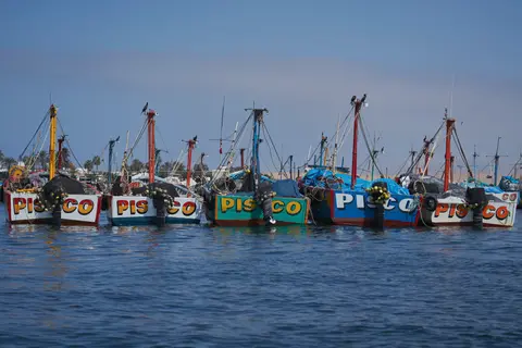
Pisco, Peru is a distinctive port city where deep cultural heritage meets authentic local atmosphere, featured on itineraries by Oceania Cruises. Must-do experiences include exploring the vibrant local markets for regional specialties and fresh seafood, and discovering the waterfront quarter where maritime heritage meets contemporary energy. The optimal time to visit is November through April, when dry season brings clear skies and calm seas.
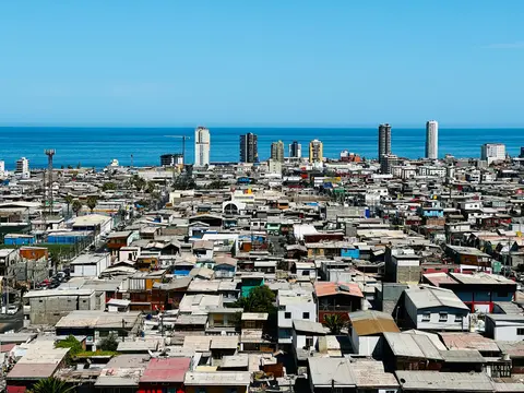
Iquique, Chile, delivers South America's irresistible combination of dramatic landscapes, vibrant culture, and extraordinary biodiversity. Essential experiences include exploring local markets, tasting the distinctive regional cuisine, and venturing into the surrounding natural environments. Best visited May through September, when drier conditions prevail and temperatures remain pleasant. Cruise lines including Azamara feature this port on their most compelling itineraries. Whether you have a few hours or a full day, the port rewards exploration at every pace and in every direction.
The southeastern-most point in the Polynesian Triangle, tiny Easter Island in the South Pacific is one of the most remote places on earth. Even more oddly, it belongs to Chile, which lies 3,700 miles away over the eastern horizon. In fact, a large slice of the island is Chile’s Rapa Nui National Park, preserving the sculptural heritage of the indigenous Rapa Nui people, whose ancestors carved the huge human effigies called moai that give the island its renown and earned it UNESCO World Heritage Site status. These stylized sculptures stand on the slopes of the island, gazing implacably out to sea, often on stone platforms called ahu. They were apparently carved between the 13th and 16th centuries, for reasons that are debated. But the enigmatic effigies, the dramatic volcanic landscape, the Rapa Nui people themselves and the sheer isolation of the island combine to draw visitors from every corner of the globe to this speck in the world’s largest ocean.
Hiva Oa in the Marquesas Islands is the remote Pacific island where Gauguin and Jacques Brel chose to spend their final years, drawn by volcanic landscapes of razor ridges and black-sand bays that remain among the most dramatic in Polynesia. Must-dos include the Calvaire Cemetery, the Puamau archaeological tiki, and tasting Marquesan goat stew with breadfruit. May through October's dry season offers the best conditions for exploring this extraordinarily isolated paradise.
Fakarava is a UNESCO Biosphere Reserve atoll in French Polynesia's Tuamotu Archipelago, offering some of the world's most spectacular diving — including drift dives through shark-filled passes — and pristine pink-sand beaches. Must-dos include diving the Garuae "wall of sharks," visiting a black pearl farm, and stargazing from an uninhabited motu. April through November brings the driest weather, with June and July featuring the legendary grouper spawning.
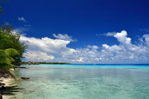
Rangiroa is the world's second-largest coral atoll, a ring of palm-fringed islets in French Polynesia's Tuamotus encircling a lagoon vast enough to contain Tahiti. Visitors must drift-dive or snorkel Tiputa Pass for sharks and dolphins, visit the surreal Blue Lagoon and Pink Sands beach, and savour poisson cru in a Polynesian pension. May through October offers calm diving conditions, while January-March brings hammerhead sharks.
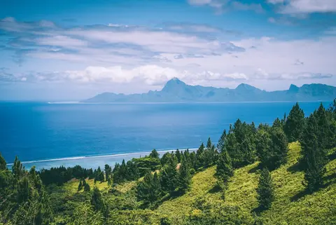
Papeete is the spirited, slightly ragged capital of French Polynesia — not the languorous paradise of travel-poster imagination, but a working harbour city of fresh produce markets, baguette bakeries, and Tahitian outrigger canoe clubs that provides an authentic counterpoint to the pearl-still lagoons of Bora Bora and Moorea nearby. The daily Marché de Papeete is the city's essential experience, its stalls piling high with vanilla pods, monoi-scented oils, black pearls, and the most exuberant floral arrangements in the Pacific. Moorea, visible across the Sea of the Moon and just 30 minutes by fast ferry, offers a dramatically quieter alternative. The dry season, May through October, brings the finest weather.
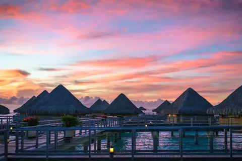
Bora Bora rises from the South Pacific like the platonic ideal of a tropical island — a volcanic peak ringed by a lagoon of impossible turquoise clarity whose beauty has made it the benchmark against which all other island destinations are measured. The overwater bungalow was effectively invented here, and the island's luxury resorts remain the definitive expression of that sublime form of hospitality. Snorkel or dive the outer reef's extraordinary coral gardens, or simply watch the shifting light transform Mount Otemanu's basalt silhouette through the long Pacific afternoon. Visit April through October for the calmest, driest conditions. Tahiti's Faa'a International Airport is a forty-five-minute flight away.
Aitutaki is the Cook Islands atoll whose lagoon — arguably the world's most beautiful — shimmers in impossible blues around palm-fringed motus including One Foot Island's legendary beach and remote post office. Visit May through October via Paul Gauguin or Silversea for crystal-clear snorkeling, traditional Polynesian umukai feasts, and the rare Pacific island experience that silences even the most jaded traveler.
The capital of Tonga is on Tongatapu, its largest island. Learn about the history and heritage of the Tongans at the Tonga Cultural Centre, a complex of traditional buildings holding museums and artisans workshops where traditional crafts are made. In the nearby village of Mu’a, see the marvelously crafted stone tombs of Tongan kings from the past.
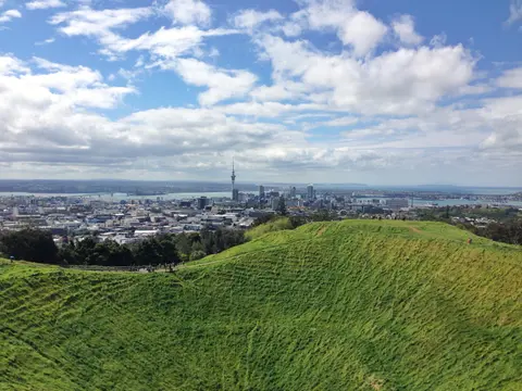
Auckland, New Zealand's largest city, straddles a volcanic isthmus between two harbours, offering a rare blend of Pacific Rim sophistication, Māori heritage, and dramatic natural beauty. Must-do experiences include a wine-and-oyster afternoon on Waiheke Island and the panoramic ascent of Maungawhau (Mount Eden) overlooking the harbour and Rangitoto Island. The ideal cruising season runs from November through March, when long summer days, calm seas, and pohutukawa trees in scarlet bloom make the Waitematā Harbour approach truly unforgettable.
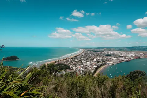
Tauranga is the gateway to New Zealand's Bay of Plenty, where the perfect beach at Mount Maunganui, Rotorua's erupting geysers, and Māori cultural experiences at Te Puia create one of the North Island's most diverse destination areas. Visit November through March via Celebrity or Princess Cruises for summit walks, geothermal wonderlands, and the authentic Māori encounters that give this sun-drenched coast cultural depth to match its natural beauty.
Napier is a New Zealand coastal city renowned for the world's most complete collection of Art Deco architecture, rebuilt after a devastating 1931 earthquake. Must-dos include a guided Art Deco walking tour, wine tasting across Hawke's Bay's celebrated vineyards, and visiting the gannet colony at Cape Kidnappers. November through April offers the warmest weather, with February's Art Deco Weekend providing the ultimate vintage-style celebration.
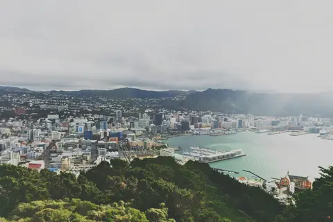
Wellington is New Zealand's compact, creative capital, home to the world-class Te Papa museum, the Peter Jackson filmmaking empire, and a café-and-craft-beer culture rivalling cities many times its size. Must-do experiences include Te Papa's Gallipoli exhibition, Cuba Street's bohemian dining scene, and the cable car ride to the Botanic Garden. November through March is warmest, though Wellington's four-seasons-in-a-day climate adds character year-round.
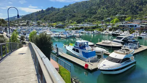
Picton is the gateway to the Marlborough Sounds' 1,500 kilometers of scenic coastline and New Zealand's premier Sauvignon Blanc wine region. Must-dos include walking sections of the Queen Charlotte Track, wine tasting in the Wairau Valley, and dolphin watching in the sheltered sounds. November through March offers the warmest weather and longest days for both sound exploration and cellar-door visits.
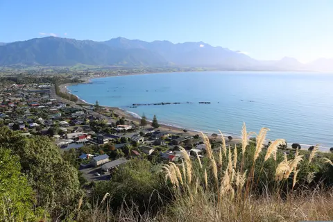
Kaikoura is a marine wildlife capital on New Zealand's South Island coast, where deep submarine canyons create conditions for year-round sperm whale watching, dolphin swimming, and albatross encounters against a backdrop of snow-capped mountains. Must-dos include whale watching with its 95% sighting rate, eating crayfish at the legendary Nin's Bin roadside stand, and swimming with dusky dolphins. Visit year-round — whales are always present, with different seasons favouring different species.
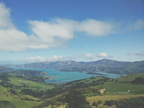
Akaroa is a French-heritage village nestled in an ancient volcanic crater on New Zealand's Banks Peninsula, home to the rare Hector's dolphin and a sophisticated food scene featuring harbour-fresh salmon and cool-climate wines. Must-dos include swimming with Hector's dolphins, exploring the French colonial heritage along Rue Lavaud, and dining on local green-lipped mussels. Visit December through March for the warmest weather and best dolphin-watching conditions.
Timaru, New Zealand is a distinctive port city where deep cultural heritage meets authentic local atmosphere, featured on itineraries by Holland America Line. Must-do experiences include walking the historic center to experience the layered architectural heritage, and seeking out the regional culinary traditions at a locally favored establishment away from the port area. The optimal time to visit is November through March, when mild temperatures and long days favor unhurried exploration.
Dunedin is New Zealand's Scottish-founded southern city, home to the Southern Hemisphere's most beautiful railway station, the world's only mainland royal albatross colony, and rare yellow-eyed penguin nesting sites on the Otago Peninsula. Visit November through March via Seabourn or Oceania Cruises for wildlife encounters, Victorian architectural grandeur, and a university-town culture that punches far above its weight.
Oban, Scotland’s Gateway to the Isles, is a charming harbor town on the west coast where world-class seafood meets Hebridean island adventures. Must-dos include tasting langoustines at the famous Seafood Hut, visiting sacred Iona and Fingal’s Cave on Staffa, and sampling Oban Distillery’s maritime single malt. Visit May through September for the best weather and longest days to explore the Inner Hebrides.
Sydney, on Cape Breton Island in Nova Scotia, is a charming harbour city where Scottish-Acadian heritage meets raw Atlantic beauty, serving as the gateway to the legendary Cabot Trail — one of the world's most spectacular coastal drives. Visitors should savour the island's renowned seafood chowder and traditional oatcakes while exploring the colourful waterfront boardwalk. The peak season stretches from late June through October, when autumn's fiery foliage transforms the highlands into a tapestry of crimson and gold.
Day 1
Miami is a city of perpetual reinvention — the Art Deco jewel of South Beach giving way to the street-art murals of Wynwood, the Cuban rhythms of Calle Ocho, and the glass-and-steel towers of a skyline that has redrawn itself every decade since Julia Tuttle convinced Henry Flagler to extend his railroad south in 1896. Must-dos include strolling the pastel-fronted Ocean Drive at dusk and exploring the world-class collections at the Pérez Art Museum Miami overlooking Biscayne Bay. November through April delivers idyllic weather — warm and dry — while summer brings heat, humidity, and hurricane risk. Miami handles cruise departures elegantly, with the Port of Miami a short taxi ride from the best neighbourhoods.
Day 2
Day 3
Day 4
Day 5
In the early morning, your ship joins the flotilla of hulls of every shape and purpose from the far corners of the globe. They gather in Limon Bay off the shoreline of Cristobal in the Caribbean Sea to form the day’s convoy. Soon you will parade in file into the mighty Gatun Locks, there to be lifted patiently by inrushing water through three steps and exit into Gatun Lake to begin your transit of the canal. In truth, your ship sails from west to east, threading the jungled Gaillard Cut and before arriving at the Pedro Miguel Locks to begin your descent to the Pacific Ocean. At the Miraflores Locks, your ship files through the three descending steps, lowered gracefully by the outrushing waters into the mouth of the canal, bidding farewell to your convoy, and sailing on into the largest ocean on earth.
After a thrilling day passing through the mighty, water-powered locks and jungled channels of the Panama Canal, reflect on the engineering marvel that you have experienced, as your ship glides majestically out of the canal and into your first night in the Pacific Ocean. As the first stars sparkle in the horizon, lift your glass to the bold visionaries who dreamt of such an accomplishment so long ago, and to the untold thousands who toiled to make it real. VIEW CRUISES
Day 6
Day 7
If you are a “pollywog,” who has never crossed the line at sea, you will be expected to undergo a mock trial by King Neptune and his court for the entertainment of the “shellbacks” who have already done so. Mild but hilarious indignities will be conjured, and in the end a good time will be had by most, if not all.
Day 8
Ecuador's largest city and Pacific gateway, Guayaquil has reinvented its historic waterfront with the celebrated Malecón 2000, a sweeping riverside promenade where museums, gardens, and spectacular views of the Guayas River coexist with the energy of a genuinely ambitious city. The historic Las Peñas neighbourhood, its painted wooden houses climbing a hillside crowned by the Cerro Santa Ana lighthouse, offers the most atmospheric corner of the old city. As the embarkation point for most Galápagos expeditions, Guayaquil rewards a day or two of exploration before the archipelago's more famous wonders. The dry season — May through December — is the preferred window for visiting the coast.
Day 9
Machala is Ecuador's "Banana Capital of the World," a working port city on the Pacific coast surrounded by vast plantations and mangrove-fringed islands of ecological richness. Must-dos include visiting a banana plantation, taking a boat through the Jambelí Archipelago mangroves, and tasting black clam ceviche. June through November offers the most comfortable weather, with excursions available to colonial Cuenca and the Puyango Petrified Forest.
Day 10
Day 11
Day 12
Callao, Peru, delivers South America's irresistible combination of dramatic landscapes, vibrant culture, and extraordinary biodiversity. Essential experiences include exploring local markets, tasting the distinctive regional cuisine, and venturing into the surrounding natural environments. Best visited May through September, when drier conditions prevail and temperatures remain pleasant. Cruise lines including Cunard feature this port on their most compelling itineraries. Whether you have a few hours or a full day, the port rewards exploration at every pace and in every direction.
Day 14
Pisco, Peru is a distinctive port city where deep cultural heritage meets authentic local atmosphere, featured on itineraries by Oceania Cruises. Must-do experiences include exploring the vibrant local markets for regional specialties and fresh seafood, and discovering the waterfront quarter where maritime heritage meets contemporary energy. The optimal time to visit is November through April, when dry season brings clear skies and calm seas.
Day 15
Day 16
Iquique, Chile, delivers South America's irresistible combination of dramatic landscapes, vibrant culture, and extraordinary biodiversity. Essential experiences include exploring local markets, tasting the distinctive regional cuisine, and venturing into the surrounding natural environments. Best visited May through September, when drier conditions prevail and temperatures remain pleasant. Cruise lines including Azamara feature this port on their most compelling itineraries. Whether you have a few hours or a full day, the port rewards exploration at every pace and in every direction.
Day 17
Day 18
Day 19
Day 20
Day 21
Day 22
Day 23
The southeastern-most point in the Polynesian Triangle, tiny Easter Island in the South Pacific is one of the most remote places on earth. Even more oddly, it belongs to Chile, which lies 3,700 miles away over the eastern horizon. In fact, a large slice of the island is Chile’s Rapa Nui National Park, preserving the sculptural heritage of the indigenous Rapa Nui people, whose ancestors carved the huge human effigies called moai that give the island its renown and earned it UNESCO World Heritage Site status. These stylized sculptures stand on the slopes of the island, gazing implacably out to sea, often on stone platforms called ahu. They were apparently carved between the 13th and 16th centuries, for reasons that are debated. But the enigmatic effigies, the dramatic volcanic landscape, the Rapa Nui people themselves and the sheer isolation of the island combine to draw visitors from every corner of the globe to this speck in the world’s largest ocean.
Day 25
Day 26
Day 27
Day 28
Day 29
Day 30
Day 31
Hiva Oa in the Marquesas Islands is the remote Pacific island where Gauguin and Jacques Brel chose to spend their final years, drawn by volcanic landscapes of razor ridges and black-sand bays that remain among the most dramatic in Polynesia. Must-dos include the Calvaire Cemetery, the Puamau archaeological tiki, and tasting Marquesan goat stew with breadfruit. May through October's dry season offers the best conditions for exploring this extraordinarily isolated paradise.
Day 32
Day 33
Fakarava is a UNESCO Biosphere Reserve atoll in French Polynesia's Tuamotu Archipelago, offering some of the world's most spectacular diving — including drift dives through shark-filled passes — and pristine pink-sand beaches. Must-dos include diving the Garuae "wall of sharks," visiting a black pearl farm, and stargazing from an uninhabited motu. April through November brings the driest weather, with June and July featuring the legendary grouper spawning.
Day 34
Rangiroa is the world's second-largest coral atoll, a ring of palm-fringed islets in French Polynesia's Tuamotus encircling a lagoon vast enough to contain Tahiti. Visitors must drift-dive or snorkel Tiputa Pass for sharks and dolphins, visit the surreal Blue Lagoon and Pink Sands beach, and savour poisson cru in a Polynesian pension. May through October offers calm diving conditions, while January-March brings hammerhead sharks.
Day 35
Papeete is the spirited, slightly ragged capital of French Polynesia — not the languorous paradise of travel-poster imagination, but a working harbour city of fresh produce markets, baguette bakeries, and Tahitian outrigger canoe clubs that provides an authentic counterpoint to the pearl-still lagoons of Bora Bora and Moorea nearby. The daily Marché de Papeete is the city's essential experience, its stalls piling high with vanilla pods, monoi-scented oils, black pearls, and the most exuberant floral arrangements in the Pacific. Moorea, visible across the Sea of the Moon and just 30 minutes by fast ferry, offers a dramatically quieter alternative. The dry season, May through October, brings the finest weather.
Day 37
Day 38
Bora Bora rises from the South Pacific like the platonic ideal of a tropical island — a volcanic peak ringed by a lagoon of impossible turquoise clarity whose beauty has made it the benchmark against which all other island destinations are measured. The overwater bungalow was effectively invented here, and the island's luxury resorts remain the definitive expression of that sublime form of hospitality. Snorkel or dive the outer reef's extraordinary coral gardens, or simply watch the shifting light transform Mount Otemanu's basalt silhouette through the long Pacific afternoon. Visit April through October for the calmest, driest conditions. Tahiti's Faa'a International Airport is a forty-five-minute flight away.
Day 39
Day 40
Aitutaki is the Cook Islands atoll whose lagoon — arguably the world's most beautiful — shimmers in impossible blues around palm-fringed motus including One Foot Island's legendary beach and remote post office. Visit May through October via Paul Gauguin or Silversea for crystal-clear snorkeling, traditional Polynesian umukai feasts, and the rare Pacific island experience that silences even the most jaded traveler.
Day 41
Day 42
Day 43
The capital of Tonga is on Tongatapu, its largest island. Learn about the history and heritage of the Tongans at the Tonga Cultural Centre, a complex of traditional buildings holding museums and artisans workshops where traditional crafts are made. In the nearby village of Mu’a, see the marvelously crafted stone tombs of Tongan kings from the past.
Day 44
Day 45
Day 46
Day 47
Day 48
Auckland, New Zealand's largest city, straddles a volcanic isthmus between two harbours, offering a rare blend of Pacific Rim sophistication, Māori heritage, and dramatic natural beauty. Must-do experiences include a wine-and-oyster afternoon on Waiheke Island and the panoramic ascent of Maungawhau (Mount Eden) overlooking the harbour and Rangitoto Island. The ideal cruising season runs from November through March, when long summer days, calm seas, and pohutukawa trees in scarlet bloom make the Waitematā Harbour approach truly unforgettable.
Day 49
Tauranga is the gateway to New Zealand's Bay of Plenty, where the perfect beach at Mount Maunganui, Rotorua's erupting geysers, and Māori cultural experiences at Te Puia create one of the North Island's most diverse destination areas. Visit November through March via Celebrity or Princess Cruises for summit walks, geothermal wonderlands, and the authentic Māori encounters that give this sun-drenched coast cultural depth to match its natural beauty.
Day 50
Day 51
Napier is a New Zealand coastal city renowned for the world's most complete collection of Art Deco architecture, rebuilt after a devastating 1931 earthquake. Must-dos include a guided Art Deco walking tour, wine tasting across Hawke's Bay's celebrated vineyards, and visiting the gannet colony at Cape Kidnappers. November through April offers the warmest weather, with February's Art Deco Weekend providing the ultimate vintage-style celebration.
Day 52
Wellington is New Zealand's compact, creative capital, home to the world-class Te Papa museum, the Peter Jackson filmmaking empire, and a café-and-craft-beer culture rivalling cities many times its size. Must-do experiences include Te Papa's Gallipoli exhibition, Cuba Street's bohemian dining scene, and the cable car ride to the Botanic Garden. November through March is warmest, though Wellington's four-seasons-in-a-day climate adds character year-round.
Day 53
Picton is the gateway to the Marlborough Sounds' 1,500 kilometers of scenic coastline and New Zealand's premier Sauvignon Blanc wine region. Must-dos include walking sections of the Queen Charlotte Track, wine tasting in the Wairau Valley, and dolphin watching in the sheltered sounds. November through March offers the warmest weather and longest days for both sound exploration and cellar-door visits.
Day 54
Kaikoura is a marine wildlife capital on New Zealand's South Island coast, where deep submarine canyons create conditions for year-round sperm whale watching, dolphin swimming, and albatross encounters against a backdrop of snow-capped mountains. Must-dos include whale watching with its 95% sighting rate, eating crayfish at the legendary Nin's Bin roadside stand, and swimming with dusky dolphins. Visit year-round — whales are always present, with different seasons favouring different species.
Day 55
Akaroa is a French-heritage village nestled in an ancient volcanic crater on New Zealand's Banks Peninsula, home to the rare Hector's dolphin and a sophisticated food scene featuring harbour-fresh salmon and cool-climate wines. Must-dos include swimming with Hector's dolphins, exploring the French colonial heritage along Rue Lavaud, and dining on local green-lipped mussels. Visit December through March for the warmest weather and best dolphin-watching conditions.
Day 56
Timaru, New Zealand is a distinctive port city where deep cultural heritage meets authentic local atmosphere, featured on itineraries by Holland America Line. Must-do experiences include walking the historic center to experience the layered architectural heritage, and seeking out the regional culinary traditions at a locally favored establishment away from the port area. The optimal time to visit is November through March, when mild temperatures and long days favor unhurried exploration.
Day 57
Dunedin is New Zealand's Scottish-founded southern city, home to the Southern Hemisphere's most beautiful railway station, the world's only mainland royal albatross colony, and rare yellow-eyed penguin nesting sites on the Otago Peninsula. Visit November through March via Seabourn or Oceania Cruises for wildlife encounters, Victorian architectural grandeur, and a university-town culture that punches far above its weight.
Day 58
Oban, Scotland’s Gateway to the Isles, is a charming harbor town on the west coast where world-class seafood meets Hebridean island adventures. Must-dos include tasting langoustines at the famous Seafood Hut, visiting sacred Iona and Fingal’s Cave on Staffa, and sampling Oban Distillery’s maritime single malt. Visit May through September for the best weather and longest days to explore the Inner Hebrides.
Day 59
Day 60
Day 61
Day 62
Day 63
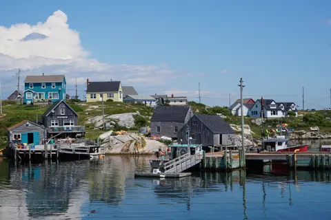
Sydney, on Cape Breton Island in Nova Scotia, is a charming harbour city where Scottish-Acadian heritage meets raw Atlantic beauty, serving as the gateway to the legendary Cabot Trail — one of the world's most spectacular coastal drives. Visitors should savour the island's renowned seafood chowder and traditional oatcakes while exploring the colourful waterfront boardwalk. The peak season stretches from late June through October, when autumn's fiery foliage transforms the highlands into a tapestry of crimson and gold.

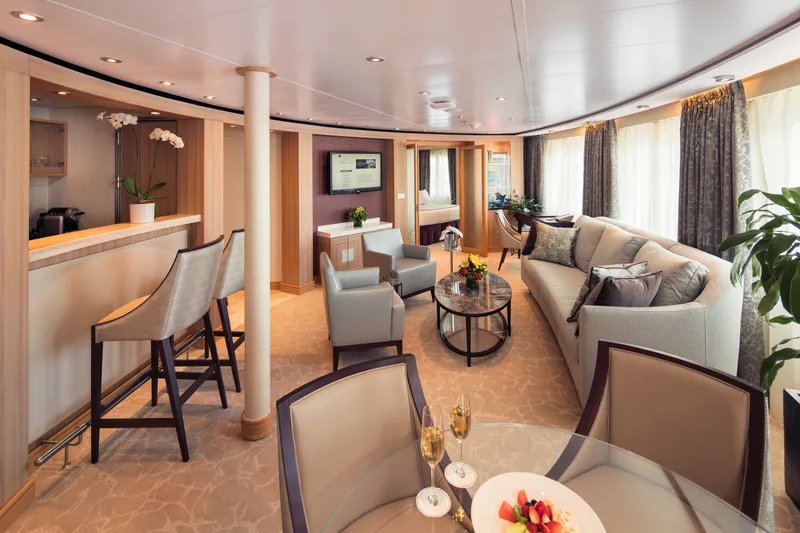
Approximately 1189 square feet (110 square meters) of inside space, plus two verandas totaling 214 square feet (20 square meters)
Grand Wintergarden Suites feature
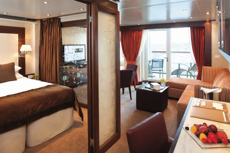
Large windows
Dining for six
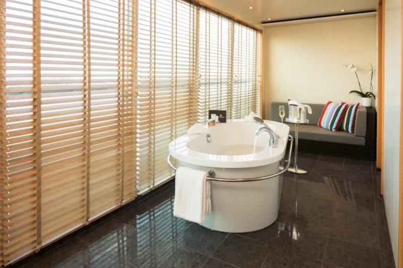
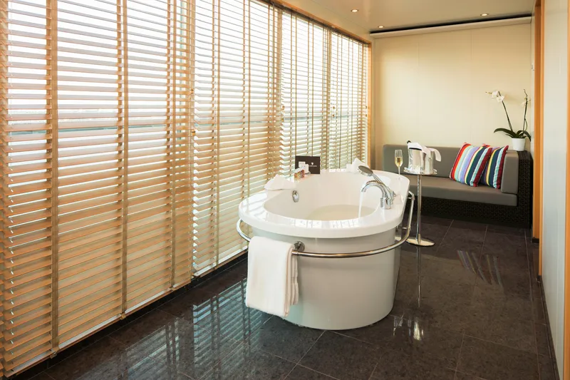
Glass-enclosed solarium with tub and day bed
Two bedrooms
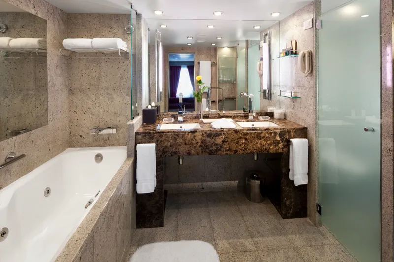
Two bathrooms (one whirlpool)
Guest bath
Convertible sofa bed for one
Pantry with wet bar
Three flat-screen TVs
Complimentary internet/Wi-Fi service

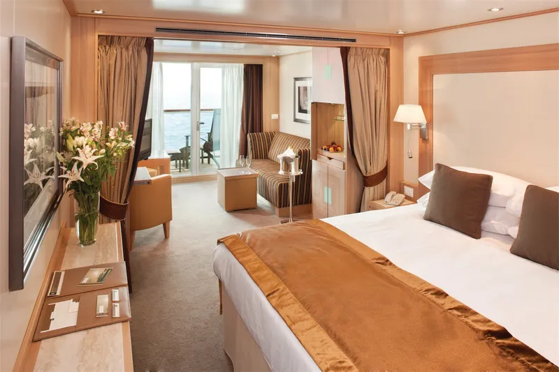
Approximately 526 & 593 square feet (49 to 55 square meters) of inside space, plus one veranda of 133 & 354 square feet (12 to 33 square meters)
Owner's Suites feature:
Expansive ocean views
Forward-facing windows
Dining for four to six
Bathroom with whirlpool bathtub
Guest bath
Pantry with wet bar
Two flat-screen TVs
Complimentary Internet/Wi-Fi service
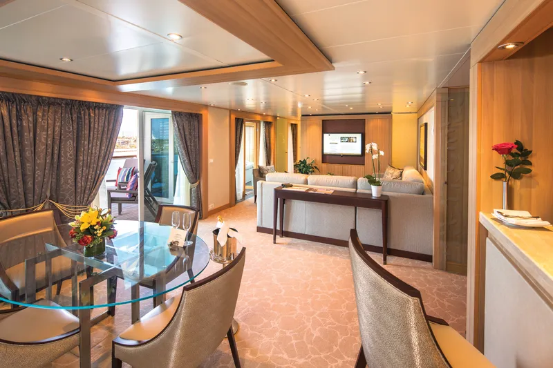
Penthouse Spa Suite
Approximately 536 to 539 square feet (50 square meters) of inside space, plus one veranda of 167 to 200 square feet (16 to 19 square meters)
All Penthouse Spa Suite feature:
Dining table for two to four
Separate bedroom
Glass door to veranda
Two flat-screen TVs
Fully stocked bar
Spacious bathroom with tub, shower and large vanity.


Penthouse Suite
Approximately 436 square feet (41 square meters) of inside space, plus one veranda of 98 square feet (9 square meters)
All Penthouse Suite feature:
Dining table for two to four
Separate bedroom
Glass door to veranda
Two flat-screen TVs
Fully stocked bar
Spacious bathroom with tub, shower and large vanity.
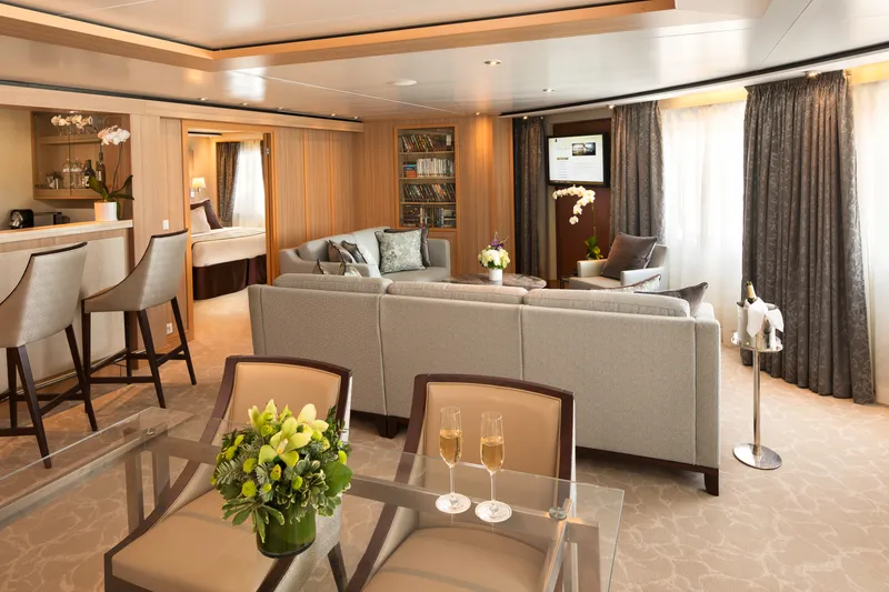
Signature Suite
Approximately 859 square feet (80 square meters) of inside space, plus one veranda of 493 square feet (46 square meters)
Signature Suites feature:
Expansive ocean views
Forward-facing windows
Dining for four to six
Bathroom with whirlpool bathtub
Guest bath
Pantry with wet bar
Two flat-screen TVs
Complimentary Internet/Wi-Fi service

Approximately 914 square feet (85 square meters) of inside space, one veranda of 183 sq. ft. (17 square meters.).
Wintergarden Suites feature
Large windows
Dining for six
Whirlpool bathtub
Guest bath
Convertible sofa bed for one
Pantry with wet bar
Glass-enclosed solarium with tub and day bed
Two closets
Two flat-screen TVs
Complimentary Internet/Wi-Fi service
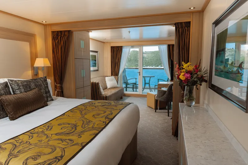
Located on Deck 5; Approximately 300 square feet (28 square meters) of inside space, plus one veranda of 65 square feet (6 square meters)
All Veranda Suites feature:
A full-length window and glass door to private veranda
Comfortable living area
Queen-size bed or two twin beds
Dining table for two
Walk-in closet
Interactive flat-screen television with music and movies
Fully stocked bar and refrigerator
Makeup vanity
Spacious bathroom with separate tub and shower.
Veranda Suite Guarantee
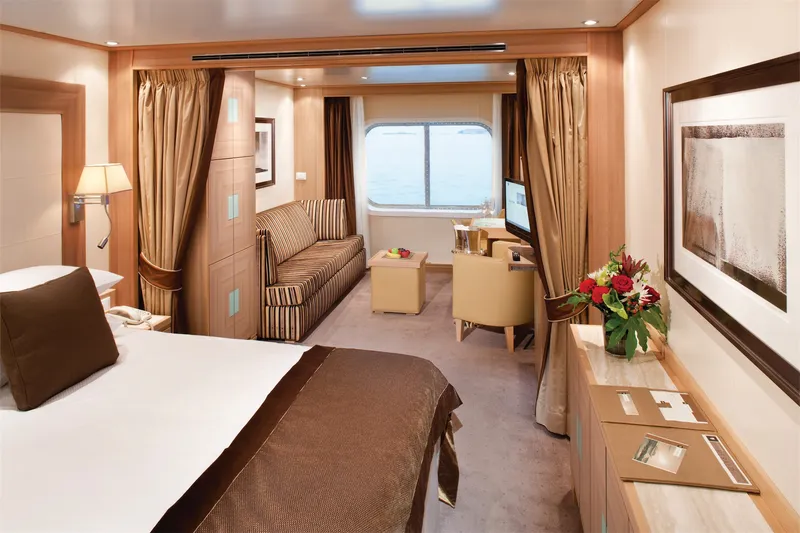
Approximately 295 square feet (28 square meters) of inside space
For this option we select the location and specific suite for you, and notify you prior to departure. Guests are guaranteed to be assigned a suite in the category selected or higher.
All Ocean View Suites feature a large picture window, comfortable living area, queen-size bed or two twin beds, dining table for two, walk-in closet, interactive flat-screen television with music and movies, fully stocked bar and refrigerator, makeup vanity, spacious bathroom with separate tub and shower.
Our cruise specialists can help you find the perfect cabin and the best available pricing.
(+886) 02-2721-7300Contact Advisor