Greenland
Igaliku
3 voyages
In a sheltered valley at the head of a fjord in southern Greenland, the farming settlement of Igaliku occupies one of the most historically resonant landscapes in the Arctic. This is Gardar — the ecclesiastical capital of Norse Greenland for over four centuries, where a bishop's cathedral once stood and where the fate of Europe's most remote medieval colony was ultimately sealed. Today, Igaliku is a village of fewer than thirty inhabitants, their brightly painted houses scattered across emerald-green meadows that slope gently toward the fjord in a scene of almost impossible pastoral beauty. The ruins of the Norse cathedral and bishop's residence lie just beneath the surface of the grass, their outlines visible as geometric shadows when the low Arctic sun rakes across the valley.
The character of Igaliku is defined by the astonishing contrast between its gentle, almost idyllic setting and its location near the edge of the habitable world. The valley is one of the warmest and most fertile spots in Greenland, its south-facing slopes nurturing grass that grows thick enough to support sheep farming — a direct echo of the Norse settlers who chose this site precisely for its agricultural potential a thousand years ago. Wildflowers bloom across the meadows in July and August: Arctic willowherb, buttercups, and the delicate white heads of cotton grass. Behind the village, mountains rise to peaks still streaked with snow, and the air carries the particular clarity that comes from the complete absence of industrial activity within hundreds of kilometres.
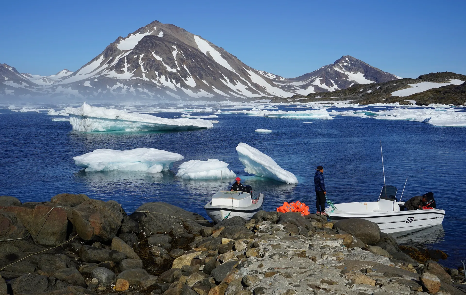
Visiting Igaliku involves a journey that is itself part of the experience. Most expedition cruise passengers arrive by Zodiac at the landing point of Itilleq, then follow a trail across a mountain pass — a walk of approximately four kilometres known as the King's Road, said to have been used by Greenlandic royalty on their way to visit the bishop. The walk rewards hikers with sweeping views of the fjord below and the ice cap glinting in the distance. In the village, the ruins of the Norse cathedral — once the largest church in the Norse Atlantic world — can be explored alongside more recent Inuit and Danish colonial buildings. The small church, still used for services, sits amid the ruins of its medieval predecessor.
The surrounding region of southern Greenland offers some of the island's most accessible and varied landscapes. The nearby Qooroq Ice Fjord, where the Greenland ice sheet calves directly into a narrow channel, provides one of the most intimate glacier encounters available anywhere. Narsarsuaq, the former American air base that now serves as the region's transport hub, sits across the fjord and offers hiking to the edge of the ice sheet. The ruins of Brattahlid, Erik the Red's original farmstead, lie nearby, completing a circuit of Norse Greenland's most important historical sites. The region's mild summer climate — temperatures can reach fifteen degrees Celsius in July — supports an emerging agricultural sector producing vegetables, herbs, and even some grains.
Igaliku is accessible by expedition cruise ship, with Zodiac landings at Itilleq followed by the overland walk, or by boat from Narsarsuaq. The visiting season runs from June through September, with July and August offering the warmest temperatures and longest days. The King's Road walk is moderately challenging with some uphill sections, and hikers should be prepared for muddy conditions after rain. There are no shops or restaurants in the village, so visitors should bring water and snacks. For those with an interest in the intersection of history, archaeology, and breathtaking natural beauty, Igaliku offers an experience that resonates long after the fjord has disappeared from view.
Gallery