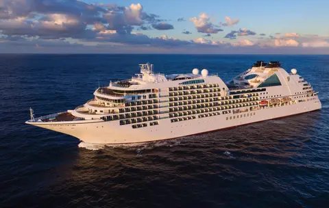
סיבורן7731A
קרוז של 14 יום לקרחונים, פיوردים ומעבר פנימי באלסקה
Date
2027-05-28
Duration
14 nights
Departure Port
ונקובר
קנדה
Arrival Port
ונקובר
קנדה
Rating
Luxury
Theme
—
Date
2027-05-28
Duration
14 nights
Departure Port
ונקובר
קנדה
Arrival Port
ונקובר
קנדה
Rating
Luxury
Theme
—





סיבורן
2016
—
40,350 GT
600
266
330
690 m
28 m
19 knots
No
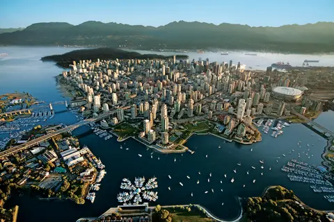
לחוצה בין האוקיינוס השקט להררי החוף, ונקובר היא השער הטבעי למעבר הפנימי של אלסקה — עיר שבה יערות גשם מתונים נפגשים עם מגדלי זכוכית ושבה סרטן דונגנס ופסל הסלמון הפראי מגדירים מטבח של חוף האוקיינוס השקט שמתחרה בכל מטבח בצפון אמריקה. טיילו על חוף הים של פארק סטנלי באורך 22 קילומטרים, תנו לעצמכם לאבד את עצמכם בשוק של גרנוויל, ואז חצו במעבורת אל הפאר של ויקטוריה בעידן אדוארד. עונת השייט לאלסקה מגיעה לשיאה ממאי עד ספטמבר, מה שהופך את ונקובר לנקודת התחלה אידיאלית לאחת מהמסעות הגדולים של האוקיינוס.
The Seymour Narrows is a 3-mile/5 km stretch of the Discovery Channel north of Vancouver Island, British Columbia that is notorious for the strength of the tidal currents flowing through it. The average width of the narrows is just 750 meters. During extreme tides, the current through the narrows is subject to severe Venturi effect, resulting in an increased velocity that can reach 15 knots. For much of its modern history, there was an additional hazard in the narrows called Ripple Rock, a shallow obstruction that claimed no fewer than 119 ships and 114 lives. In 1958, after months of tunneling and preparation, Ripple Rock was blown up in the largest commercial, non-nuclear explosion ever recorded in North America. Still, the navigation of Seymour Narrows is dependent on tidal and other conditions, and requires skill and technical accomplishment.
The Queen Charlotte Sound lies between the Queen Charlotte Strait, which winds between Vancouver Island and the British Columbia mainland in the south, and Hecate Strait, which is northward, adjacent to the Haida Gwaii Islands off the Pacific coast of British Columbia. It is a broad reach in the long shipping route called the Inside Passage threading the myriad islands stretching from Washington’s Puget Sound to Alaska.
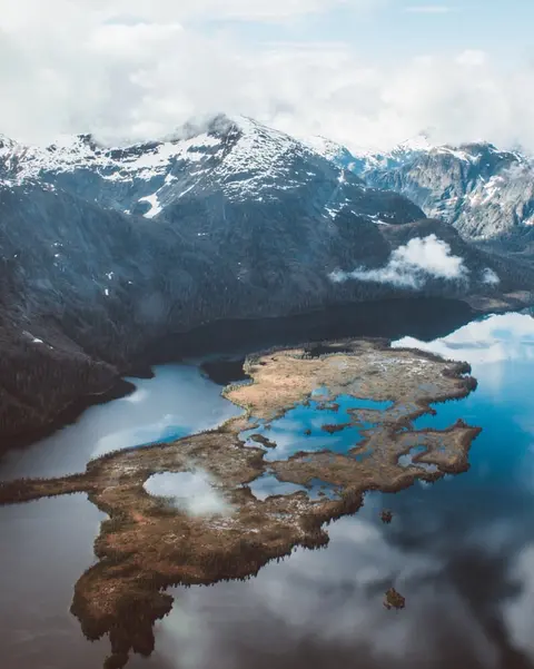
קטצ'יקן מחזיקה על חוף היער של האי רוויאליגידו באלסקה — עיירה כה צרה שהמקומיים צוחקים שהיא באורך של שלושה מיילים ורוחבה של שלושה רחובות. נערצת על ידי בני ה-Tlingit במשך אלפי שנים כמקום של סלמון בשפע, היא כיום מוכרת כבירת עמודי הטוטם של העולם: האוספים בכפר הסכמני ובפארק ההיסטורי Totem Bight שומרים על ריכוז המונומנטים האמנותיים הללו בכל מקום. רחוב קריק, טיילת של בתים היסטוריים צבעוניים שנבנו מעל נחל קטצ'יקן, לא כדאי לפספס. הקיץ (מאי–ספטמבר) מביא את מזג האוויר הטוב ביותר, עם סלמון זורם בנחלים למטה.
In the passage between Sumner Strait and Clarence Strait in Southeast Alaska’s Alexander Archipelago, midway between Price of Wales Island on the west and Zarembo Island on the east, is a small cluster of islands with a picturesque passageway between them called Snow Pass. It makes a scenic up-close route for your Seabourn ship during the transit.
Decision Passage is the western end of the Sumner Strait, which runs through the Alexander Archipelago into the Pacific Ocean in Southeastern Alaska, bounded on the north by Kuiu Island and Cape Decision, the location of a 1932 lighthouse. This is the route your ship takes when coming from or going to the colorful historic community of Sitka on the west coast of Baranof Island, which was originally the Russian fortress town of New Archangel.
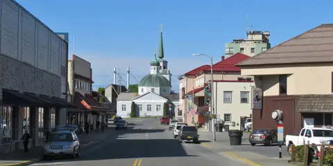
סיטקה, הממוקמת על החוף המערבי הפראי של האי בארנוף בדרום מזרח אלסקה, היא אחת הנמלים ההיסטוריים המהדהדים ביותר בצפון מערב האוקיינוס השקט — מקום שבו כיפות הבצל של האורתודוקסים הרוסים עולות מעל לפולס טוטם והיער הטרופי הגדול לוחץ עד לקו המים. הפארק ההיסטורי הלאומי סיטקה שומר על אתר הקרב של 1804 בין לוחמי טלינגיט למתיישבים רוסים לצד אוסף מרהיב של פולסים מונומנטליים. צפייה בלווייתנים, קיאקים בין לוטרות ים, וצפייה בדובים חומים בטבע הסובב מגדירים את החוויה החיצונית. מאי עד ספטמבר מציע את התנאים הנגישים והמאירים ביותר.
Yakutat Bay is 18 miles wide at its entry, and cuts from the Gulf of Alaska into Disenchantment Bay, the entryway to the huge Hubbard Glacier, North America’s largest tidewater glacier. As the bay narrows and the shorelines draw closer, the 400-foot face of the glacier exerts a luminous, ghostly presence, often from as much as 30 miles away. More and more floating ice dimples the surface of the water, and seals bob up and disappear again. The chilled air from the glacier flows in a downdraft of cold that gives rise to mists and gray clouds, through which the vivid blue of the ice wall shimmers. It is an impressive sight of nature’s immense raw workplace, shaping the earth itself as part of an endless cycle of water from the sea evaporating to the sky, falling as snow on the heights and inching over centuries back again to the sea.
The Hubbard Glacier is the largest, and one of the most spectacular tidewater glaciers in North America. Its ice cliffs, some 400’ (121 m) tall, calve icebergs into the fjord, which may frequently be larger than a five-story building. The glacier’s surface is creased and contorted, resembling the wrinkled skin of a giant elephant. Records show it has been growing in thickness and advancing since 1895. This stands in stark contrast to other glaciers around the world, most of which have been receding during the past century. In 2002, the glacier blocked Russell Fjord for two and a half months, raising water levels 61’ (18 m) and threatening local communities with flooding. Nutrient-rich waters along the glacier face attract many species. Gulls and kittiwake colonies adorn smaller islands and harbor seals patrol the icy waters. In 1890, Israel Russell explored the area of Yakutat Bay and Hubbard Glacier, naming it after Gardiner G. Hubbard, a financier of his expedition and a founder and the first president of the National Geographic Society. VIEW CRUISES
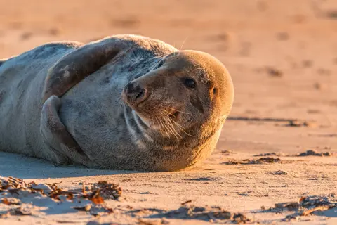
איי איניאן הם קבוצת איים פראית ובלתי מיושבת בכניסה למצר קרוס באלסקה, ידועים במפגשי חיות בר יוצאי דופן כולל האכלה של לווייתנים גבנוניים בבועות וריכוזים עצומים של אריות ים סטלר. חוויות חובה כוללות טיולי זודיאק לאורך החופים הסלעיים של האיים, צפייה בהאכלה משותפת של לווייתנים, וחקר בריכות גאות מלאות בחיים ימיים. בקרו ביולי-אוגוסט לפעילות לווייתנים בשיאה ולתנאי ים הטובים ביותר.
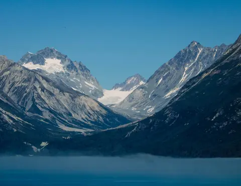
אייסי סטרייט פוינט הוא נמל אלסקי מדהים הידוע ביופיו הטבעי המרהיב ובתרבות הילידים הטלינגיט העשירה. חוויות שחובה לעשות כוללות ליהנות מפירות ים טריים מקומיים ויציאה לטיולי חיות בר בפארק הלאומי גליישר ביי. העונה הטובה ביותר לביקור היא במהלך חודשי הקיץ, כאשר מזג האוויר מתון וחיות הבר בשפע.
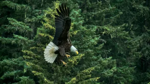
היינס היא עיירה אותנטית באלסקה, הממוקמת על פיורד העמוק ביותר בצפון אמריקה, ביתה של הקהילה הגדולה ביותר בעולם של עיטם לבן — עד ארבעה אלפים עופות לאורך נהר צ'ילקט — וקהילה אמנותית משגשגת השומרת על מסורות תרבותיות של טלינגיט. בקרו בין יוני לאוגוסט דרך קונרד או לינבלד לנחיתות מסוק על קרחונים וטיולים沿 החוף, או בין אוקטובר לפברואר למופע העיטים המדהים שהופך את היינס לסוד השמור ביותר של אלסקה.
Lynn Canal is a 90-mile long inlet into Alaska’s coast running from the Chilkat River in the north to the Chatham Strait and Stephens Passage in the south. Because it connects the towns of Skagway and Haines to Juneau and the rest of the Inside Passage, it is an important shipping lane for ferries, cargo and cruise ships, and was a crucial passageway to the Klondike gold fields during the Gold Rush. It was discovered by Joseph Whidbey in 1794 and named by George Vancouver after his birthplace, King’s Lynn in Norfolk, England. More than 2,000 feet in depth, it is one of the deepest and longest fjords in the world, and the deepest in North America outside Greenland.
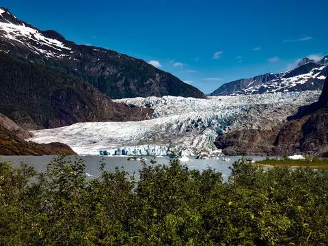
ג'ונו, בירת מדינת אמריקה היחידה שאינה ניתנת להגעה בכביש, מתגמלת את המסע עם יופי פראי שמעט ערים על פני כדור הארץ יכולות להתחרות בו. קרחון מנדנהול — נהר חי של קרח עתיק — נמצא רק חמש עשרה דקות ממרכז העיר, שם מטוסי מים טסים מעל חוף שמוקף בהרים מכוסים עץ אשוח המתמוטטים היישר אל הים. החוויה שחייבים לחוות היא נחיתה במסוק על גבי שדה הקרח או טיול לצפייה בלווייתנים במעבר סטפנס, שם לווייתני גבנון קופצים בקרבה מדהימה. ג'ונו היא החמה ביותר מיוני עד אוגוסט, אם כי גם ימי הקיץ יכולים להביא את הגשם המפורסם של אלסקה הדרומית-מזרחית ששומר על היער הגשום זוהר תמיד.
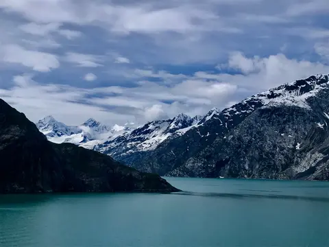
פארק הלאומי מפרץ הקרח הוא אחד הנופים המדהימים ביותר של התפרצות קרח פעילה על פני כדור הארץ — 3.3 מיליון דונם של אלסקה הדרומית-מזרחית שבהם קרחונים חותכים קרחונים בגובה קתדרלות לתוך פיורדים של מים כחולים זוהרים, והאדמה עצמה עדיין עולה, משוחררת מעומס הקרח שכבש את כל האזור הזה רק לפני שני מאות. הפארק, שניתן להגיע אליו רק בספינה או במטוס קטן, מתגמל את המבקרים במפגשים עם חיות בר — לווייתני גבנון, דובים חומים, אוטרים ימיים ועיזי הרים — על רקע נופים כמעט מדהימים. העונה נמשכת מאי עד ספטמבר; סוף יוני ויולי מציעים את הימים הארוכים ביותר ואת הפעילות המהימנה ביותר של חיות הבר.
Decision Passage is the western end of the Sumner Strait, which runs through the Alexander Archipelago into the Pacific Ocean in Southeastern Alaska, bounded on the north by Kuiu Island and Cape Decision, the location of a 1932 lighthouse. This is the route your ship takes when coming from or going to the colorful historic community of Sitka on the west coast of Baranof Island, which was originally the Russian fortress town of New Archangel.
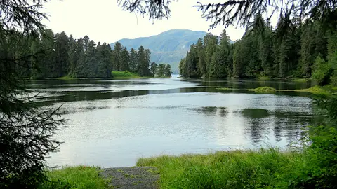
וראנג'ל הוא אחד מהנמלים האותנטיים ביותר של מעבר הפנימי באלסקה, שבו מורשת טלינגיט, פטרוגליפים עתיקים וחיות בר ברמה עולמית מתאגדים בפתחו של נהר סטיקין העצום. חוויות חיוניות כוללות שיט בסירת ג'ט אל קרחון לקונטה, צפייה בדובים דגים בנחל אנן וטעם סלמון מעושן מקומי. יולי ואוגוסט מציעים את תקופת הדיג המקסימלית של הסלמון וצפייה בדובים.
Stikine Strait is a picturesque channel in the Alexander Archipelago of Alaska between Zarembo Island and Woronkofski and Etolin Islands near the mouth of the Stikine River south of Wrangell. It first appears on an 1848 Russian chart as Stakhin Strait and has been spelled variously on many charts since that time.
The 108-mile Behm Canal runs from the Clarence Strait through the Alexander Archipelago of Southeast Alaska, and into the channel separating Revillagigedo Island from the mainland. It forms part Inside Passage on the route between Ketchikan and the Misty Fjords National Monument. The canal was named by George Vancouver during his surveying expedition in 1793, in honor of Magnus von Behm, who had been governor of Kamchatka in the Russian Far East when Vancouver called at Petropavlovsk with Captain Cook’s expedition following the Cook’s murder in Hawaii.
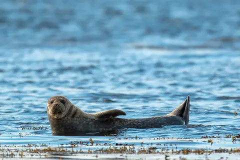
אנדרטת מיסטי פיורדס היא שמורת טבע של 930,000 דונם בדרום מזרח אלסקה, שבה צוקים גרניטיים תלולים עולים מתוך פיורדים שקטים דרך ערפילים ועננים מתמשכים. דברים שחובה לעשות כוללים קיאקים דרך זרועות פיורד שקטות, שיט בזודיאק ליד מפלים וסלע הוולקני ניו אדי סטון, וצפייה בדובים, עיטים ואורקות בערוצים בתוליים. מאי עד ספטמבר מציע את עונת הביקור, כאשר הגשם מוסיף לאווירה האתראלית של האנדרטה.
Misty Fjords National Monument is a section of the Tongass National Forest in Alaska’s extreme southeastern Panhandle region. The monument consists of over two million acres of deeply cut fjords cradled in U-shaped valleys between mountain ranges rising 2,000 to 3,000 feet above sea level. The fjords themselves extend as much as 1,000 feet below the surface. These granite ranges are covered with virgin forest, and most of the monument is also a dedicated wilderness area. Misty Fjords inspired the explorer John Muir to proclaim them among the most beautiful places he had ever seen. Your ship will cruise among these spectacular forests, waterfalls and mountains. The onboard Ventures by Seabourn team will offer optional excursions including kayaking the fjords and a short sightseeing floatplane flight.
נסיך רופרט, תחנת רכבת היסטורית על חוף הצפון של קולומביה הבריטית, enchant מבקרים עם מורשת טסימשיאן העמוקה שלו, דיג הליבוט המוביל בעולם, ונופי יערות הגשם המסתוריים לאורך המעבר הפנימי. טעם סלמון מעושן טרי על שפת המים וחקר את מפעל הקנינג של צפון האוקיינוס השקט, מפעל הקנינג הוותיק ביותר בקנדה, עבור מפגש חי עם נשמת הים של הנמל. הזמן הטוב ביותר לבקר הוא בין יוני לאוגוסט, כאשר הימים הארוכים מאטים את הגשמים המפורסמים ופעילות חיות הבר בשיאה לאורך החוף.
Grenville Channel is a long, well-protected channel along the northern British Columbia coast between the large Pitt Island and the mainland. It is an important shipping lane, and you are likely to see ships of many different types and sizes as you pass through. The shores are mountainous on both sides, with two notable peaks about halfway through, Mt. Batchellor on the east side and Mt. Saunders on Pitt Island to the west. There are a number of Indian Reserves and Marine Parks in the mountains and narrow waterways off the channel.
Whale Channel is a picturesque waterway separating Gil Island from Princess Royal Island in British Columbia’s Inside Passage. Surrounded by snow-capped mountain ranges and teeming with marine life, It is a diversion from the main shipping lane, located roughly halfway between Prince Rupert and the First Nations village of Klemtu. VIEW CRUISES Skip Footer Content About Us
The Princess Royal Channel separates the largest island along British Columbia’s coast from the mainland. It is located roughly halfway between Bella Bella in the south and Prince Rupert in the north, in one of the province’s most remote areas. Princess Royal island was named in 1788 by Captain Charles Duncan, in honor of his ship, the Princess Royal. The island is uninhabited, although there are two small villages in the channel, the First Nations community of Klemtu on Swindle Island and Hartley Bay on the mainland. Wildlife, by contrast, is plentiful, including Kermode, black and grizzly bears, deer, wolves and foxes. Golden and bald eagles nest in the region, as well as the endangered marbled murrelet. In the waters, there are abundant salmon, elephant seals, whales, orcas and dolphins.
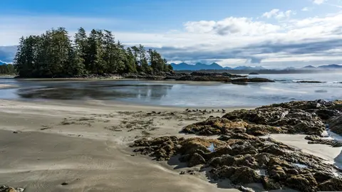
אלרט ביי, קנדה היא עיר נמל ייחודית שבה מורשת תרבותית עמוקה פוגשת אווירה מקומית אותנטית, המופיעה במסלולים של HX Expeditions. חוויות שחובה לעשות כוללות הליכה במרכז ההיסטורי כדי לחוות את המורשת האדריכלית המורכבת, וחיפוש אחר המסורות הקולינריות האזוריות במוסד מועדף מקומית הרחק מאזור הנמל. הזמן האופטימלי לביקור הוא מיוני עד אוגוסט, כאשר חודשי הקיץ מביאים את הטמפרטורות החמות ביותר והימים הארוכים ביותר.
Johnstone Strait is a well-protected shipping route passing 68 miles/110 km along the northeast shore of Vancouver Island between the island and the mainland of British Columbia. The strait is between 1 ½ miles and 3 miles wide, and leads from the broad Georgia Strait through a narrow channel called Discovery Passage. The strait was named by Vancouver in 1792 for James Johnstone, the master of one of his tenders during the survey expedition that revealed Vancouver Island to be an island. There are no cities or towns on the strait. The Johnstone Strait is the summer range of a large pod of seasonally resident orcas which are frequently seen in the area. VIEW CRUISES Skip Footer Content About Us Our Company News Careers Contact Us Video Gallery Accessibility Seabourn Club Seabourn Referral Program Travel Resources
The Seymour Narrows is a 3-mile/5 km stretch of the Discovery Channel north of Vancouver Island, British Columbia that is notorious for the strength of the tidal currents flowing through it. The average width of the narrows is just 750 meters. During extreme tides, the current through the narrows is subject to severe Venturi effect, resulting in an increased velocity that can reach 15 knots. For much of its modern history, there was an additional hazard in the narrows called Ripple Rock, a shallow obstruction that claimed no fewer than 119 ships and 114 lives. In 1958, after months of tunneling and preparation, Ripple Rock was blown up in the largest commercial, non-nuclear explosion ever recorded in North America. Still, the navigation of Seymour Narrows is dependent on tidal and other conditions, and requires skill and technical accomplishment.
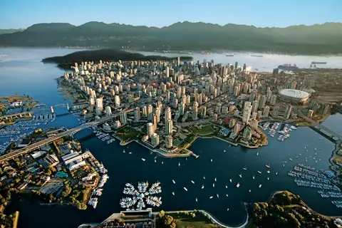
לחוצה בין האוקיינוס השקט להררי החוף, ונקובר היא השער הטבעי למעבר הפנימי של אלסקה — עיר שבה יערות גשם מתונים נפגשים עם מגדלי זכוכית ושבה סרטן דונגנס ופסל הסלמון הפראי מגדירים מטבח של חוף האוקיינוס השקט שמתחרה בכל מטבח בצפון אמריקה. טיילו על חוף הים של פארק סטנלי באורך 22 קילומטרים, תנו לעצמכם לאבד את עצמכם בשוק של גרנוויל, ואז חצו במעבורת אל הפאר של ויקטוריה בעידן אדוארד. עונת השייט לאלסקה מגיעה לשיאה ממאי עד ספטמבר, מה שהופך את ונקובר לנקודת התחלה אידיאלית לאחת מהמסעות הגדולים של האוקיינוס.
Day 1
לחוצה בין האוקיינוס השקט להררי החוף, ונקובר היא השער הטבעי למעבר הפנימי של אלסקה — עיר שבה יערות גשם מתונים נפגשים עם מגדלי זכוכית ושבה סרטן דונגנס ופסל הסלמון הפראי מגדירים מטבח של חוף האוקיינוס השקט שמתחרה בכל מטבח בצפון אמריקה. טיילו על חוף הים של פארק סטנלי באורך 22 קילומטרים, תנו לעצמכם לאבד את עצמכם בשוק של גרנוויל, ואז חצו במעבורת אל הפאר של ויקטוריה בעידן אדוארד. עונת השייט לאלסקה מגיעה לשיאה ממאי עד ספטמבר, מה שהופך את ונקובר לנקודת התחלה אידיאלית לאחת מהמסעות הגדולים של האוקיינוס.
The Seymour Narrows is a 3-mile/5 km stretch of the Discovery Channel north of Vancouver Island, British Columbia that is notorious for the strength of the tidal currents flowing through it. The average width of the narrows is just 750 meters. During extreme tides, the current through the narrows is subject to severe Venturi effect, resulting in an increased velocity that can reach 15 knots. For much of its modern history, there was an additional hazard in the narrows called Ripple Rock, a shallow obstruction that claimed no fewer than 119 ships and 114 lives. In 1958, after months of tunneling and preparation, Ripple Rock was blown up in the largest commercial, non-nuclear explosion ever recorded in North America. Still, the navigation of Seymour Narrows is dependent on tidal and other conditions, and requires skill and technical accomplishment.
Day 2
The Queen Charlotte Sound lies between the Queen Charlotte Strait, which winds between Vancouver Island and the British Columbia mainland in the south, and Hecate Strait, which is northward, adjacent to the Haida Gwaii Islands off the Pacific coast of British Columbia. It is a broad reach in the long shipping route called the Inside Passage threading the myriad islands stretching from Washington’s Puget Sound to Alaska.
Day 3
קטצ'יקן מחזיקה על חוף היער של האי רוויאליגידו באלסקה — עיירה כה צרה שהמקומיים צוחקים שהיא באורך של שלושה מיילים ורוחבה של שלושה רחובות. נערצת על ידי בני ה-Tlingit במשך אלפי שנים כמקום של סלמון בשפע, היא כיום מוכרת כבירת עמודי הטוטם של העולם: האוספים בכפר הסכמני ובפארק ההיסטורי Totem Bight שומרים על ריכוז המונומנטים האמנותיים הללו בכל מקום. רחוב קריק, טיילת של בתים היסטוריים צבעוניים שנבנו מעל נחל קטצ'יקן, לא כדאי לפספס. הקיץ (מאי–ספטמבר) מביא את מזג האוויר הטוב ביותר, עם סלמון זורם בנחלים למטה.
In the passage between Sumner Strait and Clarence Strait in Southeast Alaska’s Alexander Archipelago, midway between Price of Wales Island on the west and Zarembo Island on the east, is a small cluster of islands with a picturesque passageway between them called Snow Pass. It makes a scenic up-close route for your Seabourn ship during the transit.
Decision Passage is the western end of the Sumner Strait, which runs through the Alexander Archipelago into the Pacific Ocean in Southeastern Alaska, bounded on the north by Kuiu Island and Cape Decision, the location of a 1932 lighthouse. This is the route your ship takes when coming from or going to the colorful historic community of Sitka on the west coast of Baranof Island, which was originally the Russian fortress town of New Archangel.
Day 4
סיטקה, הממוקמת על החוף המערבי הפראי של האי בארנוף בדרום מזרח אלסקה, היא אחת הנמלים ההיסטוריים המהדהדים ביותר בצפון מערב האוקיינוס השקט — מקום שבו כיפות הבצל של האורתודוקסים הרוסים עולות מעל לפולס טוטם והיער הטרופי הגדול לוחץ עד לקו המים. הפארק ההיסטורי הלאומי סיטקה שומר על אתר הקרב של 1804 בין לוחמי טלינגיט למתיישבים רוסים לצד אוסף מרהיב של פולסים מונומנטליים. צפייה בלווייתנים, קיאקים בין לוטרות ים, וצפייה בדובים חומים בטבע הסובב מגדירים את החוויה החיצונית. מאי עד ספטמבר מציע את התנאים הנגישים והמאירים ביותר.
Day 5
Yakutat Bay is 18 miles wide at its entry, and cuts from the Gulf of Alaska into Disenchantment Bay, the entryway to the huge Hubbard Glacier, North America’s largest tidewater glacier. As the bay narrows and the shorelines draw closer, the 400-foot face of the glacier exerts a luminous, ghostly presence, often from as much as 30 miles away. More and more floating ice dimples the surface of the water, and seals bob up and disappear again. The chilled air from the glacier flows in a downdraft of cold that gives rise to mists and gray clouds, through which the vivid blue of the ice wall shimmers. It is an impressive sight of nature’s immense raw workplace, shaping the earth itself as part of an endless cycle of water from the sea evaporating to the sky, falling as snow on the heights and inching over centuries back again to the sea.
The Hubbard Glacier is the largest, and one of the most spectacular tidewater glaciers in North America. Its ice cliffs, some 400’ (121 m) tall, calve icebergs into the fjord, which may frequently be larger than a five-story building. The glacier’s surface is creased and contorted, resembling the wrinkled skin of a giant elephant. Records show it has been growing in thickness and advancing since 1895. This stands in stark contrast to other glaciers around the world, most of which have been receding during the past century. In 2002, the glacier blocked Russell Fjord for two and a half months, raising water levels 61’ (18 m) and threatening local communities with flooding. Nutrient-rich waters along the glacier face attract many species. Gulls and kittiwake colonies adorn smaller islands and harbor seals patrol the icy waters. In 1890, Israel Russell explored the area of Yakutat Bay and Hubbard Glacier, naming it after Gardiner G. Hubbard, a financier of his expedition and a founder and the first president of the National Geographic Society. VIEW CRUISES
Day 6
איי איניאן הם קבוצת איים פראית ובלתי מיושבת בכניסה למצר קרוס באלסקה, ידועים במפגשי חיות בר יוצאי דופן כולל האכלה של לווייתנים גבנוניים בבועות וריכוזים עצומים של אריות ים סטלר. חוויות חובה כוללות טיולי זודיאק לאורך החופים הסלעיים של האיים, צפייה בהאכלה משותפת של לווייתנים, וחקר בריכות גאות מלאות בחיים ימיים. בקרו ביולי-אוגוסט לפעילות לווייתנים בשיאה ולתנאי ים הטובים ביותר.
אייסי סטרייט פוינט הוא נמל אלסקי מדהים הידוע ביופיו הטבעי המרהיב ובתרבות הילידים הטלינגיט העשירה. חוויות שחובה לעשות כוללות ליהנות מפירות ים טריים מקומיים ויציאה לטיולי חיות בר בפארק הלאומי גליישר ביי. העונה הטובה ביותר לביקור היא במהלך חודשי הקיץ, כאשר מזג האוויר מתון וחיות הבר בשפע.
Day 7
היינס היא עיירה אותנטית באלסקה, הממוקמת על פיורד העמוק ביותר בצפון אמריקה, ביתה של הקהילה הגדולה ביותר בעולם של עיטם לבן — עד ארבעה אלפים עופות לאורך נהר צ'ילקט — וקהילה אמנותית משגשגת השומרת על מסורות תרבותיות של טלינגיט. בקרו בין יוני לאוגוסט דרך קונרד או לינבלד לנחיתות מסוק על קרחונים וטיולים沿 החוף, או בין אוקטובר לפברואר למופע העיטים המדהים שהופך את היינס לסוד השמור ביותר של אלסקה.
Lynn Canal is a 90-mile long inlet into Alaska’s coast running from the Chilkat River in the north to the Chatham Strait and Stephens Passage in the south. Because it connects the towns of Skagway and Haines to Juneau and the rest of the Inside Passage, it is an important shipping lane for ferries, cargo and cruise ships, and was a crucial passageway to the Klondike gold fields during the Gold Rush. It was discovered by Joseph Whidbey in 1794 and named by George Vancouver after his birthplace, King’s Lynn in Norfolk, England. More than 2,000 feet in depth, it is one of the deepest and longest fjords in the world, and the deepest in North America outside Greenland.
Day 8
ג'ונו, בירת מדינת אמריקה היחידה שאינה ניתנת להגעה בכביש, מתגמלת את המסע עם יופי פראי שמעט ערים על פני כדור הארץ יכולות להתחרות בו. קרחון מנדנהול — נהר חי של קרח עתיק — נמצא רק חמש עשרה דקות ממרכז העיר, שם מטוסי מים טסים מעל חוף שמוקף בהרים מכוסים עץ אשוח המתמוטטים היישר אל הים. החוויה שחייבים לחוות היא נחיתה במסוק על גבי שדה הקרח או טיול לצפייה בלווייתנים במעבר סטפנס, שם לווייתני גבנון קופצים בקרבה מדהימה. ג'ונו היא החמה ביותר מיוני עד אוגוסט, אם כי גם ימי הקיץ יכולים להביא את הגשם המפורסם של אלסקה הדרומית-מזרחית ששומר על היער הגשום זוהר תמיד.
Day 9
פארק הלאומי מפרץ הקרח הוא אחד הנופים המדהימים ביותר של התפרצות קרח פעילה על פני כדור הארץ — 3.3 מיליון דונם של אלסקה הדרומית-מזרחית שבהם קרחונים חותכים קרחונים בגובה קתדרלות לתוך פיורדים של מים כחולים זוהרים, והאדמה עצמה עדיין עולה, משוחררת מעומס הקרח שכבש את כל האזור הזה רק לפני שני מאות. הפארק, שניתן להגיע אליו רק בספינה או במטוס קטן, מתגמל את המבקרים במפגשים עם חיות בר — לווייתני גבנון, דובים חומים, אוטרים ימיים ועיזי הרים — על רקע נופים כמעט מדהימים. העונה נמשכת מאי עד ספטמבר; סוף יוני ויולי מציעים את הימים הארוכים ביותר ואת הפעילות המהימנה ביותר של חיות הבר.
Day 10
Decision Passage is the western end of the Sumner Strait, which runs through the Alexander Archipelago into the Pacific Ocean in Southeastern Alaska, bounded on the north by Kuiu Island and Cape Decision, the location of a 1932 lighthouse. This is the route your ship takes when coming from or going to the colorful historic community of Sitka on the west coast of Baranof Island, which was originally the Russian fortress town of New Archangel.
וראנג'ל הוא אחד מהנמלים האותנטיים ביותר של מעבר הפנימי באלסקה, שבו מורשת טלינגיט, פטרוגליפים עתיקים וחיות בר ברמה עולמית מתאגדים בפתחו של נהר סטיקין העצום. חוויות חיוניות כוללות שיט בסירת ג'ט אל קרחון לקונטה, צפייה בדובים דגים בנחל אנן וטעם סלמון מעושן מקומי. יולי ואוגוסט מציעים את תקופת הדיג המקסימלית של הסלמון וצפייה בדובים.
Stikine Strait is a picturesque channel in the Alexander Archipelago of Alaska between Zarembo Island and Woronkofski and Etolin Islands near the mouth of the Stikine River south of Wrangell. It first appears on an 1848 Russian chart as Stakhin Strait and has been spelled variously on many charts since that time.
Day 11
The 108-mile Behm Canal runs from the Clarence Strait through the Alexander Archipelago of Southeast Alaska, and into the channel separating Revillagigedo Island from the mainland. It forms part Inside Passage on the route between Ketchikan and the Misty Fjords National Monument. The canal was named by George Vancouver during his surveying expedition in 1793, in honor of Magnus von Behm, who had been governor of Kamchatka in the Russian Far East when Vancouver called at Petropavlovsk with Captain Cook’s expedition following the Cook’s murder in Hawaii.
אנדרטת מיסטי פיורדס היא שמורת טבע של 930,000 דונם בדרום מזרח אלסקה, שבה צוקים גרניטיים תלולים עולים מתוך פיורדים שקטים דרך ערפילים ועננים מתמשכים. דברים שחובה לעשות כוללים קיאקים דרך זרועות פיורד שקטות, שיט בזודיאק ליד מפלים וסלע הוולקני ניו אדי סטון, וצפייה בדובים, עיטים ואורקות בערוצים בתוליים. מאי עד ספטמבר מציע את עונת הביקור, כאשר הגשם מוסיף לאווירה האתראלית של האנדרטה.
Misty Fjords National Monument is a section of the Tongass National Forest in Alaska’s extreme southeastern Panhandle region. The monument consists of over two million acres of deeply cut fjords cradled in U-shaped valleys between mountain ranges rising 2,000 to 3,000 feet above sea level. The fjords themselves extend as much as 1,000 feet below the surface. These granite ranges are covered with virgin forest, and most of the monument is also a dedicated wilderness area. Misty Fjords inspired the explorer John Muir to proclaim them among the most beautiful places he had ever seen. Your ship will cruise among these spectacular forests, waterfalls and mountains. The onboard Ventures by Seabourn team will offer optional excursions including kayaking the fjords and a short sightseeing floatplane flight.
Day 12
נסיך רופרט, תחנת רכבת היסטורית על חוף הצפון של קולומביה הבריטית, enchant מבקרים עם מורשת טסימשיאן העמוקה שלו, דיג הליבוט המוביל בעולם, ונופי יערות הגשם המסתוריים לאורך המעבר הפנימי. טעם סלמון מעושן טרי על שפת המים וחקר את מפעל הקנינג של צפון האוקיינוס השקט, מפעל הקנינג הוותיק ביותר בקנדה, עבור מפגש חי עם נשמת הים של הנמל. הזמן הטוב ביותר לבקר הוא בין יוני לאוגוסט, כאשר הימים הארוכים מאטים את הגשמים המפורסמים ופעילות חיות הבר בשיאה לאורך החוף.
Day 13
Grenville Channel is a long, well-protected channel along the northern British Columbia coast between the large Pitt Island and the mainland. It is an important shipping lane, and you are likely to see ships of many different types and sizes as you pass through. The shores are mountainous on both sides, with two notable peaks about halfway through, Mt. Batchellor on the east side and Mt. Saunders on Pitt Island to the west. There are a number of Indian Reserves and Marine Parks in the mountains and narrow waterways off the channel.
Whale Channel is a picturesque waterway separating Gil Island from Princess Royal Island in British Columbia’s Inside Passage. Surrounded by snow-capped mountain ranges and teeming with marine life, It is a diversion from the main shipping lane, located roughly halfway between Prince Rupert and the First Nations village of Klemtu. VIEW CRUISES Skip Footer Content About Us
The Princess Royal Channel separates the largest island along British Columbia’s coast from the mainland. It is located roughly halfway between Bella Bella in the south and Prince Rupert in the north, in one of the province’s most remote areas. Princess Royal island was named in 1788 by Captain Charles Duncan, in honor of his ship, the Princess Royal. The island is uninhabited, although there are two small villages in the channel, the First Nations community of Klemtu on Swindle Island and Hartley Bay on the mainland. Wildlife, by contrast, is plentiful, including Kermode, black and grizzly bears, deer, wolves and foxes. Golden and bald eagles nest in the region, as well as the endangered marbled murrelet. In the waters, there are abundant salmon, elephant seals, whales, orcas and dolphins.
Day 14
אלרט ביי, קנדה היא עיר נמל ייחודית שבה מורשת תרבותית עמוקה פוגשת אווירה מקומית אותנטית, המופיעה במסלולים של HX Expeditions. חוויות שחובה לעשות כוללות הליכה במרכז ההיסטורי כדי לחוות את המורשת האדריכלית המורכבת, וחיפוש אחר המסורות הקולינריות האזוריות במוסד מועדף מקומית הרחק מאזור הנמל. הזמן האופטימלי לביקור הוא מיוני עד אוגוסט, כאשר חודשי הקיץ מביאים את הטמפרטורות החמות ביותר והימים הארוכים ביותר.
Johnstone Strait is a well-protected shipping route passing 68 miles/110 km along the northeast shore of Vancouver Island between the island and the mainland of British Columbia. The strait is between 1 ½ miles and 3 miles wide, and leads from the broad Georgia Strait through a narrow channel called Discovery Passage. The strait was named by Vancouver in 1792 for James Johnstone, the master of one of his tenders during the survey expedition that revealed Vancouver Island to be an island. There are no cities or towns on the strait. The Johnstone Strait is the summer range of a large pod of seasonally resident orcas which are frequently seen in the area. VIEW CRUISES Skip Footer Content About Us Our Company News Careers Contact Us Video Gallery Accessibility Seabourn Club Seabourn Referral Program Travel Resources
The Seymour Narrows is a 3-mile/5 km stretch of the Discovery Channel north of Vancouver Island, British Columbia that is notorious for the strength of the tidal currents flowing through it. The average width of the narrows is just 750 meters. During extreme tides, the current through the narrows is subject to severe Venturi effect, resulting in an increased velocity that can reach 15 knots. For much of its modern history, there was an additional hazard in the narrows called Ripple Rock, a shallow obstruction that claimed no fewer than 119 ships and 114 lives. In 1958, after months of tunneling and preparation, Ripple Rock was blown up in the largest commercial, non-nuclear explosion ever recorded in North America. Still, the navigation of Seymour Narrows is dependent on tidal and other conditions, and requires skill and technical accomplishment.
Day 15
לחוצה בין האוקיינוס השקט להררי החוף, ונקובר היא השער הטבעי למעבר הפנימי של אלסקה — עיר שבה יערות גשם מתונים נפגשים עם מגדלי זכוכית ושבה סרטן דונגנס ופסל הסלמון הפראי מגדירים מטבח של חוף האוקיינוס השקט שמתחרה בכל מטבח בצפון אמריקה. טיילו על חוף הים של פארק סטנלי באורך 22 קילומטרים, תנו לעצמכם לאבד את עצמכם בשוק של גרנוויל, ואז חצו במעבורת אל הפאר של ויקטוריה בעידן אדוארד. עונת השייט לאלסקה מגיעה לשיאה ממאי עד ספטמבר, מה שהופך את ונקובר לנקודת התחלה אידיאלית לאחת מהמסעות הגדולים של האוקיינוס.
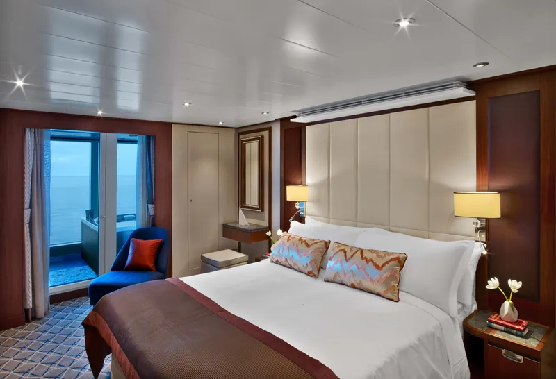
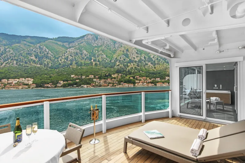

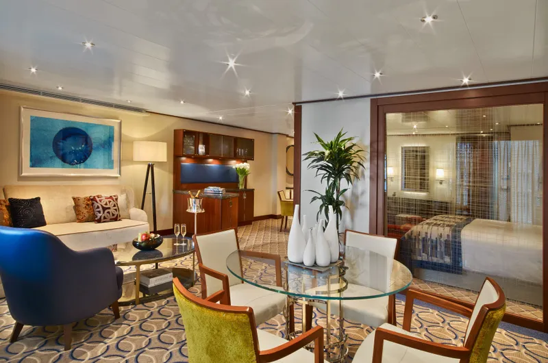

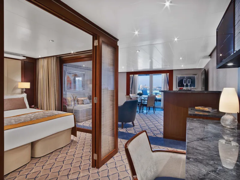


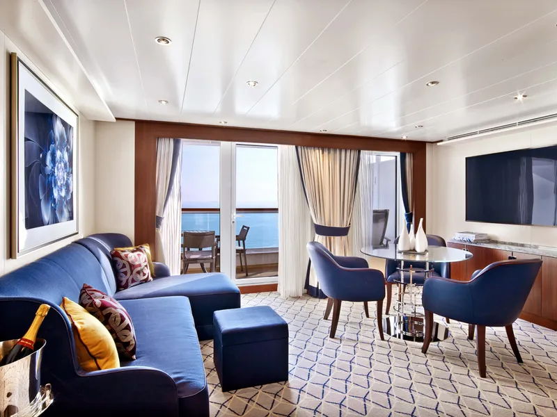



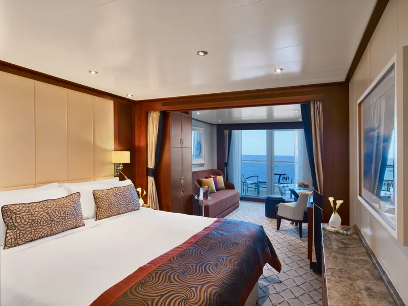
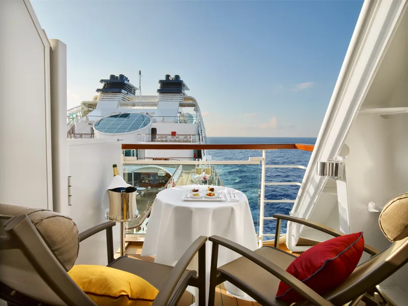

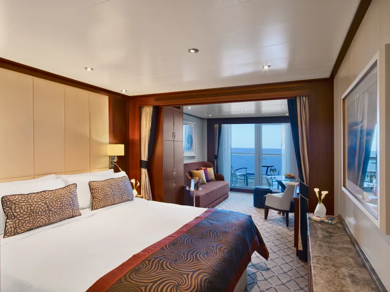
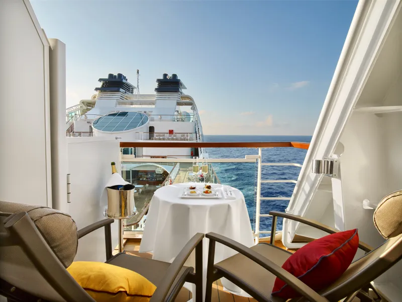

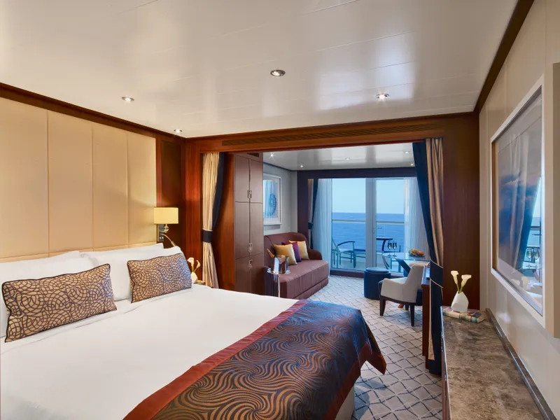
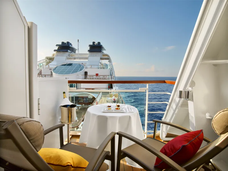

Our cruise specialists can help you find the perfect cabin and the best available pricing.
(+886) 02-2721-7300Contact Advisor