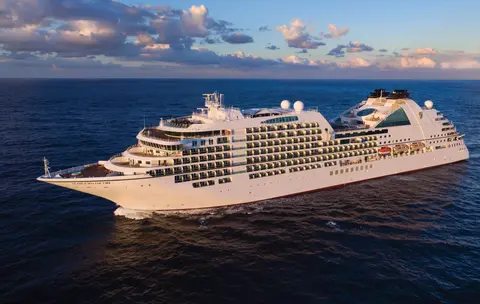
Seabourn7734
7-Day Alaska Glaciers & Canadian Inside Passage
Date
2027-06-04
Duration
7 nights
Departure Port
Juneau
Sjedinjene Američke Države
Arrival Port
Vancouver
Kanada
Rating
—
Theme
—
Date
2027-06-04
Duration
7 nights
Departure Port
Juneau
Sjedinjene Američke Države
Arrival Port
Vancouver
Kanada
Rating
—
Theme
—





Seabourn
2016
—
40,350 GT
600
266
330
690 m
28 m
19 knots
No
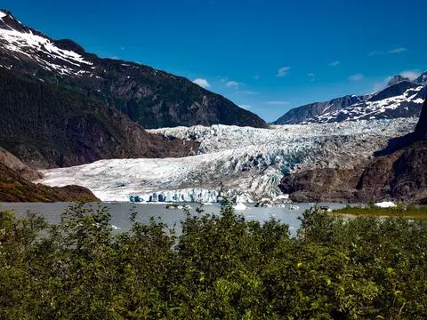
Jedini glavni grad američke savezne države kojem se ne može pristupiti cestom, Juneau nagrađuje putnike divljom veličanstvenošću koju rijetki gradovi na svijetu mogu nadmašiti. Mendenhall Glacier — živa rijeka drevnog leda — nalazi se samo petnaest minuta od centra grada, gdje hidroavioni lete iznad šetnice uz obalu, okružene planinama prekrivenim smrekama koje se strmo spuštaju u more. Nezaobilazno iskustvo je helikoptersko slijetanje na ledeno polje ili izlet promatranja kitova u Stephens Passageu, gdje se grbavi kitovi izdižu u zadivljujućoj blizini. Juneau je najtopliji od lipnja do kolovoza, iako čak i ljetni dani mogu donijeti poznatu kišu jugoistočnog Aljaske koja održava prašumu vječno svjetlucavom.
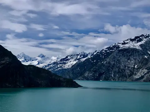
Nacionalni park Glacier Bay jedno je od najimpresivnijih krajolika aktivnog glacijalnog djelovanja na Zemlji — 3,3 milijuna hektara jugoistočnog Aljaske gdje plimni ledenjaci odvajaju ledenjake veličine katedrala u fjordove svjetlucavo plave vode, a zemlja sama i dalje se diže, oslobođena težine leda koji je prije samo dva stoljeća prekrivao cijelu ovu regiju. Park, do kojeg se može doći samo brodom ili malim zrakoplovom, nagrađuje posjetitelje susretima s divljim životinjama — grbavim kitovima, smeđim medvjedima, morskim vidrama i planinskim kozama — smještenima u krajoliku gotovo neodoljive veličine. Sezona traje od svibnja do rujna; kraj lipnja i srpanj nude najduže dane i najpouzdaniju aktivnost divljih životinja.
Decision Passage is the western end of the Sumner Strait, which runs through the Alexander Archipelago into the Pacific Ocean in Southeastern Alaska, bounded on the north by Kuiu Island and Cape Decision, the location of a 1932 lighthouse. This is the route your ship takes when coming from or going to the colorful historic community of Sitka on the west coast of Baranof Island, which was originally the Russian fortress town of New Archangel.
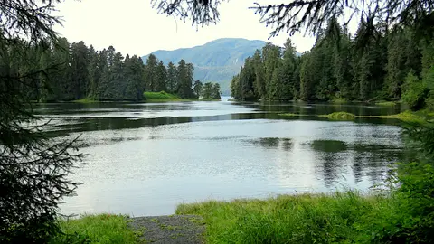
Wrangell je jedna od najautentičnijih luka Aljaske na Inside Passageu, gdje se tlingitska baština, drevni petroglifi i svjetski poznata divlja priroda sjedinjuju na ušću moćne rijeke Stikine. Nezaobilazna iskustva uključuju vožnju brzim čamcem do ledenjaka LeConte, promatranje medvjeda kako love ribu na potoku Anan te kušanje lokalno dimljenog lososa. Srpanj i kolovoz donose vrhunac migracije lososa i priliku za promatranje medvjeda.
Stikine Strait is a picturesque channel in the Alexander Archipelago of Alaska between Zarembo Island and Woronkofski and Etolin Islands near the mouth of the Stikine River south of Wrangell. It first appears on an 1848 Russian chart as Stakhin Strait and has been spelled variously on many charts since that time.
The 108-mile Behm Canal runs from the Clarence Strait through the Alexander Archipelago of Southeast Alaska, and into the channel separating Revillagigedo Island from the mainland. It forms part Inside Passage on the route between Ketchikan and the Misty Fjords National Monument. The canal was named by George Vancouver during his surveying expedition in 1793, in honor of Magnus von Behm, who had been governor of Kamchatka in the Russian Far East when Vancouver called at Petropavlovsk with Captain Cook’s expedition following the Cook’s murder in Hawaii.
Nacionalni spomenik Misty Fjords prostire se na 930.000 hektara netaknute divljine u jugoistočnom Aljasci, gdje se strme granitne litice uzdižu iz zrcalno mirnih fjordova kroz vječne zastore magle i oblaka. Nezaobilazna iskustva uključuju vožnju kajakom kroz tihe ruke fjordova, krstarenje zodiacom pored slapova i vulkanskog New Eddystone Rocka te promatranje medvjeda, orlova i orki u netaknutim kanalima. Sezona posjeta traje od svibnja do rujna, a kiša dodatno pojačava eteričnu atmosferu spomenika.
Misty Fjords National Monument is a section of the Tongass National Forest in Alaska’s extreme southeastern Panhandle region. The monument consists of over two million acres of deeply cut fjords cradled in U-shaped valleys between mountain ranges rising 2,000 to 3,000 feet above sea level. The fjords themselves extend as much as 1,000 feet below the surface. These granite ranges are covered with virgin forest, and most of the monument is also a dedicated wilderness area. Misty Fjords inspired the explorer John Muir to proclaim them among the most beautiful places he had ever seen. Your ship will cruise among these spectacular forests, waterfalls and mountains. The onboard Ventures by Seabourn team will offer optional excursions including kayaking the fjords and a short sightseeing floatplane flight.
Prince Rupert, povijesna željeznička stanica na sjevernoj obali Britanske Kolumbije, očarava posjetitelje svojom dubokom Tsimshian baštinom, vrhunskim ribolovom halibuta i maglovitim krajolikom prašume duž Inside Passagea. Kušajte svježe dimljeni losos na obali i istražite North Pacific Cannery, najstariju preživjelu tvornicu konzervi u Kanadi, za živopisni susret s pomorskom dušom ovog luka. Najbolje vrijeme za posjet je od lipnja do kolovoza, kada duži dani ublažavaju poznatu kišnu sezonu, a aktivnost divljih životinja duž obale doseže vrhunac.
Grenville Channel is a long, well-protected channel along the northern British Columbia coast between the large Pitt Island and the mainland. It is an important shipping lane, and you are likely to see ships of many different types and sizes as you pass through. The shores are mountainous on both sides, with two notable peaks about halfway through, Mt. Batchellor on the east side and Mt. Saunders on Pitt Island to the west. There are a number of Indian Reserves and Marine Parks in the mountains and narrow waterways off the channel.
Whale Channel is a picturesque waterway separating Gil Island from Princess Royal Island in British Columbia’s Inside Passage. Surrounded by snow-capped mountain ranges and teeming with marine life, It is a diversion from the main shipping lane, located roughly halfway between Prince Rupert and the First Nations village of Klemtu. VIEW CRUISES Skip Footer Content About Us
The Princess Royal Channel separates the largest island along British Columbia’s coast from the mainland. It is located roughly halfway between Bella Bella in the south and Prince Rupert in the north, in one of the province’s most remote areas. Princess Royal island was named in 1788 by Captain Charles Duncan, in honor of his ship, the Princess Royal. The island is uninhabited, although there are two small villages in the channel, the First Nations community of Klemtu on Swindle Island and Hartley Bay on the mainland. Wildlife, by contrast, is plentiful, including Kermode, black and grizzly bears, deer, wolves and foxes. Golden and bald eagles nest in the region, as well as the endangered marbled murrelet. In the waters, there are abundant salmon, elephant seals, whales, orcas and dolphins.
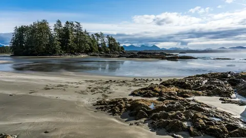
Alert Bay, Kanada, jedinstveni je lučki grad gdje se duboka kulturna baština susreće s autentičnom lokalnom atmosferom, a nalazi se na itinerarima HX Expeditions. Nezaobilazna iskustva uključuju šetnju povijesnim središtem kako biste osjetili slojevitu arhitektonsku baštinu te istraživanje regionalnih kulinarskih tradicija u lokalno omiljenom restoranu izvan lučke zone. Najbolje vrijeme za posjet je od lipnja do kolovoza, kada ljetni mjeseci donose najtoplije temperature i najduže dane.
Johnstone Strait is a well-protected shipping route passing 68 miles/110 km along the northeast shore of Vancouver Island between the island and the mainland of British Columbia. The strait is between 1 ½ miles and 3 miles wide, and leads from the broad Georgia Strait through a narrow channel called Discovery Passage. The strait was named by Vancouver in 1792 for James Johnstone, the master of one of his tenders during the survey expedition that revealed Vancouver Island to be an island. There are no cities or towns on the strait. The Johnstone Strait is the summer range of a large pod of seasonally resident orcas which are frequently seen in the area. VIEW CRUISES Skip Footer Content About Us Our Company News Careers Contact Us Video Gallery Accessibility Seabourn Club Seabourn Referral Program Travel Resources
The Seymour Narrows is a 3-mile/5 km stretch of the Discovery Channel north of Vancouver Island, British Columbia that is notorious for the strength of the tidal currents flowing through it. The average width of the narrows is just 750 meters. During extreme tides, the current through the narrows is subject to severe Venturi effect, resulting in an increased velocity that can reach 15 knots. For much of its modern history, there was an additional hazard in the narrows called Ripple Rock, a shallow obstruction that claimed no fewer than 119 ships and 114 lives. In 1958, after months of tunneling and preparation, Ripple Rock was blown up in the largest commercial, non-nuclear explosion ever recorded in North America. Still, the navigation of Seymour Narrows is dependent on tidal and other conditions, and requires skill and technical accomplishment.
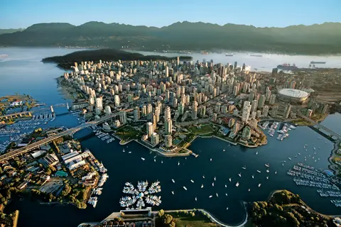
Smješten između Tihog oceana i planina Coast, Vancouver je prirodna vrata prema unutarnjem prolazu Aljaske — grad u kojem umjerena prašuma susreće staklene tornjeve, a dungeness rak i divlji sockeye losos definiraju kuhinju Pacifičkog ruba koja može parirati bilo kojoj u Sjevernoj Americi. Prošećite 22 kilometra dugom šetnicom uz more u parku Stanley, izgubite se u tržnici Granville Island, a zatim se trajektom uputite prema edvardijanskoj raskoši Victorije. Sezona krstarenja Aljaskom doseže vrhunac od svibnja do rujna, čineći Vancouver idealnom polaznom točkom za jedno od najvećih oceanskih putovanja na svijetu.
Day 1
Jedini glavni grad američke savezne države kojem se ne može pristupiti cestom, Juneau nagrađuje putnike divljom veličanstvenošću koju rijetki gradovi na svijetu mogu nadmašiti. Mendenhall Glacier — živa rijeka drevnog leda — nalazi se samo petnaest minuta od centra grada, gdje hidroavioni lete iznad šetnice uz obalu, okružene planinama prekrivenim smrekama koje se strmo spuštaju u more. Nezaobilazno iskustvo je helikoptersko slijetanje na ledeno polje ili izlet promatranja kitova u Stephens Passageu, gdje se grbavi kitovi izdižu u zadivljujućoj blizini. Juneau je najtopliji od lipnja do kolovoza, iako čak i ljetni dani mogu donijeti poznatu kišu jugoistočnog Aljaske koja održava prašumu vječno svjetlucavom.
Day 2
Nacionalni park Glacier Bay jedno je od najimpresivnijih krajolika aktivnog glacijalnog djelovanja na Zemlji — 3,3 milijuna hektara jugoistočnog Aljaske gdje plimni ledenjaci odvajaju ledenjake veličine katedrala u fjordove svjetlucavo plave vode, a zemlja sama i dalje se diže, oslobođena težine leda koji je prije samo dva stoljeća prekrivao cijelu ovu regiju. Park, do kojeg se može doći samo brodom ili malim zrakoplovom, nagrađuje posjetitelje susretima s divljim životinjama — grbavim kitovima, smeđim medvjedima, morskim vidrama i planinskim kozama — smještenima u krajoliku gotovo neodoljive veličine. Sezona traje od svibnja do rujna; kraj lipnja i srpanj nude najduže dane i najpouzdaniju aktivnost divljih životinja.
Day 3
Decision Passage is the western end of the Sumner Strait, which runs through the Alexander Archipelago into the Pacific Ocean in Southeastern Alaska, bounded on the north by Kuiu Island and Cape Decision, the location of a 1932 lighthouse. This is the route your ship takes when coming from or going to the colorful historic community of Sitka on the west coast of Baranof Island, which was originally the Russian fortress town of New Archangel.
Wrangell je jedna od najautentičnijih luka Aljaske na Inside Passageu, gdje se tlingitska baština, drevni petroglifi i svjetski poznata divlja priroda sjedinjuju na ušću moćne rijeke Stikine. Nezaobilazna iskustva uključuju vožnju brzim čamcem do ledenjaka LeConte, promatranje medvjeda kako love ribu na potoku Anan te kušanje lokalno dimljenog lososa. Srpanj i kolovoz donose vrhunac migracije lososa i priliku za promatranje medvjeda.
Stikine Strait is a picturesque channel in the Alexander Archipelago of Alaska between Zarembo Island and Woronkofski and Etolin Islands near the mouth of the Stikine River south of Wrangell. It first appears on an 1848 Russian chart as Stakhin Strait and has been spelled variously on many charts since that time.
Day 4
The 108-mile Behm Canal runs from the Clarence Strait through the Alexander Archipelago of Southeast Alaska, and into the channel separating Revillagigedo Island from the mainland. It forms part Inside Passage on the route between Ketchikan and the Misty Fjords National Monument. The canal was named by George Vancouver during his surveying expedition in 1793, in honor of Magnus von Behm, who had been governor of Kamchatka in the Russian Far East when Vancouver called at Petropavlovsk with Captain Cook’s expedition following the Cook’s murder in Hawaii.
Nacionalni spomenik Misty Fjords prostire se na 930.000 hektara netaknute divljine u jugoistočnom Aljasci, gdje se strme granitne litice uzdižu iz zrcalno mirnih fjordova kroz vječne zastore magle i oblaka. Nezaobilazna iskustva uključuju vožnju kajakom kroz tihe ruke fjordova, krstarenje zodiacom pored slapova i vulkanskog New Eddystone Rocka te promatranje medvjeda, orlova i orki u netaknutim kanalima. Sezona posjeta traje od svibnja do rujna, a kiša dodatno pojačava eteričnu atmosferu spomenika.
Misty Fjords National Monument is a section of the Tongass National Forest in Alaska’s extreme southeastern Panhandle region. The monument consists of over two million acres of deeply cut fjords cradled in U-shaped valleys between mountain ranges rising 2,000 to 3,000 feet above sea level. The fjords themselves extend as much as 1,000 feet below the surface. These granite ranges are covered with virgin forest, and most of the monument is also a dedicated wilderness area. Misty Fjords inspired the explorer John Muir to proclaim them among the most beautiful places he had ever seen. Your ship will cruise among these spectacular forests, waterfalls and mountains. The onboard Ventures by Seabourn team will offer optional excursions including kayaking the fjords and a short sightseeing floatplane flight.
Day 5
Prince Rupert, povijesna željeznička stanica na sjevernoj obali Britanske Kolumbije, očarava posjetitelje svojom dubokom Tsimshian baštinom, vrhunskim ribolovom halibuta i maglovitim krajolikom prašume duž Inside Passagea. Kušajte svježe dimljeni losos na obali i istražite North Pacific Cannery, najstariju preživjelu tvornicu konzervi u Kanadi, za živopisni susret s pomorskom dušom ovog luka. Najbolje vrijeme za posjet je od lipnja do kolovoza, kada duži dani ublažavaju poznatu kišnu sezonu, a aktivnost divljih životinja duž obale doseže vrhunac.
Day 6
Grenville Channel is a long, well-protected channel along the northern British Columbia coast between the large Pitt Island and the mainland. It is an important shipping lane, and you are likely to see ships of many different types and sizes as you pass through. The shores are mountainous on both sides, with two notable peaks about halfway through, Mt. Batchellor on the east side and Mt. Saunders on Pitt Island to the west. There are a number of Indian Reserves and Marine Parks in the mountains and narrow waterways off the channel.
Whale Channel is a picturesque waterway separating Gil Island from Princess Royal Island in British Columbia’s Inside Passage. Surrounded by snow-capped mountain ranges and teeming with marine life, It is a diversion from the main shipping lane, located roughly halfway between Prince Rupert and the First Nations village of Klemtu. VIEW CRUISES Skip Footer Content About Us
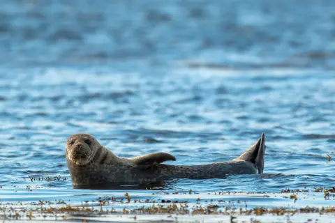
The Princess Royal Channel separates the largest island along British Columbia’s coast from the mainland. It is located roughly halfway between Bella Bella in the south and Prince Rupert in the north, in one of the province’s most remote areas. Princess Royal island was named in 1788 by Captain Charles Duncan, in honor of his ship, the Princess Royal. The island is uninhabited, although there are two small villages in the channel, the First Nations community of Klemtu on Swindle Island and Hartley Bay on the mainland. Wildlife, by contrast, is plentiful, including Kermode, black and grizzly bears, deer, wolves and foxes. Golden and bald eagles nest in the region, as well as the endangered marbled murrelet. In the waters, there are abundant salmon, elephant seals, whales, orcas and dolphins.
Day 7
Alert Bay, Kanada, jedinstveni je lučki grad gdje se duboka kulturna baština susreće s autentičnom lokalnom atmosferom, a nalazi se na itinerarima HX Expeditions. Nezaobilazna iskustva uključuju šetnju povijesnim središtem kako biste osjetili slojevitu arhitektonsku baštinu te istraživanje regionalnih kulinarskih tradicija u lokalno omiljenom restoranu izvan lučke zone. Najbolje vrijeme za posjet je od lipnja do kolovoza, kada ljetni mjeseci donose najtoplije temperature i najduže dane.
Johnstone Strait is a well-protected shipping route passing 68 miles/110 km along the northeast shore of Vancouver Island between the island and the mainland of British Columbia. The strait is between 1 ½ miles and 3 miles wide, and leads from the broad Georgia Strait through a narrow channel called Discovery Passage. The strait was named by Vancouver in 1792 for James Johnstone, the master of one of his tenders during the survey expedition that revealed Vancouver Island to be an island. There are no cities or towns on the strait. The Johnstone Strait is the summer range of a large pod of seasonally resident orcas which are frequently seen in the area. VIEW CRUISES Skip Footer Content About Us Our Company News Careers Contact Us Video Gallery Accessibility Seabourn Club Seabourn Referral Program Travel Resources
The Seymour Narrows is a 3-mile/5 km stretch of the Discovery Channel north of Vancouver Island, British Columbia that is notorious for the strength of the tidal currents flowing through it. The average width of the narrows is just 750 meters. During extreme tides, the current through the narrows is subject to severe Venturi effect, resulting in an increased velocity that can reach 15 knots. For much of its modern history, there was an additional hazard in the narrows called Ripple Rock, a shallow obstruction that claimed no fewer than 119 ships and 114 lives. In 1958, after months of tunneling and preparation, Ripple Rock was blown up in the largest commercial, non-nuclear explosion ever recorded in North America. Still, the navigation of Seymour Narrows is dependent on tidal and other conditions, and requires skill and technical accomplishment.
Day 8
Smješten između Tihog oceana i planina Coast, Vancouver je prirodna vrata prema unutarnjem prolazu Aljaske — grad u kojem umjerena prašuma susreće staklene tornjeve, a dungeness rak i divlji sockeye losos definiraju kuhinju Pacifičkog ruba koja može parirati bilo kojoj u Sjevernoj Americi. Prošećite 22 kilometra dugom šetnicom uz more u parku Stanley, izgubite se u tržnici Granville Island, a zatim se trajektom uputite prema edvardijanskoj raskoši Victorije. Sezona krstarenja Aljaskom doseže vrhunac od svibnja do rujna, čineći Vancouver idealnom polaznom točkom za jedno od najvećih oceanskih putovanja na svijetu.
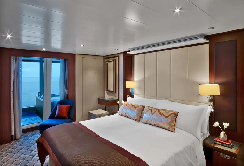
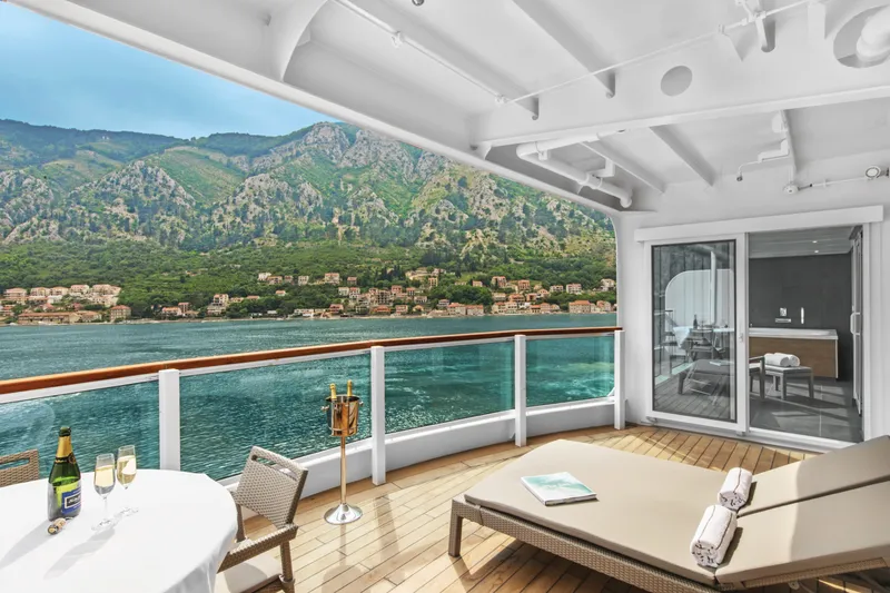

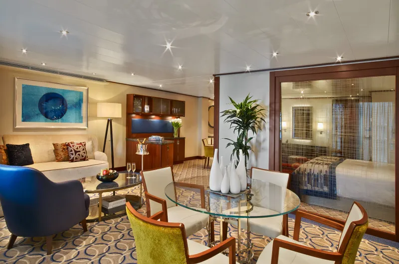
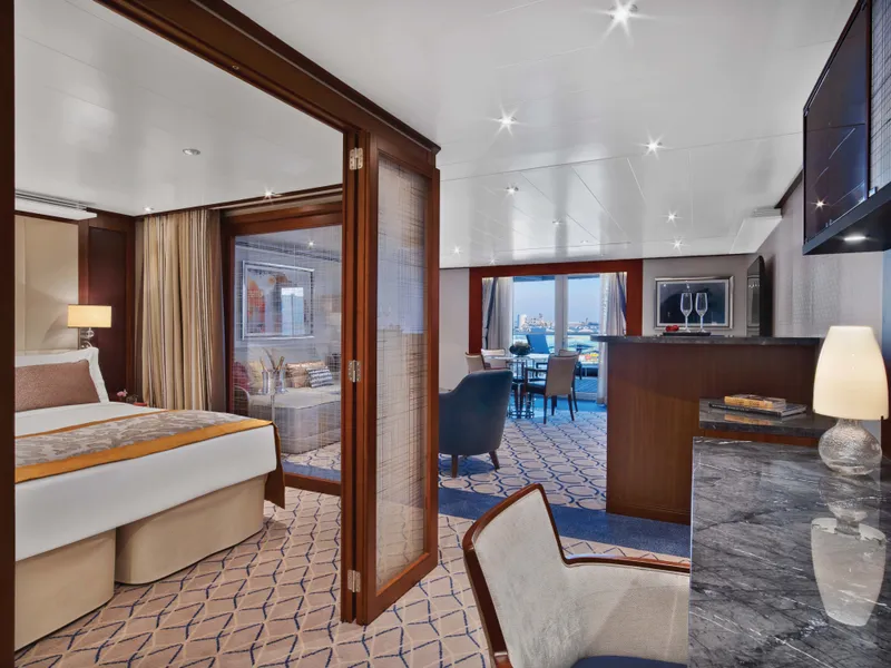
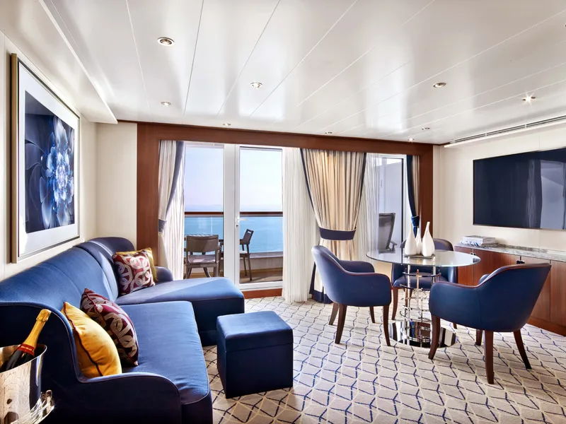
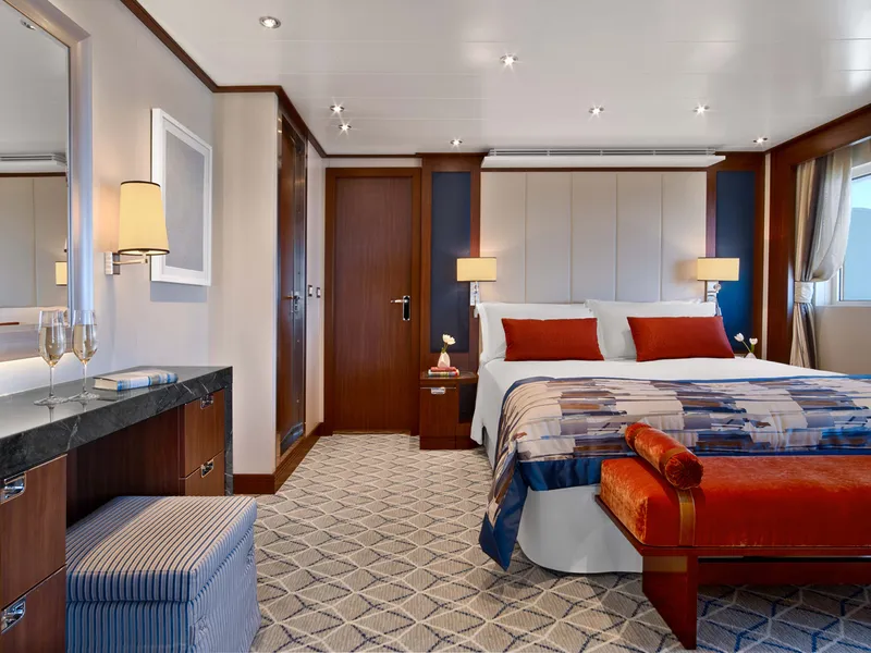
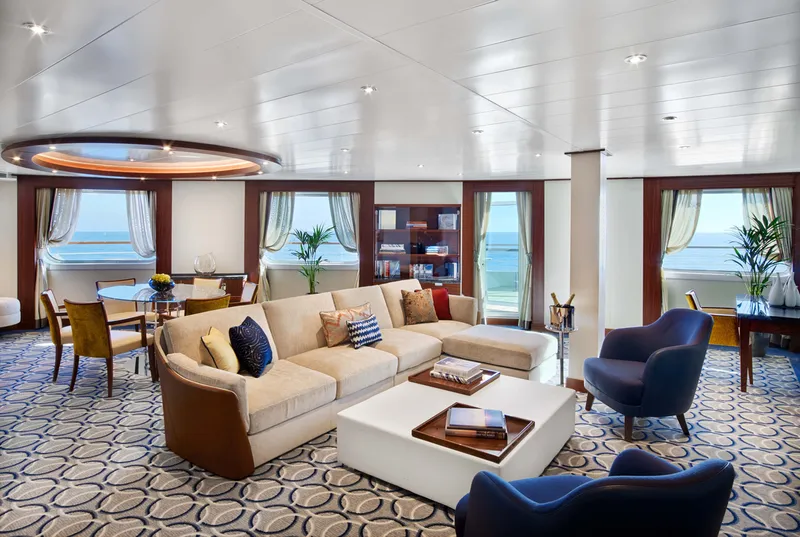
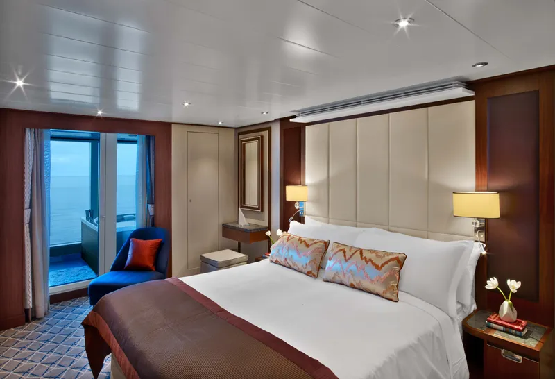
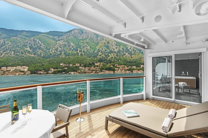
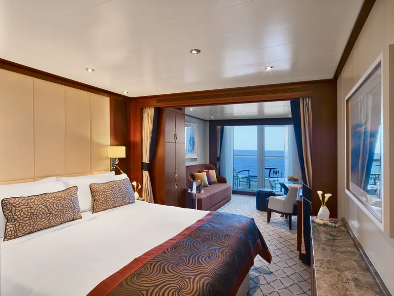
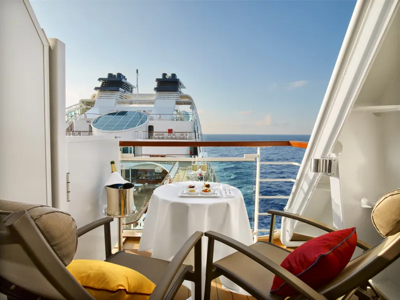
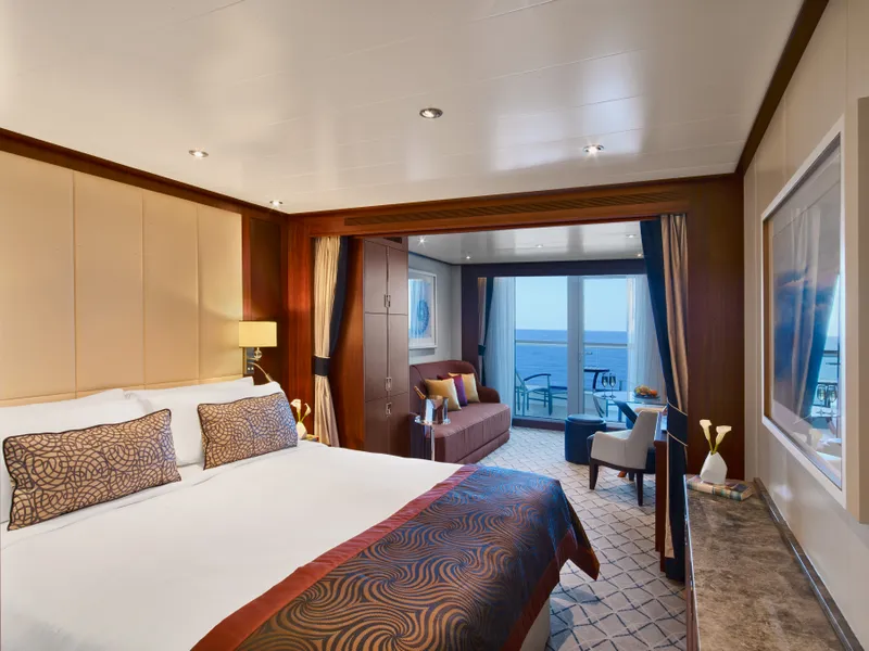
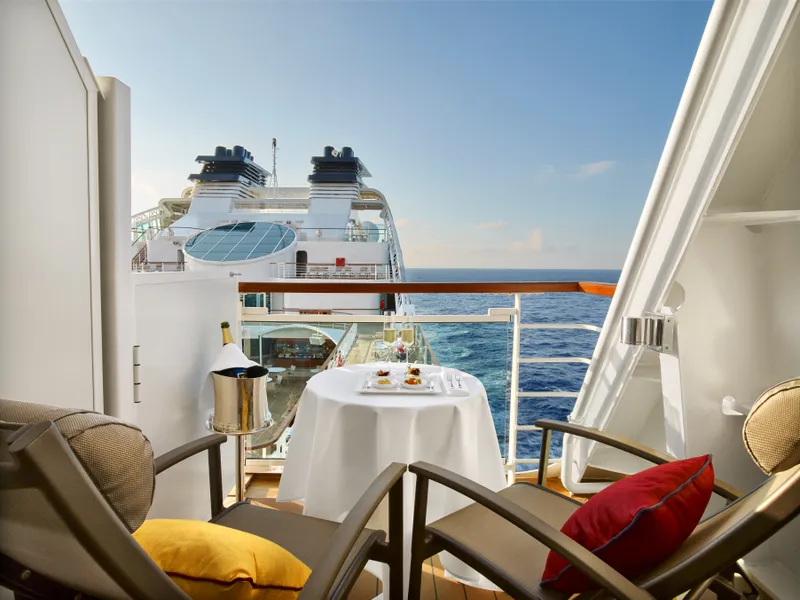
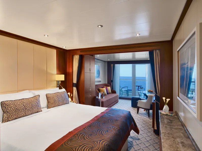
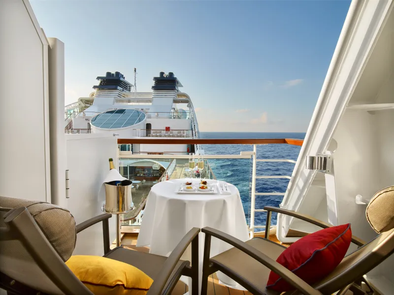
Located on Deck 8; Combine mid-ship suites 849 and 851 for suite 8491 or suites 846 and 848 for suite 8468 for a total inside space of 1,292 square feet (120 square meters) plus two verandas totaling 244 square feet (23 square meters)
Grand Wintergarden Suites feature
Large windows
Dining for six
Glass-enclosed solarium with tub and day bed
Two bedrooms
Two bathrooms (one whirlpool)
Convertible sofa bed for one
Pantry with wet bar
Two flat-screen TVs
Complimentary Internet/Wi-Fi service









Our cruise specialists can help you find the perfect cabin and the best available pricing.
(+886) 02-2721-7300Contact Advisor