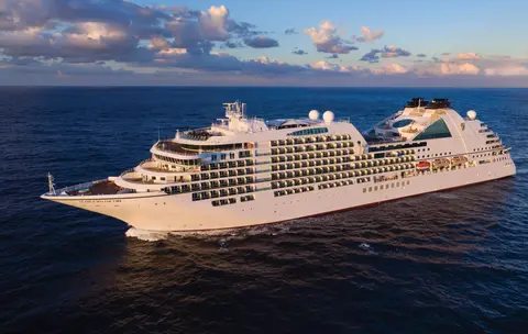
Seabourn7663
7 хоногийн Аляскийн фьёрд, Канадын дотоод зам & мөсөн булан
Date
2026-09-11
Duration
7 nights
Departure Port
Жюно
Америкийн Нэгдсэн Улс
Arrival Port
Ванкувер
Канад
Rating
Luxury
Theme
—
Date
2026-09-11
Duration
7 nights
Departure Port
Жюно
Америкийн Нэгдсэн Улс
Arrival Port
Ванкувер
Канад
Rating
Luxury
Theme
—





Seabourn
2016
—
40,350 GT
600
266
330
690 m
28 m
19 knots
No
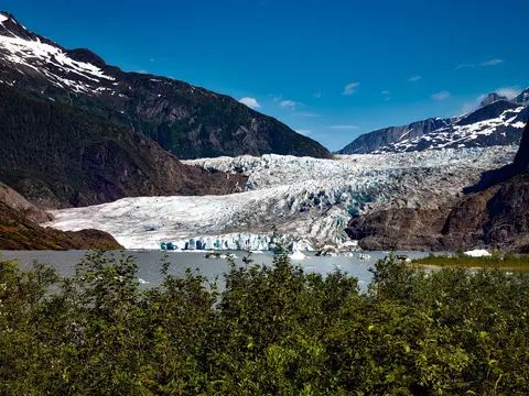
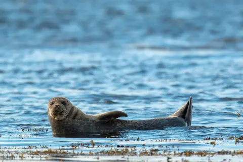
Америкийн замаар хүрэх боломжгүй ганц мужийн нийслэл Жуно нь дэлхийн олон хотуудтай харьцуулахад ховорхон байдаг зэрлэг байгальтай аялалынхаа шагналыг өгдөг. Мэнденхолл мөсөн гол — эртний мөсөөр бүрхэгдсэн амьд гол — төвөөс ердөө 15 минутын зайд байрладаг бөгөөд усан онгоцнууд модоор бүрхэгдсэн уулс дээгүүр нисэж, далай руу шууд унадаг. Мөсөн талбай дээр хеликоптер буух эсвэл Стивенс Проходод кит ажиглах аялал хийх нь заавал хийх ёстой туршлага юм. Хумбэк китүүд гайхамшигтай ойрхон усан дээр гарч ирдэг. Жуно нь зун, наймдугаар сард хамгийн дулаан байдаг ч, зун ч гэсэн Өмнөд Алслагийн алдартай бороо орж, ширэнгэн ойг үргэлж гэрэлтсэн байдалд байлгадаг.
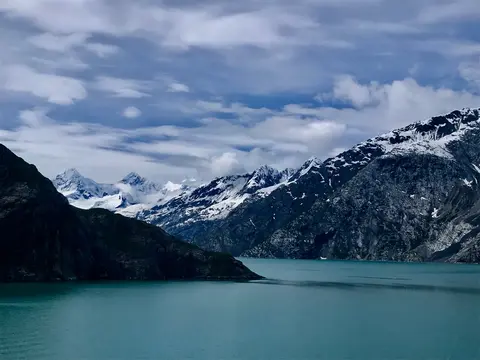
Гляциарын булангийн үндэсний парк нь дэлхийн хамгийн идэвхтэй мөсөн голуудын нэг бөгөөд 3.3 сая акр талбайтай, өмнөд Аляскад байрладаг. Энд далайн мөсөн голууд катедралын хэмжээтэй мөсөн уулсийг гэрэлт цэнхэр усны фьордуудад хаяж, газар нь мөснөөс чөлөөлөгдсөнөөр одоогийн байдлаар өссөөр байна. Энэ бүс нутаг 200 жилийн өмнө мөсөөр даруулсан байсан. Парк нь зөвхөн хөлөг онгоц эсвэл жижиг онгоцоор хүрэх боломжтой бөгөөд зочдод хөхтөн амьтдын уулзалт, хөхрөн хөхрөх кит, бор баавгай, далайн усны гахай, уулын ямаа зэрэг амьтдыг үзэх боломжийг олгодог. Эдгээр нь бараг л гайхамшигтай сүр жавхлантай байгальд тохирсон байдаг. Улирал нь тавдугаар сараас есдүгээр сар хүртэл үргэлжилнэ; зургаадугаар сарын сүүлч, долдугаар сар нь хамгийн урт өдөр, хамгийн найдвартай амьтдын идэвхтэй байдалтай байдаг.
Decision Passage is the western end of the Sumner Strait, which runs through the Alexander Archipelago into the Pacific Ocean in Southeastern Alaska, bounded on the north by Kuiu Island and Cape Decision, the location of a 1932 lighthouse. This is the route your ship takes when coming from or going to the colorful historic community of Sitka on the west coast of Baranof Island, which was originally the Russian fortress town of New Archangel.
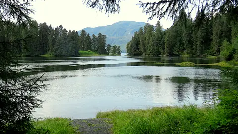
Wrangell нь Аляскийн хамгийн жинхэнэ Inside Passage боомтуудын нэг бөгөөд Тлингит өв соёл, эртний петроглифүүд, дэлхийн хэмжээний зэрлэг амьтад хүчтэй Stikine голын аманд нэгддэг. Чухал туршлагуудын дунд LeConte мөсөн гол руу жийп завиар явах, Anan голд баавгай загас барихыг харах, мөн орон нутгийн тамхи татсан загас амтлах зэрэг орно. VII сар болон VIII сар нь загасны хамгийн их хөдөлгөөн, баавгайг ажиглах хамгийн тохиромжтой үе юм.
Stikine Strait is a picturesque channel in the Alexander Archipelago of Alaska between Zarembo Island and Woronkofski and Etolin Islands near the mouth of the Stikine River south of Wrangell. It first appears on an 1848 Russian chart as Stakhin Strait and has been spelled variously on many charts since that time.
The 108-mile Behm Canal runs from the Clarence Strait through the Alexander Archipelago of Southeast Alaska, and into the channel separating Revillagigedo Island from the mainland. It forms part Inside Passage on the route between Ketchikan and the Misty Fjords National Monument. The canal was named by George Vancouver during his surveying expedition in 1793, in honor of Magnus von Behm, who had been governor of Kamchatka in the Russian Far East when Vancouver called at Petropavlovsk with Captain Cook’s expedition following the Cook’s murder in Hawaii.
Мисти Фьёрдс үндэсний дурсгалт газар нь Өмнөд Аляскад байрлах 930,000 гектарын зэрлэг байгаль бөгөөд энд хүйтэн усны фьёрдүүдээс хөөрхийлөлтэй гранитын өндөр хаднууд мянган жилийн туршид бүрхэгдсэн манан, үүлний хөшигнөөс дээш өргөгдсөн байдаг. Заавал хийх зүйлсийн дунд нам гүм фьёрдүүдийн гаруудыг каяк хийх, усны уруу болон галт уулын шинэ Эддистон рокыг тойрон зодиак завиар аялж, цэвэрхэн сувгууд дахь баавгай, бүргэд, орка загаснуудыг ажиглах багтана. 5-р сараас 9-р сар хүртэлх хугацаа нь зочлох улирал бөгөөд бороо нь дурсгалт газрын хачирхалтай уур амьсгалыг нэмэгдүүлдэг.
Misty Fjords National Monument is a section of the Tongass National Forest in Alaska’s extreme southeastern Panhandle region. The monument consists of over two million acres of deeply cut fjords cradled in U-shaped valleys between mountain ranges rising 2,000 to 3,000 feet above sea level. The fjords themselves extend as much as 1,000 feet below the surface. These granite ranges are covered with virgin forest, and most of the monument is also a dedicated wilderness area. Misty Fjords inspired the explorer John Muir to proclaim them among the most beautiful places he had ever seen. Your ship will cruise among these spectacular forests, waterfalls and mountains. The onboard Ventures by Seabourn team will offer optional excursions including kayaking the fjords and a short sightseeing floatplane flight.
Принс Руперт, Британийн Колумбийн хойд эргийн түүхэн төмөр замын терминал, гүн Тсимшиан өв соёл, дэлхийн хэмжээний халибут загасчлал, болон Дотоод замын дагуу байрлах манан татсан борооны ой модны үзэсгэлэнт байгальтайгаар зочдод сэтгэл татам байдлыг төрүүлдэг. Далайн эрэг дээр шинэ тамхи татсан самар загасны амтыг амталж, Канадын хамгийн эртний үлдсэн консервийн үйлдвэр болох Умард Номхон Далайн Консервыг судлаарай. Энэ нь портуудын далайн сүнсийг амьдралтайгаар мэдрэх боломжийг олгодог. Зочлох хамгийн тохиромжтой цаг нь зургаадугаар сараас наймдугаар сар хүртэл байдаг бөгөөд энэ үед урт өдрүүд алдарт борооны хэмжээг багасгаж, зэрлэг амьтдын идэвхжил эргийн дагуу оргилд хүрдэг.
Grenville Channel is a long, well-protected channel along the northern British Columbia coast between the large Pitt Island and the mainland. It is an important shipping lane, and you are likely to see ships of many different types and sizes as you pass through. The shores are mountainous on both sides, with two notable peaks about halfway through, Mt. Batchellor on the east side and Mt. Saunders on Pitt Island to the west. There are a number of Indian Reserves and Marine Parks in the mountains and narrow waterways off the channel.
Whale Channel is a picturesque waterway separating Gil Island from Princess Royal Island in British Columbia’s Inside Passage. Surrounded by snow-capped mountain ranges and teeming with marine life, It is a diversion from the main shipping lane, located roughly halfway between Prince Rupert and the First Nations village of Klemtu. VIEW CRUISES Skip Footer Content About Us
The Princess Royal Channel separates the largest island along British Columbia’s coast from the mainland. It is located roughly halfway between Bella Bella in the south and Prince Rupert in the north, in one of the province’s most remote areas. Princess Royal island was named in 1788 by Captain Charles Duncan, in honor of his ship, the Princess Royal. The island is uninhabited, although there are two small villages in the channel, the First Nations community of Klemtu on Swindle Island and Hartley Bay on the mainland. Wildlife, by contrast, is plentiful, including Kermode, black and grizzly bears, deer, wolves and foxes. Golden and bald eagles nest in the region, as well as the endangered marbled murrelet. In the waters, there are abundant salmon, elephant seals, whales, orcas and dolphins.
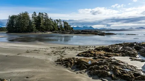
Алерт Бэй, Канад нь гүн соёлын өв уламжлалтай, жинхэнэ орон нутгийн уур амьсгалтай онцгой боомт хот бөгөөд HX Expeditions-ийн аяллын хөтөлбөрт багтдаг. Түүхэн төвөөр алхаж, давхарласан архитектурын өвийг мэдрэх, боомтын бүсээс хол оршдог орон нутгийн хүнсний уламжлалыг хайж олох нь заавал хийх туршлага юм. Зуны сарууд хамгийн дулаан температур, хамгийн урт өдрүүдийг авчирдаг тул зочлох хамгийн тохиромжтой цаг нь 6-р сараас 8-р сар хүртэл байдаг.
Johnstone Strait is a well-protected shipping route passing 68 miles/110 km along the northeast shore of Vancouver Island between the island and the mainland of British Columbia. The strait is between 1 ½ miles and 3 miles wide, and leads from the broad Georgia Strait through a narrow channel called Discovery Passage. The strait was named by Vancouver in 1792 for James Johnstone, the master of one of his tenders during the survey expedition that revealed Vancouver Island to be an island. There are no cities or towns on the strait. The Johnstone Strait is the summer range of a large pod of seasonally resident orcas which are frequently seen in the area. VIEW CRUISES Skip Footer Content About Us Our Company News Careers Contact Us Video Gallery Accessibility Seabourn Club Seabourn Referral Program Travel Resources
The Seymour Narrows is a 3-mile/5 km stretch of the Discovery Channel north of Vancouver Island, British Columbia that is notorious for the strength of the tidal currents flowing through it. The average width of the narrows is just 750 meters. During extreme tides, the current through the narrows is subject to severe Venturi effect, resulting in an increased velocity that can reach 15 knots. For much of its modern history, there was an additional hazard in the narrows called Ripple Rock, a shallow obstruction that claimed no fewer than 119 ships and 114 lives. In 1958, after months of tunneling and preparation, Ripple Rock was blown up in the largest commercial, non-nuclear explosion ever recorded in North America. Still, the navigation of Seymour Narrows is dependent on tidal and other conditions, and requires skill and technical accomplishment.
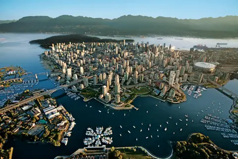
Номхон далай болон эргийн уулс хооронд дарагдсан Ванкувер нь Аляскийн Дотоод замын байгалийн хаалга бөгөөд энэхүү хотод зөөлөн ширэнгэн ой, шилэн цамхагууд уулзаж, Дунгенесс хяруул болон зэрлэг сокай salmon нь Хойд Америкт өрсөлдөхүйц Номхон далайн эргийн хоолны соёлыг тодорхойлдог. 22 км урт Стэнли паркийн далайн ханаар алхаж, Гранвилл арал дахь зах дээр уусаж, дараа нь Викторийн Эдвардиан гайхамшигт руу завиар гатал. Аляскийн круизийн улирал нь тавдугаар сараас есдүгээр сар хүртэл оргилдоо хүрч, Ванкувер нь дэлхийн агуу далайн аяллуудын нэгийг эхлэхэд төгс цэг болдог.
Day 1
Америкийн замаар хүрэх боломжгүй ганц мужийн нийслэл Жуно нь дэлхийн олон хотуудтай харьцуулахад ховорхон байдаг зэрлэг байгальтай аялалынхаа шагналыг өгдөг. Мэнденхолл мөсөн гол — эртний мөсөөр бүрхэгдсэн амьд гол — төвөөс ердөө 15 минутын зайд байрладаг бөгөөд усан онгоцнууд модоор бүрхэгдсэн уулс дээгүүр нисэж, далай руу шууд унадаг. Мөсөн талбай дээр хеликоптер буух эсвэл Стивенс Проходод кит ажиглах аялал хийх нь заавал хийх ёстой туршлага юм. Хумбэк китүүд гайхамшигтай ойрхон усан дээр гарч ирдэг. Жуно нь зун, наймдугаар сард хамгийн дулаан байдаг ч, зун ч гэсэн Өмнөд Алслагийн алдартай бороо орж, ширэнгэн ойг үргэлж гэрэлтсэн байдалд байлгадаг.
Day 2
Гляциарын булангийн үндэсний парк нь дэлхийн хамгийн идэвхтэй мөсөн голуудын нэг бөгөөд 3.3 сая акр талбайтай, өмнөд Аляскад байрладаг. Энд далайн мөсөн голууд катедралын хэмжээтэй мөсөн уулсийг гэрэлт цэнхэр усны фьордуудад хаяж, газар нь мөснөөс чөлөөлөгдсөнөөр одоогийн байдлаар өссөөр байна. Энэ бүс нутаг 200 жилийн өмнө мөсөөр даруулсан байсан. Парк нь зөвхөн хөлөг онгоц эсвэл жижиг онгоцоор хүрэх боломжтой бөгөөд зочдод хөхтөн амьтдын уулзалт, хөхрөн хөхрөх кит, бор баавгай, далайн усны гахай, уулын ямаа зэрэг амьтдыг үзэх боломжийг олгодог. Эдгээр нь бараг л гайхамшигтай сүр жавхлантай байгальд тохирсон байдаг. Улирал нь тавдугаар сараас есдүгээр сар хүртэл үргэлжилнэ; зургаадугаар сарын сүүлч, долдугаар сар нь хамгийн урт өдөр, хамгийн найдвартай амьтдын идэвхтэй байдалтай байдаг.
Day 3
Decision Passage is the western end of the Sumner Strait, which runs through the Alexander Archipelago into the Pacific Ocean in Southeastern Alaska, bounded on the north by Kuiu Island and Cape Decision, the location of a 1932 lighthouse. This is the route your ship takes when coming from or going to the colorful historic community of Sitka on the west coast of Baranof Island, which was originally the Russian fortress town of New Archangel.
Wrangell нь Аляскийн хамгийн жинхэнэ Inside Passage боомтуудын нэг бөгөөд Тлингит өв соёл, эртний петроглифүүд, дэлхийн хэмжээний зэрлэг амьтад хүчтэй Stikine голын аманд нэгддэг. Чухал туршлагуудын дунд LeConte мөсөн гол руу жийп завиар явах, Anan голд баавгай загас барихыг харах, мөн орон нутгийн тамхи татсан загас амтлах зэрэг орно. VII сар болон VIII сар нь загасны хамгийн их хөдөлгөөн, баавгайг ажиглах хамгийн тохиромжтой үе юм.
Stikine Strait is a picturesque channel in the Alexander Archipelago of Alaska between Zarembo Island and Woronkofski and Etolin Islands near the mouth of the Stikine River south of Wrangell. It first appears on an 1848 Russian chart as Stakhin Strait and has been spelled variously on many charts since that time.
Day 4
The 108-mile Behm Canal runs from the Clarence Strait through the Alexander Archipelago of Southeast Alaska, and into the channel separating Revillagigedo Island from the mainland. It forms part Inside Passage on the route between Ketchikan and the Misty Fjords National Monument. The canal was named by George Vancouver during his surveying expedition in 1793, in honor of Magnus von Behm, who had been governor of Kamchatka in the Russian Far East when Vancouver called at Petropavlovsk with Captain Cook’s expedition following the Cook’s murder in Hawaii.
Мисти Фьёрдс үндэсний дурсгалт газар нь Өмнөд Аляскад байрлах 930,000 гектарын зэрлэг байгаль бөгөөд энд хүйтэн усны фьёрдүүдээс хөөрхийлөлтэй гранитын өндөр хаднууд мянган жилийн туршид бүрхэгдсэн манан, үүлний хөшигнөөс дээш өргөгдсөн байдаг. Заавал хийх зүйлсийн дунд нам гүм фьёрдүүдийн гаруудыг каяк хийх, усны уруу болон галт уулын шинэ Эддистон рокыг тойрон зодиак завиар аялж, цэвэрхэн сувгууд дахь баавгай, бүргэд, орка загаснуудыг ажиглах багтана. 5-р сараас 9-р сар хүртэлх хугацаа нь зочлох улирал бөгөөд бороо нь дурсгалт газрын хачирхалтай уур амьсгалыг нэмэгдүүлдэг.
Misty Fjords National Monument is a section of the Tongass National Forest in Alaska’s extreme southeastern Panhandle region. The monument consists of over two million acres of deeply cut fjords cradled in U-shaped valleys between mountain ranges rising 2,000 to 3,000 feet above sea level. The fjords themselves extend as much as 1,000 feet below the surface. These granite ranges are covered with virgin forest, and most of the monument is also a dedicated wilderness area. Misty Fjords inspired the explorer John Muir to proclaim them among the most beautiful places he had ever seen. Your ship will cruise among these spectacular forests, waterfalls and mountains. The onboard Ventures by Seabourn team will offer optional excursions including kayaking the fjords and a short sightseeing floatplane flight.
Day 5
Принс Руперт, Британийн Колумбийн хойд эргийн түүхэн төмөр замын терминал, гүн Тсимшиан өв соёл, дэлхийн хэмжээний халибут загасчлал, болон Дотоод замын дагуу байрлах манан татсан борооны ой модны үзэсгэлэнт байгальтайгаар зочдод сэтгэл татам байдлыг төрүүлдэг. Далайн эрэг дээр шинэ тамхи татсан самар загасны амтыг амталж, Канадын хамгийн эртний үлдсэн консервийн үйлдвэр болох Умард Номхон Далайн Консервыг судлаарай. Энэ нь портуудын далайн сүнсийг амьдралтайгаар мэдрэх боломжийг олгодог. Зочлох хамгийн тохиромжтой цаг нь зургаадугаар сараас наймдугаар сар хүртэл байдаг бөгөөд энэ үед урт өдрүүд алдарт борооны хэмжээг багасгаж, зэрлэг амьтдын идэвхжил эргийн дагуу оргилд хүрдэг.
Day 6
Grenville Channel is a long, well-protected channel along the northern British Columbia coast between the large Pitt Island and the mainland. It is an important shipping lane, and you are likely to see ships of many different types and sizes as you pass through. The shores are mountainous on both sides, with two notable peaks about halfway through, Mt. Batchellor on the east side and Mt. Saunders on Pitt Island to the west. There are a number of Indian Reserves and Marine Parks in the mountains and narrow waterways off the channel.
Whale Channel is a picturesque waterway separating Gil Island from Princess Royal Island in British Columbia’s Inside Passage. Surrounded by snow-capped mountain ranges and teeming with marine life, It is a diversion from the main shipping lane, located roughly halfway between Prince Rupert and the First Nations village of Klemtu. VIEW CRUISES Skip Footer Content About Us
The Princess Royal Channel separates the largest island along British Columbia’s coast from the mainland. It is located roughly halfway between Bella Bella in the south and Prince Rupert in the north, in one of the province’s most remote areas. Princess Royal island was named in 1788 by Captain Charles Duncan, in honor of his ship, the Princess Royal. The island is uninhabited, although there are two small villages in the channel, the First Nations community of Klemtu on Swindle Island and Hartley Bay on the mainland. Wildlife, by contrast, is plentiful, including Kermode, black and grizzly bears, deer, wolves and foxes. Golden and bald eagles nest in the region, as well as the endangered marbled murrelet. In the waters, there are abundant salmon, elephant seals, whales, orcas and dolphins.
Day 7
Алерт Бэй, Канад нь гүн соёлын өв уламжлалтай, жинхэнэ орон нутгийн уур амьсгалтай онцгой боомт хот бөгөөд HX Expeditions-ийн аяллын хөтөлбөрт багтдаг. Түүхэн төвөөр алхаж, давхарласан архитектурын өвийг мэдрэх, боомтын бүсээс хол оршдог орон нутгийн хүнсний уламжлалыг хайж олох нь заавал хийх туршлага юм. Зуны сарууд хамгийн дулаан температур, хамгийн урт өдрүүдийг авчирдаг тул зочлох хамгийн тохиромжтой цаг нь 6-р сараас 8-р сар хүртэл байдаг.
Johnstone Strait is a well-protected shipping route passing 68 miles/110 km along the northeast shore of Vancouver Island between the island and the mainland of British Columbia. The strait is between 1 ½ miles and 3 miles wide, and leads from the broad Georgia Strait through a narrow channel called Discovery Passage. The strait was named by Vancouver in 1792 for James Johnstone, the master of one of his tenders during the survey expedition that revealed Vancouver Island to be an island. There are no cities or towns on the strait. The Johnstone Strait is the summer range of a large pod of seasonally resident orcas which are frequently seen in the area. VIEW CRUISES Skip Footer Content About Us Our Company News Careers Contact Us Video Gallery Accessibility Seabourn Club Seabourn Referral Program Travel Resources
The Seymour Narrows is a 3-mile/5 km stretch of the Discovery Channel north of Vancouver Island, British Columbia that is notorious for the strength of the tidal currents flowing through it. The average width of the narrows is just 750 meters. During extreme tides, the current through the narrows is subject to severe Venturi effect, resulting in an increased velocity that can reach 15 knots. For much of its modern history, there was an additional hazard in the narrows called Ripple Rock, a shallow obstruction that claimed no fewer than 119 ships and 114 lives. In 1958, after months of tunneling and preparation, Ripple Rock was blown up in the largest commercial, non-nuclear explosion ever recorded in North America. Still, the navigation of Seymour Narrows is dependent on tidal and other conditions, and requires skill and technical accomplishment.
Day 8
Номхон далай болон эргийн уулс хооронд дарагдсан Ванкувер нь Аляскийн Дотоод замын байгалийн хаалга бөгөөд энэхүү хотод зөөлөн ширэнгэн ой, шилэн цамхагууд уулзаж, Дунгенесс хяруул болон зэрлэг сокай salmon нь Хойд Америкт өрсөлдөхүйц Номхон далайн эргийн хоолны соёлыг тодорхойлдог. 22 км урт Стэнли паркийн далайн ханаар алхаж, Гранвилл арал дахь зах дээр уусаж, дараа нь Викторийн Эдвардиан гайхамшигт руу завиар гатал. Аляскийн круизийн улирал нь тавдугаар сараас есдүгээр сар хүртэл оргилдоо хүрч, Ванкувер нь дэлхийн агуу далайн аяллуудын нэгийг эхлэхэд төгс цэг болдог.
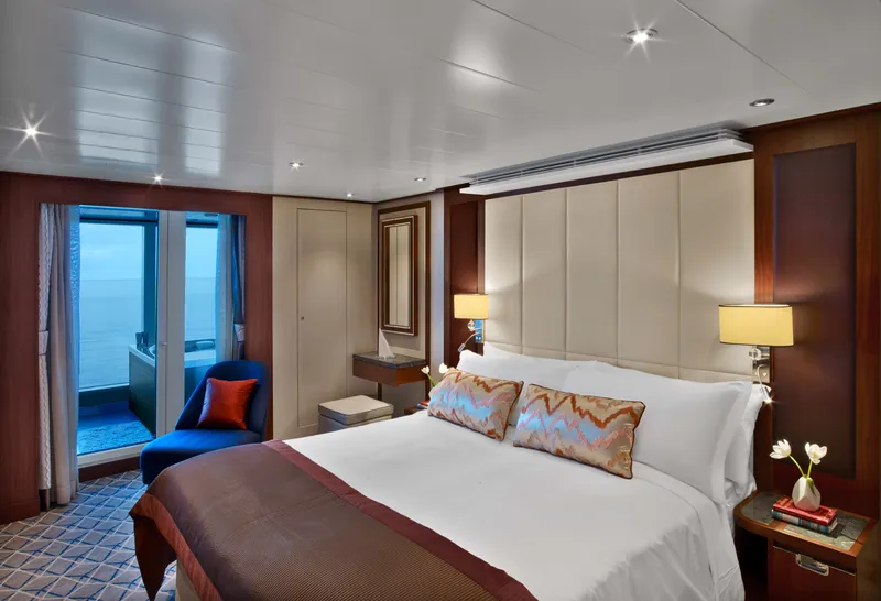
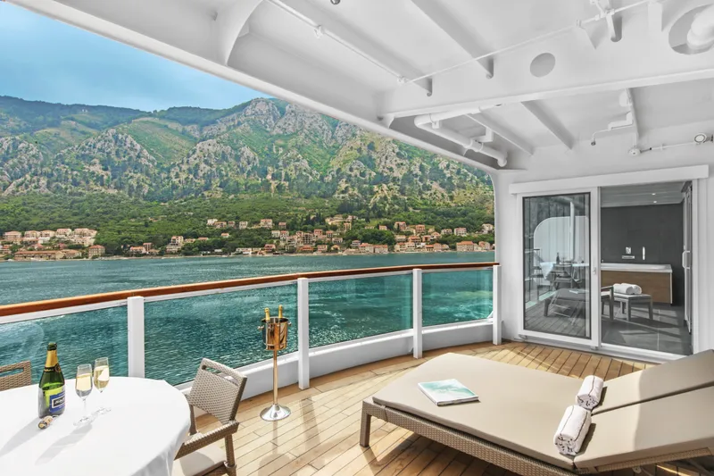

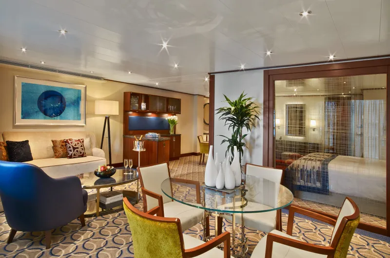

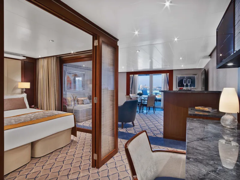


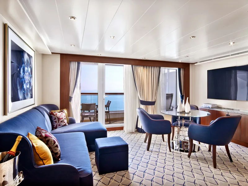

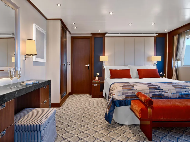
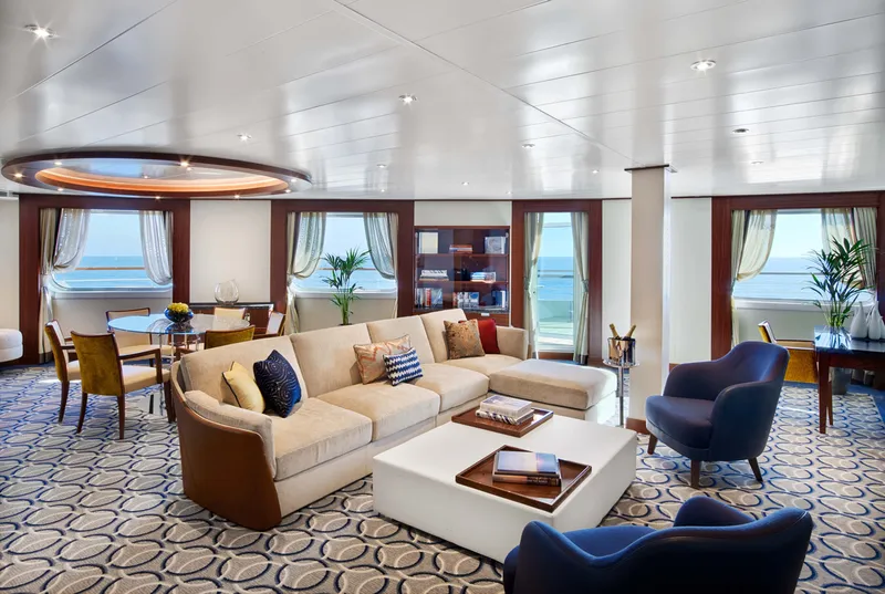

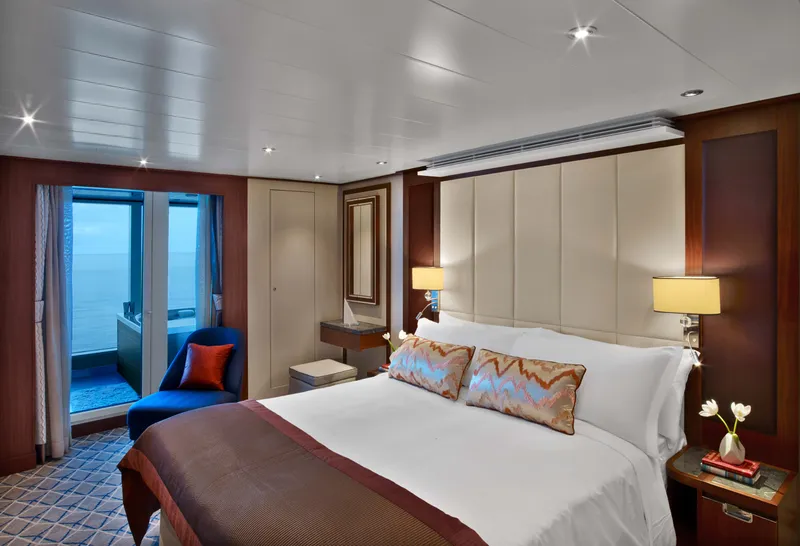
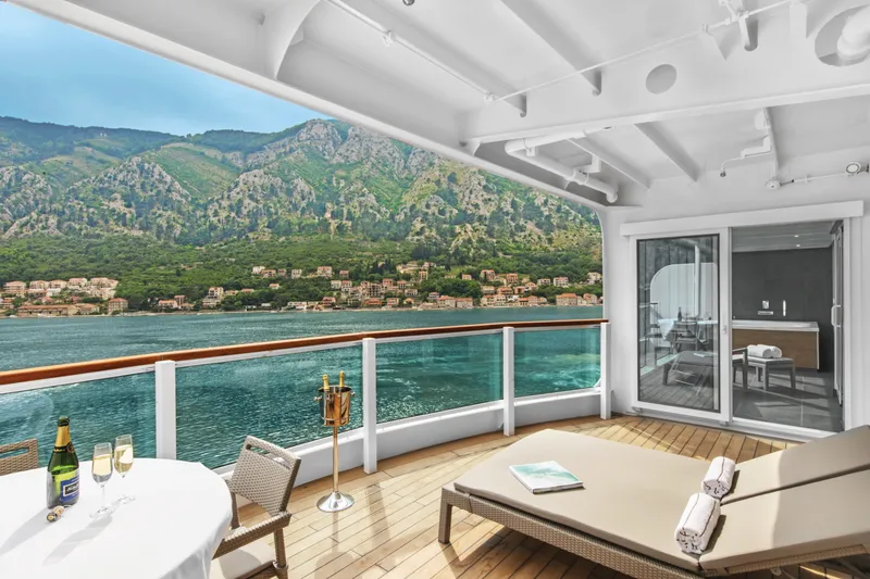

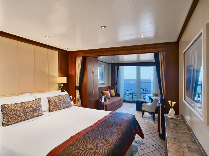
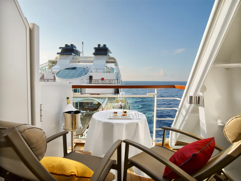

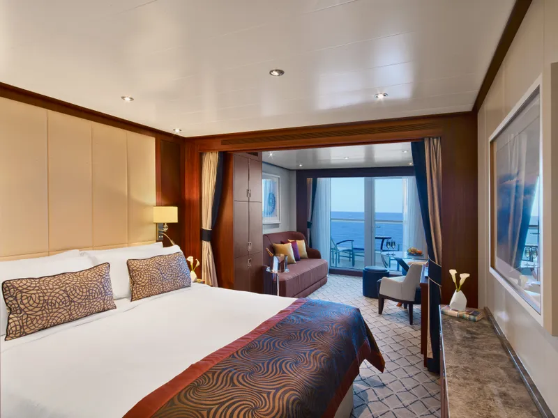
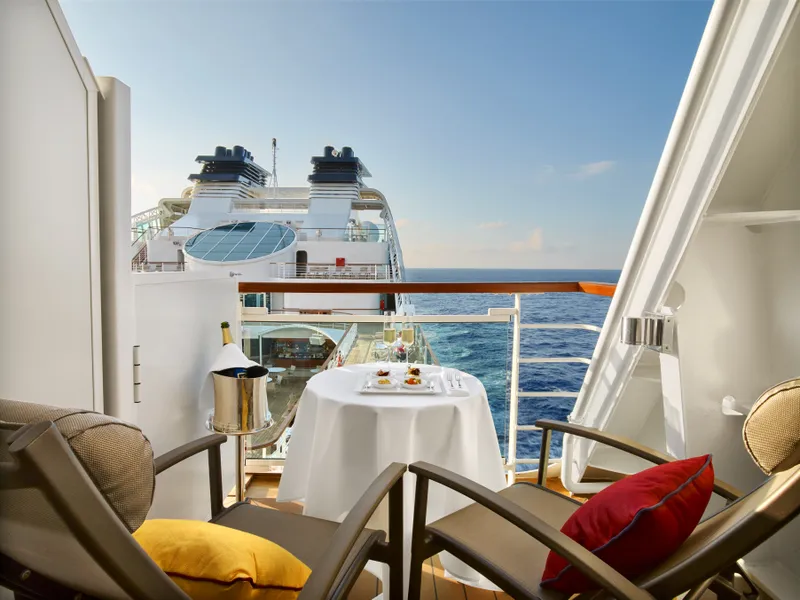


Our cruise specialists can help you find the perfect cabin and the best available pricing.
(+886) 02-2721-7300Contact Advisor