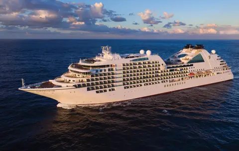
Seabourn7731
7 хоногын мөсөн гол, Аляска дотоод зам
Date
2027-05-28
Duration
7 nights
Departure Port
Ванкувер
Канад
Arrival Port
Жюно
Америкийн Нэгдсэн Улс
Rating
—
Theme
—
Date
2027-05-28
Duration
7 nights
Departure Port
Ванкувер
Канад
Arrival Port
Жюно
Америкийн Нэгдсэн Улс
Rating
—
Theme
—

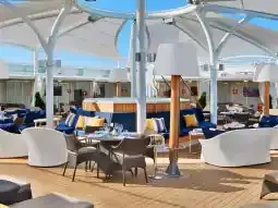




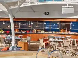
Seabourn
2016
—
40,350 GT
600
266
330
690 m
28 m
19 knots
No
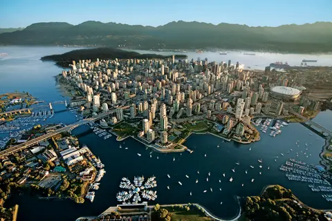
Номхон далай болон эргийн уулс хооронд дарагдсан Ванкувер нь Аляскийн Дотоод замын байгалийн хаалга бөгөөд энэхүү хотод зөөлөн ширэнгэн ой, шилэн цамхагууд уулзаж, Дунгенесс хяруул болон зэрлэг сокай salmon нь Хойд Америкт өрсөлдөхүйц Номхон далайн эргийн хоолны соёлыг тодорхойлдог. 22 км урт Стэнли паркийн далайн ханаар алхаж, Гранвилл арал дахь зах дээр уусаж, дараа нь Викторийн Эдвардиан гайхамшигт руу завиар гатал. Аляскийн круизийн улирал нь тавдугаар сараас есдүгээр сар хүртэл оргилдоо хүрч, Ванкувер нь дэлхийн агуу далайн аяллуудын нэгийг эхлэхэд төгс цэг болдог.
The Seymour Narrows is a 3-mile/5 km stretch of the Discovery Channel north of Vancouver Island, British Columbia that is notorious for the strength of the tidal currents flowing through it. The average width of the narrows is just 750 meters. During extreme tides, the current through the narrows is subject to severe Venturi effect, resulting in an increased velocity that can reach 15 knots. For much of its modern history, there was an additional hazard in the narrows called Ripple Rock, a shallow obstruction that claimed no fewer than 119 ships and 114 lives. In 1958, after months of tunneling and preparation, Ripple Rock was blown up in the largest commercial, non-nuclear explosion ever recorded in North America. Still, the navigation of Seymour Narrows is dependent on tidal and other conditions, and requires skill and technical accomplishment.
The Queen Charlotte Sound lies between the Queen Charlotte Strait, which winds between Vancouver Island and the British Columbia mainland in the south, and Hecate Strait, which is northward, adjacent to the Haida Gwaii Islands off the Pacific coast of British Columbia. It is a broad reach in the long shipping route called the Inside Passage threading the myriad islands stretching from Washington’s Puget Sound to Alaska.
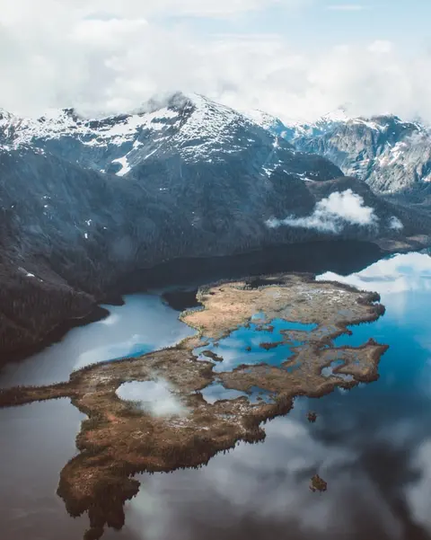
Кетчикан нь Аляскийн зүүн өмнөд хязгаар дахь Ревиллагигедо аралд ой модоор хүрээлэгдсэн эрэг дээр байрладаг — орон нутгийнхан энэ хотыг гурван миль урт, гурван гудамж өргөн гэж шоглож ярьдаг. Тлинкит хүмүүсийн хувьд мянга мянган жилийн турш загасны изотон ихтэй газар гэж хүндэтгэлтэйгээр үзэгддэг энэ хот одоо дэлхийн Тотем баганын нийслэл гэж тэмдэглэгддэг: Саксманы уугуул тосгон болон Тотем Байт улсын түүхийн парк нь эдгээр агуу бүтээлүүдийн хамгийн чухал төвлөрлийг хадгалан хамгаалдаг. Кетчикан голын дээгүүр баригдсан өнгөлөг түүхэн байшингуудын модон зам, Крик Стритийг алгасах ёсгүй. Зун (5-р сараас 9-р сар) хамгийн сайн цаг агаар ирдэг бөгөөд доорхи голуудаар загас гүйж эхэлдэг.
In the passage between Sumner Strait and Clarence Strait in Southeast Alaska’s Alexander Archipelago, midway between Price of Wales Island on the west and Zarembo Island on the east, is a small cluster of islands with a picturesque passageway between them called Snow Pass. It makes a scenic up-close route for your Seabourn ship during the transit.
Decision Passage is the western end of the Sumner Strait, which runs through the Alexander Archipelago into the Pacific Ocean in Southeastern Alaska, bounded on the north by Kuiu Island and Cape Decision, the location of a 1932 lighthouse. This is the route your ship takes when coming from or going to the colorful historic community of Sitka on the west coast of Baranof Island, which was originally the Russian fortress town of New Archangel.
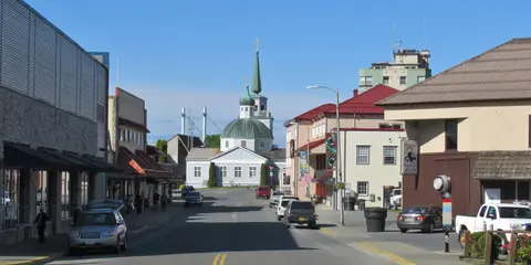
Ситка, Өмнөд Аляскийн Баранов арал дээрх зэрлэг баруун эрэгт байрлах, Номхон далайн Хойд хэсгийн түүхэн хувьд хамгийн чухал боомтуудын нэг юм — Оросын Православ сүмийн сонгино хэлбэрийн оройнууд тотемийн багануудын дээгүүр өргөгдсөн, агуу дунд зэргийн ой мод усны зах руу шахагдсан байдаг. Ситкагийн Үндэсний Түүхийн Парк нь 1804 онд Тлингит дайчид болон Оросын колончидын хооронд болсон тулааны газрыг хадгалан, гайхамшигтай том багануудын цуглуулгатай. Загасны ажиглалт, далайн гахайнуудын дунд далайн завиар аялах, болон ойролцоох зэрлэг байгалийн дунд бор баавгайн ажиглалт нь гадаа амралтын туршлагыг тодорхойлдог. 5-р сараас 9-р сар хүртэлх хугацаа нь хамгийн хялбар, гэрэлтсэн нөхцлийг санал болгодог.
Yakutat Bay is 18 miles wide at its entry, and cuts from the Gulf of Alaska into Disenchantment Bay, the entryway to the huge Hubbard Glacier, North America’s largest tidewater glacier. As the bay narrows and the shorelines draw closer, the 400-foot face of the glacier exerts a luminous, ghostly presence, often from as much as 30 miles away. More and more floating ice dimples the surface of the water, and seals bob up and disappear again. The chilled air from the glacier flows in a downdraft of cold that gives rise to mists and gray clouds, through which the vivid blue of the ice wall shimmers. It is an impressive sight of nature’s immense raw workplace, shaping the earth itself as part of an endless cycle of water from the sea evaporating to the sky, falling as snow on the heights and inching over centuries back again to the sea.
The Hubbard Glacier is the largest, and one of the most spectacular tidewater glaciers in North America. Its ice cliffs, some 400’ (121 m) tall, calve icebergs into the fjord, which may frequently be larger than a five-story building. The glacier’s surface is creased and contorted, resembling the wrinkled skin of a giant elephant. Records show it has been growing in thickness and advancing since 1895. This stands in stark contrast to other glaciers around the world, most of which have been receding during the past century. In 2002, the glacier blocked Russell Fjord for two and a half months, raising water levels 61’ (18 m) and threatening local communities with flooding. Nutrient-rich waters along the glacier face attract many species. Gulls and kittiwake colonies adorn smaller islands and harbor seals patrol the icy waters. In 1890, Israel Russell explored the area of Yakutat Bay and Hubbard Glacier, naming it after Gardiner G. Hubbard, a financier of his expedition and a founder and the first president of the National Geographic Society. VIEW CRUISES
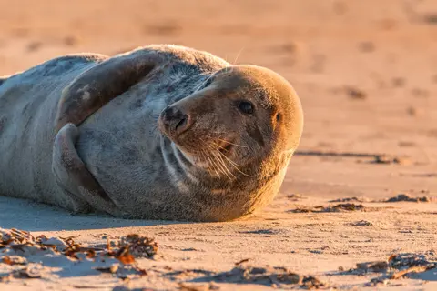
Иниан арлууд нь Аляскийн Кросс Саундын аманд байрлах, хүн амьдардаггүй, зэрлэг арлуудын бүлэг бөгөөд хөхтөн амьтдын гайхамшигтай уулзалт, хөхрөх загасны бөмбөлөгт хооллох, асар том Стеллерийн далайн арслангийн колониудын хувьд алдартай. Арлуудын хадархаг эрэг дээр Зодиак завиар аялж, хамтран загас барихыг ажиглах, далайн амьтдаар дүүрэн усны худагнуудыг судлах зэрэг заавал хийх зүйлс бий. Хөхтөн амьтдын идэвхитэй үе болон хамгийн сайн далайн нөхцлийг хангахын тулд долдугаар сарын – наймдугаар сарын хооронд зочлоорой.
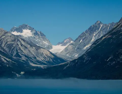
Icy Strait Point нь үзэсгэлэнт байгаль, баялаг уугуул Тлингит соёлын хувьд алдартай, гайхамшигтай Аляскийн боомт юм. Заавал хийх зүйлсийн дунд шинэ, орон нутгийн далайн хоолыг амтлах болон Гляссер Бэй үндэсний паркад амьтдын аялалд гарах явдал багтдаг. Зуны улиралд, цаг агаар зөөлөн, амьтад элбэг байдаг тул зочлох хамгийн тохиромжтой улирал юм.
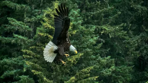
Хэйнс нь Хойд Америкийн хамгийн гүн фьорд дээр байрлах жинхэнэ Аляскийн хот бөгөөд дэлхийн хамгийн том цагаан толгойт бүргэдийн цугларалт, Чилкат голын дагуу дөрвөн мянга хүртэлх шувууны тоо, Тлингит соёлын уламжлалыг хадгалан хамгаалж буй урлагийн цэцэглэн хөгжиж буй нийгэмлэгтэй. Кунард эсвэл Линдблад-тай хамт зургадугаар сараас наймдугаар сар хүртэл мөсөн уулын нисдэг тэрэгний газардах, далайн эргийн алхалт хийхээр зочилно уу, эсвэл аравдугаар сараас хоёрдугаар сар хүртэл Хэйнсийг Аляскийн хамгийн сайн хадгалагдсан нууц болгодог гайхамшигтай бүргэдийн үзвэрийг үзээрэй.
Lynn Canal is a 90-mile long inlet into Alaska’s coast running from the Chilkat River in the north to the Chatham Strait and Stephens Passage in the south. Because it connects the towns of Skagway and Haines to Juneau and the rest of the Inside Passage, it is an important shipping lane for ferries, cargo and cruise ships, and was a crucial passageway to the Klondike gold fields during the Gold Rush. It was discovered by Joseph Whidbey in 1794 and named by George Vancouver after his birthplace, King’s Lynn in Norfolk, England. More than 2,000 feet in depth, it is one of the deepest and longest fjords in the world, and the deepest in North America outside Greenland.
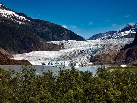
Америкийн замаар хүрэх боломжгүй ганц мужийн нийслэл Жуно нь дэлхийн олон хотуудтай харьцуулахад ховорхон байдаг зэрлэг байгальтай аялалынхаа шагналыг өгдөг. Мэнденхолл мөсөн гол — эртний мөсөөр бүрхэгдсэн амьд гол — төвөөс ердөө 15 минутын зайд байрладаг бөгөөд усан онгоцнууд модоор бүрхэгдсэн уулс дээгүүр нисэж, далай руу шууд унадаг. Мөсөн талбай дээр хеликоптер буух эсвэл Стивенс Проходод кит ажиглах аялал хийх нь заавал хийх ёстой туршлага юм. Хумбэк китүүд гайхамшигтай ойрхон усан дээр гарч ирдэг. Жуно нь зун, наймдугаар сард хамгийн дулаан байдаг ч, зун ч гэсэн Өмнөд Алслагийн алдартай бороо орж, ширэнгэн ойг үргэлж гэрэлтсэн байдалд байлгадаг.
Day 1
Номхон далай болон эргийн уулс хооронд дарагдсан Ванкувер нь Аляскийн Дотоод замын байгалийн хаалга бөгөөд энэхүү хотод зөөлөн ширэнгэн ой, шилэн цамхагууд уулзаж, Дунгенесс хяруул болон зэрлэг сокай salmon нь Хойд Америкт өрсөлдөхүйц Номхон далайн эргийн хоолны соёлыг тодорхойлдог. 22 км урт Стэнли паркийн далайн ханаар алхаж, Гранвилл арал дахь зах дээр уусаж, дараа нь Викторийн Эдвардиан гайхамшигт руу завиар гатал. Аляскийн круизийн улирал нь тавдугаар сараас есдүгээр сар хүртэл оргилдоо хүрч, Ванкувер нь дэлхийн агуу далайн аяллуудын нэгийг эхлэхэд төгс цэг болдог.
The Seymour Narrows is a 3-mile/5 km stretch of the Discovery Channel north of Vancouver Island, British Columbia that is notorious for the strength of the tidal currents flowing through it. The average width of the narrows is just 750 meters. During extreme tides, the current through the narrows is subject to severe Venturi effect, resulting in an increased velocity that can reach 15 knots. For much of its modern history, there was an additional hazard in the narrows called Ripple Rock, a shallow obstruction that claimed no fewer than 119 ships and 114 lives. In 1958, after months of tunneling and preparation, Ripple Rock was blown up in the largest commercial, non-nuclear explosion ever recorded in North America. Still, the navigation of Seymour Narrows is dependent on tidal and other conditions, and requires skill and technical accomplishment.
Day 2
The Queen Charlotte Sound lies between the Queen Charlotte Strait, which winds between Vancouver Island and the British Columbia mainland in the south, and Hecate Strait, which is northward, adjacent to the Haida Gwaii Islands off the Pacific coast of British Columbia. It is a broad reach in the long shipping route called the Inside Passage threading the myriad islands stretching from Washington’s Puget Sound to Alaska.
Day 3
Кетчикан нь Аляскийн зүүн өмнөд хязгаар дахь Ревиллагигедо аралд ой модоор хүрээлэгдсэн эрэг дээр байрладаг — орон нутгийнхан энэ хотыг гурван миль урт, гурван гудамж өргөн гэж шоглож ярьдаг. Тлинкит хүмүүсийн хувьд мянга мянган жилийн турш загасны изотон ихтэй газар гэж хүндэтгэлтэйгээр үзэгддэг энэ хот одоо дэлхийн Тотем баганын нийслэл гэж тэмдэглэгддэг: Саксманы уугуул тосгон болон Тотем Байт улсын түүхийн парк нь эдгээр агуу бүтээлүүдийн хамгийн чухал төвлөрлийг хадгалан хамгаалдаг. Кетчикан голын дээгүүр баригдсан өнгөлөг түүхэн байшингуудын модон зам, Крик Стритийг алгасах ёсгүй. Зун (5-р сараас 9-р сар) хамгийн сайн цаг агаар ирдэг бөгөөд доорхи голуудаар загас гүйж эхэлдэг.
In the passage between Sumner Strait and Clarence Strait in Southeast Alaska’s Alexander Archipelago, midway between Price of Wales Island on the west and Zarembo Island on the east, is a small cluster of islands with a picturesque passageway between them called Snow Pass. It makes a scenic up-close route for your Seabourn ship during the transit.
Decision Passage is the western end of the Sumner Strait, which runs through the Alexander Archipelago into the Pacific Ocean in Southeastern Alaska, bounded on the north by Kuiu Island and Cape Decision, the location of a 1932 lighthouse. This is the route your ship takes when coming from or going to the colorful historic community of Sitka on the west coast of Baranof Island, which was originally the Russian fortress town of New Archangel.
Day 4
Ситка, Өмнөд Аляскийн Баранов арал дээрх зэрлэг баруун эрэгт байрлах, Номхон далайн Хойд хэсгийн түүхэн хувьд хамгийн чухал боомтуудын нэг юм — Оросын Православ сүмийн сонгино хэлбэрийн оройнууд тотемийн багануудын дээгүүр өргөгдсөн, агуу дунд зэргийн ой мод усны зах руу шахагдсан байдаг. Ситкагийн Үндэсний Түүхийн Парк нь 1804 онд Тлингит дайчид болон Оросын колончидын хооронд болсон тулааны газрыг хадгалан, гайхамшигтай том багануудын цуглуулгатай. Загасны ажиглалт, далайн гахайнуудын дунд далайн завиар аялах, болон ойролцоох зэрлэг байгалийн дунд бор баавгайн ажиглалт нь гадаа амралтын туршлагыг тодорхойлдог. 5-р сараас 9-р сар хүртэлх хугацаа нь хамгийн хялбар, гэрэлтсэн нөхцлийг санал болгодог.
Day 5
Yakutat Bay is 18 miles wide at its entry, and cuts from the Gulf of Alaska into Disenchantment Bay, the entryway to the huge Hubbard Glacier, North America’s largest tidewater glacier. As the bay narrows and the shorelines draw closer, the 400-foot face of the glacier exerts a luminous, ghostly presence, often from as much as 30 miles away. More and more floating ice dimples the surface of the water, and seals bob up and disappear again. The chilled air from the glacier flows in a downdraft of cold that gives rise to mists and gray clouds, through which the vivid blue of the ice wall shimmers. It is an impressive sight of nature’s immense raw workplace, shaping the earth itself as part of an endless cycle of water from the sea evaporating to the sky, falling as snow on the heights and inching over centuries back again to the sea.
The Hubbard Glacier is the largest, and one of the most spectacular tidewater glaciers in North America. Its ice cliffs, some 400’ (121 m) tall, calve icebergs into the fjord, which may frequently be larger than a five-story building. The glacier’s surface is creased and contorted, resembling the wrinkled skin of a giant elephant. Records show it has been growing in thickness and advancing since 1895. This stands in stark contrast to other glaciers around the world, most of which have been receding during the past century. In 2002, the glacier blocked Russell Fjord for two and a half months, raising water levels 61’ (18 m) and threatening local communities with flooding. Nutrient-rich waters along the glacier face attract many species. Gulls and kittiwake colonies adorn smaller islands and harbor seals patrol the icy waters. In 1890, Israel Russell explored the area of Yakutat Bay and Hubbard Glacier, naming it after Gardiner G. Hubbard, a financier of his expedition and a founder and the first president of the National Geographic Society. VIEW CRUISES
Day 6
Иниан арлууд нь Аляскийн Кросс Саундын аманд байрлах, хүн амьдардаггүй, зэрлэг арлуудын бүлэг бөгөөд хөхтөн амьтдын гайхамшигтай уулзалт, хөхрөх загасны бөмбөлөгт хооллох, асар том Стеллерийн далайн арслангийн колониудын хувьд алдартай. Арлуудын хадархаг эрэг дээр Зодиак завиар аялж, хамтран загас барихыг ажиглах, далайн амьтдаар дүүрэн усны худагнуудыг судлах зэрэг заавал хийх зүйлс бий. Хөхтөн амьтдын идэвхитэй үе болон хамгийн сайн далайн нөхцлийг хангахын тулд долдугаар сарын – наймдугаар сарын хооронд зочлоорой.
Icy Strait Point нь үзэсгэлэнт байгаль, баялаг уугуул Тлингит соёлын хувьд алдартай, гайхамшигтай Аляскийн боомт юм. Заавал хийх зүйлсийн дунд шинэ, орон нутгийн далайн хоолыг амтлах болон Гляссер Бэй үндэсний паркад амьтдын аялалд гарах явдал багтдаг. Зуны улиралд, цаг агаар зөөлөн, амьтад элбэг байдаг тул зочлох хамгийн тохиромжтой улирал юм.
Day 7
Хэйнс нь Хойд Америкийн хамгийн гүн фьорд дээр байрлах жинхэнэ Аляскийн хот бөгөөд дэлхийн хамгийн том цагаан толгойт бүргэдийн цугларалт, Чилкат голын дагуу дөрвөн мянга хүртэлх шувууны тоо, Тлингит соёлын уламжлалыг хадгалан хамгаалж буй урлагийн цэцэглэн хөгжиж буй нийгэмлэгтэй. Кунард эсвэл Линдблад-тай хамт зургадугаар сараас наймдугаар сар хүртэл мөсөн уулын нисдэг тэрэгний газардах, далайн эргийн алхалт хийхээр зочилно уу, эсвэл аравдугаар сараас хоёрдугаар сар хүртэл Хэйнсийг Аляскийн хамгийн сайн хадгалагдсан нууц болгодог гайхамшигтай бүргэдийн үзвэрийг үзээрэй.
Lynn Canal is a 90-mile long inlet into Alaska’s coast running from the Chilkat River in the north to the Chatham Strait and Stephens Passage in the south. Because it connects the towns of Skagway and Haines to Juneau and the rest of the Inside Passage, it is an important shipping lane for ferries, cargo and cruise ships, and was a crucial passageway to the Klondike gold fields during the Gold Rush. It was discovered by Joseph Whidbey in 1794 and named by George Vancouver after his birthplace, King’s Lynn in Norfolk, England. More than 2,000 feet in depth, it is one of the deepest and longest fjords in the world, and the deepest in North America outside Greenland.
Day 8
Америкийн замаар хүрэх боломжгүй ганц мужийн нийслэл Жуно нь дэлхийн олон хотуудтай харьцуулахад ховорхон байдаг зэрлэг байгальтай аялалынхаа шагналыг өгдөг. Мэнденхолл мөсөн гол — эртний мөсөөр бүрхэгдсэн амьд гол — төвөөс ердөө 15 минутын зайд байрладаг бөгөөд усан онгоцнууд модоор бүрхэгдсэн уулс дээгүүр нисэж, далай руу шууд унадаг. Мөсөн талбай дээр хеликоптер буух эсвэл Стивенс Проходод кит ажиглах аялал хийх нь заавал хийх ёстой туршлага юм. Хумбэк китүүд гайхамшигтай ойрхон усан дээр гарч ирдэг. Жуно нь зун, наймдугаар сард хамгийн дулаан байдаг ч, зун ч гэсэн Өмнөд Алслагийн алдартай бороо орж, ширэнгэн ойг үргэлж гэрэлтсэн байдалд байлгадаг.








Our cruise specialists can help you find the perfect cabin and the best available pricing.
(+886) 02-2721-7300Contact Advisor