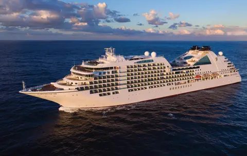
Seabourn7731
7-Daagse Gletsjers & Alaska Binnenpassage
Date
2027-05-28
Duration
7 nights
Departure Port
Vancouver
Canada
Arrival Port
Juneau
Verenigde Staten
Rating
—
Theme
—
Date
2027-05-28
Duration
7 nights
Departure Port
Vancouver
Canada
Arrival Port
Juneau
Verenigde Staten
Rating
—
Theme
—

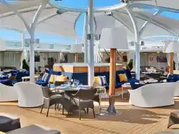




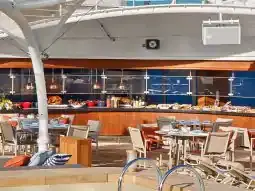
Seabourn
2016
—
40,350 GT
600
266
330
690 m
28 m
19 knots
No
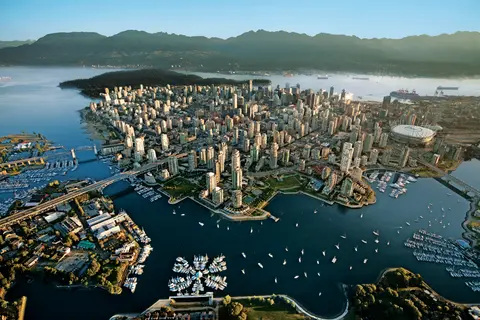
Geperst tussen de Stille Oceaan en de Coast Mountains, is Vancouver de natuurlijke toegangspoort tot de Inside Passage van Alaska — een stad waar gematigd regenwoud ontmoet glazen torens en waar Dungeness-kreeft en wilde sockeye-zalm een Pacific Rim-keuken definiëren die met elke in Noord-Amerika kan concurreren. Wandel over de 22 kilometer lange zeewering van Stanley Park, verdwaal in de markt van Granville Island en neem de veerboot naar de Edwardiaanse pracht van Victoria. Het cruiseseizoen naar Alaska bereikt zijn hoogtepunt van mei tot september, waardoor Vancouver een ideaal startpunt is voor een van de grootste oceaanreizen ter wereld.
The Seymour Narrows is a 3-mile/5 km stretch of the Discovery Channel north of Vancouver Island, British Columbia that is notorious for the strength of the tidal currents flowing through it. The average width of the narrows is just 750 meters. During extreme tides, the current through the narrows is subject to severe Venturi effect, resulting in an increased velocity that can reach 15 knots. For much of its modern history, there was an additional hazard in the narrows called Ripple Rock, a shallow obstruction that claimed no fewer than 119 ships and 114 lives. In 1958, after months of tunneling and preparation, Ripple Rock was blown up in the largest commercial, non-nuclear explosion ever recorded in North America. Still, the navigation of Seymour Narrows is dependent on tidal and other conditions, and requires skill and technical accomplishment.
The Queen Charlotte Sound lies between the Queen Charlotte Strait, which winds between Vancouver Island and the British Columbia mainland in the south, and Hecate Strait, which is northward, adjacent to the Haida Gwaii Islands off the Pacific coast of British Columbia. It is a broad reach in the long shipping route called the Inside Passage threading the myriad islands stretching from Washington’s Puget Sound to Alaska.
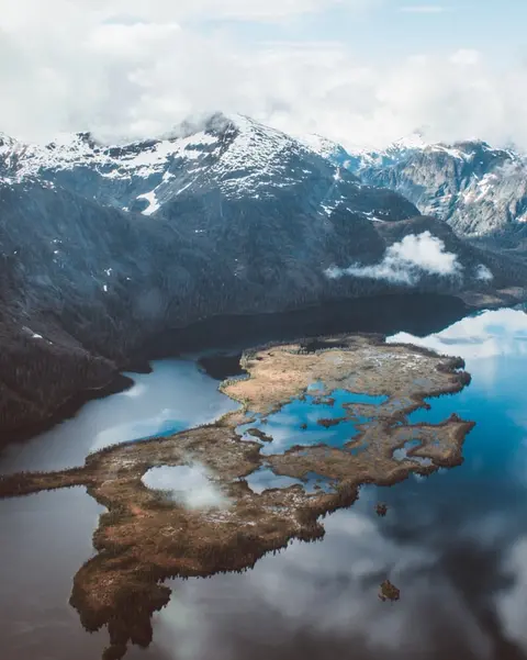
Ketchikan kleeft aan de beboste kust van Revillagigedo Island in de zuidoostelijke panhandle van Alaska — een stad zo smal dat de lokale bevolking grapt dat het drie mijl lang en drie blokken breed is. Geëerd door de Tlingit-bevolking gedurende millennia als een plek van overvloedige zalm, wordt het vandaag de dag gevierd als de Totem Pole Capital of the World: de collecties in Saxman Native Village en Totem Bight State Historical Park behouden de meest significante concentratie van deze monumentale kunstwerken ter wereld. Creek Street, een promenade van kleurrijke historische huizen gebouwd over Ketchikan Creek, mag niet worden gemist. De zomer (mei-september) brengt het beste weer, met zalm die in de kreken beneden zwemt.
In the passage between Sumner Strait and Clarence Strait in Southeast Alaska’s Alexander Archipelago, midway between Price of Wales Island on the west and Zarembo Island on the east, is a small cluster of islands with a picturesque passageway between them called Snow Pass. It makes a scenic up-close route for your Seabourn ship during the transit.
Decision Passage is the western end of the Sumner Strait, which runs through the Alexander Archipelago into the Pacific Ocean in Southeastern Alaska, bounded on the north by Kuiu Island and Cape Decision, the location of a 1932 lighthouse. This is the route your ship takes when coming from or going to the colorful historic community of Sitka on the west coast of Baranof Island, which was originally the Russian fortress town of New Archangel.
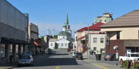
Sitka, gelegen aan de wilde westkust van Baranof Island in Zuidoost-Alaska, is een van de meest historisch resonante havens van de Pacific Northwest — een plek waar Russische Orthodoxe uivormige koepels oprijzen boven totempalen en het grote gematigde regenwoud naar de waterkant drukt. Het Sitka National Historical Park bewaart de plaats van de strijd in 1804 tussen Tlingit-krijgers en Russische kolonisten, naast een prachtige collectie monumentale palen. Walvisobservatie, zeekajakken tussen zeeotters, en het spotten van bruine beren in de omliggende wildernis definiëren de buitenervaring. Van mei tot september biedt de meest toegankelijke en heldere omstandigheden.
Yakutat Bay is 18 miles wide at its entry, and cuts from the Gulf of Alaska into Disenchantment Bay, the entryway to the huge Hubbard Glacier, North America’s largest tidewater glacier. As the bay narrows and the shorelines draw closer, the 400-foot face of the glacier exerts a luminous, ghostly presence, often from as much as 30 miles away. More and more floating ice dimples the surface of the water, and seals bob up and disappear again. The chilled air from the glacier flows in a downdraft of cold that gives rise to mists and gray clouds, through which the vivid blue of the ice wall shimmers. It is an impressive sight of nature’s immense raw workplace, shaping the earth itself as part of an endless cycle of water from the sea evaporating to the sky, falling as snow on the heights and inching over centuries back again to the sea.
The Hubbard Glacier is the largest, and one of the most spectacular tidewater glaciers in North America. Its ice cliffs, some 400’ (121 m) tall, calve icebergs into the fjord, which may frequently be larger than a five-story building. The glacier’s surface is creased and contorted, resembling the wrinkled skin of a giant elephant. Records show it has been growing in thickness and advancing since 1895. This stands in stark contrast to other glaciers around the world, most of which have been receding during the past century. In 2002, the glacier blocked Russell Fjord for two and a half months, raising water levels 61’ (18 m) and threatening local communities with flooding. Nutrient-rich waters along the glacier face attract many species. Gulls and kittiwake colonies adorn smaller islands and harbor seals patrol the icy waters. In 1890, Israel Russell explored the area of Yakutat Bay and Hubbard Glacier, naming it after Gardiner G. Hubbard, a financier of his expedition and a founder and the first president of the National Geographic Society. VIEW CRUISES
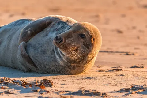
De Inian-eilanden zijn een wilde, onbewoonde cluster bij de ingang van Alaska's Cross Sound, beroemd om buitengewone ontmoetingen met wilde dieren, waaronder bultrugwalvissen die in bubbels voeden en enorme Steller-zeelionen kolonies. Must-dos zijn onder andere Zodiac-excursies langs de rotsachtige kusten van de eilanden, het bekijken van coöperatieve walvisvoeding, en het verkennen van getijdenpoelen vol met zeeleven. Bezoek van juli tot augustus voor de piek walvisactiviteit en de beste zeeomstandigheden.
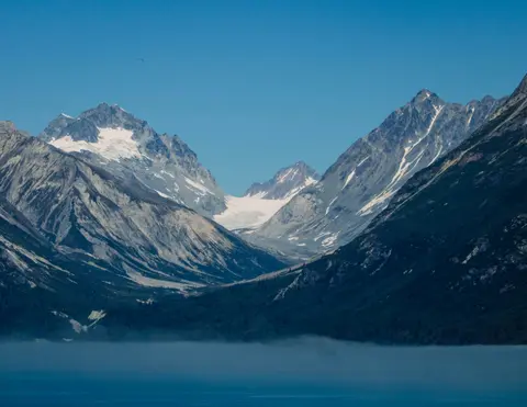
Icy Strait Point is een prachtige Alaskaanse haven die bekend staat om zijn adembenemende natuurlijke schoonheid en rijke inheemse Tlingit-cultuur. Must-do ervaringen zijn onder andere het proeven van verse lokale zeevruchten en het ondernemen van wildlife-excursies in Glacier Bay National Park. Het beste seizoen om te bezoeken is tijdens de zomermaanden, wanneer het weer mild is en wildlife overvloedig aanwezig is.
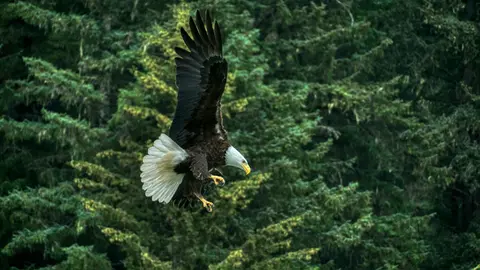
Haines is een authentieke Alaskaanse stad aan de diepste fjord van Noord-Amerika, de thuisbasis van 's werelds grootste verzameling zeearenden — tot vierduizend vogels langs de Chilkat-rivier — en een bloeiende kunstgemeenschap die de Tlingit-culturele tradities behoudt. Bezoek van juni tot augustus via Cunard of Lindblad voor gletsjerhelikopterlandingen en kustwandelingen, of van oktober tot februari voor het buitengewone arendspectakel dat Haines tot het best bewaarde geheim van Alaska maakt.
Lynn Canal is a 90-mile long inlet into Alaska’s coast running from the Chilkat River in the north to the Chatham Strait and Stephens Passage in the south. Because it connects the towns of Skagway and Haines to Juneau and the rest of the Inside Passage, it is an important shipping lane for ferries, cargo and cruise ships, and was a crucial passageway to the Klondike gold fields during the Gold Rush. It was discovered by Joseph Whidbey in 1794 and named by George Vancouver after his birthplace, King’s Lynn in Norfolk, England. More than 2,000 feet in depth, it is one of the deepest and longest fjords in the world, and the deepest in North America outside Greenland.
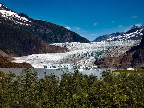
De enige staatshoofdstad van Amerika die niet per weg bereikbaar is, Juneau beloont de reis met een wildernisgrootheid die weinige steden op aarde kunnen evenaren. De Mendenhall-gletsjer — een levende rivier van oude ijs — ligt op slechts vijftien minuten van het centrum, waar watervliegtuigen boven een waterfront dartelen dat wordt geflankeerd door met sparren bedekte bergen die recht in de zee duiken. De must-do ervaring is een helikopterlanding op de ijsveld of een walvisspot-excursie in Stephens Passage, waar bultruggen in verbazingwekkende nabijheid breken. Juneau is het warmst van juni tot augustus, hoewel zelfs zomerse dagen de beroemde regen van Zuidoost-Alaska kunnen brengen die het regenwoud perpetueel stralend houdt.
Day 1
Geperst tussen de Stille Oceaan en de Coast Mountains, is Vancouver de natuurlijke toegangspoort tot de Inside Passage van Alaska — een stad waar gematigd regenwoud ontmoet glazen torens en waar Dungeness-kreeft en wilde sockeye-zalm een Pacific Rim-keuken definiëren die met elke in Noord-Amerika kan concurreren. Wandel over de 22 kilometer lange zeewering van Stanley Park, verdwaal in de markt van Granville Island en neem de veerboot naar de Edwardiaanse pracht van Victoria. Het cruiseseizoen naar Alaska bereikt zijn hoogtepunt van mei tot september, waardoor Vancouver een ideaal startpunt is voor een van de grootste oceaanreizen ter wereld.
The Seymour Narrows is a 3-mile/5 km stretch of the Discovery Channel north of Vancouver Island, British Columbia that is notorious for the strength of the tidal currents flowing through it. The average width of the narrows is just 750 meters. During extreme tides, the current through the narrows is subject to severe Venturi effect, resulting in an increased velocity that can reach 15 knots. For much of its modern history, there was an additional hazard in the narrows called Ripple Rock, a shallow obstruction that claimed no fewer than 119 ships and 114 lives. In 1958, after months of tunneling and preparation, Ripple Rock was blown up in the largest commercial, non-nuclear explosion ever recorded in North America. Still, the navigation of Seymour Narrows is dependent on tidal and other conditions, and requires skill and technical accomplishment.
Day 2
The Queen Charlotte Sound lies between the Queen Charlotte Strait, which winds between Vancouver Island and the British Columbia mainland in the south, and Hecate Strait, which is northward, adjacent to the Haida Gwaii Islands off the Pacific coast of British Columbia. It is a broad reach in the long shipping route called the Inside Passage threading the myriad islands stretching from Washington’s Puget Sound to Alaska.
Day 3
Ketchikan kleeft aan de beboste kust van Revillagigedo Island in de zuidoostelijke panhandle van Alaska — een stad zo smal dat de lokale bevolking grapt dat het drie mijl lang en drie blokken breed is. Geëerd door de Tlingit-bevolking gedurende millennia als een plek van overvloedige zalm, wordt het vandaag de dag gevierd als de Totem Pole Capital of the World: de collecties in Saxman Native Village en Totem Bight State Historical Park behouden de meest significante concentratie van deze monumentale kunstwerken ter wereld. Creek Street, een promenade van kleurrijke historische huizen gebouwd over Ketchikan Creek, mag niet worden gemist. De zomer (mei-september) brengt het beste weer, met zalm die in de kreken beneden zwemt.
In the passage between Sumner Strait and Clarence Strait in Southeast Alaska’s Alexander Archipelago, midway between Price of Wales Island on the west and Zarembo Island on the east, is a small cluster of islands with a picturesque passageway between them called Snow Pass. It makes a scenic up-close route for your Seabourn ship during the transit.
Decision Passage is the western end of the Sumner Strait, which runs through the Alexander Archipelago into the Pacific Ocean in Southeastern Alaska, bounded on the north by Kuiu Island and Cape Decision, the location of a 1932 lighthouse. This is the route your ship takes when coming from or going to the colorful historic community of Sitka on the west coast of Baranof Island, which was originally the Russian fortress town of New Archangel.
Day 4
Sitka, gelegen aan de wilde westkust van Baranof Island in Zuidoost-Alaska, is een van de meest historisch resonante havens van de Pacific Northwest — een plek waar Russische Orthodoxe uivormige koepels oprijzen boven totempalen en het grote gematigde regenwoud naar de waterkant drukt. Het Sitka National Historical Park bewaart de plaats van de strijd in 1804 tussen Tlingit-krijgers en Russische kolonisten, naast een prachtige collectie monumentale palen. Walvisobservatie, zeekajakken tussen zeeotters, en het spotten van bruine beren in de omliggende wildernis definiëren de buitenervaring. Van mei tot september biedt de meest toegankelijke en heldere omstandigheden.
Day 5
Yakutat Bay is 18 miles wide at its entry, and cuts from the Gulf of Alaska into Disenchantment Bay, the entryway to the huge Hubbard Glacier, North America’s largest tidewater glacier. As the bay narrows and the shorelines draw closer, the 400-foot face of the glacier exerts a luminous, ghostly presence, often from as much as 30 miles away. More and more floating ice dimples the surface of the water, and seals bob up and disappear again. The chilled air from the glacier flows in a downdraft of cold that gives rise to mists and gray clouds, through which the vivid blue of the ice wall shimmers. It is an impressive sight of nature’s immense raw workplace, shaping the earth itself as part of an endless cycle of water from the sea evaporating to the sky, falling as snow on the heights and inching over centuries back again to the sea.
The Hubbard Glacier is the largest, and one of the most spectacular tidewater glaciers in North America. Its ice cliffs, some 400’ (121 m) tall, calve icebergs into the fjord, which may frequently be larger than a five-story building. The glacier’s surface is creased and contorted, resembling the wrinkled skin of a giant elephant. Records show it has been growing in thickness and advancing since 1895. This stands in stark contrast to other glaciers around the world, most of which have been receding during the past century. In 2002, the glacier blocked Russell Fjord for two and a half months, raising water levels 61’ (18 m) and threatening local communities with flooding. Nutrient-rich waters along the glacier face attract many species. Gulls and kittiwake colonies adorn smaller islands and harbor seals patrol the icy waters. In 1890, Israel Russell explored the area of Yakutat Bay and Hubbard Glacier, naming it after Gardiner G. Hubbard, a financier of his expedition and a founder and the first president of the National Geographic Society. VIEW CRUISES
Day 6
De Inian-eilanden zijn een wilde, onbewoonde cluster bij de ingang van Alaska's Cross Sound, beroemd om buitengewone ontmoetingen met wilde dieren, waaronder bultrugwalvissen die in bubbels voeden en enorme Steller-zeelionen kolonies. Must-dos zijn onder andere Zodiac-excursies langs de rotsachtige kusten van de eilanden, het bekijken van coöperatieve walvisvoeding, en het verkennen van getijdenpoelen vol met zeeleven. Bezoek van juli tot augustus voor de piek walvisactiviteit en de beste zeeomstandigheden.
Icy Strait Point is een prachtige Alaskaanse haven die bekend staat om zijn adembenemende natuurlijke schoonheid en rijke inheemse Tlingit-cultuur. Must-do ervaringen zijn onder andere het proeven van verse lokale zeevruchten en het ondernemen van wildlife-excursies in Glacier Bay National Park. Het beste seizoen om te bezoeken is tijdens de zomermaanden, wanneer het weer mild is en wildlife overvloedig aanwezig is.
Day 7
Haines is een authentieke Alaskaanse stad aan de diepste fjord van Noord-Amerika, de thuisbasis van 's werelds grootste verzameling zeearenden — tot vierduizend vogels langs de Chilkat-rivier — en een bloeiende kunstgemeenschap die de Tlingit-culturele tradities behoudt. Bezoek van juni tot augustus via Cunard of Lindblad voor gletsjerhelikopterlandingen en kustwandelingen, of van oktober tot februari voor het buitengewone arendspectakel dat Haines tot het best bewaarde geheim van Alaska maakt.
Lynn Canal is a 90-mile long inlet into Alaska’s coast running from the Chilkat River in the north to the Chatham Strait and Stephens Passage in the south. Because it connects the towns of Skagway and Haines to Juneau and the rest of the Inside Passage, it is an important shipping lane for ferries, cargo and cruise ships, and was a crucial passageway to the Klondike gold fields during the Gold Rush. It was discovered by Joseph Whidbey in 1794 and named by George Vancouver after his birthplace, King’s Lynn in Norfolk, England. More than 2,000 feet in depth, it is one of the deepest and longest fjords in the world, and the deepest in North America outside Greenland.
Day 8
De enige staatshoofdstad van Amerika die niet per weg bereikbaar is, Juneau beloont de reis met een wildernisgrootheid die weinige steden op aarde kunnen evenaren. De Mendenhall-gletsjer — een levende rivier van oude ijs — ligt op slechts vijftien minuten van het centrum, waar watervliegtuigen boven een waterfront dartelen dat wordt geflankeerd door met sparren bedekte bergen die recht in de zee duiken. De must-do ervaring is een helikopterlanding op de ijsveld of een walvisspot-excursie in Stephens Passage, waar bultruggen in verbazingwekkende nabijheid breken. Juneau is het warmst van juni tot augustus, hoewel zelfs zomerse dagen de beroemde regen van Zuidoost-Alaska kunnen brengen die het regenwoud perpetueel stralend houdt.
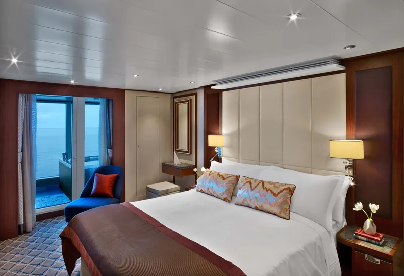
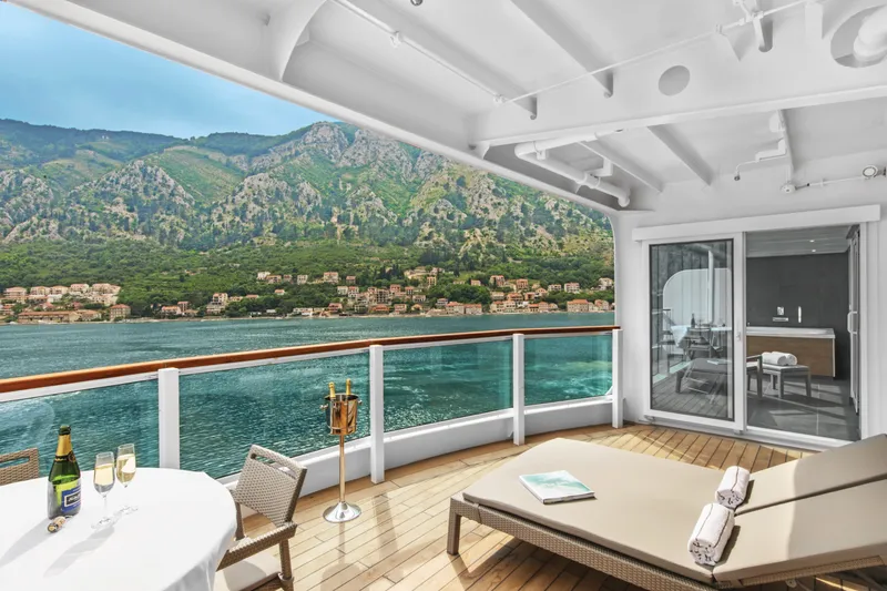

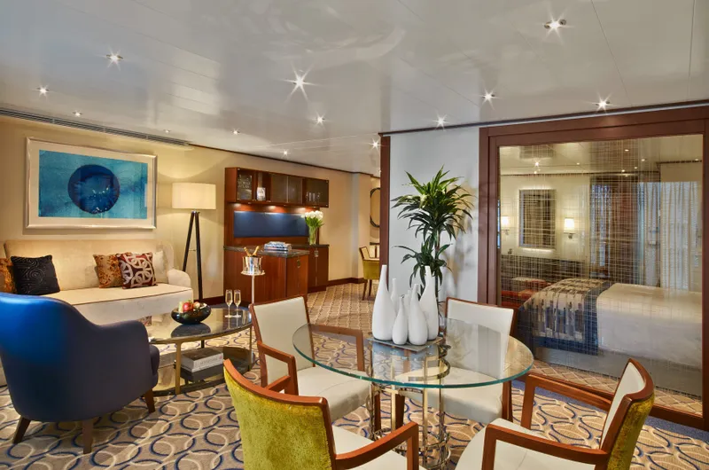
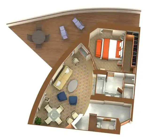
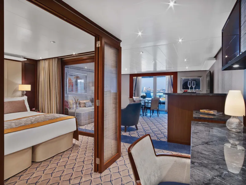
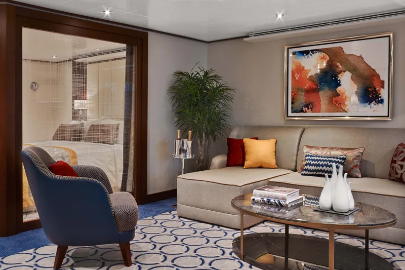

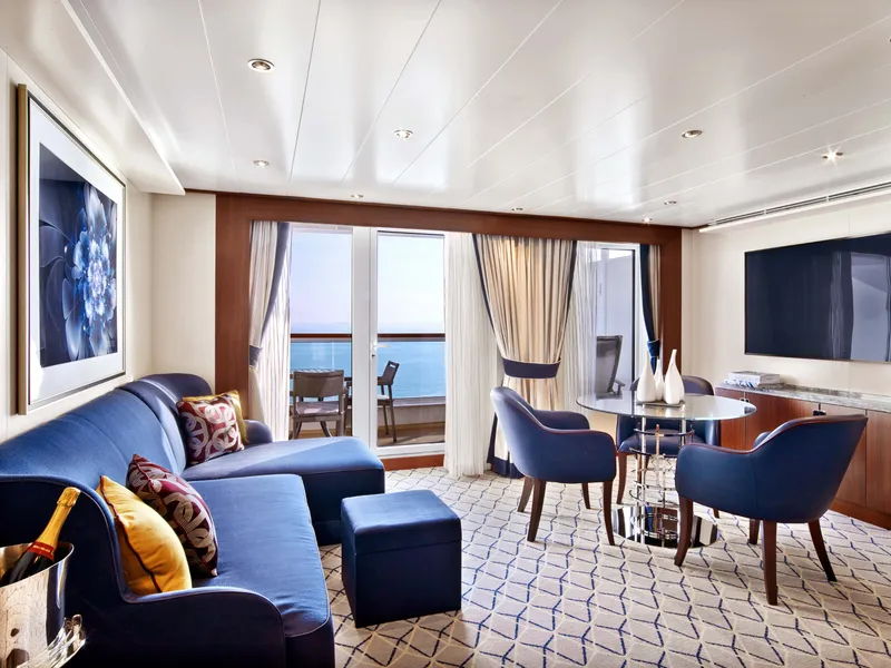

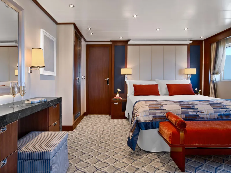
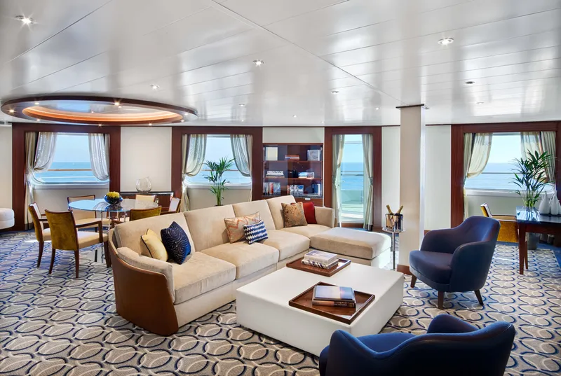
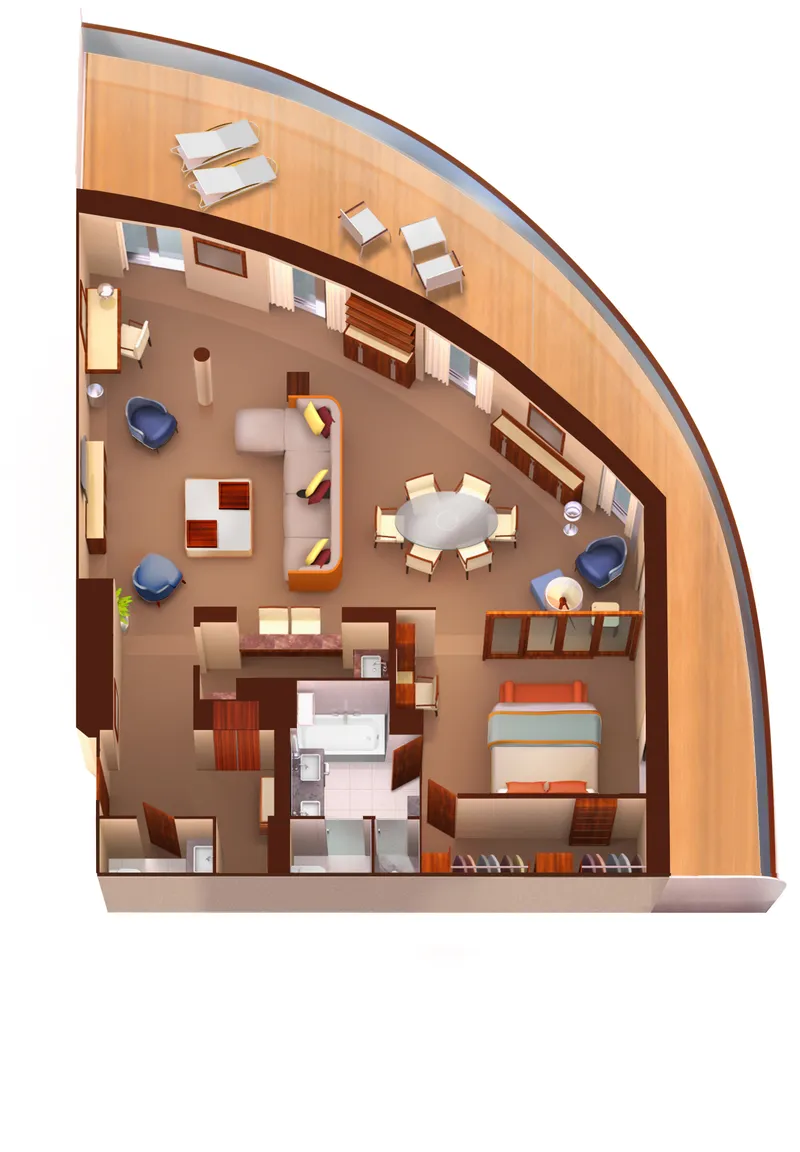


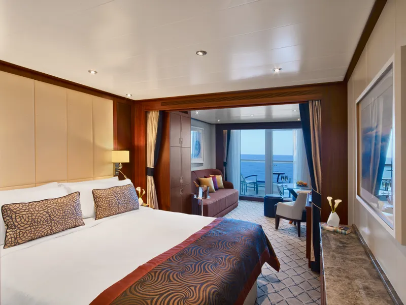
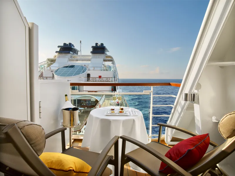


Our cruise specialists can help you find the perfect cabin and the best available pricing.
(+886) 02-2721-7300Contact Advisor