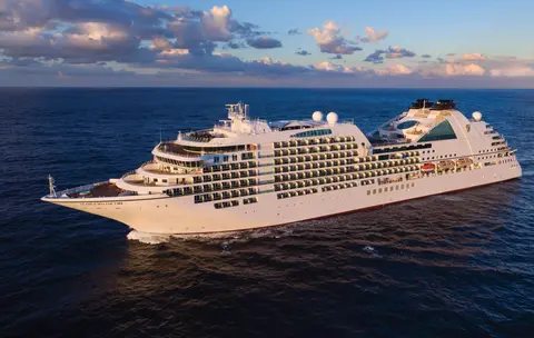
Seabourn7731
7-dagers breer & Alaskas indre passasje
Date
2027-05-28
Duration
7 nights
Departure Port
Vancouver
Canada
Arrival Port
Juneau
De forente stater
Rating
—
Theme
—
Date
2027-05-28
Duration
7 nights
Departure Port
Vancouver
Canada
Arrival Port
Juneau
De forente stater
Rating
—
Theme
—

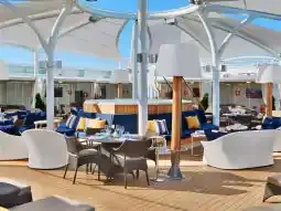




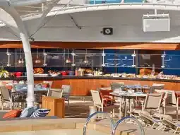
Seabourn
2016
—
40,350 GT
600
266
330
690 m
28 m
19 knots
No
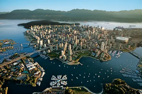
Presset mellom Stillehavet og Coast Mountains, er Vancouver den naturlige porten til Alaskas Inside Passage — en by hvor temperert regnskog møter glassbygninger og hvor Dungeness-krabbe og vill sockeye-laks definerer en Pacific Rim-kjøkken som kan konkurrere med enhver i Nord-Amerika. Gå den 22 kilometer lange Stanley Park-kystlinjen, mist deg selv i Granville Island-markedet, og ta deretter ferge over til Victorias edvardianske prakt. Alaskas cruisesesong når sitt høydepunkt fra mai til september, noe som gjør Vancouver til et ideelt utgangspunkt for en av verdens store havreiser.
The Seymour Narrows is a 3-mile/5 km stretch of the Discovery Channel north of Vancouver Island, British Columbia that is notorious for the strength of the tidal currents flowing through it. The average width of the narrows is just 750 meters. During extreme tides, the current through the narrows is subject to severe Venturi effect, resulting in an increased velocity that can reach 15 knots. For much of its modern history, there was an additional hazard in the narrows called Ripple Rock, a shallow obstruction that claimed no fewer than 119 ships and 114 lives. In 1958, after months of tunneling and preparation, Ripple Rock was blown up in the largest commercial, non-nuclear explosion ever recorded in North America. Still, the navigation of Seymour Narrows is dependent on tidal and other conditions, and requires skill and technical accomplishment.
The Queen Charlotte Sound lies between the Queen Charlotte Strait, which winds between Vancouver Island and the British Columbia mainland in the south, and Hecate Strait, which is northward, adjacent to the Haida Gwaii Islands off the Pacific coast of British Columbia. It is a broad reach in the long shipping route called the Inside Passage threading the myriad islands stretching from Washington’s Puget Sound to Alaska.
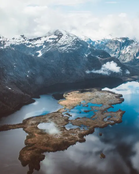
Ketchikan klamrer seg til den skogkledde kysten av Revillagigedo Island i Alaskas sørøstlige panhandle — en by så smal at lokalbefolkningen spøker med at den er tre miles lang og tre kvartaler bred. Beundret av Tlingit-folket i årtusener som et sted med rikelig med laks, feires den i dag som Totem Pole Capital of the World: samlingene ved Saxman Native Village og Totem Bight State Historical Park bevarer den mest betydningsfulle konsentrasjonen av disse monumentale kunstverkene noe sted. Creek Street, en gangvei av fargerike historiske hus bygget over Ketchikan Creek, bør ikke gås glipp av. Sommer (mai–september) gir det beste været, med laks som svømmer i elvene nedenfor.
In the passage between Sumner Strait and Clarence Strait in Southeast Alaska’s Alexander Archipelago, midway between Price of Wales Island on the west and Zarembo Island on the east, is a small cluster of islands with a picturesque passageway between them called Snow Pass. It makes a scenic up-close route for your Seabourn ship during the transit.
Decision Passage is the western end of the Sumner Strait, which runs through the Alexander Archipelago into the Pacific Ocean in Southeastern Alaska, bounded on the north by Kuiu Island and Cape Decision, the location of a 1932 lighthouse. This is the route your ship takes when coming from or going to the colorful historic community of Sitka on the west coast of Baranof Island, which was originally the Russian fortress town of New Archangel.
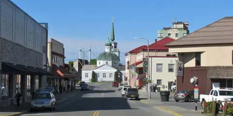
Sitka, som ligger på den ville vestkysten av Baranof Island i Sør-Alaska, er en av Stillehavets nordvestligste havner med stor historisk resonans — et sted hvor russisk ortodokse løkkupler reiser seg over totempåler og det store tempererte regnskogen presser seg ned til vannkanten. Sitka National Historical Park bevarer stedet for slaget i 1804 mellom Tlingit-krigere og russiske kolonister, sammen med en storslått samling av monumentale påler. Hvalsafari, havkajakk blant sjøottere, og observasjon av brune bjørner i det omkringliggende villmark definerer utendørsopplevelsen. Mai til september tilbyr de mest tilgjengelige og lysende forholdene.
Yakutat Bay is 18 miles wide at its entry, and cuts from the Gulf of Alaska into Disenchantment Bay, the entryway to the huge Hubbard Glacier, North America’s largest tidewater glacier. As the bay narrows and the shorelines draw closer, the 400-foot face of the glacier exerts a luminous, ghostly presence, often from as much as 30 miles away. More and more floating ice dimples the surface of the water, and seals bob up and disappear again. The chilled air from the glacier flows in a downdraft of cold that gives rise to mists and gray clouds, through which the vivid blue of the ice wall shimmers. It is an impressive sight of nature’s immense raw workplace, shaping the earth itself as part of an endless cycle of water from the sea evaporating to the sky, falling as snow on the heights and inching over centuries back again to the sea.
The Hubbard Glacier is the largest, and one of the most spectacular tidewater glaciers in North America. Its ice cliffs, some 400’ (121 m) tall, calve icebergs into the fjord, which may frequently be larger than a five-story building. The glacier’s surface is creased and contorted, resembling the wrinkled skin of a giant elephant. Records show it has been growing in thickness and advancing since 1895. This stands in stark contrast to other glaciers around the world, most of which have been receding during the past century. In 2002, the glacier blocked Russell Fjord for two and a half months, raising water levels 61’ (18 m) and threatening local communities with flooding. Nutrient-rich waters along the glacier face attract many species. Gulls and kittiwake colonies adorn smaller islands and harbor seals patrol the icy waters. In 1890, Israel Russell explored the area of Yakutat Bay and Hubbard Glacier, naming it after Gardiner G. Hubbard, a financier of his expedition and a founder and the first president of the National Geographic Society. VIEW CRUISES
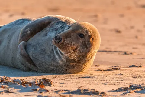
Inian-øyene er en vill, ubebodd klynge ved inngangen til Alaskas Cross Sound, kjent for ekstraordinære dyrelivsmøter inkludert humpback-hvaler som fôrer med bobler og massive kolonier av Steller-sealioner. Uunnværlige aktiviteter inkluderer Zodiac-utflukter langs øyenes steinete kyster, å se på samarbeidsfôring av hvaler, og utforske tidevannspooler fylt med marint liv. Besøk i juli–august for maksimal hvalaktivitet og de beste sjøforholdene.
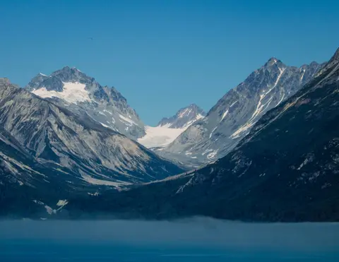
Icy Strait Point er en fantastisk alaskansk havn kjent for sin fantastiske naturskjønnhet og rike urfolk Tlingit kultur. Opplevelser du må få med deg inkluderer å nyte fersk lokal sjømat og delta på dyrelivseventyr i Glacier Bay nasjonalpark. Den beste sesongen å besøke er i sommermånedene, når været er mildt og dyrelivet er rikelig.
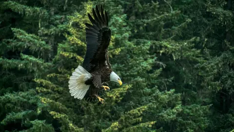
Haines er en autentisk by i Alaska, beliggende ved Nord-Amerikas dypeste fjord, hjem til verdens største samling av hvithodede havørner — opptil fire tusen fugler langs Chilkat-elven — og et blomstrende kunstmiljø som bevarer Tlingit-kulturelle tradisjoner. Besøk fra juni til august via Cunard eller Lindblad for helikopterlandinger på breene og kystvandringer, eller fra oktober til februar for det ekstraordinære ørnespektrumet som gjør Haines til Alaskas best bevarte hemmelighet.
Lynn Canal is a 90-mile long inlet into Alaska’s coast running from the Chilkat River in the north to the Chatham Strait and Stephens Passage in the south. Because it connects the towns of Skagway and Haines to Juneau and the rest of the Inside Passage, it is an important shipping lane for ferries, cargo and cruise ships, and was a crucial passageway to the Klondike gold fields during the Gold Rush. It was discovered by Joseph Whidbey in 1794 and named by George Vancouver after his birthplace, King’s Lynn in Norfolk, England. More than 2,000 feet in depth, it is one of the deepest and longest fjords in the world, and the deepest in North America outside Greenland.
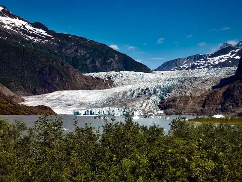
Amerikas eneste delstatshovedstad som ikke kan nås med vei, Juneau belønner reisen med en villmarksglans som få byer på jorden kan matche. Mendenhall-breen — en levende elv av gammel is — ligger bare femten minutter fra sentrum, hvor flytefly suser over en vannfront flankert av grantrær som dykker rett ned i havet. Den må-gjøre opplevelsen er en helikopterlanding på isfeltet eller en hvalsafari i Stephens Passage, hvor knølhvaler bryter overflaten i imponerende nærhet. Juneau er varmest fra juni til august, selv om selv sommerdager kan bringe den berømte regnet fra Sørøst-Alaska som holder regnskogen evig lysende.
Day 1
Presset mellom Stillehavet og Coast Mountains, er Vancouver den naturlige porten til Alaskas Inside Passage — en by hvor temperert regnskog møter glassbygninger og hvor Dungeness-krabbe og vill sockeye-laks definerer en Pacific Rim-kjøkken som kan konkurrere med enhver i Nord-Amerika. Gå den 22 kilometer lange Stanley Park-kystlinjen, mist deg selv i Granville Island-markedet, og ta deretter ferge over til Victorias edvardianske prakt. Alaskas cruisesesong når sitt høydepunkt fra mai til september, noe som gjør Vancouver til et ideelt utgangspunkt for en av verdens store havreiser.
The Seymour Narrows is a 3-mile/5 km stretch of the Discovery Channel north of Vancouver Island, British Columbia that is notorious for the strength of the tidal currents flowing through it. The average width of the narrows is just 750 meters. During extreme tides, the current through the narrows is subject to severe Venturi effect, resulting in an increased velocity that can reach 15 knots. For much of its modern history, there was an additional hazard in the narrows called Ripple Rock, a shallow obstruction that claimed no fewer than 119 ships and 114 lives. In 1958, after months of tunneling and preparation, Ripple Rock was blown up in the largest commercial, non-nuclear explosion ever recorded in North America. Still, the navigation of Seymour Narrows is dependent on tidal and other conditions, and requires skill and technical accomplishment.
Day 2
The Queen Charlotte Sound lies between the Queen Charlotte Strait, which winds between Vancouver Island and the British Columbia mainland in the south, and Hecate Strait, which is northward, adjacent to the Haida Gwaii Islands off the Pacific coast of British Columbia. It is a broad reach in the long shipping route called the Inside Passage threading the myriad islands stretching from Washington’s Puget Sound to Alaska.
Day 3
Ketchikan klamrer seg til den skogkledde kysten av Revillagigedo Island i Alaskas sørøstlige panhandle — en by så smal at lokalbefolkningen spøker med at den er tre miles lang og tre kvartaler bred. Beundret av Tlingit-folket i årtusener som et sted med rikelig med laks, feires den i dag som Totem Pole Capital of the World: samlingene ved Saxman Native Village og Totem Bight State Historical Park bevarer den mest betydningsfulle konsentrasjonen av disse monumentale kunstverkene noe sted. Creek Street, en gangvei av fargerike historiske hus bygget over Ketchikan Creek, bør ikke gås glipp av. Sommer (mai–september) gir det beste været, med laks som svømmer i elvene nedenfor.
In the passage between Sumner Strait and Clarence Strait in Southeast Alaska’s Alexander Archipelago, midway between Price of Wales Island on the west and Zarembo Island on the east, is a small cluster of islands with a picturesque passageway between them called Snow Pass. It makes a scenic up-close route for your Seabourn ship during the transit.
Decision Passage is the western end of the Sumner Strait, which runs through the Alexander Archipelago into the Pacific Ocean in Southeastern Alaska, bounded on the north by Kuiu Island and Cape Decision, the location of a 1932 lighthouse. This is the route your ship takes when coming from or going to the colorful historic community of Sitka on the west coast of Baranof Island, which was originally the Russian fortress town of New Archangel.
Day 4
Sitka, som ligger på den ville vestkysten av Baranof Island i Sør-Alaska, er en av Stillehavets nordvestligste havner med stor historisk resonans — et sted hvor russisk ortodokse løkkupler reiser seg over totempåler og det store tempererte regnskogen presser seg ned til vannkanten. Sitka National Historical Park bevarer stedet for slaget i 1804 mellom Tlingit-krigere og russiske kolonister, sammen med en storslått samling av monumentale påler. Hvalsafari, havkajakk blant sjøottere, og observasjon av brune bjørner i det omkringliggende villmark definerer utendørsopplevelsen. Mai til september tilbyr de mest tilgjengelige og lysende forholdene.
Day 5
Yakutat Bay is 18 miles wide at its entry, and cuts from the Gulf of Alaska into Disenchantment Bay, the entryway to the huge Hubbard Glacier, North America’s largest tidewater glacier. As the bay narrows and the shorelines draw closer, the 400-foot face of the glacier exerts a luminous, ghostly presence, often from as much as 30 miles away. More and more floating ice dimples the surface of the water, and seals bob up and disappear again. The chilled air from the glacier flows in a downdraft of cold that gives rise to mists and gray clouds, through which the vivid blue of the ice wall shimmers. It is an impressive sight of nature’s immense raw workplace, shaping the earth itself as part of an endless cycle of water from the sea evaporating to the sky, falling as snow on the heights and inching over centuries back again to the sea.
The Hubbard Glacier is the largest, and one of the most spectacular tidewater glaciers in North America. Its ice cliffs, some 400’ (121 m) tall, calve icebergs into the fjord, which may frequently be larger than a five-story building. The glacier’s surface is creased and contorted, resembling the wrinkled skin of a giant elephant. Records show it has been growing in thickness and advancing since 1895. This stands in stark contrast to other glaciers around the world, most of which have been receding during the past century. In 2002, the glacier blocked Russell Fjord for two and a half months, raising water levels 61’ (18 m) and threatening local communities with flooding. Nutrient-rich waters along the glacier face attract many species. Gulls and kittiwake colonies adorn smaller islands and harbor seals patrol the icy waters. In 1890, Israel Russell explored the area of Yakutat Bay and Hubbard Glacier, naming it after Gardiner G. Hubbard, a financier of his expedition and a founder and the first president of the National Geographic Society. VIEW CRUISES
Day 6
Inian-øyene er en vill, ubebodd klynge ved inngangen til Alaskas Cross Sound, kjent for ekstraordinære dyrelivsmøter inkludert humpback-hvaler som fôrer med bobler og massive kolonier av Steller-sealioner. Uunnværlige aktiviteter inkluderer Zodiac-utflukter langs øyenes steinete kyster, å se på samarbeidsfôring av hvaler, og utforske tidevannspooler fylt med marint liv. Besøk i juli–august for maksimal hvalaktivitet og de beste sjøforholdene.
Icy Strait Point er en fantastisk alaskansk havn kjent for sin fantastiske naturskjønnhet og rike urfolk Tlingit kultur. Opplevelser du må få med deg inkluderer å nyte fersk lokal sjømat og delta på dyrelivseventyr i Glacier Bay nasjonalpark. Den beste sesongen å besøke er i sommermånedene, når været er mildt og dyrelivet er rikelig.
Day 7
Haines er en autentisk by i Alaska, beliggende ved Nord-Amerikas dypeste fjord, hjem til verdens største samling av hvithodede havørner — opptil fire tusen fugler langs Chilkat-elven — og et blomstrende kunstmiljø som bevarer Tlingit-kulturelle tradisjoner. Besøk fra juni til august via Cunard eller Lindblad for helikopterlandinger på breene og kystvandringer, eller fra oktober til februar for det ekstraordinære ørnespektrumet som gjør Haines til Alaskas best bevarte hemmelighet.
Lynn Canal is a 90-mile long inlet into Alaska’s coast running from the Chilkat River in the north to the Chatham Strait and Stephens Passage in the south. Because it connects the towns of Skagway and Haines to Juneau and the rest of the Inside Passage, it is an important shipping lane for ferries, cargo and cruise ships, and was a crucial passageway to the Klondike gold fields during the Gold Rush. It was discovered by Joseph Whidbey in 1794 and named by George Vancouver after his birthplace, King’s Lynn in Norfolk, England. More than 2,000 feet in depth, it is one of the deepest and longest fjords in the world, and the deepest in North America outside Greenland.
Day 8
Amerikas eneste delstatshovedstad som ikke kan nås med vei, Juneau belønner reisen med en villmarksglans som få byer på jorden kan matche. Mendenhall-breen — en levende elv av gammel is — ligger bare femten minutter fra sentrum, hvor flytefly suser over en vannfront flankert av grantrær som dykker rett ned i havet. Den må-gjøre opplevelsen er en helikopterlanding på isfeltet eller en hvalsafari i Stephens Passage, hvor knølhvaler bryter overflaten i imponerende nærhet. Juneau er varmest fra juni til august, selv om selv sommerdager kan bringe den berømte regnet fra Sørøst-Alaska som holder regnskogen evig lysende.
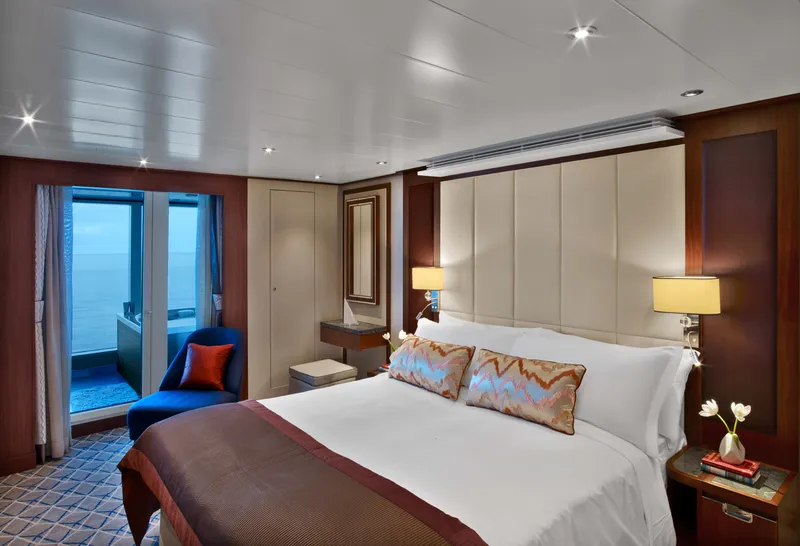
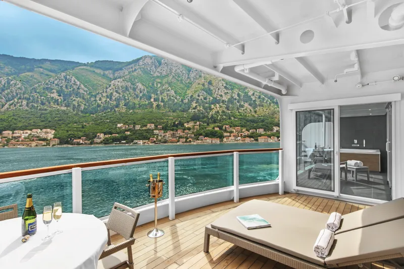






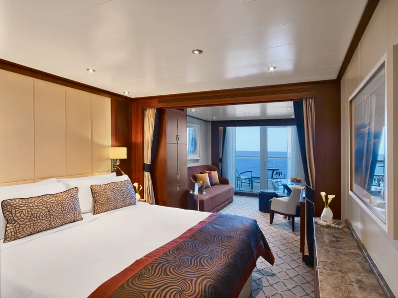
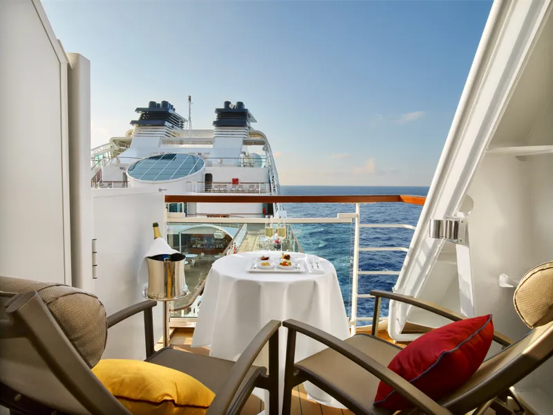

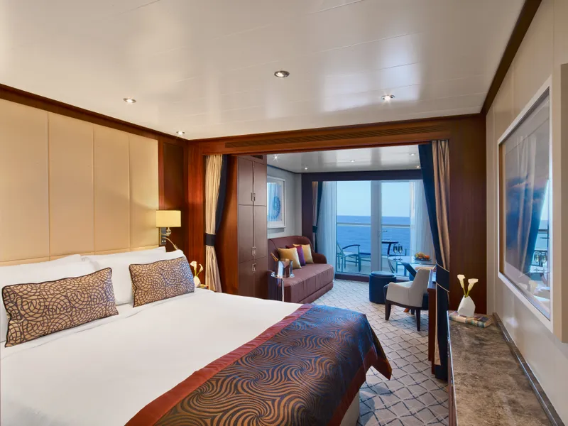
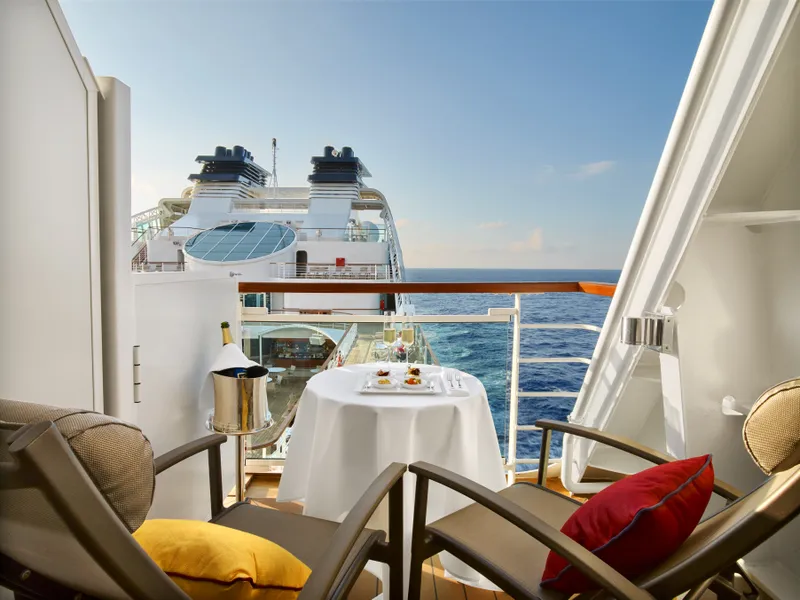

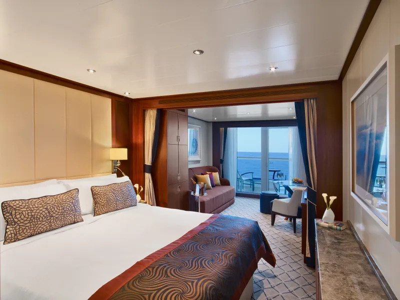
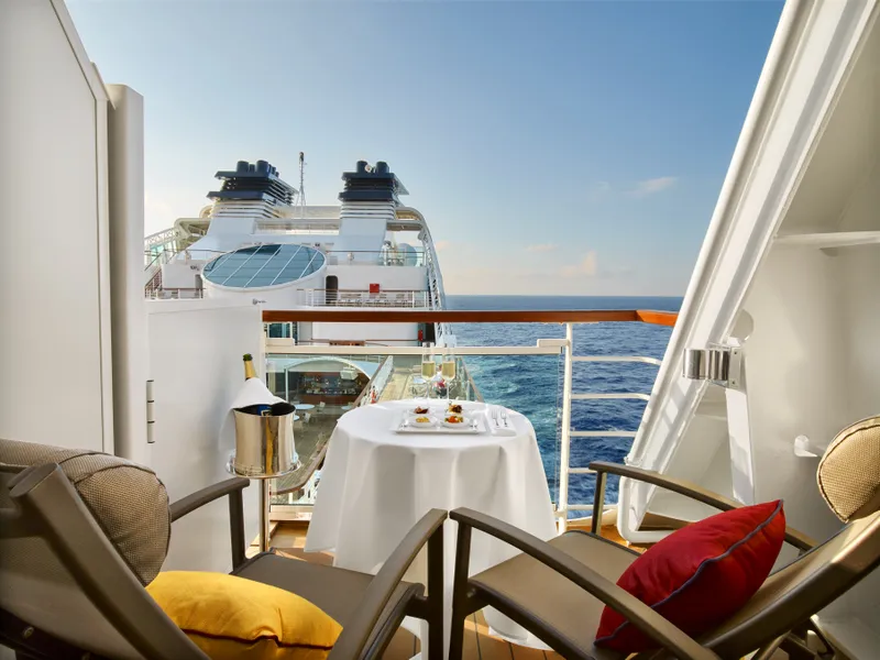

Our cruise specialists can help you find the perfect cabin and the best available pricing.
(+886) 02-2721-7300Contact Advisor