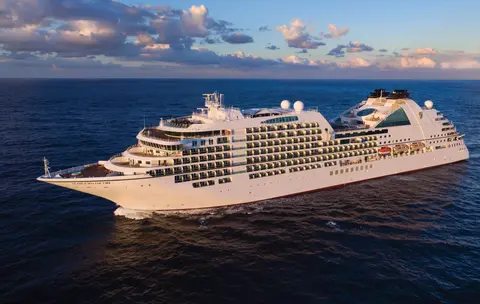
Seabourn7662
Cruzeiro de 7 Dias pelos Glaciares e a Passagem Interior do Alasca
Date
2026-09-04
Duration
7 nights
Departure Port
Vancouver
Canadá
Arrival Port
Juneau
Estados Unidos
Rating
Luxury
Theme
—
Date
2026-09-04
Duration
7 nights
Departure Port
Vancouver
Canadá
Arrival Port
Juneau
Estados Unidos
Rating
Luxury
Theme
—





Seabourn
2016
—
40,350 GT
600
266
330
690 m
28 m
19 knots
No
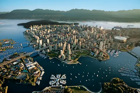
Apressada entre o Pacífico e as Montanhas Costeiras, Vancouver é a porta de entrada natural para o Inside Passage do Alasca — uma cidade onde a floresta tropical temperada encontra torres de vidro e onde o caranguejo Dungeness e o salmão sockeye selvagem definem uma culinária da Costa do Pacífico que rivaliza com qualquer uma na América do Norte. Caminhe pela muralha do mar de Stanley Park de 22 quilômetros, perca-se no mercado da Granville Island e depois pegue a balsa para a esplendor edwardiano de Victoria. A temporada de cruzeiros para o Alasca atinge seu pico de maio a setembro, tornando Vancouver um ponto de partida ideal para uma das grandes jornadas oceânicas do mundo.
The Seymour Narrows is a 3-mile/5 km stretch of the Discovery Channel north of Vancouver Island, British Columbia that is notorious for the strength of the tidal currents flowing through it. The average width of the narrows is just 750 meters. During extreme tides, the current through the narrows is subject to severe Venturi effect, resulting in an increased velocity that can reach 15 knots. For much of its modern history, there was an additional hazard in the narrows called Ripple Rock, a shallow obstruction that claimed no fewer than 119 ships and 114 lives. In 1958, after months of tunneling and preparation, Ripple Rock was blown up in the largest commercial, non-nuclear explosion ever recorded in North America. Still, the navigation of Seymour Narrows is dependent on tidal and other conditions, and requires skill and technical accomplishment.
The Queen Charlotte Sound lies between the Queen Charlotte Strait, which winds between Vancouver Island and the British Columbia mainland in the south, and Hecate Strait, which is northward, adjacent to the Haida Gwaii Islands off the Pacific coast of British Columbia. It is a broad reach in the long shipping route called the Inside Passage threading the myriad islands stretching from Washington’s Puget Sound to Alaska.
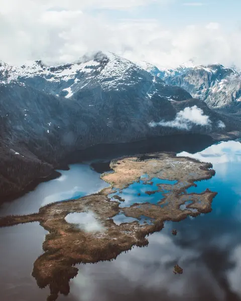
Ketchikan se agarra à costa arborizada da Ilha Revillagigedo, no panhandle sudeste do Alasca — uma cidade tão estreita que os locais brincam que tem três milhas de comprimento e três quarteirões de largura. Reverenciada pelo povo Tlingit por milênios como um lugar de abundância de salmão, hoje é celebrada como a Capital Mundial dos Totens: as coleções na Vila Nativa Saxman e no Parque Histórico Estadual Totem Bight preservam a concentração mais significativa dessas obras monumentais em qualquer lugar. Creek Street, um calçadão de casas históricas coloridas construídas sobre o Ketchikan Creek, não deve ser perdido. O verão (maio a setembro) traz o melhor clima, com salmão correndo nos riachos abaixo.
In the passage between Sumner Strait and Clarence Strait in Southeast Alaska’s Alexander Archipelago, midway between Price of Wales Island on the west and Zarembo Island on the east, is a small cluster of islands with a picturesque passageway between them called Snow Pass. It makes a scenic up-close route for your Seabourn ship during the transit.
Decision Passage is the western end of the Sumner Strait, which runs through the Alexander Archipelago into the Pacific Ocean in Southeastern Alaska, bounded on the north by Kuiu Island and Cape Decision, the location of a 1932 lighthouse. This is the route your ship takes when coming from or going to the colorful historic community of Sitka on the west coast of Baranof Island, which was originally the Russian fortress town of New Archangel.
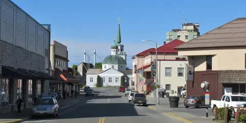
Sitka, situada na selvagem costa oeste da Ilha Baranof, no sudeste do Alasca, é um dos portos mais historicamente ressonantes do Pacífico Noroeste — um lugar onde as cúpulas em cebola da Igreja Ortodoxa Russa se erguem acima de totens e a grande floresta tropical temperada se pressiona até a beira da água. O Parque Histórico Nacional de Sitka preserva o local da batalha de 1804 entre guerreiros Tlingit e colonizadores russos, juntamente com uma magnífica coleção de postes monumentais. A observação de baleias, caiaque entre lontras marinhas e avistar ursos pardos na natureza circundante definem a experiência ao ar livre. De maio a setembro, as condições são mais acessíveis e luminosas.
Yakutat Bay is 18 miles wide at its entry, and cuts from the Gulf of Alaska into Disenchantment Bay, the entryway to the huge Hubbard Glacier, North America’s largest tidewater glacier. As the bay narrows and the shorelines draw closer, the 400-foot face of the glacier exerts a luminous, ghostly presence, often from as much as 30 miles away. More and more floating ice dimples the surface of the water, and seals bob up and disappear again. The chilled air from the glacier flows in a downdraft of cold that gives rise to mists and gray clouds, through which the vivid blue of the ice wall shimmers. It is an impressive sight of nature’s immense raw workplace, shaping the earth itself as part of an endless cycle of water from the sea evaporating to the sky, falling as snow on the heights and inching over centuries back again to the sea.
The Hubbard Glacier is the largest, and one of the most spectacular tidewater glaciers in North America. Its ice cliffs, some 400’ (121 m) tall, calve icebergs into the fjord, which may frequently be larger than a five-story building. The glacier’s surface is creased and contorted, resembling the wrinkled skin of a giant elephant. Records show it has been growing in thickness and advancing since 1895. This stands in stark contrast to other glaciers around the world, most of which have been receding during the past century. In 2002, the glacier blocked Russell Fjord for two and a half months, raising water levels 61’ (18 m) and threatening local communities with flooding. Nutrient-rich waters along the glacier face attract many species. Gulls and kittiwake colonies adorn smaller islands and harbor seals patrol the icy waters. In 1890, Israel Russell explored the area of Yakutat Bay and Hubbard Glacier, naming it after Gardiner G. Hubbard, a financier of his expedition and a founder and the first president of the National Geographic Society. VIEW CRUISES
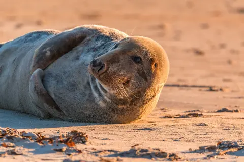
As Ilhas Inian são um cluster selvagem e desabitado na entrada do Cross Sound, no Alasca, renomadas por encontros extraordinários com a vida selvagem, incluindo a alimentação em rede de bolhas das baleias jubarte e enormes colônias de leões marinhos Steller. As atividades imperdíveis incluem excursões de Zodiac ao longo das costas rochosas das ilhas, observar a alimentação cooperativa das baleias e explorar poças de maré repletas de vida marinha. Visite de julho a agosto para a atividade máxima das baleias e as melhores condições do mar.
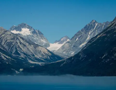
Icy Strait Point é um deslumbrante porto do Alasca conhecido por sua beleza natural de tirar o fôlego e rica cultura nativa Tlingit. As experiências imperdíveis incluem saborear frutos do mar frescos locais e embarcar em excursões de observação da vida selvagem no Parque Nacional Glacier Bay. A melhor temporada para visitar é durante os meses de verão, quando o clima é ameno e a vida selvagem é abundante.
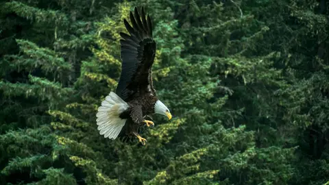
Haines é uma autêntica cidade do Alasca, localizada no fiorde mais profundo da América do Norte, lar da maior congregação de águias-carecas do mundo — até quatro mil aves ao longo do rio Chilkat — e de uma próspera comunidade artística que preserva as tradições culturais Tlingit. Visite de junho a agosto com a Cunard ou Lindblad para pousos de helicóptero em geleiras e caminhadas costeiras, ou de outubro a fevereiro para o extraordinário espetáculo das águias que faz de Haines o melhor segredo guardado do Alasca.
Lynn Canal is a 90-mile long inlet into Alaska’s coast running from the Chilkat River in the north to the Chatham Strait and Stephens Passage in the south. Because it connects the towns of Skagway and Haines to Juneau and the rest of the Inside Passage, it is an important shipping lane for ferries, cargo and cruise ships, and was a crucial passageway to the Klondike gold fields during the Gold Rush. It was discovered by Joseph Whidbey in 1794 and named by George Vancouver after his birthplace, King’s Lynn in Norfolk, England. More than 2,000 feet in depth, it is one of the deepest and longest fjords in the world, and the deepest in North America outside Greenland.
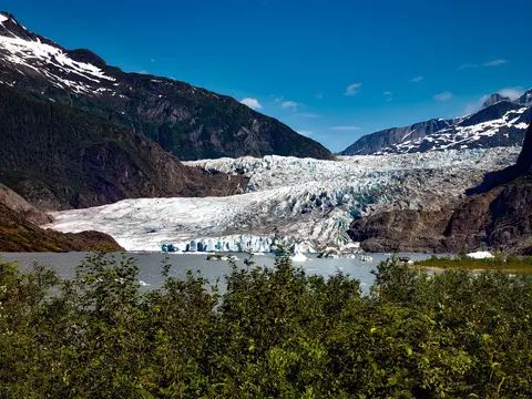
A única capital estadual da América inacessível por estrada, Juneau recompensa a jornada com uma grandeza selvagem que poucas cidades na Terra podem igualar. O Glaciar Mendenhall — um rio vivo de gelo antigo — fica a apenas quinze minutos do centro, onde hidroaviões voam acima de uma orla ladeada por montanhas cobertas de abetos que mergulham diretamente no mar. A experiência imperdível é um pouso de helicóptero no topo do campo de gelo ou uma excursão de observação de baleias no Stephens Passage, onde as jubartes saltam em proximidade impressionante. Juneau é mais quente de junho a agosto, embora até os dias de verão possam trazer a famosa chuva do sudeste do Alasca que mantém a floresta tropical perpetuamente luminosa.
Day 1
Apressada entre o Pacífico e as Montanhas Costeiras, Vancouver é a porta de entrada natural para o Inside Passage do Alasca — uma cidade onde a floresta tropical temperada encontra torres de vidro e onde o caranguejo Dungeness e o salmão sockeye selvagem definem uma culinária da Costa do Pacífico que rivaliza com qualquer uma na América do Norte. Caminhe pela muralha do mar de Stanley Park de 22 quilômetros, perca-se no mercado da Granville Island e depois pegue a balsa para a esplendor edwardiano de Victoria. A temporada de cruzeiros para o Alasca atinge seu pico de maio a setembro, tornando Vancouver um ponto de partida ideal para uma das grandes jornadas oceânicas do mundo.
The Seymour Narrows is a 3-mile/5 km stretch of the Discovery Channel north of Vancouver Island, British Columbia that is notorious for the strength of the tidal currents flowing through it. The average width of the narrows is just 750 meters. During extreme tides, the current through the narrows is subject to severe Venturi effect, resulting in an increased velocity that can reach 15 knots. For much of its modern history, there was an additional hazard in the narrows called Ripple Rock, a shallow obstruction that claimed no fewer than 119 ships and 114 lives. In 1958, after months of tunneling and preparation, Ripple Rock was blown up in the largest commercial, non-nuclear explosion ever recorded in North America. Still, the navigation of Seymour Narrows is dependent on tidal and other conditions, and requires skill and technical accomplishment.
Day 2
The Queen Charlotte Sound lies between the Queen Charlotte Strait, which winds between Vancouver Island and the British Columbia mainland in the south, and Hecate Strait, which is northward, adjacent to the Haida Gwaii Islands off the Pacific coast of British Columbia. It is a broad reach in the long shipping route called the Inside Passage threading the myriad islands stretching from Washington’s Puget Sound to Alaska.
Day 3
Ketchikan se agarra à costa arborizada da Ilha Revillagigedo, no panhandle sudeste do Alasca — uma cidade tão estreita que os locais brincam que tem três milhas de comprimento e três quarteirões de largura. Reverenciada pelo povo Tlingit por milênios como um lugar de abundância de salmão, hoje é celebrada como a Capital Mundial dos Totens: as coleções na Vila Nativa Saxman e no Parque Histórico Estadual Totem Bight preservam a concentração mais significativa dessas obras monumentais em qualquer lugar. Creek Street, um calçadão de casas históricas coloridas construídas sobre o Ketchikan Creek, não deve ser perdido. O verão (maio a setembro) traz o melhor clima, com salmão correndo nos riachos abaixo.
In the passage between Sumner Strait and Clarence Strait in Southeast Alaska’s Alexander Archipelago, midway between Price of Wales Island on the west and Zarembo Island on the east, is a small cluster of islands with a picturesque passageway between them called Snow Pass. It makes a scenic up-close route for your Seabourn ship during the transit.
Decision Passage is the western end of the Sumner Strait, which runs through the Alexander Archipelago into the Pacific Ocean in Southeastern Alaska, bounded on the north by Kuiu Island and Cape Decision, the location of a 1932 lighthouse. This is the route your ship takes when coming from or going to the colorful historic community of Sitka on the west coast of Baranof Island, which was originally the Russian fortress town of New Archangel.
Day 4
Sitka, situada na selvagem costa oeste da Ilha Baranof, no sudeste do Alasca, é um dos portos mais historicamente ressonantes do Pacífico Noroeste — um lugar onde as cúpulas em cebola da Igreja Ortodoxa Russa se erguem acima de totens e a grande floresta tropical temperada se pressiona até a beira da água. O Parque Histórico Nacional de Sitka preserva o local da batalha de 1804 entre guerreiros Tlingit e colonizadores russos, juntamente com uma magnífica coleção de postes monumentais. A observação de baleias, caiaque entre lontras marinhas e avistar ursos pardos na natureza circundante definem a experiência ao ar livre. De maio a setembro, as condições são mais acessíveis e luminosas.
Day 5
Yakutat Bay is 18 miles wide at its entry, and cuts from the Gulf of Alaska into Disenchantment Bay, the entryway to the huge Hubbard Glacier, North America’s largest tidewater glacier. As the bay narrows and the shorelines draw closer, the 400-foot face of the glacier exerts a luminous, ghostly presence, often from as much as 30 miles away. More and more floating ice dimples the surface of the water, and seals bob up and disappear again. The chilled air from the glacier flows in a downdraft of cold that gives rise to mists and gray clouds, through which the vivid blue of the ice wall shimmers. It is an impressive sight of nature’s immense raw workplace, shaping the earth itself as part of an endless cycle of water from the sea evaporating to the sky, falling as snow on the heights and inching over centuries back again to the sea.
The Hubbard Glacier is the largest, and one of the most spectacular tidewater glaciers in North America. Its ice cliffs, some 400’ (121 m) tall, calve icebergs into the fjord, which may frequently be larger than a five-story building. The glacier’s surface is creased and contorted, resembling the wrinkled skin of a giant elephant. Records show it has been growing in thickness and advancing since 1895. This stands in stark contrast to other glaciers around the world, most of which have been receding during the past century. In 2002, the glacier blocked Russell Fjord for two and a half months, raising water levels 61’ (18 m) and threatening local communities with flooding. Nutrient-rich waters along the glacier face attract many species. Gulls and kittiwake colonies adorn smaller islands and harbor seals patrol the icy waters. In 1890, Israel Russell explored the area of Yakutat Bay and Hubbard Glacier, naming it after Gardiner G. Hubbard, a financier of his expedition and a founder and the first president of the National Geographic Society. VIEW CRUISES
Day 6
As Ilhas Inian são um cluster selvagem e desabitado na entrada do Cross Sound, no Alasca, renomadas por encontros extraordinários com a vida selvagem, incluindo a alimentação em rede de bolhas das baleias jubarte e enormes colônias de leões marinhos Steller. As atividades imperdíveis incluem excursões de Zodiac ao longo das costas rochosas das ilhas, observar a alimentação cooperativa das baleias e explorar poças de maré repletas de vida marinha. Visite de julho a agosto para a atividade máxima das baleias e as melhores condições do mar.
Icy Strait Point é um deslumbrante porto do Alasca conhecido por sua beleza natural de tirar o fôlego e rica cultura nativa Tlingit. As experiências imperdíveis incluem saborear frutos do mar frescos locais e embarcar em excursões de observação da vida selvagem no Parque Nacional Glacier Bay. A melhor temporada para visitar é durante os meses de verão, quando o clima é ameno e a vida selvagem é abundante.
Day 7
Haines é uma autêntica cidade do Alasca, localizada no fiorde mais profundo da América do Norte, lar da maior congregação de águias-carecas do mundo — até quatro mil aves ao longo do rio Chilkat — e de uma próspera comunidade artística que preserva as tradições culturais Tlingit. Visite de junho a agosto com a Cunard ou Lindblad para pousos de helicóptero em geleiras e caminhadas costeiras, ou de outubro a fevereiro para o extraordinário espetáculo das águias que faz de Haines o melhor segredo guardado do Alasca.
Lynn Canal is a 90-mile long inlet into Alaska’s coast running from the Chilkat River in the north to the Chatham Strait and Stephens Passage in the south. Because it connects the towns of Skagway and Haines to Juneau and the rest of the Inside Passage, it is an important shipping lane for ferries, cargo and cruise ships, and was a crucial passageway to the Klondike gold fields during the Gold Rush. It was discovered by Joseph Whidbey in 1794 and named by George Vancouver after his birthplace, King’s Lynn in Norfolk, England. More than 2,000 feet in depth, it is one of the deepest and longest fjords in the world, and the deepest in North America outside Greenland.
Day 8
A única capital estadual da América inacessível por estrada, Juneau recompensa a jornada com uma grandeza selvagem que poucas cidades na Terra podem igualar. O Glaciar Mendenhall — um rio vivo de gelo antigo — fica a apenas quinze minutos do centro, onde hidroaviões voam acima de uma orla ladeada por montanhas cobertas de abetos que mergulham diretamente no mar. A experiência imperdível é um pouso de helicóptero no topo do campo de gelo ou uma excursão de observação de baleias no Stephens Passage, onde as jubartes saltam em proximidade impressionante. Juneau é mais quente de junho a agosto, embora até os dias de verão possam trazer a famosa chuva do sudeste do Alasca que mantém a floresta tropical perpetuamente luminosa.
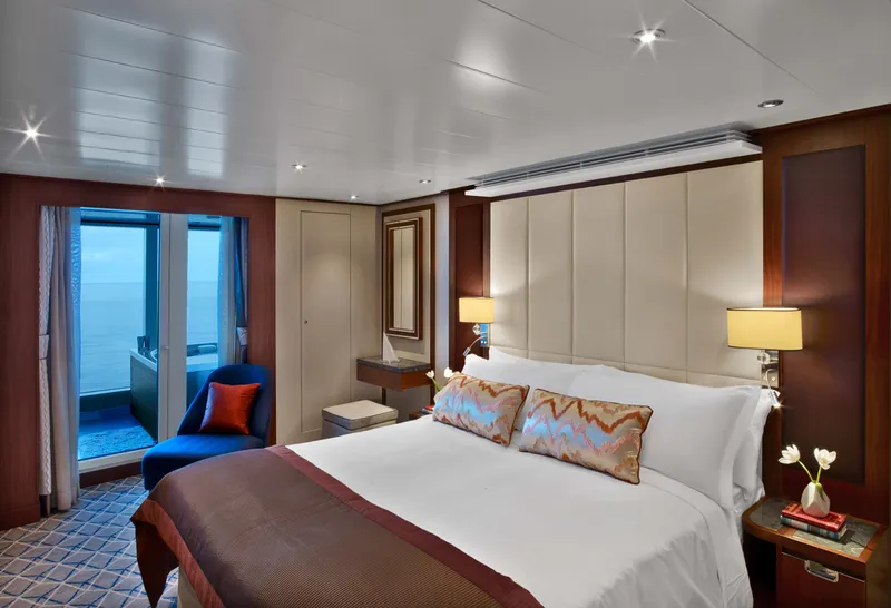
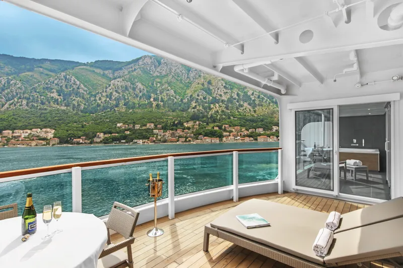

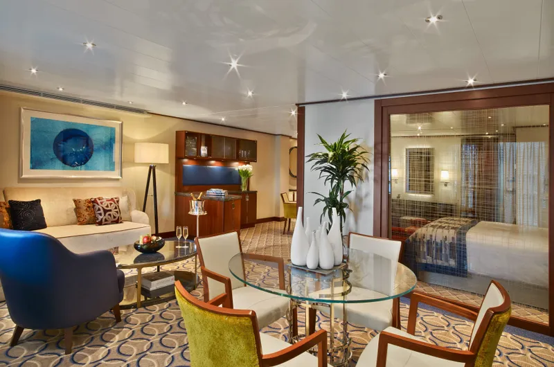
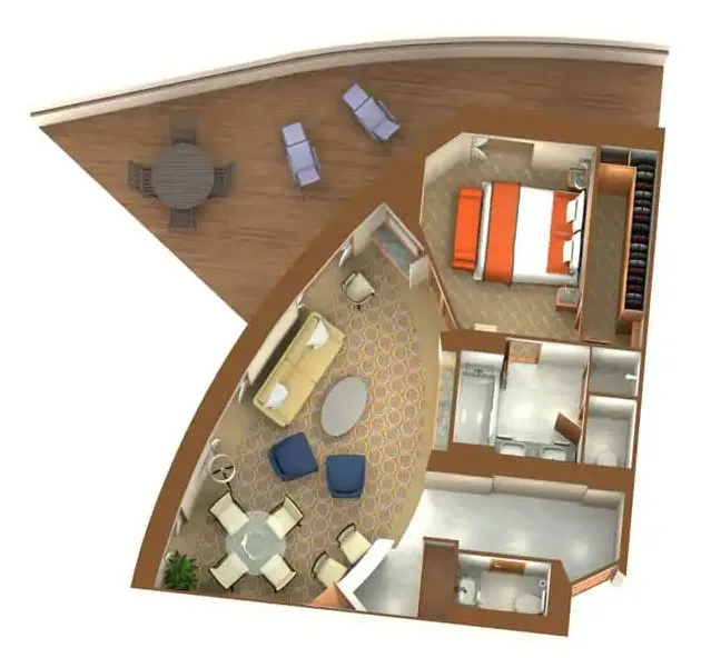
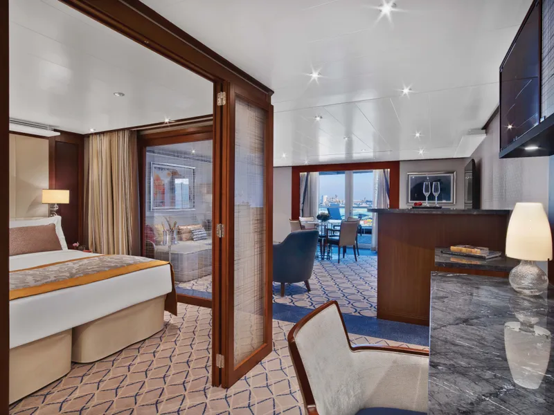


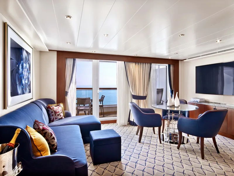



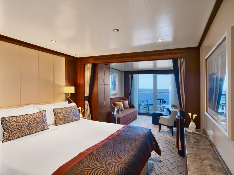
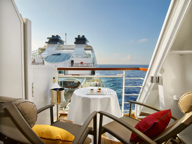


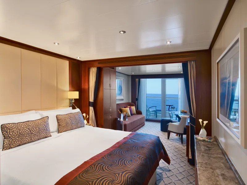
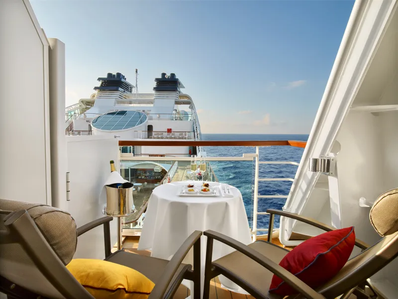

Our cruise specialists can help you find the perfect cabin and the best available pricing.
(+886) 02-2721-7300Contact Advisor