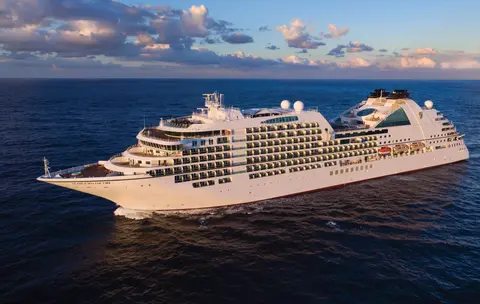
ซีบอร์น7731A
การเดินทาง 14 วันในอลาสก้า: ธารน้ำแข็ง, ฟยอร์ดและเส้นทางภายใน
Date
2027-05-28
Duration
14 nights
Departure Port
แวนคูเวอร์
แคนาดา
Arrival Port
แวนคูเวอร์
แคนาดา
Rating
Luxury
Theme
—
Date
2027-05-28
Duration
14 nights
Departure Port
แวนคูเวอร์
แคนาดา
Arrival Port
แวนคูเวอร์
แคนาดา
Rating
Luxury
Theme
—

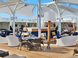




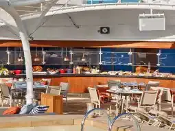
ซีบอร์น
2016
—
40,350 GT
600
266
330
690 m
28 m
19 knots
No
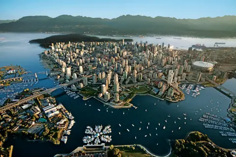
ตั้งอยู่ระหว่างมหาสมุทรแปซิฟิกและเทือกเขาช Küst, แวนคูเวอร์เป็นประตูสู่ช่องแคบภายในของอลาสก้า — เมืองที่ป่าไม้เขตร้อนที่มีอากาศอบอุ่นพบกับตึกกระจก และที่ปูดันเจนเนสและแซลมอนซ็อคอายป่าเป็นตัวแทนของอาหารที่มีรสชาติจากริมมหาสมุทรแปซิฟิกที่ไม่เป็นสองรองใครในอเมริกาเหนือ เดินเล่นตามกำแพงทะเลของสวนสแตนลีย์ยาว 22 กิโลเมตร, หลงใหลในตลาดเกรนวิลล์ไอส์แลนด์, แล้วนั่งเรือข้ามไปยังความงดงามในยุคเอ็ดเวิร์ดของวิคตอเรีย ฤดูกาลล่องเรืออลาสก้าจะถึงจุดสูงสุดตั้งแต่เดือนพฤษภาคมถึงกันยายน ทำให้แวนคูเวอร์เป็นจุดเริ่มต้นที่เหมาะสมสำหรับหนึ่งในเส้นทางมหาสมุทรที่ยิ่งใหญ่ที่สุดในโลก.
The Seymour Narrows is a 3-mile/5 km stretch of the Discovery Channel north of Vancouver Island, British Columbia that is notorious for the strength of the tidal currents flowing through it. The average width of the narrows is just 750 meters. During extreme tides, the current through the narrows is subject to severe Venturi effect, resulting in an increased velocity that can reach 15 knots. For much of its modern history, there was an additional hazard in the narrows called Ripple Rock, a shallow obstruction that claimed no fewer than 119 ships and 114 lives. In 1958, after months of tunneling and preparation, Ripple Rock was blown up in the largest commercial, non-nuclear explosion ever recorded in North America. Still, the navigation of Seymour Narrows is dependent on tidal and other conditions, and requires skill and technical accomplishment.
The Queen Charlotte Sound lies between the Queen Charlotte Strait, which winds between Vancouver Island and the British Columbia mainland in the south, and Hecate Strait, which is northward, adjacent to the Haida Gwaii Islands off the Pacific coast of British Columbia. It is a broad reach in the long shipping route called the Inside Passage threading the myriad islands stretching from Washington’s Puget Sound to Alaska.
เคชิแคนยึดติดอยู่กับชายฝั่งที่มีป่าไม้ของเกาะเรวิลลากิเกโดในแอลาสก้าตอนใต้ — เมืองที่แคบจนชาวบ้านล้อเล่นว่ามีความยาวสามไมล์และกว้างเพียงสามบล็อก เทลิงกิตให้ความเคารพสถานที่แห่งนี้มานานหลายพันปีในฐานะสถานที่ที่มีปลาแซลมอนอุดมสมบูรณ์ และในปัจจุบันได้รับการเฉลิมฉลองว่าเป็นเมืองหลวงของเสาโทเท็มแห่งโลก: การสะสมที่หมู่บ้านพื้นเมืองซักซ์แมนและอุทยานประวัติศาสตร์โทเท็มไบท์รักษาความเข้มข้นที่สำคัญที่สุดของงานศิลปะขนาดมหึมาเหล่านี้ไว้ที่ใดที่หนึ่ง สตรีทครีก ถนนไม้ที่มีบ้านประวัติศาสตร์สีสันสดใสสร้างขึ้นเหนือครีกเคชิแคน ไม่ควรพลาดในฤดูร้อน (พฤษภาคม–กันยายน) ซึ่งเป็นช่วงเวลาที่อากาศดีที่สุด โดยมีปลาแซลมอนว่ายอยู่ในครีกด้านล่าง.
In the passage between Sumner Strait and Clarence Strait in Southeast Alaska’s Alexander Archipelago, midway between Price of Wales Island on the west and Zarembo Island on the east, is a small cluster of islands with a picturesque passageway between them called Snow Pass. It makes a scenic up-close route for your Seabourn ship during the transit.
Decision Passage is the western end of the Sumner Strait, which runs through the Alexander Archipelago into the Pacific Ocean in Southeastern Alaska, bounded on the north by Kuiu Island and Cape Decision, the location of a 1932 lighthouse. This is the route your ship takes when coming from or going to the colorful historic community of Sitka on the west coast of Baranof Island, which was originally the Russian fortress town of New Archangel.
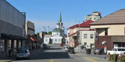
ซิตกา ตั้งอยู่บนชายฝั่งที่ดุเดือดของเกาะบารานอฟในภาคตะวันออกเฉียงใต้ของอลาสกา เป็นหนึ่งในท่าเรือที่มีประวัติศาสตร์ลึกซึ้งที่สุดในแปซิฟิกตะวันตกเฉียงเหนือ — สถานที่ที่โดมหัวหอมของโบสถ์รัสเซียออร์โธดอกซ์ตั้งสูงเหนือเสาโทเท็ม และป่าฝนเขตร้อนที่ยิ่งใหญ่กดดันลงมาจนถึงขอบน้ำ สวนสาธารณะประวัติศาสตร์ซิตกา (Sitka National Historical Park) รักษาสถานที่ของการต่อสู้ในปี 1804 ระหว่างนักรบทลิงกิตและผู้ตั้งถิ่นฐานชาวรัสเซีย พร้อมกับการจัดแสดงเสาที่มีขนาดใหญ่และงดงาม การชมวาฬ การพายเรือคายัคในทะเลท่ามกลางนากทะเล และการสังเกตหมีสีน้ำตาลในป่ารอบๆ เป็นประสบการณ์กลางแจ้งที่ไม่ควรพลาด ช่วงเดือนพฤษภาคมถึงกันยายนเป็นช่วงเวลาที่มีสภาพอากาศที่เข้าถึงได้ง่ายและมีแสงสว่างที่งดงามที่สุด.
Yakutat Bay is 18 miles wide at its entry, and cuts from the Gulf of Alaska into Disenchantment Bay, the entryway to the huge Hubbard Glacier, North America’s largest tidewater glacier. As the bay narrows and the shorelines draw closer, the 400-foot face of the glacier exerts a luminous, ghostly presence, often from as much as 30 miles away. More and more floating ice dimples the surface of the water, and seals bob up and disappear again. The chilled air from the glacier flows in a downdraft of cold that gives rise to mists and gray clouds, through which the vivid blue of the ice wall shimmers. It is an impressive sight of nature’s immense raw workplace, shaping the earth itself as part of an endless cycle of water from the sea evaporating to the sky, falling as snow on the heights and inching over centuries back again to the sea.
The Hubbard Glacier is the largest, and one of the most spectacular tidewater glaciers in North America. Its ice cliffs, some 400’ (121 m) tall, calve icebergs into the fjord, which may frequently be larger than a five-story building. The glacier’s surface is creased and contorted, resembling the wrinkled skin of a giant elephant. Records show it has been growing in thickness and advancing since 1895. This stands in stark contrast to other glaciers around the world, most of which have been receding during the past century. In 2002, the glacier blocked Russell Fjord for two and a half months, raising water levels 61’ (18 m) and threatening local communities with flooding. Nutrient-rich waters along the glacier face attract many species. Gulls and kittiwake colonies adorn smaller islands and harbor seals patrol the icy waters. In 1890, Israel Russell explored the area of Yakutat Bay and Hubbard Glacier, naming it after Gardiner G. Hubbard, a financier of his expedition and a founder and the first president of the National Geographic Society. VIEW CRUISES
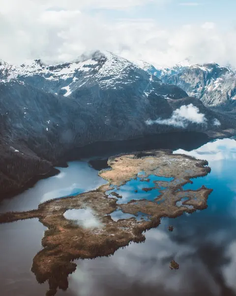
หมู่เกาะอินเนียนเป็นกลุ่มเกาะที่ป่าเถื่อนและไม่มีผู้คนอาศัยอยู่ ตั้งอยู่ที่ปากทางเข้าสู่ช่องเสียงครอสซาวด์ของอลาสกา เป็นที่รู้จักในเรื่องการพบเห็นสัตว์ป่าที่น่าทึ่ง รวมถึงการให้อาหารปลาวาฬหลังค่อมด้วยฟองอากาศและอาณานิคมของสิงโตทะเลสเตลเลอร์ที่มีขนาดใหญ่ สิ่งที่ต้องทำรวมถึงการเดินทางด้วยเรือโซเดียคตามแนวชายฝั่งที่ขรุขระของเกาะ การชมการให้อาหารปลาวาฬแบบร่วมมือ และการสำรวจสระน้ำที่เต็มไปด้วยชีวิตทางทะเล แนะนำให้เยี่ยมชมในช่วงเดือนกรกฎาคมถึงสิงหาคม เพื่อสัมผัสกับกิจกรรมของปลาวาฬที่สูงสุดและสภาพทะเลที่ดีที่สุด.
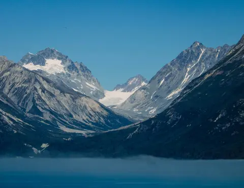
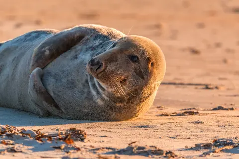
Icy Strait Point เป็นท่าเรือที่สวยงามในอลาสก้า ซึ่งมีชื่อเสียงในด้านความงดงามของธรรมชาติที่น่าทึ่งและวัฒนธรรมพื้นเมือง Tlingit ที่มีความหลากหลาย ประสบการณ์ที่ต้องทำรวมถึงการลิ้มรสอาหารทะเลสดใหม่จากท้องถิ่นและการออกเดินทางสำรวจสัตว์ป่าในอุทยานแห่งชาติ Glacier Bay ฤดูที่ดีที่สุดในการเยี่ยมชมคือช่วงฤดูร้อน เมื่อสภาพอากาศอบอุ่นและสัตว์ป่ามีความอุดมสมบูรณ์.
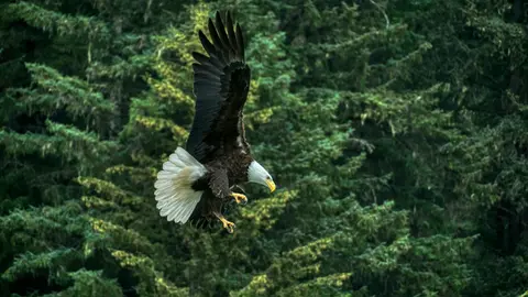
เฮนส์คือเมืองอัลลาสก้าที่แท้จริง ตั้งอยู่บนฟยอร์ดที่ลึกที่สุดในอเมริกาเหนือ เป็นที่อยู่ของการรวมตัวของนกอินทรีหัวล้านที่ใหญ่ที่สุดในโลก — มีนกถึงสี่พันตัวตามแม่น้ำชิลคัต — และชุมชนศิลปะที่เจริญรุ่งเรืองซึ่งรักษาประเพณีวัฒนธรรมท้องถิ่นของชนเผ่าทริงกิตไว้ เยี่ยมชมระหว่างเดือนมิถุนายนถึงสิงหาคมผ่านเรือสำราญของคูนาด์หรือลินด์แบลด เพื่อสัมผัสการลงจอดเฮลิคอปเตอร์บนธารน้ำแข็งและการเดินป่าชายฝั่ง หรือระหว่างเดือนตุลาคมถึงกุมภาพันธ์เพื่อชมการแสดงนกอินทรีที่น่าทึ่ง ซึ่งทำให้เฮนส์เป็นความลับที่ดีที่สุดของอัลลาสกา.
Lynn Canal is a 90-mile long inlet into Alaska’s coast running from the Chilkat River in the north to the Chatham Strait and Stephens Passage in the south. Because it connects the towns of Skagway and Haines to Juneau and the rest of the Inside Passage, it is an important shipping lane for ferries, cargo and cruise ships, and was a crucial passageway to the Klondike gold fields during the Gold Rush. It was discovered by Joseph Whidbey in 1794 and named by George Vancouver after his birthplace, King’s Lynn in Norfolk, England. More than 2,000 feet in depth, it is one of the deepest and longest fjords in the world, and the deepest in North America outside Greenland.
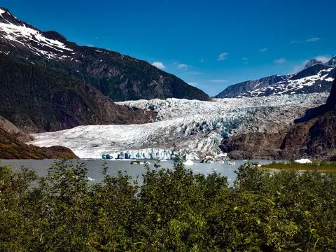
เมืองหลวงของรัฐอเมริกาที่ไม่สามารถเข้าถึงได้ด้วยถนน, จูโน่ มอบรางวัลแห่งการเดินทางด้วยความยิ่งใหญ่ของธรรมชาติที่ไม่เหมือนใครซึ่งเมืองใดในโลกก็ไม่อาจเทียบได้ น้ำแข็งที่มีชีวิต — ธารน้ำแข็งเมนเดนฮอลล์ — ตั้งอยู่ห่างจากใจกลางเมืองเพียงสิบห้านาที ที่ซึ่งเครื่องบินลอยน้ำบินผ่านเหนือชายฝั่งที่มีภูเขาเฟอร์ปกคลุมซึ่งดิ่งลงสู่ทะเล ประสบการณ์ที่ต้องทำคือการลงจอดเฮลิคอปเตอร์บนสนามน้ำแข็งหรือการออกไปชมปลาวาฬในช่องสตีเฟนส์ ที่ซึ่งปลาวาฬหลังค่อมโผล่ขึ้นมาในระยะที่น่าทึ่ง จูโน่จะอบอุ่นที่สุดตั้งแต่เดือนมิถุนายนถึงสิงหาคม แม้ว่าวันฤดูร้อนอาจนำฝนที่มีชื่อเสียงของอลาสก้าใต้ตะวันออกซึ่งทำให้ป่าฝนส่องสว่างอยู่เสมอ.
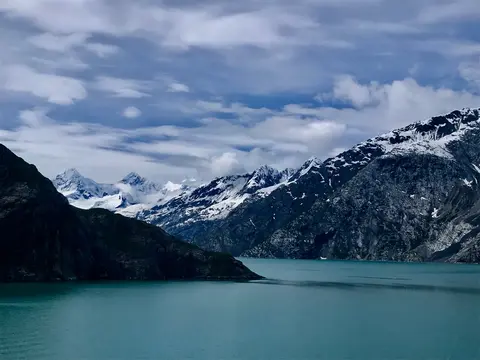
อุทยานแห่งชาติ Glacier Bay เป็นหนึ่งในภูมิทัศน์ที่ลึกซึ้งที่สุดของการเกิดน้ำแข็งที่ยังคงมีอยู่บนโลก — พื้นที่ 3.3 ล้านเอเคอร์ในภาคตะวันออกเฉียงใต้ของอลาสก้า ซึ่งมีธารน้ำแข็งที่ไหลลงสู่ทะเลปล่อยน้ำแข็งขนาดมหึมาเหมือนมหาวิหารลงสู่ฟยอร์ดที่มีน้ำสีฟ้าสดใส และที่ดินเองยังคงสูงขึ้นอย่างต่อเนื่อง หลุดพ้นจากน้ำหนักของน้ำแข็งที่เคยฝังอยู่ในภูมิภาคนี้เมื่อสองศตวรรษที่ผ่านมา อุทยานแห่งนี้เข้าถึงได้เฉพาะทางเรือหรือเครื่องบินขนาดเล็ก และมอบประสบการณ์การพบเห็นสัตว์ป่า — วาฬหลังค่อม, หมีสีน้ำตาล, นากทะเล, และแพะภูเขา — ท่ามกลางทิวทัศน์ที่มีความยิ่งใหญ่แทบจะล้นหลาม ฤดูกาลเริ่มตั้งแต่เดือนพฤษภาคมถึงกันยายน; ช่วงปลายเดือนมิถุนายนและเดือนกรกฎาคมมีวันยาวนานที่สุดและกิจกรรมสัตว์ป่าที่เชื่อถือได้มากที่สุด.
Decision Passage is the western end of the Sumner Strait, which runs through the Alexander Archipelago into the Pacific Ocean in Southeastern Alaska, bounded on the north by Kuiu Island and Cape Decision, the location of a 1932 lighthouse. This is the route your ship takes when coming from or going to the colorful historic community of Sitka on the west coast of Baranof Island, which was originally the Russian fortress town of New Archangel.
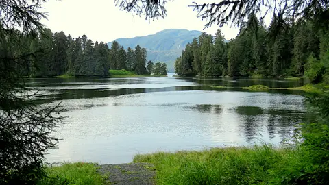
แวรังเกลล์เป็นหนึ่งในท่าเรือที่แท้จริงที่สุดในช่องทางภายในของอลาสก้า ที่ซึ่งมรดกของชนเผ่าทลิงกิต, ภาพสลักโบราณ และสัตว์ป่าระดับโลกมาบรรจบกันที่ปากแม่น้ำสติคีนที่ทรงพลัง ประสบการณ์ที่ไม่ควรพลาดรวมถึงการนั่งเรือเจ็ตไปยังธารน้ำแข็งเลคอนเต้, การชมหมีจับปลา ณ ลำธารอานัน และการลิ้มลองปลาแซลมอนรมควันจากท้องถิ่น เดือนกรกฎาคมและสิงหาคมเป็นช่วงเวลาที่ดีที่สุดในการชมการอพยพของปลาแซลมอนและการดูหมี.
Stikine Strait is a picturesque channel in the Alexander Archipelago of Alaska between Zarembo Island and Woronkofski and Etolin Islands near the mouth of the Stikine River south of Wrangell. It first appears on an 1848 Russian chart as Stakhin Strait and has been spelled variously on many charts since that time.
The 108-mile Behm Canal runs from the Clarence Strait through the Alexander Archipelago of Southeast Alaska, and into the channel separating Revillagigedo Island from the mainland. It forms part Inside Passage on the route between Ketchikan and the Misty Fjords National Monument. The canal was named by George Vancouver during his surveying expedition in 1793, in honor of Magnus von Behm, who had been governor of Kamchatka in the Russian Far East when Vancouver called at Petropavlovsk with Captain Cook’s expedition following the Cook’s murder in Hawaii.
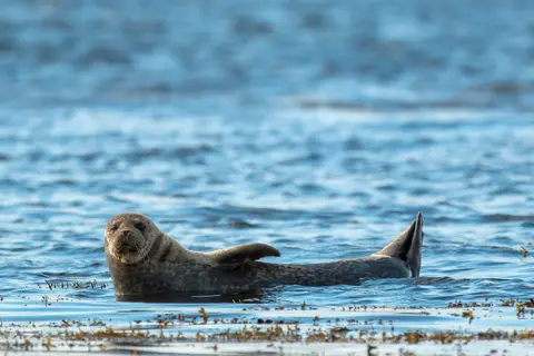
อนุสาวรีย์แห่งธรรมชาติ Misty Fjords เป็นพื้นที่ป่าอันกว้างใหญ่ถึง 930,000 เฮกตาร์ในภาคตะวันออกเฉียงใต้ของอลาสก้า ที่ซึ่งหน้าผาหินแกรนิตสูงชันตั้งตระหง่านจากฟยอร์ดที่สงบเงียบ ผ่านม่านหมอกและเมฆอันเป็นนิรันดร์ สิ่งที่ต้องทำ ได้แก่ การพายเรือคายัคผ่านแขนฟยอร์ดที่เงียบสงบ การล่องเรือซูดิคผ่านน้ำตกและหินภูเขาไฟ New Eddystone และการเฝ้าดูหมี, นกอินทรี และวาฬเพชฌฆาตในช่องทางน้ำที่บริสุทธิ์ ช่วงเดือนพฤษภาคมถึงกันยายนเป็นฤดูกาลที่เหมาะแก่การเยี่ยมชม โดยมีฝนช่วยเพิ่มบรรยากาศอันลึกลับของอนุสาวรีย์นี้.
Misty Fjords National Monument is a section of the Tongass National Forest in Alaska’s extreme southeastern Panhandle region. The monument consists of over two million acres of deeply cut fjords cradled in U-shaped valleys between mountain ranges rising 2,000 to 3,000 feet above sea level. The fjords themselves extend as much as 1,000 feet below the surface. These granite ranges are covered with virgin forest, and most of the monument is also a dedicated wilderness area. Misty Fjords inspired the explorer John Muir to proclaim them among the most beautiful places he had ever seen. Your ship will cruise among these spectacular forests, waterfalls and mountains. The onboard Ventures by Seabourn team will offer optional excursions including kayaking the fjords and a short sightseeing floatplane flight.
พริ๊นซ์รูเพิร์ต เมืองท่าที่มีประวัติศาสตร์เป็นสถานีรถไฟในชายฝั่งตอนเหนือของบริติชโคลัมเบีย ดึงดูดนักท่องเที่ยวด้วยมรดกทางวัฒนธรรมของชนเผ่าซิมเชียนที่ลึกซึ้ง การตกปลาฮาลิบัตระดับโลก และทิวทัศน์ของป่าฝนที่มีหมอกปกคลุมตามเส้นทางอินไซด์พาสเสจ ลิ้มลองแซลมอนรมควันสดใหม่ที่ริมน้ำและสำรวจโรงงานกระป๋องนอร์ธแปซิฟิก ซึ่งเป็นโรงงานกระป๋องที่เก่าแก่ที่สุดในแคนาดา เพื่อสัมผัสประสบการณ์ที่มีชีวิตชีวากับจิตวิญญาณทางทะเลของเมืองท่าแห่งนี้ ช่วงเวลาที่ดีที่สุดในการเยี่ยมชมคือระหว่างเดือนมิถุนายนถึงสิงหาคม เมื่อวันยาวนานช่วยลดความชื้นจากฝนที่มีชื่อเสียง และกิจกรรมของสัตว์ป่าถึงจุดสูงสุดตามชายฝั่ง.
Grenville Channel is a long, well-protected channel along the northern British Columbia coast between the large Pitt Island and the mainland. It is an important shipping lane, and you are likely to see ships of many different types and sizes as you pass through. The shores are mountainous on both sides, with two notable peaks about halfway through, Mt. Batchellor on the east side and Mt. Saunders on Pitt Island to the west. There are a number of Indian Reserves and Marine Parks in the mountains and narrow waterways off the channel.
Whale Channel is a picturesque waterway separating Gil Island from Princess Royal Island in British Columbia’s Inside Passage. Surrounded by snow-capped mountain ranges and teeming with marine life, It is a diversion from the main shipping lane, located roughly halfway between Prince Rupert and the First Nations village of Klemtu. VIEW CRUISES Skip Footer Content About Us
The Princess Royal Channel separates the largest island along British Columbia’s coast from the mainland. It is located roughly halfway between Bella Bella in the south and Prince Rupert in the north, in one of the province’s most remote areas. Princess Royal island was named in 1788 by Captain Charles Duncan, in honor of his ship, the Princess Royal. The island is uninhabited, although there are two small villages in the channel, the First Nations community of Klemtu on Swindle Island and Hartley Bay on the mainland. Wildlife, by contrast, is plentiful, including Kermode, black and grizzly bears, deer, wolves and foxes. Golden and bald eagles nest in the region, as well as the endangered marbled murrelet. In the waters, there are abundant salmon, elephant seals, whales, orcas and dolphins.
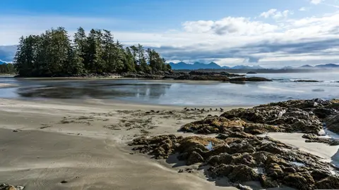
อเลิร์ตเบย์ ประเทศแคนาดา เป็นเมืองท่าที่มีเอกลักษณ์ซึ่งมรดกทางวัฒนธรรมที่ลึกซึ้งได้มาบรรจบกับบรรยากาศท้องถิ่นที่แท้จริง โดยเป็นหนึ่งในจุดหมายปลายทางที่ถูกนำเสนอในเส้นทางการเดินทางของ HX Expeditions ประสบการณ์ที่ไม่ควรพลาด ได้แก่ การเดินชมย่านประวัติศาสตร์เพื่อสัมผัสกับมรดกทางสถาปัตยกรรมที่หลากหลาย และการค้นหาประเพณีการทำอาหารท้องถิ่นที่ร้านค้าที่ได้รับความนิยมในพื้นที่ห่างไกลจากท่าเรือ ช่วงเวลาที่เหมาะสมที่สุดในการเยี่ยมชมคือระหว่างเดือนมิถุนายนถึงสิงหาคม เมื่อเดือนฤดูร้อนนำมาซึ่งอุณหภูมิที่อบอุ่นที่สุดและวันที่ยาวนานที่สุด.
Johnstone Strait is a well-protected shipping route passing 68 miles/110 km along the northeast shore of Vancouver Island between the island and the mainland of British Columbia. The strait is between 1 ½ miles and 3 miles wide, and leads from the broad Georgia Strait through a narrow channel called Discovery Passage. The strait was named by Vancouver in 1792 for James Johnstone, the master of one of his tenders during the survey expedition that revealed Vancouver Island to be an island. There are no cities or towns on the strait. The Johnstone Strait is the summer range of a large pod of seasonally resident orcas which are frequently seen in the area. VIEW CRUISES Skip Footer Content About Us Our Company News Careers Contact Us Video Gallery Accessibility Seabourn Club Seabourn Referral Program Travel Resources
The Seymour Narrows is a 3-mile/5 km stretch of the Discovery Channel north of Vancouver Island, British Columbia that is notorious for the strength of the tidal currents flowing through it. The average width of the narrows is just 750 meters. During extreme tides, the current through the narrows is subject to severe Venturi effect, resulting in an increased velocity that can reach 15 knots. For much of its modern history, there was an additional hazard in the narrows called Ripple Rock, a shallow obstruction that claimed no fewer than 119 ships and 114 lives. In 1958, after months of tunneling and preparation, Ripple Rock was blown up in the largest commercial, non-nuclear explosion ever recorded in North America. Still, the navigation of Seymour Narrows is dependent on tidal and other conditions, and requires skill and technical accomplishment.
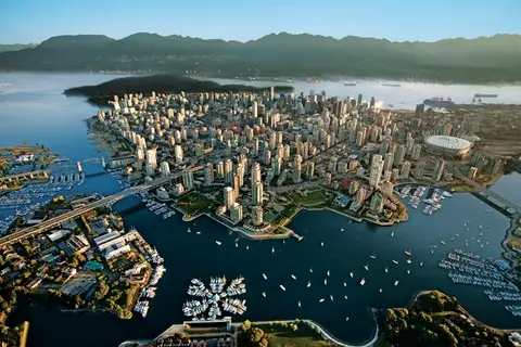
ตั้งอยู่ระหว่างมหาสมุทรแปซิฟิกและเทือกเขาช Küst, แวนคูเวอร์เป็นประตูสู่ช่องแคบภายในของอลาสก้า — เมืองที่ป่าไม้เขตร้อนที่มีอากาศอบอุ่นพบกับตึกกระจก และที่ปูดันเจนเนสและแซลมอนซ็อคอายป่าเป็นตัวแทนของอาหารที่มีรสชาติจากริมมหาสมุทรแปซิฟิกที่ไม่เป็นสองรองใครในอเมริกาเหนือ เดินเล่นตามกำแพงทะเลของสวนสแตนลีย์ยาว 22 กิโลเมตร, หลงใหลในตลาดเกรนวิลล์ไอส์แลนด์, แล้วนั่งเรือข้ามไปยังความงดงามในยุคเอ็ดเวิร์ดของวิคตอเรีย ฤดูกาลล่องเรืออลาสก้าจะถึงจุดสูงสุดตั้งแต่เดือนพฤษภาคมถึงกันยายน ทำให้แวนคูเวอร์เป็นจุดเริ่มต้นที่เหมาะสมสำหรับหนึ่งในเส้นทางมหาสมุทรที่ยิ่งใหญ่ที่สุดในโลก.
Day 1
ตั้งอยู่ระหว่างมหาสมุทรแปซิฟิกและเทือกเขาช Küst, แวนคูเวอร์เป็นประตูสู่ช่องแคบภายในของอลาสก้า — เมืองที่ป่าไม้เขตร้อนที่มีอากาศอบอุ่นพบกับตึกกระจก และที่ปูดันเจนเนสและแซลมอนซ็อคอายป่าเป็นตัวแทนของอาหารที่มีรสชาติจากริมมหาสมุทรแปซิฟิกที่ไม่เป็นสองรองใครในอเมริกาเหนือ เดินเล่นตามกำแพงทะเลของสวนสแตนลีย์ยาว 22 กิโลเมตร, หลงใหลในตลาดเกรนวิลล์ไอส์แลนด์, แล้วนั่งเรือข้ามไปยังความงดงามในยุคเอ็ดเวิร์ดของวิคตอเรีย ฤดูกาลล่องเรืออลาสก้าจะถึงจุดสูงสุดตั้งแต่เดือนพฤษภาคมถึงกันยายน ทำให้แวนคูเวอร์เป็นจุดเริ่มต้นที่เหมาะสมสำหรับหนึ่งในเส้นทางมหาสมุทรที่ยิ่งใหญ่ที่สุดในโลก.
The Seymour Narrows is a 3-mile/5 km stretch of the Discovery Channel north of Vancouver Island, British Columbia that is notorious for the strength of the tidal currents flowing through it. The average width of the narrows is just 750 meters. During extreme tides, the current through the narrows is subject to severe Venturi effect, resulting in an increased velocity that can reach 15 knots. For much of its modern history, there was an additional hazard in the narrows called Ripple Rock, a shallow obstruction that claimed no fewer than 119 ships and 114 lives. In 1958, after months of tunneling and preparation, Ripple Rock was blown up in the largest commercial, non-nuclear explosion ever recorded in North America. Still, the navigation of Seymour Narrows is dependent on tidal and other conditions, and requires skill and technical accomplishment.
Day 2
The Queen Charlotte Sound lies between the Queen Charlotte Strait, which winds between Vancouver Island and the British Columbia mainland in the south, and Hecate Strait, which is northward, adjacent to the Haida Gwaii Islands off the Pacific coast of British Columbia. It is a broad reach in the long shipping route called the Inside Passage threading the myriad islands stretching from Washington’s Puget Sound to Alaska.
Day 3
เคชิแคนยึดติดอยู่กับชายฝั่งที่มีป่าไม้ของเกาะเรวิลลากิเกโดในแอลาสก้าตอนใต้ — เมืองที่แคบจนชาวบ้านล้อเล่นว่ามีความยาวสามไมล์และกว้างเพียงสามบล็อก เทลิงกิตให้ความเคารพสถานที่แห่งนี้มานานหลายพันปีในฐานะสถานที่ที่มีปลาแซลมอนอุดมสมบูรณ์ และในปัจจุบันได้รับการเฉลิมฉลองว่าเป็นเมืองหลวงของเสาโทเท็มแห่งโลก: การสะสมที่หมู่บ้านพื้นเมืองซักซ์แมนและอุทยานประวัติศาสตร์โทเท็มไบท์รักษาความเข้มข้นที่สำคัญที่สุดของงานศิลปะขนาดมหึมาเหล่านี้ไว้ที่ใดที่หนึ่ง สตรีทครีก ถนนไม้ที่มีบ้านประวัติศาสตร์สีสันสดใสสร้างขึ้นเหนือครีกเคชิแคน ไม่ควรพลาดในฤดูร้อน (พฤษภาคม–กันยายน) ซึ่งเป็นช่วงเวลาที่อากาศดีที่สุด โดยมีปลาแซลมอนว่ายอยู่ในครีกด้านล่าง.
In the passage between Sumner Strait and Clarence Strait in Southeast Alaska’s Alexander Archipelago, midway between Price of Wales Island on the west and Zarembo Island on the east, is a small cluster of islands with a picturesque passageway between them called Snow Pass. It makes a scenic up-close route for your Seabourn ship during the transit.
Decision Passage is the western end of the Sumner Strait, which runs through the Alexander Archipelago into the Pacific Ocean in Southeastern Alaska, bounded on the north by Kuiu Island and Cape Decision, the location of a 1932 lighthouse. This is the route your ship takes when coming from or going to the colorful historic community of Sitka on the west coast of Baranof Island, which was originally the Russian fortress town of New Archangel.
Day 4
ซิตกา ตั้งอยู่บนชายฝั่งที่ดุเดือดของเกาะบารานอฟในภาคตะวันออกเฉียงใต้ของอลาสกา เป็นหนึ่งในท่าเรือที่มีประวัติศาสตร์ลึกซึ้งที่สุดในแปซิฟิกตะวันตกเฉียงเหนือ — สถานที่ที่โดมหัวหอมของโบสถ์รัสเซียออร์โธดอกซ์ตั้งสูงเหนือเสาโทเท็ม และป่าฝนเขตร้อนที่ยิ่งใหญ่กดดันลงมาจนถึงขอบน้ำ สวนสาธารณะประวัติศาสตร์ซิตกา (Sitka National Historical Park) รักษาสถานที่ของการต่อสู้ในปี 1804 ระหว่างนักรบทลิงกิตและผู้ตั้งถิ่นฐานชาวรัสเซีย พร้อมกับการจัดแสดงเสาที่มีขนาดใหญ่และงดงาม การชมวาฬ การพายเรือคายัคในทะเลท่ามกลางนากทะเล และการสังเกตหมีสีน้ำตาลในป่ารอบๆ เป็นประสบการณ์กลางแจ้งที่ไม่ควรพลาด ช่วงเดือนพฤษภาคมถึงกันยายนเป็นช่วงเวลาที่มีสภาพอากาศที่เข้าถึงได้ง่ายและมีแสงสว่างที่งดงามที่สุด.
Day 5
Yakutat Bay is 18 miles wide at its entry, and cuts from the Gulf of Alaska into Disenchantment Bay, the entryway to the huge Hubbard Glacier, North America’s largest tidewater glacier. As the bay narrows and the shorelines draw closer, the 400-foot face of the glacier exerts a luminous, ghostly presence, often from as much as 30 miles away. More and more floating ice dimples the surface of the water, and seals bob up and disappear again. The chilled air from the glacier flows in a downdraft of cold that gives rise to mists and gray clouds, through which the vivid blue of the ice wall shimmers. It is an impressive sight of nature’s immense raw workplace, shaping the earth itself as part of an endless cycle of water from the sea evaporating to the sky, falling as snow on the heights and inching over centuries back again to the sea.
The Hubbard Glacier is the largest, and one of the most spectacular tidewater glaciers in North America. Its ice cliffs, some 400’ (121 m) tall, calve icebergs into the fjord, which may frequently be larger than a five-story building. The glacier’s surface is creased and contorted, resembling the wrinkled skin of a giant elephant. Records show it has been growing in thickness and advancing since 1895. This stands in stark contrast to other glaciers around the world, most of which have been receding during the past century. In 2002, the glacier blocked Russell Fjord for two and a half months, raising water levels 61’ (18 m) and threatening local communities with flooding. Nutrient-rich waters along the glacier face attract many species. Gulls and kittiwake colonies adorn smaller islands and harbor seals patrol the icy waters. In 1890, Israel Russell explored the area of Yakutat Bay and Hubbard Glacier, naming it after Gardiner G. Hubbard, a financier of his expedition and a founder and the first president of the National Geographic Society. VIEW CRUISES
Day 6
หมู่เกาะอินเนียนเป็นกลุ่มเกาะที่ป่าเถื่อนและไม่มีผู้คนอาศัยอยู่ ตั้งอยู่ที่ปากทางเข้าสู่ช่องเสียงครอสซาวด์ของอลาสกา เป็นที่รู้จักในเรื่องการพบเห็นสัตว์ป่าที่น่าทึ่ง รวมถึงการให้อาหารปลาวาฬหลังค่อมด้วยฟองอากาศและอาณานิคมของสิงโตทะเลสเตลเลอร์ที่มีขนาดใหญ่ สิ่งที่ต้องทำรวมถึงการเดินทางด้วยเรือโซเดียคตามแนวชายฝั่งที่ขรุขระของเกาะ การชมการให้อาหารปลาวาฬแบบร่วมมือ และการสำรวจสระน้ำที่เต็มไปด้วยชีวิตทางทะเล แนะนำให้เยี่ยมชมในช่วงเดือนกรกฎาคมถึงสิงหาคม เพื่อสัมผัสกับกิจกรรมของปลาวาฬที่สูงสุดและสภาพทะเลที่ดีที่สุด.
Icy Strait Point เป็นท่าเรือที่สวยงามในอลาสก้า ซึ่งมีชื่อเสียงในด้านความงดงามของธรรมชาติที่น่าทึ่งและวัฒนธรรมพื้นเมือง Tlingit ที่มีความหลากหลาย ประสบการณ์ที่ต้องทำรวมถึงการลิ้มรสอาหารทะเลสดใหม่จากท้องถิ่นและการออกเดินทางสำรวจสัตว์ป่าในอุทยานแห่งชาติ Glacier Bay ฤดูที่ดีที่สุดในการเยี่ยมชมคือช่วงฤดูร้อน เมื่อสภาพอากาศอบอุ่นและสัตว์ป่ามีความอุดมสมบูรณ์.
Day 7
เฮนส์คือเมืองอัลลาสก้าที่แท้จริง ตั้งอยู่บนฟยอร์ดที่ลึกที่สุดในอเมริกาเหนือ เป็นที่อยู่ของการรวมตัวของนกอินทรีหัวล้านที่ใหญ่ที่สุดในโลก — มีนกถึงสี่พันตัวตามแม่น้ำชิลคัต — และชุมชนศิลปะที่เจริญรุ่งเรืองซึ่งรักษาประเพณีวัฒนธรรมท้องถิ่นของชนเผ่าทริงกิตไว้ เยี่ยมชมระหว่างเดือนมิถุนายนถึงสิงหาคมผ่านเรือสำราญของคูนาด์หรือลินด์แบลด เพื่อสัมผัสการลงจอดเฮลิคอปเตอร์บนธารน้ำแข็งและการเดินป่าชายฝั่ง หรือระหว่างเดือนตุลาคมถึงกุมภาพันธ์เพื่อชมการแสดงนกอินทรีที่น่าทึ่ง ซึ่งทำให้เฮนส์เป็นความลับที่ดีที่สุดของอัลลาสกา.
Lynn Canal is a 90-mile long inlet into Alaska’s coast running from the Chilkat River in the north to the Chatham Strait and Stephens Passage in the south. Because it connects the towns of Skagway and Haines to Juneau and the rest of the Inside Passage, it is an important shipping lane for ferries, cargo and cruise ships, and was a crucial passageway to the Klondike gold fields during the Gold Rush. It was discovered by Joseph Whidbey in 1794 and named by George Vancouver after his birthplace, King’s Lynn in Norfolk, England. More than 2,000 feet in depth, it is one of the deepest and longest fjords in the world, and the deepest in North America outside Greenland.
Day 8
เมืองหลวงของรัฐอเมริกาที่ไม่สามารถเข้าถึงได้ด้วยถนน, จูโน่ มอบรางวัลแห่งการเดินทางด้วยความยิ่งใหญ่ของธรรมชาติที่ไม่เหมือนใครซึ่งเมืองใดในโลกก็ไม่อาจเทียบได้ น้ำแข็งที่มีชีวิต — ธารน้ำแข็งเมนเดนฮอลล์ — ตั้งอยู่ห่างจากใจกลางเมืองเพียงสิบห้านาที ที่ซึ่งเครื่องบินลอยน้ำบินผ่านเหนือชายฝั่งที่มีภูเขาเฟอร์ปกคลุมซึ่งดิ่งลงสู่ทะเล ประสบการณ์ที่ต้องทำคือการลงจอดเฮลิคอปเตอร์บนสนามน้ำแข็งหรือการออกไปชมปลาวาฬในช่องสตีเฟนส์ ที่ซึ่งปลาวาฬหลังค่อมโผล่ขึ้นมาในระยะที่น่าทึ่ง จูโน่จะอบอุ่นที่สุดตั้งแต่เดือนมิถุนายนถึงสิงหาคม แม้ว่าวันฤดูร้อนอาจนำฝนที่มีชื่อเสียงของอลาสก้าใต้ตะวันออกซึ่งทำให้ป่าฝนส่องสว่างอยู่เสมอ.
Day 9
อุทยานแห่งชาติ Glacier Bay เป็นหนึ่งในภูมิทัศน์ที่ลึกซึ้งที่สุดของการเกิดน้ำแข็งที่ยังคงมีอยู่บนโลก — พื้นที่ 3.3 ล้านเอเคอร์ในภาคตะวันออกเฉียงใต้ของอลาสก้า ซึ่งมีธารน้ำแข็งที่ไหลลงสู่ทะเลปล่อยน้ำแข็งขนาดมหึมาเหมือนมหาวิหารลงสู่ฟยอร์ดที่มีน้ำสีฟ้าสดใส และที่ดินเองยังคงสูงขึ้นอย่างต่อเนื่อง หลุดพ้นจากน้ำหนักของน้ำแข็งที่เคยฝังอยู่ในภูมิภาคนี้เมื่อสองศตวรรษที่ผ่านมา อุทยานแห่งนี้เข้าถึงได้เฉพาะทางเรือหรือเครื่องบินขนาดเล็ก และมอบประสบการณ์การพบเห็นสัตว์ป่า — วาฬหลังค่อม, หมีสีน้ำตาล, นากทะเล, และแพะภูเขา — ท่ามกลางทิวทัศน์ที่มีความยิ่งใหญ่แทบจะล้นหลาม ฤดูกาลเริ่มตั้งแต่เดือนพฤษภาคมถึงกันยายน; ช่วงปลายเดือนมิถุนายนและเดือนกรกฎาคมมีวันยาวนานที่สุดและกิจกรรมสัตว์ป่าที่เชื่อถือได้มากที่สุด.
Day 10
Decision Passage is the western end of the Sumner Strait, which runs through the Alexander Archipelago into the Pacific Ocean in Southeastern Alaska, bounded on the north by Kuiu Island and Cape Decision, the location of a 1932 lighthouse. This is the route your ship takes when coming from or going to the colorful historic community of Sitka on the west coast of Baranof Island, which was originally the Russian fortress town of New Archangel.
แวรังเกลล์เป็นหนึ่งในท่าเรือที่แท้จริงที่สุดในช่องทางภายในของอลาสก้า ที่ซึ่งมรดกของชนเผ่าทลิงกิต, ภาพสลักโบราณ และสัตว์ป่าระดับโลกมาบรรจบกันที่ปากแม่น้ำสติคีนที่ทรงพลัง ประสบการณ์ที่ไม่ควรพลาดรวมถึงการนั่งเรือเจ็ตไปยังธารน้ำแข็งเลคอนเต้, การชมหมีจับปลา ณ ลำธารอานัน และการลิ้มลองปลาแซลมอนรมควันจากท้องถิ่น เดือนกรกฎาคมและสิงหาคมเป็นช่วงเวลาที่ดีที่สุดในการชมการอพยพของปลาแซลมอนและการดูหมี.
Stikine Strait is a picturesque channel in the Alexander Archipelago of Alaska between Zarembo Island and Woronkofski and Etolin Islands near the mouth of the Stikine River south of Wrangell. It first appears on an 1848 Russian chart as Stakhin Strait and has been spelled variously on many charts since that time.
Day 11
The 108-mile Behm Canal runs from the Clarence Strait through the Alexander Archipelago of Southeast Alaska, and into the channel separating Revillagigedo Island from the mainland. It forms part Inside Passage on the route between Ketchikan and the Misty Fjords National Monument. The canal was named by George Vancouver during his surveying expedition in 1793, in honor of Magnus von Behm, who had been governor of Kamchatka in the Russian Far East when Vancouver called at Petropavlovsk with Captain Cook’s expedition following the Cook’s murder in Hawaii.
อนุสาวรีย์แห่งธรรมชาติ Misty Fjords เป็นพื้นที่ป่าอันกว้างใหญ่ถึง 930,000 เฮกตาร์ในภาคตะวันออกเฉียงใต้ของอลาสก้า ที่ซึ่งหน้าผาหินแกรนิตสูงชันตั้งตระหง่านจากฟยอร์ดที่สงบเงียบ ผ่านม่านหมอกและเมฆอันเป็นนิรันดร์ สิ่งที่ต้องทำ ได้แก่ การพายเรือคายัคผ่านแขนฟยอร์ดที่เงียบสงบ การล่องเรือซูดิคผ่านน้ำตกและหินภูเขาไฟ New Eddystone และการเฝ้าดูหมี, นกอินทรี และวาฬเพชฌฆาตในช่องทางน้ำที่บริสุทธิ์ ช่วงเดือนพฤษภาคมถึงกันยายนเป็นฤดูกาลที่เหมาะแก่การเยี่ยมชม โดยมีฝนช่วยเพิ่มบรรยากาศอันลึกลับของอนุสาวรีย์นี้.
Misty Fjords National Monument is a section of the Tongass National Forest in Alaska’s extreme southeastern Panhandle region. The monument consists of over two million acres of deeply cut fjords cradled in U-shaped valleys between mountain ranges rising 2,000 to 3,000 feet above sea level. The fjords themselves extend as much as 1,000 feet below the surface. These granite ranges are covered with virgin forest, and most of the monument is also a dedicated wilderness area. Misty Fjords inspired the explorer John Muir to proclaim them among the most beautiful places he had ever seen. Your ship will cruise among these spectacular forests, waterfalls and mountains. The onboard Ventures by Seabourn team will offer optional excursions including kayaking the fjords and a short sightseeing floatplane flight.
Day 12
พริ๊นซ์รูเพิร์ต เมืองท่าที่มีประวัติศาสตร์เป็นสถานีรถไฟในชายฝั่งตอนเหนือของบริติชโคลัมเบีย ดึงดูดนักท่องเที่ยวด้วยมรดกทางวัฒนธรรมของชนเผ่าซิมเชียนที่ลึกซึ้ง การตกปลาฮาลิบัตระดับโลก และทิวทัศน์ของป่าฝนที่มีหมอกปกคลุมตามเส้นทางอินไซด์พาสเสจ ลิ้มลองแซลมอนรมควันสดใหม่ที่ริมน้ำและสำรวจโรงงานกระป๋องนอร์ธแปซิฟิก ซึ่งเป็นโรงงานกระป๋องที่เก่าแก่ที่สุดในแคนาดา เพื่อสัมผัสประสบการณ์ที่มีชีวิตชีวากับจิตวิญญาณทางทะเลของเมืองท่าแห่งนี้ ช่วงเวลาที่ดีที่สุดในการเยี่ยมชมคือระหว่างเดือนมิถุนายนถึงสิงหาคม เมื่อวันยาวนานช่วยลดความชื้นจากฝนที่มีชื่อเสียง และกิจกรรมของสัตว์ป่าถึงจุดสูงสุดตามชายฝั่ง.
Day 13
Grenville Channel is a long, well-protected channel along the northern British Columbia coast between the large Pitt Island and the mainland. It is an important shipping lane, and you are likely to see ships of many different types and sizes as you pass through. The shores are mountainous on both sides, with two notable peaks about halfway through, Mt. Batchellor on the east side and Mt. Saunders on Pitt Island to the west. There are a number of Indian Reserves and Marine Parks in the mountains and narrow waterways off the channel.
Whale Channel is a picturesque waterway separating Gil Island from Princess Royal Island in British Columbia’s Inside Passage. Surrounded by snow-capped mountain ranges and teeming with marine life, It is a diversion from the main shipping lane, located roughly halfway between Prince Rupert and the First Nations village of Klemtu. VIEW CRUISES Skip Footer Content About Us
The Princess Royal Channel separates the largest island along British Columbia’s coast from the mainland. It is located roughly halfway between Bella Bella in the south and Prince Rupert in the north, in one of the province’s most remote areas. Princess Royal island was named in 1788 by Captain Charles Duncan, in honor of his ship, the Princess Royal. The island is uninhabited, although there are two small villages in the channel, the First Nations community of Klemtu on Swindle Island and Hartley Bay on the mainland. Wildlife, by contrast, is plentiful, including Kermode, black and grizzly bears, deer, wolves and foxes. Golden and bald eagles nest in the region, as well as the endangered marbled murrelet. In the waters, there are abundant salmon, elephant seals, whales, orcas and dolphins.
Day 14
อเลิร์ตเบย์ ประเทศแคนาดา เป็นเมืองท่าที่มีเอกลักษณ์ซึ่งมรดกทางวัฒนธรรมที่ลึกซึ้งได้มาบรรจบกับบรรยากาศท้องถิ่นที่แท้จริง โดยเป็นหนึ่งในจุดหมายปลายทางที่ถูกนำเสนอในเส้นทางการเดินทางของ HX Expeditions ประสบการณ์ที่ไม่ควรพลาด ได้แก่ การเดินชมย่านประวัติศาสตร์เพื่อสัมผัสกับมรดกทางสถาปัตยกรรมที่หลากหลาย และการค้นหาประเพณีการทำอาหารท้องถิ่นที่ร้านค้าที่ได้รับความนิยมในพื้นที่ห่างไกลจากท่าเรือ ช่วงเวลาที่เหมาะสมที่สุดในการเยี่ยมชมคือระหว่างเดือนมิถุนายนถึงสิงหาคม เมื่อเดือนฤดูร้อนนำมาซึ่งอุณหภูมิที่อบอุ่นที่สุดและวันที่ยาวนานที่สุด.
Johnstone Strait is a well-protected shipping route passing 68 miles/110 km along the northeast shore of Vancouver Island between the island and the mainland of British Columbia. The strait is between 1 ½ miles and 3 miles wide, and leads from the broad Georgia Strait through a narrow channel called Discovery Passage. The strait was named by Vancouver in 1792 for James Johnstone, the master of one of his tenders during the survey expedition that revealed Vancouver Island to be an island. There are no cities or towns on the strait. The Johnstone Strait is the summer range of a large pod of seasonally resident orcas which are frequently seen in the area. VIEW CRUISES Skip Footer Content About Us Our Company News Careers Contact Us Video Gallery Accessibility Seabourn Club Seabourn Referral Program Travel Resources
The Seymour Narrows is a 3-mile/5 km stretch of the Discovery Channel north of Vancouver Island, British Columbia that is notorious for the strength of the tidal currents flowing through it. The average width of the narrows is just 750 meters. During extreme tides, the current through the narrows is subject to severe Venturi effect, resulting in an increased velocity that can reach 15 knots. For much of its modern history, there was an additional hazard in the narrows called Ripple Rock, a shallow obstruction that claimed no fewer than 119 ships and 114 lives. In 1958, after months of tunneling and preparation, Ripple Rock was blown up in the largest commercial, non-nuclear explosion ever recorded in North America. Still, the navigation of Seymour Narrows is dependent on tidal and other conditions, and requires skill and technical accomplishment.
Day 15
ตั้งอยู่ระหว่างมหาสมุทรแปซิฟิกและเทือกเขาช Küst, แวนคูเวอร์เป็นประตูสู่ช่องแคบภายในของอลาสก้า — เมืองที่ป่าไม้เขตร้อนที่มีอากาศอบอุ่นพบกับตึกกระจก และที่ปูดันเจนเนสและแซลมอนซ็อคอายป่าเป็นตัวแทนของอาหารที่มีรสชาติจากริมมหาสมุทรแปซิฟิกที่ไม่เป็นสองรองใครในอเมริกาเหนือ เดินเล่นตามกำแพงทะเลของสวนสแตนลีย์ยาว 22 กิโลเมตร, หลงใหลในตลาดเกรนวิลล์ไอส์แลนด์, แล้วนั่งเรือข้ามไปยังความงดงามในยุคเอ็ดเวิร์ดของวิคตอเรีย ฤดูกาลล่องเรืออลาสก้าจะถึงจุดสูงสุดตั้งแต่เดือนพฤษภาคมถึงกันยายน ทำให้แวนคูเวอร์เป็นจุดเริ่มต้นที่เหมาะสมสำหรับหนึ่งในเส้นทางมหาสมุทรที่ยิ่งใหญ่ที่สุดในโลก.
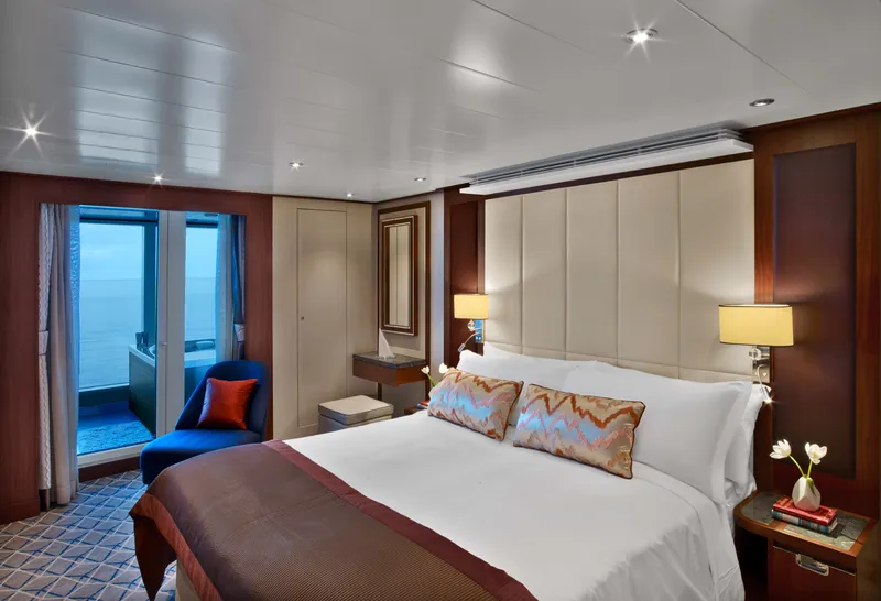






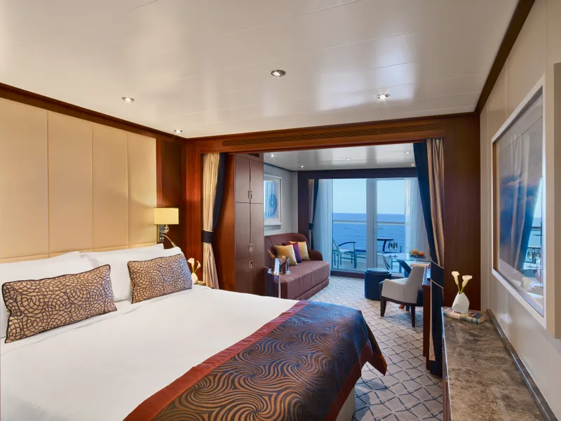
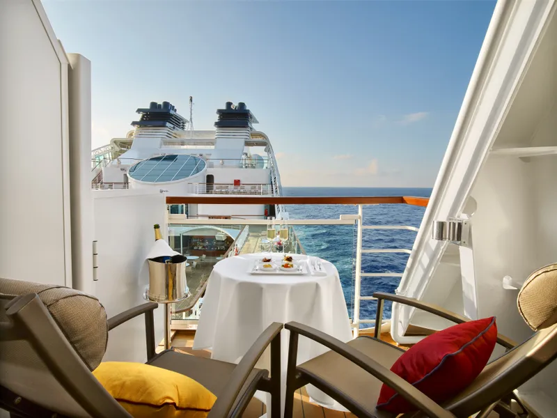

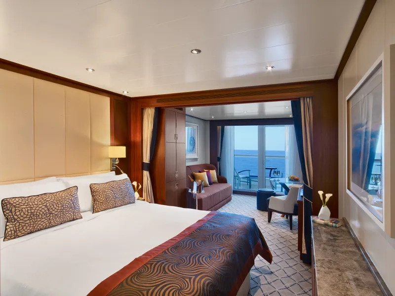
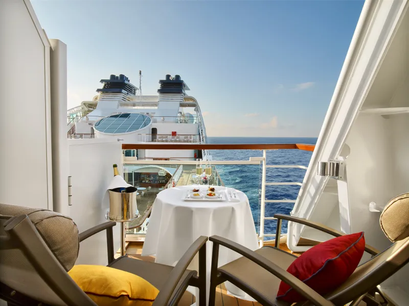

Our cruise specialists can help you find the perfect cabin and the best available pricing.
(+886) 02-2721-7300Contact Advisor