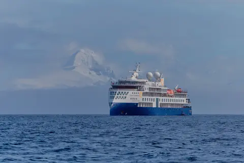
Quark ExpeditionsOEX20270817
West Greenland: Discovering Massive Icebergs and Inuit Communities, Northbound
Date
2027-08-17
Duration
10 nights
Departure Port
Reykjavik
Iceland
Arrival Port
Reykjavik
Iceland
Rating
Expedition
Theme
—
Date
2027-08-17
Duration
10 nights
Departure Port
Reykjavik
Iceland
Arrival Port
Reykjavik
Iceland
Rating
Expedition
Theme
—
Quark Expeditions
Ice Class 1A, PC6
2020
—
—
138
72
105
104.4 m
5.3 m
16 knots
No

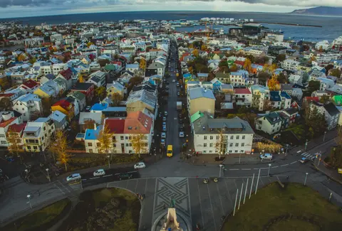
Reykjavik, the world's northernmost capital, distils the entire improbable beauty of Iceland into one compact, creatively charged city. The soaring basalt columns of Hallgrímskirkja dominate a skyline of primary-coloured rooftops, while the Harpa Concert Hall shimmers beside the harbour like a captured aurora. Day trips from the city unlock the Golden Circle's geysers and Geysir hot spring, the black sand beaches of Vík, and the ethereal glacier lagoon at Jökulsárlón. Geothermal pools — from the legendary Blue Lagoon to intimate neighbourhood hot pots — offer warmth year-round. June and July bring the bewitching midnight sun.
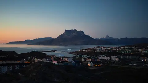
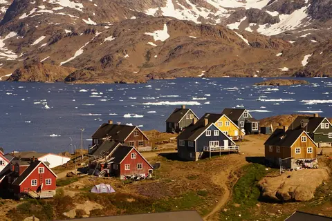
Nuuk, Greenland's diminutive capital, is a city of vivid contrasts — colourful colonial houses against Arctic granite, Inuit heritage alongside contemporary Nordic culture, and world-class museums steps from untamed fjords. Visitors should not miss the Greenland National Museum's Qilakitsoq mummies and a Zodiac excursion into the surrounding iceberg-studded fjord system. The prime cruising season runs from June through September, when extended daylight illuminates the landscape in an ethereal sub-Arctic glow and waters remain navigable for expedition vessels.
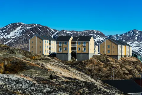
Sisimiut is Greenland's adventure capital, a colourful Arctic town of 5,500 people just north of the Arctic Circle on the west coast. Must-dos include hiking the Arctic Circle Trail, whale watching for humpbacks and narwhals, and exploring the colonial-era museum. Summer brings midnight sun and hiking conditions, while winter offers dog-sledding, skiing, and northern lights.
Eqip Sermia is one of Greenland's most actively calving tidewater glaciers, its three-kilometer face producing spectacular iceberg births in Disko Bay. Must-dos include Zodiac cruising among freshly calved icebergs, witnessing million-ton ice falls, and photographing the ice face in midnight sun light. July and August offer the warmest conditions and continuous Arctic daylight for this extraordinary glacier encounter.
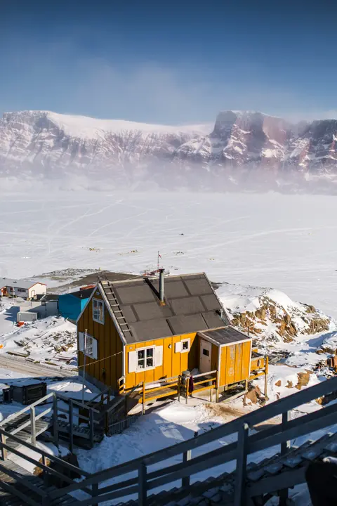
Uummannaq is a vividly painted Arctic town perched beneath a heart-shaped mountain on Greenland's western coast, surrounded by colossal icebergs and rich Inuit cultural heritage. Must-dos include zodiac cruising through the iceberg-filled fjord, visiting the Uummannaq Museum, and experiencing the midnight sun's eternal golden light. July and August offer the warmest conditions and best accessibility for Arctic expedition cruising.
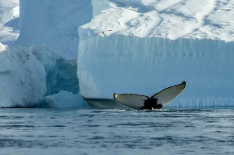
Disko Bay is Greenland's monumental iceberg gallery, where the world's most prolific glacier discharges bergs of hundred-meter scale into a UNESCO-adjacent bay that functions as a constantly refreshed Arctic sculpture garden. Navigate July through August via Hapag-Lloyd or Ponant for zodiac cruises between towering icebergs, humpback whale bubble-net feeding, and the Inuit cultural encounters that provide human context for life at 69°N latitude.
Itilleq, Greenland is a distinctive port city where deep cultural heritage meets authentic local atmosphere, featured on itineraries by Quark Expeditions. Must-do experiences include exploring the historic quarter to absorb centuries of architectural heritage, and sampling the distinctive northern cuisine that transforms local ingredients into refined dining experiences. The optimal time to visit is June through September, when brief summer window offers navigable waters and extraordinary light.
Kangerlussuaq Havn is the eastern Greenlandic gateway to the Scoresby Sund — the world's longest fjord system — where sheer basalt cliffs, colossal icebergs, and one of Earth's most isolated Inuit communities await expedition vessels from Ponant and Hapag-Lloyd. Visit July through September for muskox encounters, midnight-sun ice photography, and the Arctic in its most concentrated and demanding form.
Reykjavik, the world's northernmost capital, distils the entire improbable beauty of Iceland into one compact, creatively charged city. The soaring basalt columns of Hallgrímskirkja dominate a skyline of primary-coloured rooftops, while the Harpa Concert Hall shimmers beside the harbour like a captured aurora. Day trips from the city unlock the Golden Circle's geysers and Geysir hot spring, the black sand beaches of Vík, and the ethereal glacier lagoon at Jökulsárlón. Geothermal pools — from the legendary Blue Lagoon to intimate neighbourhood hot pots — offer warmth year-round. June and July bring the bewitching midnight sun.
Day 1
Reykjavik, the world's northernmost capital, distils the entire improbable beauty of Iceland into one compact, creatively charged city. The soaring basalt columns of Hallgrímskirkja dominate a skyline of primary-coloured rooftops, while the Harpa Concert Hall shimmers beside the harbour like a captured aurora. Day trips from the city unlock the Golden Circle's geysers and Geysir hot spring, the black sand beaches of Vík, and the ethereal glacier lagoon at Jökulsárlón. Geothermal pools — from the legendary Blue Lagoon to intimate neighbourhood hot pots — offer warmth year-round. June and July bring the bewitching midnight sun.
Day 2
Nuuk, Greenland's diminutive capital, is a city of vivid contrasts — colourful colonial houses against Arctic granite, Inuit heritage alongside contemporary Nordic culture, and world-class museums steps from untamed fjords. Visitors should not miss the Greenland National Museum's Qilakitsoq mummies and a Zodiac excursion into the surrounding iceberg-studded fjord system. The prime cruising season runs from June through September, when extended daylight illuminates the landscape in an ethereal sub-Arctic glow and waters remain navigable for expedition vessels.
Day 3
Day 4
Sisimiut is Greenland's adventure capital, a colourful Arctic town of 5,500 people just north of the Arctic Circle on the west coast. Must-dos include hiking the Arctic Circle Trail, whale watching for humpbacks and narwhals, and exploring the colonial-era museum. Summer brings midnight sun and hiking conditions, while winter offers dog-sledding, skiing, and northern lights.
Day 5
Eqip Sermia is one of Greenland's most actively calving tidewater glaciers, its three-kilometer face producing spectacular iceberg births in Disko Bay. Must-dos include Zodiac cruising among freshly calved icebergs, witnessing million-ton ice falls, and photographing the ice face in midnight sun light. July and August offer the warmest conditions and continuous Arctic daylight for this extraordinary glacier encounter.
Day 6
Uummannaq is a vividly painted Arctic town perched beneath a heart-shaped mountain on Greenland's western coast, surrounded by colossal icebergs and rich Inuit cultural heritage. Must-dos include zodiac cruising through the iceberg-filled fjord, visiting the Uummannaq Museum, and experiencing the midnight sun's eternal golden light. July and August offer the warmest conditions and best accessibility for Arctic expedition cruising.
Day 7
Disko Bay is Greenland's monumental iceberg gallery, where the world's most prolific glacier discharges bergs of hundred-meter scale into a UNESCO-adjacent bay that functions as a constantly refreshed Arctic sculpture garden. Navigate July through August via Hapag-Lloyd or Ponant for zodiac cruises between towering icebergs, humpback whale bubble-net feeding, and the Inuit cultural encounters that provide human context for life at 69°N latitude.
Day 8
Itilleq, Greenland is a distinctive port city where deep cultural heritage meets authentic local atmosphere, featured on itineraries by Quark Expeditions. Must-do experiences include exploring the historic quarter to absorb centuries of architectural heritage, and sampling the distinctive northern cuisine that transforms local ingredients into refined dining experiences. The optimal time to visit is June through September, when brief summer window offers navigable waters and extraordinary light.
Day 10
Kangerlussuaq Havn is the eastern Greenlandic gateway to the Scoresby Sund — the world's longest fjord system — where sheer basalt cliffs, colossal icebergs, and one of Earth's most isolated Inuit communities await expedition vessels from Ponant and Hapag-Lloyd. Visit July through September for muskox encounters, midnight-sun ice photography, and the Arctic in its most concentrated and demanding form.
Day 11
Reykjavik, the world's northernmost capital, distils the entire improbable beauty of Iceland into one compact, creatively charged city. The soaring basalt columns of Hallgrímskirkja dominate a skyline of primary-coloured rooftops, while the Harpa Concert Hall shimmers beside the harbour like a captured aurora. Day trips from the city unlock the Golden Circle's geysers and Geysir hot spring, the black sand beaches of Vík, and the ethereal glacier lagoon at Jökulsárlón. Geothermal pools — from the legendary Blue Lagoon to intimate neighbourhood hot pots — offer warmth year-round. June and July bring the bewitching midnight sun.
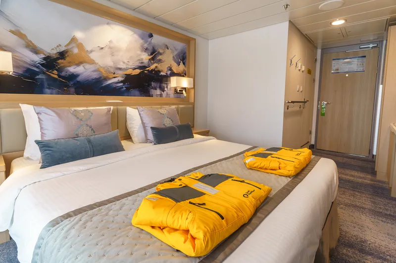
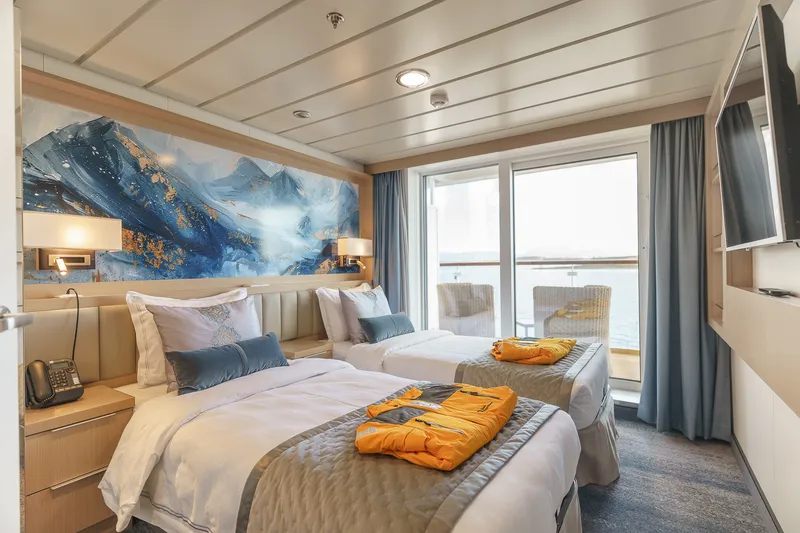
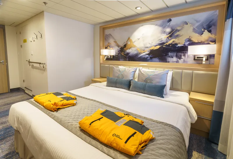
Bed Config.
One double bed made up of two twin berths
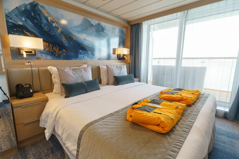

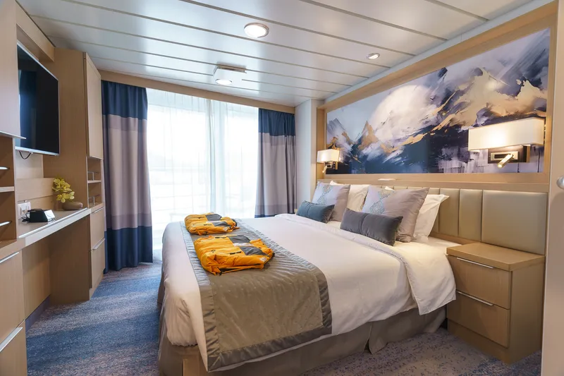
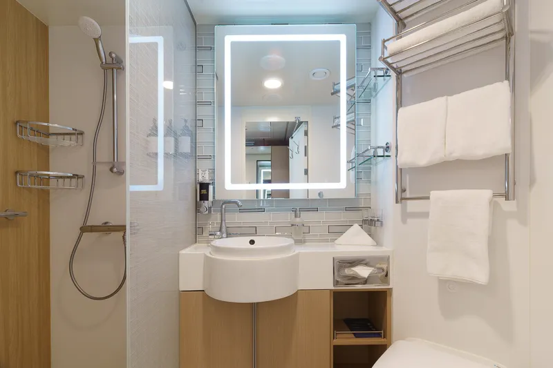
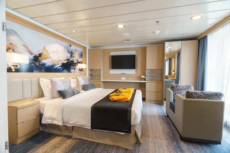
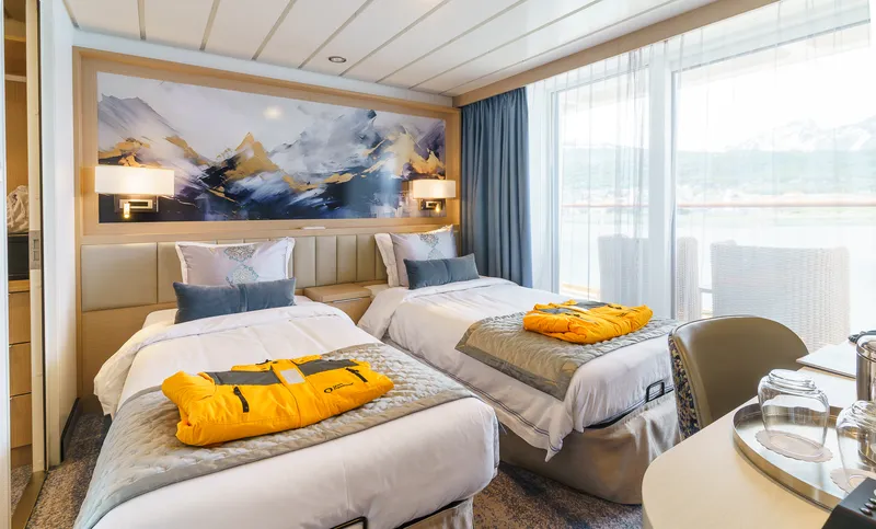
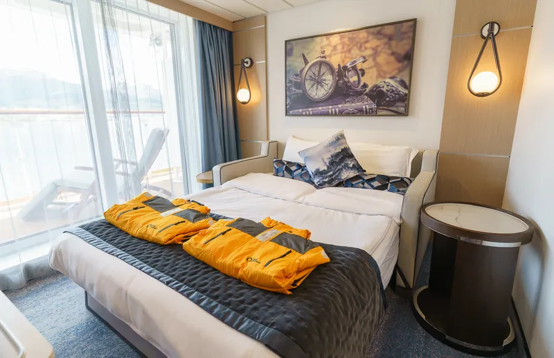
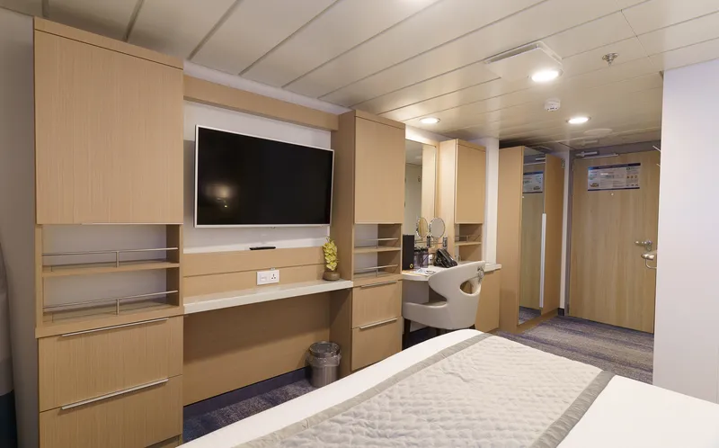
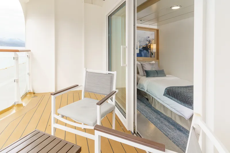
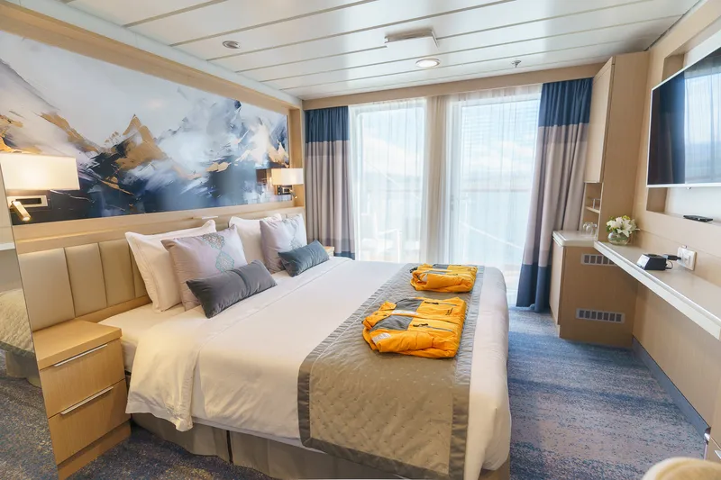
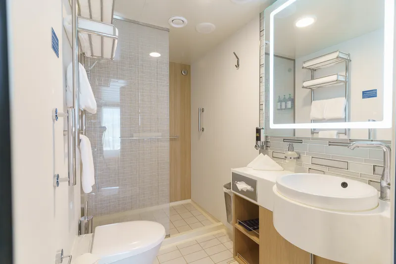
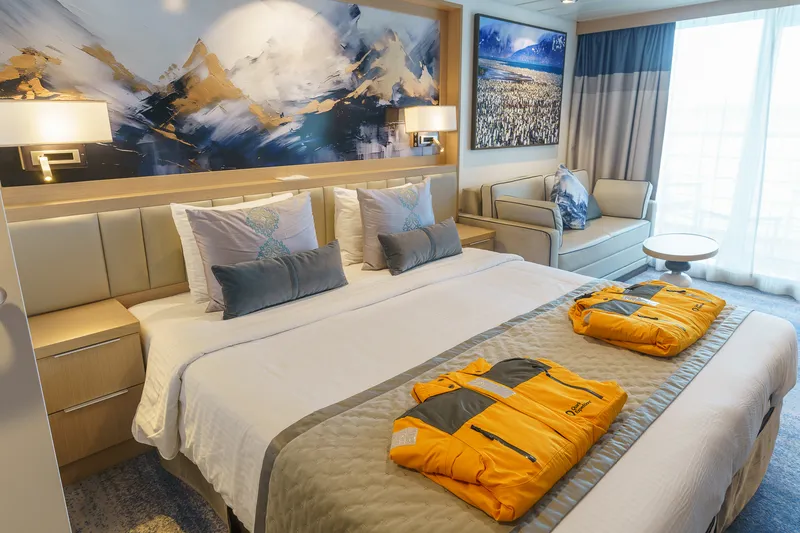
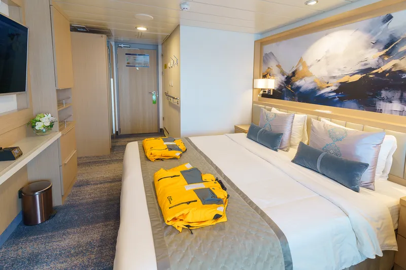
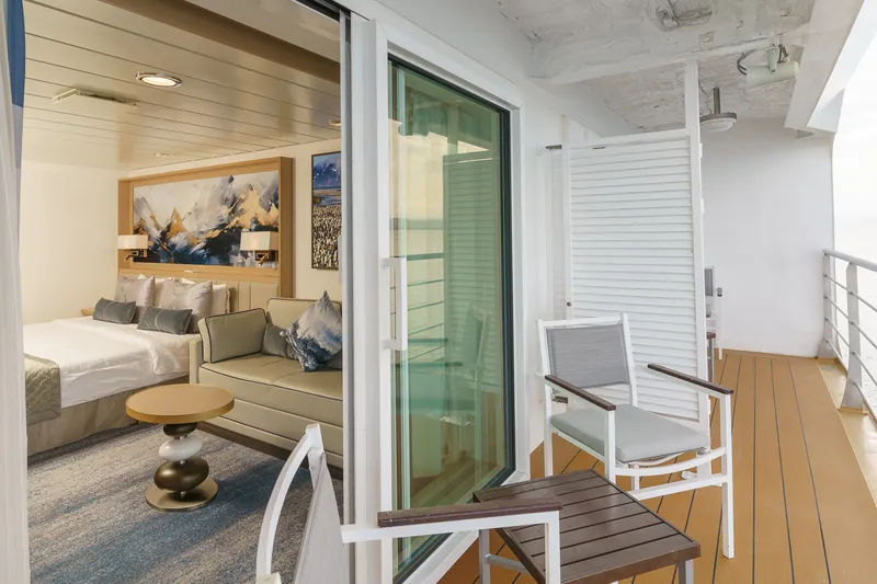
Located on Deck 6 and approximately 298 sq. f. (27.7 sq. m,) in size. These 2-room suites have one double bed that can be configured into two singles in the inner bedroom and an outer sitting room furnished with a sofa-bed, and activity table for two. From the bedroom there a floor to ceiling glass view that opens to a double sized walkout balcony. There are also 2 TV’s, state of the art ‘infotainment’ system and private bathroom with bathtub, vanity and heated floor.
Bed Config.
Two rooms. One double bed made up of two twin berths fold out sofa bed
Bed Config.
Two rooms. One double bed made up of two twin berths fold out sofa bed
Bed Config.
Two rooms. One double bed made up of two twin berths fold out sofa bed
Bed Config.
One double bed made up of two twin berths
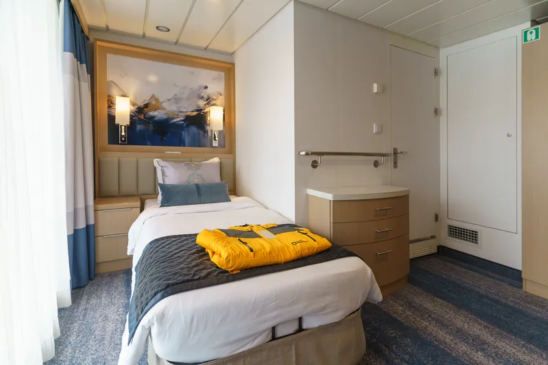
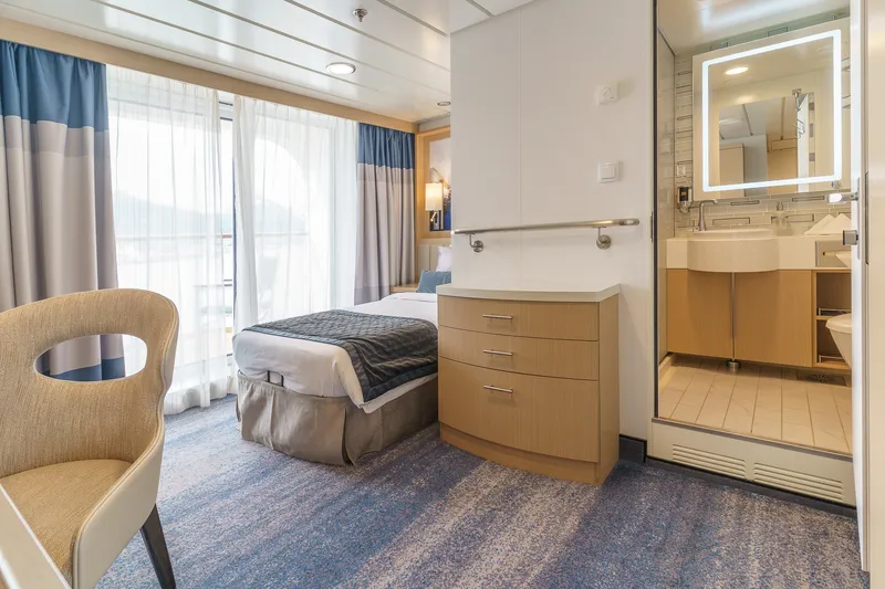
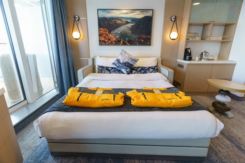
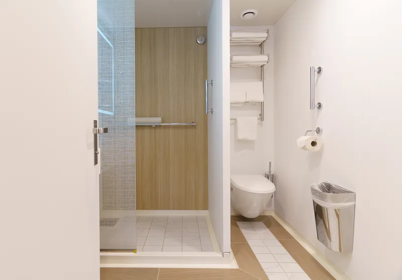
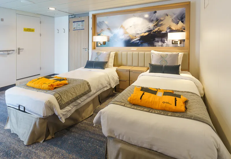
Designed for one. This unique cabin is located on Deck 7 and approximately 162 sq. f. (15.1 sq. m.). It has one twin bed with a floor to ceiling glass view that opens to a generous walkout balcony. There is also TV, state of the art ‘infotainment’ system and private bathroom with shower, vanity and heated floor.
Bed Config.
One twin single
Bed Config.
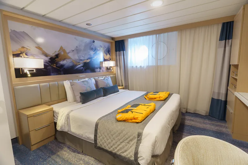
One double bed made up of two twin berths
Bed Config.
One double bed made up of two twin berths and fold out sofa bed
Our cruise specialists can help you find the perfect cabin and the best available pricing.
(+886) 02-2721-7300Contact Advisor