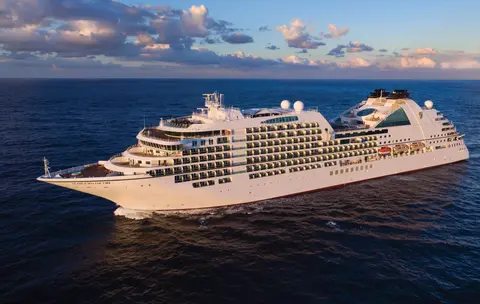
Seabourn7731A
14 päivän Alaskan jäätiköt, vuonot ja Sisäreitti
Date
2027-05-28
Duration
14 nights
Departure Port
Vancouver
Kanada
Arrival Port
Vancouver
Kanada
Rating
Luxury
Theme
—
Date
2027-05-28
Duration
14 nights
Departure Port
Vancouver
Kanada
Arrival Port
Vancouver
Kanada
Rating
Luxury
Theme
—

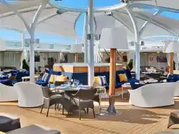




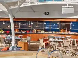
Seabourn
2016
—
40,350 GT
600
266
330
690 m
28 m
19 knots
No
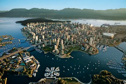
Työntyneenä Tyynenmeren ja Coast-vuoriston väliin Vancouver on luonnollinen portti Alaskan sisäiseen kulkuväylään — kaupunki, jossa lauhkea sademetsä kohtaa lasiset tornit ja jossa Dungeness-ravun sekä villin sockeye-lohen maut määrittävät Tyynenmeren alueen keittiön, joka haastaa Pohjois-Amerikan parhaat. Kävele 22 kilometrin pituinen Stanley Parkin rantakatu, eksy Granville Islandin markkinoille ja ota sitten lautta Victoriaan ihailemaan edwardiaanista loistoa. Alaskan risteilykausi huipentuu toukokuusta syyskuuhun, tehden Vancouverista ihanteellisen lähtöpisteen yhdelle maailman upeimmista merimatkoista.
The Seymour Narrows is a 3-mile/5 km stretch of the Discovery Channel north of Vancouver Island, British Columbia that is notorious for the strength of the tidal currents flowing through it. The average width of the narrows is just 750 meters. During extreme tides, the current through the narrows is subject to severe Venturi effect, resulting in an increased velocity that can reach 15 knots. For much of its modern history, there was an additional hazard in the narrows called Ripple Rock, a shallow obstruction that claimed no fewer than 119 ships and 114 lives. In 1958, after months of tunneling and preparation, Ripple Rock was blown up in the largest commercial, non-nuclear explosion ever recorded in North America. Still, the navigation of Seymour Narrows is dependent on tidal and other conditions, and requires skill and technical accomplishment.
The Queen Charlotte Sound lies between the Queen Charlotte Strait, which winds between Vancouver Island and the British Columbia mainland in the south, and Hecate Strait, which is northward, adjacent to the Haida Gwaii Islands off the Pacific coast of British Columbia. It is a broad reach in the long shipping route called the Inside Passage threading the myriad islands stretching from Washington’s Puget Sound to Alaska.
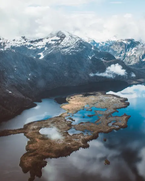
Ketchikan nojailee Revillagigedo-saarella Alaskan kaakkoisessa niemimaassa — kaupunki, joka on niin kapea, että paikalliset vitsailevat sen olevan kolme mailia pitkä ja kolme korttelia leveä. Tlingit-kansa on vuosisatojen ajan kunnioittanut tätä paikkaa runsaiden lohien kotiympäristönä, ja nykyään se tunnetaan maailman totemipylväiden pääkaupunkina: Saxman Native Village ja Totem Bight State Historical Park säilyttävät merkittävimmän kokoelman näitä monumentaalisia taideteoksia. Creek Street, värikkäiden historiallisten talojen laiturikatu, joka on rakennettu Ketchikanin puron ylle, on ehdoton vierailukohde. Kesä (touko–syyskuu) tarjoaa parhaan sään, jolloin puroissa voi nähdä lohien vaelluksen.
In the passage between Sumner Strait and Clarence Strait in Southeast Alaska’s Alexander Archipelago, midway between Price of Wales Island on the west and Zarembo Island on the east, is a small cluster of islands with a picturesque passageway between them called Snow Pass. It makes a scenic up-close route for your Seabourn ship during the transit.
Decision Passage is the western end of the Sumner Strait, which runs through the Alexander Archipelago into the Pacific Ocean in Southeastern Alaska, bounded on the north by Kuiu Island and Cape Decision, the location of a 1932 lighthouse. This is the route your ship takes when coming from or going to the colorful historic community of Sitka on the west coast of Baranof Island, which was originally the Russian fortress town of New Archangel.
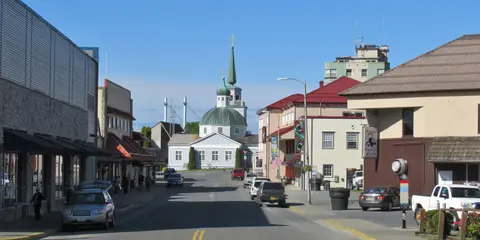
Sitka, joka sijaitsee Baranof-saarella Kaakkois-Alaskan villillä länsirannikolla, on yksi Tyynenmeren luoteisosan historian rikkaimmista satamista — paikka, jossa venäläiset ortodoksiset sipulikuplat kohoavat totemipaalujen yläpuolelle ja suuri lauhkea sademetsä ulottuu veden rajaan asti. Sitkan kansallinen historiallinen puisto säilyttää vuoden 1804 taistelun paikan Tlingit-sotureiden ja venäläisten siirtolaisten välillä sekä upean kokoelman monumentaalisia paaluja. Valaiden katselu, merinisäkkäiden keskellä meloaminen ja ruskeakarhujen bongaaminen ympäröivässä erämaassa määrittävät ulkoilmaelämystä. Touko–syyskuu tarjoaa parhaat saavutettavuuden ja valon olosuhteet.
Yakutat Bay is 18 miles wide at its entry, and cuts from the Gulf of Alaska into Disenchantment Bay, the entryway to the huge Hubbard Glacier, North America’s largest tidewater glacier. As the bay narrows and the shorelines draw closer, the 400-foot face of the glacier exerts a luminous, ghostly presence, often from as much as 30 miles away. More and more floating ice dimples the surface of the water, and seals bob up and disappear again. The chilled air from the glacier flows in a downdraft of cold that gives rise to mists and gray clouds, through which the vivid blue of the ice wall shimmers. It is an impressive sight of nature’s immense raw workplace, shaping the earth itself as part of an endless cycle of water from the sea evaporating to the sky, falling as snow on the heights and inching over centuries back again to the sea.
The Hubbard Glacier is the largest, and one of the most spectacular tidewater glaciers in North America. Its ice cliffs, some 400’ (121 m) tall, calve icebergs into the fjord, which may frequently be larger than a five-story building. The glacier’s surface is creased and contorted, resembling the wrinkled skin of a giant elephant. Records show it has been growing in thickness and advancing since 1895. This stands in stark contrast to other glaciers around the world, most of which have been receding during the past century. In 2002, the glacier blocked Russell Fjord for two and a half months, raising water levels 61’ (18 m) and threatening local communities with flooding. Nutrient-rich waters along the glacier face attract many species. Gulls and kittiwake colonies adorn smaller islands and harbor seals patrol the icy waters. In 1890, Israel Russell explored the area of Yakutat Bay and Hubbard Glacier, naming it after Gardiner G. Hubbard, a financier of his expedition and a founder and the first president of the National Geographic Society. VIEW CRUISES
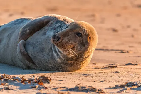
Inianin saaret ovat villi, asumatonta saaristo Alaskan Cross Soundin suulla, tunnettu poikkeuksellisista kohtaamisista villieläinten kanssa, kuten kuuttahaitten kuplaverkkoruokailusta ja valtavista Stellerin merileijonien koloniasta. Välttämättömiin kokemuksiin kuuluu Zodiac-retket saariston karuilla rannoilla, yhteistyössä tapahtuvan valasruokailun seuraaminen sekä meren elämää kuhisevien vuorovesialtaiden tutkiminen. Vieraile heinä–elokuussa, jolloin valasten aktiivisuus on huipussaan ja merisää parhaimmillaan.
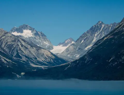
Icy Strait Point on upea Alaskan satama, joka tunnetaan henkeäsalpaavasta luonnonkauneudestaan ja rikkaasta alkuperäiskansa tlingitin kulttuuristaan. Pakollisiin kokemuksiin kuuluu tuoreen paikallisen merenelävän nauttiminen sekä villieläinretket Glacier Bayn kansallispuistossa. Paras aika vierailla on kesäkuukausina, jolloin sää on leuto ja villieläimiä on runsaasti.
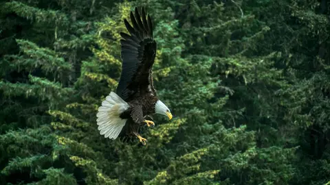
Haines on aito alaskalainen kaupunki Pohjois-Amerikan syvimmän vuonon rannalla, koti maailman suurimmalle kaljujen kotkien kokoontumiselle — jopa neljätuhatta lintua Chilkat-joen varrella — sekä kukoistava taideyhteisö, joka vaalii Tlingitin kulttuuriperinteitä. Vieraile kesäkuusta elokuuhun Cunardin tai Lindbladin risteilyillä, jolloin voit kokea jäätikköhelikopterin laskeutumiset ja rannikon patikoinnit, tai lokakuusta helmikuuhun nauttiaksesi ainutlaatuisesta kotkiesityksestä, joka tekee Hainesista Alaskan parhaiten varjellun salaisuuden.
Lynn Canal is a 90-mile long inlet into Alaska’s coast running from the Chilkat River in the north to the Chatham Strait and Stephens Passage in the south. Because it connects the towns of Skagway and Haines to Juneau and the rest of the Inside Passage, it is an important shipping lane for ferries, cargo and cruise ships, and was a crucial passageway to the Klondike gold fields during the Gold Rush. It was discovered by Joseph Whidbey in 1794 and named by George Vancouver after his birthplace, King’s Lynn in Norfolk, England. More than 2,000 feet in depth, it is one of the deepest and longest fjords in the world, and the deepest in North America outside Greenland.
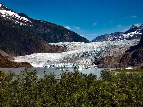
Yhdysvaltojen ainoa osavaltion pääkaupunki, johon ei pääse maanteitse, Juneau palkitsee matkansa villillä suuruudellaan, jota harvat kaupungit maailmassa voivat ylittää. Mendenhallin jäätikkö — ikiaikaisen jään elävä joki — sijaitsee vain viisitoista minuuttia keskustasta, missä vesitasot leijailevat merenrannalla, jota reunustavat kuusimetsien peittämät vuoret, jotka syöksyvät suoraan mereen. Pakollinen elämys on helikopterin laskeutuminen jäätikön ylle tai valassafarin tekeminen Stephens Passagessa, missä kuuttahait hyppivät hämmästyttävän lähellä. Juneau on lämpimimmillään kesäkuusta elokuuhun, vaikka kesäpäivät voivatkin tuoda mukanaan kuuluisan Kaakkois-Alaskan sateen, joka pitää sademetsän ikuisesti hohtavana.
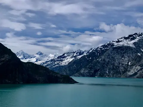
Glacier Bayin kansallispuisto on yksi maapallon vaikuttavimmista aktiivisen jäätiköitymisen maisemista — 3,3 miljoonaa hehtaaria Kaakkois-Alaskassa, missä vuorovesijäätiköt irrottavat katedraalin kokoisia jäävuoria hohtavan sinisten vuonojen veteen, ja missä maa itse kohoaa yhä, vapautuen kahden vuosisadan takaisesta jäätikön painosta, joka peitti koko tämän alueen. Puistoon pääsee ainoastaan laivalla tai pienkoneella, ja se palkitsee vierailijat eläinkohtaamisilla — kuuttahaita, ruskeakarhuja, merisaukkoja ja vuorikauriita — jotka sijoittuvat lähes ylivoimaisen upeiden maisemien keskelle. Sesonki kestää toukokuusta syyskuuhun; kesäkuun loppu ja heinäkuu tarjoavat pisimmät päivät ja luotettavimman eläinaktiivisuuden.
Decision Passage is the western end of the Sumner Strait, which runs through the Alexander Archipelago into the Pacific Ocean in Southeastern Alaska, bounded on the north by Kuiu Island and Cape Decision, the location of a 1932 lighthouse. This is the route your ship takes when coming from or going to the colorful historic community of Sitka on the west coast of Baranof Island, which was originally the Russian fortress town of New Archangel.
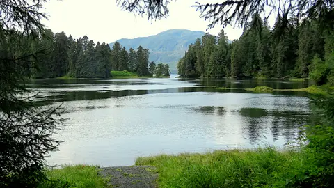
Wrangell on yksi Alaskan aidoimmista Sisäisen Väylän satamista, jossa tlingit-kulttuuri, muinaiset kalliomaalaukset ja maailmanluokan villieläimet kohtaavat mahtavan Stikine-joen suulla. Välttämättömiin elämyksiin kuuluvat jetveneajelut LeConte-glacierille, karhujen kalastuksen seuraaminen Anan-joen rannalla sekä paikallisesti savustetun lohen maistelu. Heinä- ja elokuu tarjoavat lohen nousun ja karhujen tarkkailun huippusesongin.
Stikine Strait is a picturesque channel in the Alexander Archipelago of Alaska between Zarembo Island and Woronkofski and Etolin Islands near the mouth of the Stikine River south of Wrangell. It first appears on an 1848 Russian chart as Stakhin Strait and has been spelled variously on many charts since that time.
The 108-mile Behm Canal runs from the Clarence Strait through the Alexander Archipelago of Southeast Alaska, and into the channel separating Revillagigedo Island from the mainland. It forms part Inside Passage on the route between Ketchikan and the Misty Fjords National Monument. The canal was named by George Vancouver during his surveying expedition in 1793, in honor of Magnus von Behm, who had been governor of Kamchatka in the Russian Far East when Vancouver called at Petropavlovsk with Captain Cook’s expedition following the Cook’s murder in Hawaii.
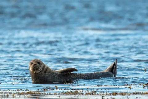
Misty Fjordsin kansallispyhäkkö on 930 000 hehtaarin laajuinen erämaa Kaakkois-Alaskassa, missä jyrkät graniittikalliot kohoavat peilityynien vuonojen ylle ikuisen sumun ja pilvien verhoamina. Elämyksiä ovat muun muassa kajakkiretket hiljaisissa vuononlahdissa, zodiac-retket vesiputousten ja tulivuorisen New Eddystone Rockin ohi sekä karhujen, kotkien ja valasryhävalaiden tarkkailu koskemattomissa vesiväylissä. Touko–syyskuu on vierailukauden huippu, jolloin sade vain korostaa pyhäkköalueen eteeristä tunnelmaa.
Misty Fjords National Monument is a section of the Tongass National Forest in Alaska’s extreme southeastern Panhandle region. The monument consists of over two million acres of deeply cut fjords cradled in U-shaped valleys between mountain ranges rising 2,000 to 3,000 feet above sea level. The fjords themselves extend as much as 1,000 feet below the surface. These granite ranges are covered with virgin forest, and most of the monument is also a dedicated wilderness area. Misty Fjords inspired the explorer John Muir to proclaim them among the most beautiful places he had ever seen. Your ship will cruise among these spectacular forests, waterfalls and mountains. The onboard Ventures by Seabourn team will offer optional excursions including kayaking the fjords and a short sightseeing floatplane flight.
Prince Rupert, historiallinen rautatien päätepiste Brittiläisen Kolumbian pohjoisrannikolla, lumoaa vierailijat syvällä tsimshian-kulttuurillaan, maailmanluokan kampelankalastuksellaan ja sumuisilla sademetsän maisemillaan Inside Passage -reitillä. Maista vastasavustettua lohta rantakadulla ja tutustu North Pacific Canneryyn, Kanadan vanhimpaan säilyketehtaaseen, joka tarjoaa elävän kosketuksen sataman merelliseen sieluun. Paras aika vierailla on kesäkuusta elokuuhun, jolloin pidemmät päivät lieventävät kuuluisan sateen määrää ja rannikon villieläimet ovat aktiivisimmillaan.
Grenville Channel is a long, well-protected channel along the northern British Columbia coast between the large Pitt Island and the mainland. It is an important shipping lane, and you are likely to see ships of many different types and sizes as you pass through. The shores are mountainous on both sides, with two notable peaks about halfway through, Mt. Batchellor on the east side and Mt. Saunders on Pitt Island to the west. There are a number of Indian Reserves and Marine Parks in the mountains and narrow waterways off the channel.
Whale Channel is a picturesque waterway separating Gil Island from Princess Royal Island in British Columbia’s Inside Passage. Surrounded by snow-capped mountain ranges and teeming with marine life, It is a diversion from the main shipping lane, located roughly halfway between Prince Rupert and the First Nations village of Klemtu. VIEW CRUISES Skip Footer Content About Us
The Princess Royal Channel separates the largest island along British Columbia’s coast from the mainland. It is located roughly halfway between Bella Bella in the south and Prince Rupert in the north, in one of the province’s most remote areas. Princess Royal island was named in 1788 by Captain Charles Duncan, in honor of his ship, the Princess Royal. The island is uninhabited, although there are two small villages in the channel, the First Nations community of Klemtu on Swindle Island and Hartley Bay on the mainland. Wildlife, by contrast, is plentiful, including Kermode, black and grizzly bears, deer, wolves and foxes. Golden and bald eagles nest in the region, as well as the endangered marbled murrelet. In the waters, there are abundant salmon, elephant seals, whales, orcas and dolphins.
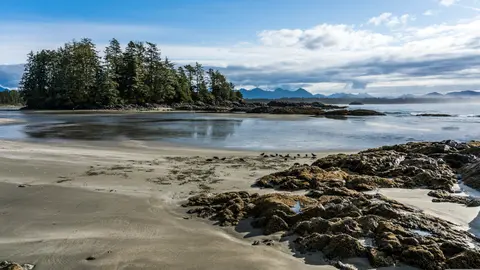
Alert Bay, Kanada, on ainutlaatuinen satamakaupunki, jossa syvä kulttuuriperintö kohtaa aidon paikallisen tunnelman. Kaupunkia esittelee HX Expeditionsin reittivalikoima. Pakollisiin kokemuksiin kuuluu historiallisen keskustan kävely, jossa voi aistia kerroksellisen arkkitehtonisen perinnön, sekä alueellisten kulinaaristen perinteiden etsiminen paikallisesti suosituista ravintoloista, kaukana satama-alueesta. Optimaalinen vierailuaika on kesäkuusta elokuuhun, jolloin kesäkuukaudet tuovat lämpimimmät lämpötilat ja pisimmät päivät.
Johnstone Strait is a well-protected shipping route passing 68 miles/110 km along the northeast shore of Vancouver Island between the island and the mainland of British Columbia. The strait is between 1 ½ miles and 3 miles wide, and leads from the broad Georgia Strait through a narrow channel called Discovery Passage. The strait was named by Vancouver in 1792 for James Johnstone, the master of one of his tenders during the survey expedition that revealed Vancouver Island to be an island. There are no cities or towns on the strait. The Johnstone Strait is the summer range of a large pod of seasonally resident orcas which are frequently seen in the area. VIEW CRUISES Skip Footer Content About Us Our Company News Careers Contact Us Video Gallery Accessibility Seabourn Club Seabourn Referral Program Travel Resources
The Seymour Narrows is a 3-mile/5 km stretch of the Discovery Channel north of Vancouver Island, British Columbia that is notorious for the strength of the tidal currents flowing through it. The average width of the narrows is just 750 meters. During extreme tides, the current through the narrows is subject to severe Venturi effect, resulting in an increased velocity that can reach 15 knots. For much of its modern history, there was an additional hazard in the narrows called Ripple Rock, a shallow obstruction that claimed no fewer than 119 ships and 114 lives. In 1958, after months of tunneling and preparation, Ripple Rock was blown up in the largest commercial, non-nuclear explosion ever recorded in North America. Still, the navigation of Seymour Narrows is dependent on tidal and other conditions, and requires skill and technical accomplishment.
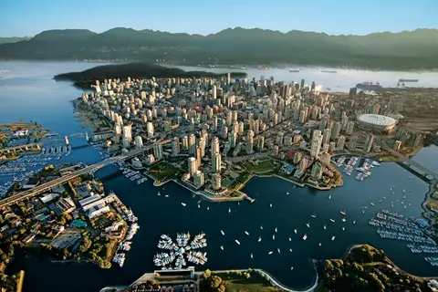
Työntyneenä Tyynenmeren ja Coast-vuoriston väliin Vancouver on luonnollinen portti Alaskan sisäiseen kulkuväylään — kaupunki, jossa lauhkea sademetsä kohtaa lasiset tornit ja jossa Dungeness-ravun sekä villin sockeye-lohen maut määrittävät Tyynenmeren alueen keittiön, joka haastaa Pohjois-Amerikan parhaat. Kävele 22 kilometrin pituinen Stanley Parkin rantakatu, eksy Granville Islandin markkinoille ja ota sitten lautta Victoriaan ihailemaan edwardiaanista loistoa. Alaskan risteilykausi huipentuu toukokuusta syyskuuhun, tehden Vancouverista ihanteellisen lähtöpisteen yhdelle maailman upeimmista merimatkoista.
Day 1
Työntyneenä Tyynenmeren ja Coast-vuoriston väliin Vancouver on luonnollinen portti Alaskan sisäiseen kulkuväylään — kaupunki, jossa lauhkea sademetsä kohtaa lasiset tornit ja jossa Dungeness-ravun sekä villin sockeye-lohen maut määrittävät Tyynenmeren alueen keittiön, joka haastaa Pohjois-Amerikan parhaat. Kävele 22 kilometrin pituinen Stanley Parkin rantakatu, eksy Granville Islandin markkinoille ja ota sitten lautta Victoriaan ihailemaan edwardiaanista loistoa. Alaskan risteilykausi huipentuu toukokuusta syyskuuhun, tehden Vancouverista ihanteellisen lähtöpisteen yhdelle maailman upeimmista merimatkoista.
The Seymour Narrows is a 3-mile/5 km stretch of the Discovery Channel north of Vancouver Island, British Columbia that is notorious for the strength of the tidal currents flowing through it. The average width of the narrows is just 750 meters. During extreme tides, the current through the narrows is subject to severe Venturi effect, resulting in an increased velocity that can reach 15 knots. For much of its modern history, there was an additional hazard in the narrows called Ripple Rock, a shallow obstruction that claimed no fewer than 119 ships and 114 lives. In 1958, after months of tunneling and preparation, Ripple Rock was blown up in the largest commercial, non-nuclear explosion ever recorded in North America. Still, the navigation of Seymour Narrows is dependent on tidal and other conditions, and requires skill and technical accomplishment.
Day 2
The Queen Charlotte Sound lies between the Queen Charlotte Strait, which winds between Vancouver Island and the British Columbia mainland in the south, and Hecate Strait, which is northward, adjacent to the Haida Gwaii Islands off the Pacific coast of British Columbia. It is a broad reach in the long shipping route called the Inside Passage threading the myriad islands stretching from Washington’s Puget Sound to Alaska.
Day 3
Ketchikan nojailee Revillagigedo-saarella Alaskan kaakkoisessa niemimaassa — kaupunki, joka on niin kapea, että paikalliset vitsailevat sen olevan kolme mailia pitkä ja kolme korttelia leveä. Tlingit-kansa on vuosisatojen ajan kunnioittanut tätä paikkaa runsaiden lohien kotiympäristönä, ja nykyään se tunnetaan maailman totemipylväiden pääkaupunkina: Saxman Native Village ja Totem Bight State Historical Park säilyttävät merkittävimmän kokoelman näitä monumentaalisia taideteoksia. Creek Street, värikkäiden historiallisten talojen laiturikatu, joka on rakennettu Ketchikanin puron ylle, on ehdoton vierailukohde. Kesä (touko–syyskuu) tarjoaa parhaan sään, jolloin puroissa voi nähdä lohien vaelluksen.
In the passage between Sumner Strait and Clarence Strait in Southeast Alaska’s Alexander Archipelago, midway between Price of Wales Island on the west and Zarembo Island on the east, is a small cluster of islands with a picturesque passageway between them called Snow Pass. It makes a scenic up-close route for your Seabourn ship during the transit.
Decision Passage is the western end of the Sumner Strait, which runs through the Alexander Archipelago into the Pacific Ocean in Southeastern Alaska, bounded on the north by Kuiu Island and Cape Decision, the location of a 1932 lighthouse. This is the route your ship takes when coming from or going to the colorful historic community of Sitka on the west coast of Baranof Island, which was originally the Russian fortress town of New Archangel.
Day 4
Sitka, joka sijaitsee Baranof-saarella Kaakkois-Alaskan villillä länsirannikolla, on yksi Tyynenmeren luoteisosan historian rikkaimmista satamista — paikka, jossa venäläiset ortodoksiset sipulikuplat kohoavat totemipaalujen yläpuolelle ja suuri lauhkea sademetsä ulottuu veden rajaan asti. Sitkan kansallinen historiallinen puisto säilyttää vuoden 1804 taistelun paikan Tlingit-sotureiden ja venäläisten siirtolaisten välillä sekä upean kokoelman monumentaalisia paaluja. Valaiden katselu, merinisäkkäiden keskellä meloaminen ja ruskeakarhujen bongaaminen ympäröivässä erämaassa määrittävät ulkoilmaelämystä. Touko–syyskuu tarjoaa parhaat saavutettavuuden ja valon olosuhteet.
Day 5
Yakutat Bay is 18 miles wide at its entry, and cuts from the Gulf of Alaska into Disenchantment Bay, the entryway to the huge Hubbard Glacier, North America’s largest tidewater glacier. As the bay narrows and the shorelines draw closer, the 400-foot face of the glacier exerts a luminous, ghostly presence, often from as much as 30 miles away. More and more floating ice dimples the surface of the water, and seals bob up and disappear again. The chilled air from the glacier flows in a downdraft of cold that gives rise to mists and gray clouds, through which the vivid blue of the ice wall shimmers. It is an impressive sight of nature’s immense raw workplace, shaping the earth itself as part of an endless cycle of water from the sea evaporating to the sky, falling as snow on the heights and inching over centuries back again to the sea.
The Hubbard Glacier is the largest, and one of the most spectacular tidewater glaciers in North America. Its ice cliffs, some 400’ (121 m) tall, calve icebergs into the fjord, which may frequently be larger than a five-story building. The glacier’s surface is creased and contorted, resembling the wrinkled skin of a giant elephant. Records show it has been growing in thickness and advancing since 1895. This stands in stark contrast to other glaciers around the world, most of which have been receding during the past century. In 2002, the glacier blocked Russell Fjord for two and a half months, raising water levels 61’ (18 m) and threatening local communities with flooding. Nutrient-rich waters along the glacier face attract many species. Gulls and kittiwake colonies adorn smaller islands and harbor seals patrol the icy waters. In 1890, Israel Russell explored the area of Yakutat Bay and Hubbard Glacier, naming it after Gardiner G. Hubbard, a financier of his expedition and a founder and the first president of the National Geographic Society. VIEW CRUISES
Day 6
Inianin saaret ovat villi, asumatonta saaristo Alaskan Cross Soundin suulla, tunnettu poikkeuksellisista kohtaamisista villieläinten kanssa, kuten kuuttahaitten kuplaverkkoruokailusta ja valtavista Stellerin merileijonien koloniasta. Välttämättömiin kokemuksiin kuuluu Zodiac-retket saariston karuilla rannoilla, yhteistyössä tapahtuvan valasruokailun seuraaminen sekä meren elämää kuhisevien vuorovesialtaiden tutkiminen. Vieraile heinä–elokuussa, jolloin valasten aktiivisuus on huipussaan ja merisää parhaimmillaan.
Icy Strait Point on upea Alaskan satama, joka tunnetaan henkeäsalpaavasta luonnonkauneudestaan ja rikkaasta alkuperäiskansa tlingitin kulttuuristaan. Pakollisiin kokemuksiin kuuluu tuoreen paikallisen merenelävän nauttiminen sekä villieläinretket Glacier Bayn kansallispuistossa. Paras aika vierailla on kesäkuukausina, jolloin sää on leuto ja villieläimiä on runsaasti.
Day 7
Haines on aito alaskalainen kaupunki Pohjois-Amerikan syvimmän vuonon rannalla, koti maailman suurimmalle kaljujen kotkien kokoontumiselle — jopa neljätuhatta lintua Chilkat-joen varrella — sekä kukoistava taideyhteisö, joka vaalii Tlingitin kulttuuriperinteitä. Vieraile kesäkuusta elokuuhun Cunardin tai Lindbladin risteilyillä, jolloin voit kokea jäätikköhelikopterin laskeutumiset ja rannikon patikoinnit, tai lokakuusta helmikuuhun nauttiaksesi ainutlaatuisesta kotkiesityksestä, joka tekee Hainesista Alaskan parhaiten varjellun salaisuuden.
Lynn Canal is a 90-mile long inlet into Alaska’s coast running from the Chilkat River in the north to the Chatham Strait and Stephens Passage in the south. Because it connects the towns of Skagway and Haines to Juneau and the rest of the Inside Passage, it is an important shipping lane for ferries, cargo and cruise ships, and was a crucial passageway to the Klondike gold fields during the Gold Rush. It was discovered by Joseph Whidbey in 1794 and named by George Vancouver after his birthplace, King’s Lynn in Norfolk, England. More than 2,000 feet in depth, it is one of the deepest and longest fjords in the world, and the deepest in North America outside Greenland.
Day 8
Yhdysvaltojen ainoa osavaltion pääkaupunki, johon ei pääse maanteitse, Juneau palkitsee matkansa villillä suuruudellaan, jota harvat kaupungit maailmassa voivat ylittää. Mendenhallin jäätikkö — ikiaikaisen jään elävä joki — sijaitsee vain viisitoista minuuttia keskustasta, missä vesitasot leijailevat merenrannalla, jota reunustavat kuusimetsien peittämät vuoret, jotka syöksyvät suoraan mereen. Pakollinen elämys on helikopterin laskeutuminen jäätikön ylle tai valassafarin tekeminen Stephens Passagessa, missä kuuttahait hyppivät hämmästyttävän lähellä. Juneau on lämpimimmillään kesäkuusta elokuuhun, vaikka kesäpäivät voivatkin tuoda mukanaan kuuluisan Kaakkois-Alaskan sateen, joka pitää sademetsän ikuisesti hohtavana.
Day 9
Glacier Bayin kansallispuisto on yksi maapallon vaikuttavimmista aktiivisen jäätiköitymisen maisemista — 3,3 miljoonaa hehtaaria Kaakkois-Alaskassa, missä vuorovesijäätiköt irrottavat katedraalin kokoisia jäävuoria hohtavan sinisten vuonojen veteen, ja missä maa itse kohoaa yhä, vapautuen kahden vuosisadan takaisesta jäätikön painosta, joka peitti koko tämän alueen. Puistoon pääsee ainoastaan laivalla tai pienkoneella, ja se palkitsee vierailijat eläinkohtaamisilla — kuuttahaita, ruskeakarhuja, merisaukkoja ja vuorikauriita — jotka sijoittuvat lähes ylivoimaisen upeiden maisemien keskelle. Sesonki kestää toukokuusta syyskuuhun; kesäkuun loppu ja heinäkuu tarjoavat pisimmät päivät ja luotettavimman eläinaktiivisuuden.
Day 10
Decision Passage is the western end of the Sumner Strait, which runs through the Alexander Archipelago into the Pacific Ocean in Southeastern Alaska, bounded on the north by Kuiu Island and Cape Decision, the location of a 1932 lighthouse. This is the route your ship takes when coming from or going to the colorful historic community of Sitka on the west coast of Baranof Island, which was originally the Russian fortress town of New Archangel.
Wrangell on yksi Alaskan aidoimmista Sisäisen Väylän satamista, jossa tlingit-kulttuuri, muinaiset kalliomaalaukset ja maailmanluokan villieläimet kohtaavat mahtavan Stikine-joen suulla. Välttämättömiin elämyksiin kuuluvat jetveneajelut LeConte-glacierille, karhujen kalastuksen seuraaminen Anan-joen rannalla sekä paikallisesti savustetun lohen maistelu. Heinä- ja elokuu tarjoavat lohen nousun ja karhujen tarkkailun huippusesongin.
Stikine Strait is a picturesque channel in the Alexander Archipelago of Alaska between Zarembo Island and Woronkofski and Etolin Islands near the mouth of the Stikine River south of Wrangell. It first appears on an 1848 Russian chart as Stakhin Strait and has been spelled variously on many charts since that time.
Day 11
The 108-mile Behm Canal runs from the Clarence Strait through the Alexander Archipelago of Southeast Alaska, and into the channel separating Revillagigedo Island from the mainland. It forms part Inside Passage on the route between Ketchikan and the Misty Fjords National Monument. The canal was named by George Vancouver during his surveying expedition in 1793, in honor of Magnus von Behm, who had been governor of Kamchatka in the Russian Far East when Vancouver called at Petropavlovsk with Captain Cook’s expedition following the Cook’s murder in Hawaii.
Misty Fjordsin kansallispyhäkkö on 930 000 hehtaarin laajuinen erämaa Kaakkois-Alaskassa, missä jyrkät graniittikalliot kohoavat peilityynien vuonojen ylle ikuisen sumun ja pilvien verhoamina. Elämyksiä ovat muun muassa kajakkiretket hiljaisissa vuononlahdissa, zodiac-retket vesiputousten ja tulivuorisen New Eddystone Rockin ohi sekä karhujen, kotkien ja valasryhävalaiden tarkkailu koskemattomissa vesiväylissä. Touko–syyskuu on vierailukauden huippu, jolloin sade vain korostaa pyhäkköalueen eteeristä tunnelmaa.
Misty Fjords National Monument is a section of the Tongass National Forest in Alaska’s extreme southeastern Panhandle region. The monument consists of over two million acres of deeply cut fjords cradled in U-shaped valleys between mountain ranges rising 2,000 to 3,000 feet above sea level. The fjords themselves extend as much as 1,000 feet below the surface. These granite ranges are covered with virgin forest, and most of the monument is also a dedicated wilderness area. Misty Fjords inspired the explorer John Muir to proclaim them among the most beautiful places he had ever seen. Your ship will cruise among these spectacular forests, waterfalls and mountains. The onboard Ventures by Seabourn team will offer optional excursions including kayaking the fjords and a short sightseeing floatplane flight.
Day 12
Prince Rupert, historiallinen rautatien päätepiste Brittiläisen Kolumbian pohjoisrannikolla, lumoaa vierailijat syvällä tsimshian-kulttuurillaan, maailmanluokan kampelankalastuksellaan ja sumuisilla sademetsän maisemillaan Inside Passage -reitillä. Maista vastasavustettua lohta rantakadulla ja tutustu North Pacific Canneryyn, Kanadan vanhimpaan säilyketehtaaseen, joka tarjoaa elävän kosketuksen sataman merelliseen sieluun. Paras aika vierailla on kesäkuusta elokuuhun, jolloin pidemmät päivät lieventävät kuuluisan sateen määrää ja rannikon villieläimet ovat aktiivisimmillaan.
Day 13
Grenville Channel is a long, well-protected channel along the northern British Columbia coast between the large Pitt Island and the mainland. It is an important shipping lane, and you are likely to see ships of many different types and sizes as you pass through. The shores are mountainous on both sides, with two notable peaks about halfway through, Mt. Batchellor on the east side and Mt. Saunders on Pitt Island to the west. There are a number of Indian Reserves and Marine Parks in the mountains and narrow waterways off the channel.
Whale Channel is a picturesque waterway separating Gil Island from Princess Royal Island in British Columbia’s Inside Passage. Surrounded by snow-capped mountain ranges and teeming with marine life, It is a diversion from the main shipping lane, located roughly halfway between Prince Rupert and the First Nations village of Klemtu. VIEW CRUISES Skip Footer Content About Us
The Princess Royal Channel separates the largest island along British Columbia’s coast from the mainland. It is located roughly halfway between Bella Bella in the south and Prince Rupert in the north, in one of the province’s most remote areas. Princess Royal island was named in 1788 by Captain Charles Duncan, in honor of his ship, the Princess Royal. The island is uninhabited, although there are two small villages in the channel, the First Nations community of Klemtu on Swindle Island and Hartley Bay on the mainland. Wildlife, by contrast, is plentiful, including Kermode, black and grizzly bears, deer, wolves and foxes. Golden and bald eagles nest in the region, as well as the endangered marbled murrelet. In the waters, there are abundant salmon, elephant seals, whales, orcas and dolphins.
Day 14
Alert Bay, Kanada, on ainutlaatuinen satamakaupunki, jossa syvä kulttuuriperintö kohtaa aidon paikallisen tunnelman. Kaupunkia esittelee HX Expeditionsin reittivalikoima. Pakollisiin kokemuksiin kuuluu historiallisen keskustan kävely, jossa voi aistia kerroksellisen arkkitehtonisen perinnön, sekä alueellisten kulinaaristen perinteiden etsiminen paikallisesti suosituista ravintoloista, kaukana satama-alueesta. Optimaalinen vierailuaika on kesäkuusta elokuuhun, jolloin kesäkuukaudet tuovat lämpimimmät lämpötilat ja pisimmät päivät.
Johnstone Strait is a well-protected shipping route passing 68 miles/110 km along the northeast shore of Vancouver Island between the island and the mainland of British Columbia. The strait is between 1 ½ miles and 3 miles wide, and leads from the broad Georgia Strait through a narrow channel called Discovery Passage. The strait was named by Vancouver in 1792 for James Johnstone, the master of one of his tenders during the survey expedition that revealed Vancouver Island to be an island. There are no cities or towns on the strait. The Johnstone Strait is the summer range of a large pod of seasonally resident orcas which are frequently seen in the area. VIEW CRUISES Skip Footer Content About Us Our Company News Careers Contact Us Video Gallery Accessibility Seabourn Club Seabourn Referral Program Travel Resources
The Seymour Narrows is a 3-mile/5 km stretch of the Discovery Channel north of Vancouver Island, British Columbia that is notorious for the strength of the tidal currents flowing through it. The average width of the narrows is just 750 meters. During extreme tides, the current through the narrows is subject to severe Venturi effect, resulting in an increased velocity that can reach 15 knots. For much of its modern history, there was an additional hazard in the narrows called Ripple Rock, a shallow obstruction that claimed no fewer than 119 ships and 114 lives. In 1958, after months of tunneling and preparation, Ripple Rock was blown up in the largest commercial, non-nuclear explosion ever recorded in North America. Still, the navigation of Seymour Narrows is dependent on tidal and other conditions, and requires skill and technical accomplishment.
Day 15
Työntyneenä Tyynenmeren ja Coast-vuoriston väliin Vancouver on luonnollinen portti Alaskan sisäiseen kulkuväylään — kaupunki, jossa lauhkea sademetsä kohtaa lasiset tornit ja jossa Dungeness-ravun sekä villin sockeye-lohen maut määrittävät Tyynenmeren alueen keittiön, joka haastaa Pohjois-Amerikan parhaat. Kävele 22 kilometrin pituinen Stanley Parkin rantakatu, eksy Granville Islandin markkinoille ja ota sitten lautta Victoriaan ihailemaan edwardiaanista loistoa. Alaskan risteilykausi huipentuu toukokuusta syyskuuhun, tehden Vancouverista ihanteellisen lähtöpisteen yhdelle maailman upeimmista merimatkoista.
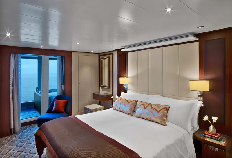
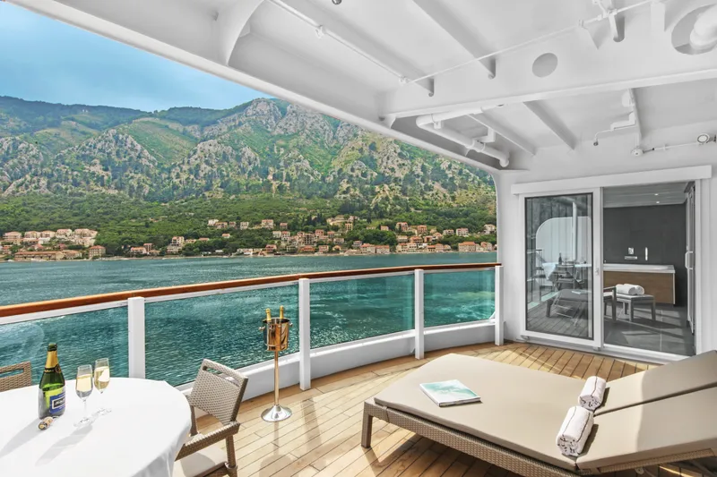

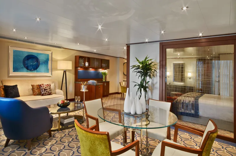

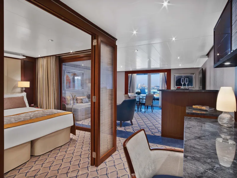


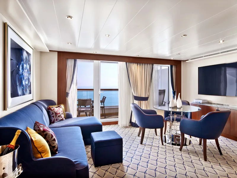



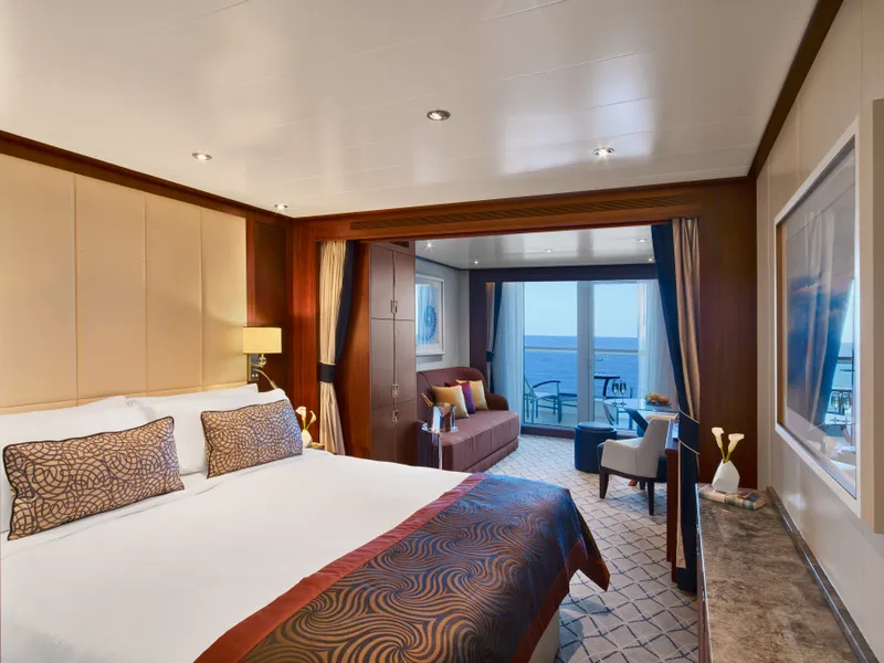
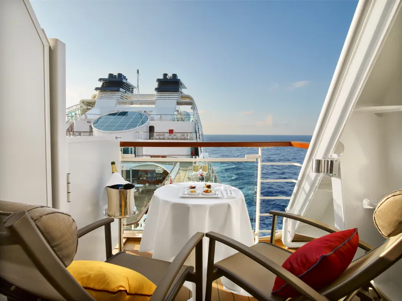



Our cruise specialists can help you find the perfect cabin and the best available pricing.
(+886) 02-2721-7300Contact Advisor