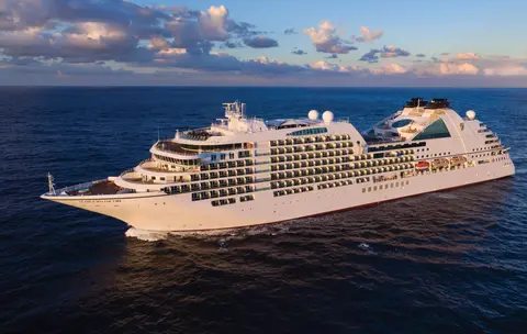
Seabourn7731
7 päivän jäätiköt ja Alaskan sisäreitti
Date
2027-05-28
Duration
7 nights
Departure Port
Vancouver
Kanada
Arrival Port
Juneau
Yhdysvallat
Rating
—
Theme
—
Date
2027-05-28
Duration
7 nights
Departure Port
Vancouver
Kanada
Arrival Port
Juneau
Yhdysvallat
Rating
—
Theme
—

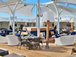




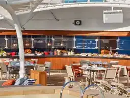
Seabourn
2016
—
40,350 GT
600
266
330
690 m
28 m
19 knots
No
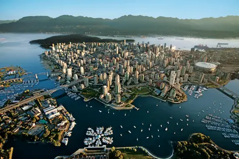
Työntyneenä Tyynenmeren ja Coast-vuoriston väliin Vancouver on luonnollinen portti Alaskan sisäiseen kulkuväylään — kaupunki, jossa lauhkea sademetsä kohtaa lasiset tornit ja jossa Dungeness-ravun sekä villin sockeye-lohen maut määrittävät Tyynenmeren alueen keittiön, joka haastaa Pohjois-Amerikan parhaat. Kävele 22 kilometrin pituinen Stanley Parkin rantakatu, eksy Granville Islandin markkinoille ja ota sitten lautta Victoriaan ihailemaan edwardiaanista loistoa. Alaskan risteilykausi huipentuu toukokuusta syyskuuhun, tehden Vancouverista ihanteellisen lähtöpisteen yhdelle maailman upeimmista merimatkoista.
The Seymour Narrows is a 3-mile/5 km stretch of the Discovery Channel north of Vancouver Island, British Columbia that is notorious for the strength of the tidal currents flowing through it. The average width of the narrows is just 750 meters. During extreme tides, the current through the narrows is subject to severe Venturi effect, resulting in an increased velocity that can reach 15 knots. For much of its modern history, there was an additional hazard in the narrows called Ripple Rock, a shallow obstruction that claimed no fewer than 119 ships and 114 lives. In 1958, after months of tunneling and preparation, Ripple Rock was blown up in the largest commercial, non-nuclear explosion ever recorded in North America. Still, the navigation of Seymour Narrows is dependent on tidal and other conditions, and requires skill and technical accomplishment.
The Queen Charlotte Sound lies between the Queen Charlotte Strait, which winds between Vancouver Island and the British Columbia mainland in the south, and Hecate Strait, which is northward, adjacent to the Haida Gwaii Islands off the Pacific coast of British Columbia. It is a broad reach in the long shipping route called the Inside Passage threading the myriad islands stretching from Washington’s Puget Sound to Alaska.
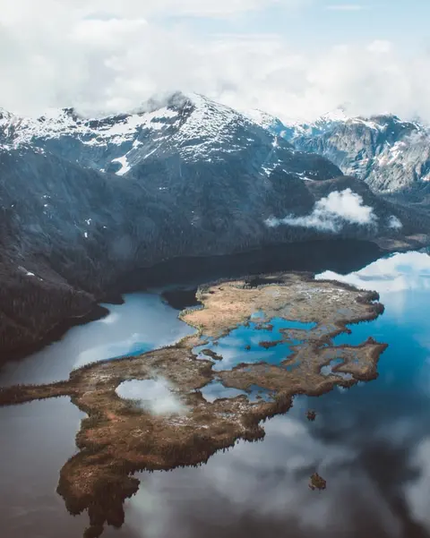
Ketchikan nojailee Revillagigedo-saarella Alaskan kaakkoisessa niemimaassa — kaupunki, joka on niin kapea, että paikalliset vitsailevat sen olevan kolme mailia pitkä ja kolme korttelia leveä. Tlingit-kansa on vuosisatojen ajan kunnioittanut tätä paikkaa runsaiden lohien kotiympäristönä, ja nykyään se tunnetaan maailman totemipylväiden pääkaupunkina: Saxman Native Village ja Totem Bight State Historical Park säilyttävät merkittävimmän kokoelman näitä monumentaalisia taideteoksia. Creek Street, värikkäiden historiallisten talojen laiturikatu, joka on rakennettu Ketchikanin puron ylle, on ehdoton vierailukohde. Kesä (touko–syyskuu) tarjoaa parhaan sään, jolloin puroissa voi nähdä lohien vaelluksen.
In the passage between Sumner Strait and Clarence Strait in Southeast Alaska’s Alexander Archipelago, midway between Price of Wales Island on the west and Zarembo Island on the east, is a small cluster of islands with a picturesque passageway between them called Snow Pass. It makes a scenic up-close route for your Seabourn ship during the transit.
Decision Passage is the western end of the Sumner Strait, which runs through the Alexander Archipelago into the Pacific Ocean in Southeastern Alaska, bounded on the north by Kuiu Island and Cape Decision, the location of a 1932 lighthouse. This is the route your ship takes when coming from or going to the colorful historic community of Sitka on the west coast of Baranof Island, which was originally the Russian fortress town of New Archangel.
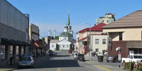
Sitka, joka sijaitsee Baranof-saarella Kaakkois-Alaskan villillä länsirannikolla, on yksi Tyynenmeren luoteisosan historian rikkaimmista satamista — paikka, jossa venäläiset ortodoksiset sipulikuplat kohoavat totemipaalujen yläpuolelle ja suuri lauhkea sademetsä ulottuu veden rajaan asti. Sitkan kansallinen historiallinen puisto säilyttää vuoden 1804 taistelun paikan Tlingit-sotureiden ja venäläisten siirtolaisten välillä sekä upean kokoelman monumentaalisia paaluja. Valaiden katselu, merinisäkkäiden keskellä meloaminen ja ruskeakarhujen bongaaminen ympäröivässä erämaassa määrittävät ulkoilmaelämystä. Touko–syyskuu tarjoaa parhaat saavutettavuuden ja valon olosuhteet.
Yakutat Bay is 18 miles wide at its entry, and cuts from the Gulf of Alaska into Disenchantment Bay, the entryway to the huge Hubbard Glacier, North America’s largest tidewater glacier. As the bay narrows and the shorelines draw closer, the 400-foot face of the glacier exerts a luminous, ghostly presence, often from as much as 30 miles away. More and more floating ice dimples the surface of the water, and seals bob up and disappear again. The chilled air from the glacier flows in a downdraft of cold that gives rise to mists and gray clouds, through which the vivid blue of the ice wall shimmers. It is an impressive sight of nature’s immense raw workplace, shaping the earth itself as part of an endless cycle of water from the sea evaporating to the sky, falling as snow on the heights and inching over centuries back again to the sea.
The Hubbard Glacier is the largest, and one of the most spectacular tidewater glaciers in North America. Its ice cliffs, some 400’ (121 m) tall, calve icebergs into the fjord, which may frequently be larger than a five-story building. The glacier’s surface is creased and contorted, resembling the wrinkled skin of a giant elephant. Records show it has been growing in thickness and advancing since 1895. This stands in stark contrast to other glaciers around the world, most of which have been receding during the past century. In 2002, the glacier blocked Russell Fjord for two and a half months, raising water levels 61’ (18 m) and threatening local communities with flooding. Nutrient-rich waters along the glacier face attract many species. Gulls and kittiwake colonies adorn smaller islands and harbor seals patrol the icy waters. In 1890, Israel Russell explored the area of Yakutat Bay and Hubbard Glacier, naming it after Gardiner G. Hubbard, a financier of his expedition and a founder and the first president of the National Geographic Society. VIEW CRUISES
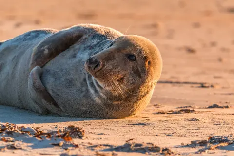
Inianin saaret ovat villi, asumatonta saaristo Alaskan Cross Soundin suulla, tunnettu poikkeuksellisista kohtaamisista villieläinten kanssa, kuten kuuttahaitten kuplaverkkoruokailusta ja valtavista Stellerin merileijonien koloniasta. Välttämättömiin kokemuksiin kuuluu Zodiac-retket saariston karuilla rannoilla, yhteistyössä tapahtuvan valasruokailun seuraaminen sekä meren elämää kuhisevien vuorovesialtaiden tutkiminen. Vieraile heinä–elokuussa, jolloin valasten aktiivisuus on huipussaan ja merisää parhaimmillaan.
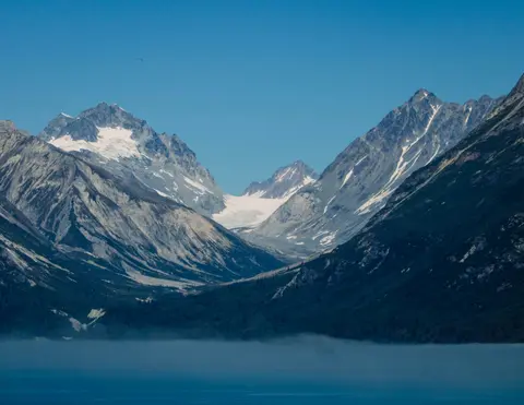
Icy Strait Point on upea Alaskan satama, joka tunnetaan henkeäsalpaavasta luonnonkauneudestaan ja rikkaasta alkuperäiskansa tlingitin kulttuuristaan. Pakollisiin kokemuksiin kuuluu tuoreen paikallisen merenelävän nauttiminen sekä villieläinretket Glacier Bayn kansallispuistossa. Paras aika vierailla on kesäkuukausina, jolloin sää on leuto ja villieläimiä on runsaasti.
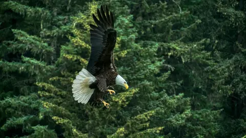
Haines on aito alaskalainen kaupunki Pohjois-Amerikan syvimmän vuonon rannalla, koti maailman suurimmalle kaljujen kotkien kokoontumiselle — jopa neljätuhatta lintua Chilkat-joen varrella — sekä kukoistava taideyhteisö, joka vaalii Tlingitin kulttuuriperinteitä. Vieraile kesäkuusta elokuuhun Cunardin tai Lindbladin risteilyillä, jolloin voit kokea jäätikköhelikopterin laskeutumiset ja rannikon patikoinnit, tai lokakuusta helmikuuhun nauttiaksesi ainutlaatuisesta kotkiesityksestä, joka tekee Hainesista Alaskan parhaiten varjellun salaisuuden.
Lynn Canal is a 90-mile long inlet into Alaska’s coast running from the Chilkat River in the north to the Chatham Strait and Stephens Passage in the south. Because it connects the towns of Skagway and Haines to Juneau and the rest of the Inside Passage, it is an important shipping lane for ferries, cargo and cruise ships, and was a crucial passageway to the Klondike gold fields during the Gold Rush. It was discovered by Joseph Whidbey in 1794 and named by George Vancouver after his birthplace, King’s Lynn in Norfolk, England. More than 2,000 feet in depth, it is one of the deepest and longest fjords in the world, and the deepest in North America outside Greenland.
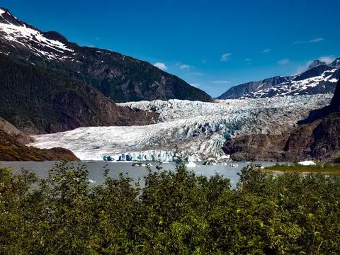
Yhdysvaltojen ainoa osavaltion pääkaupunki, johon ei pääse maanteitse, Juneau palkitsee matkansa villillä suuruudellaan, jota harvat kaupungit maailmassa voivat ylittää. Mendenhallin jäätikkö — ikiaikaisen jään elävä joki — sijaitsee vain viisitoista minuuttia keskustasta, missä vesitasot leijailevat merenrannalla, jota reunustavat kuusimetsien peittämät vuoret, jotka syöksyvät suoraan mereen. Pakollinen elämys on helikopterin laskeutuminen jäätikön ylle tai valassafarin tekeminen Stephens Passagessa, missä kuuttahait hyppivät hämmästyttävän lähellä. Juneau on lämpimimmillään kesäkuusta elokuuhun, vaikka kesäpäivät voivatkin tuoda mukanaan kuuluisan Kaakkois-Alaskan sateen, joka pitää sademetsän ikuisesti hohtavana.
Day 1
Työntyneenä Tyynenmeren ja Coast-vuoriston väliin Vancouver on luonnollinen portti Alaskan sisäiseen kulkuväylään — kaupunki, jossa lauhkea sademetsä kohtaa lasiset tornit ja jossa Dungeness-ravun sekä villin sockeye-lohen maut määrittävät Tyynenmeren alueen keittiön, joka haastaa Pohjois-Amerikan parhaat. Kävele 22 kilometrin pituinen Stanley Parkin rantakatu, eksy Granville Islandin markkinoille ja ota sitten lautta Victoriaan ihailemaan edwardiaanista loistoa. Alaskan risteilykausi huipentuu toukokuusta syyskuuhun, tehden Vancouverista ihanteellisen lähtöpisteen yhdelle maailman upeimmista merimatkoista.
The Seymour Narrows is a 3-mile/5 km stretch of the Discovery Channel north of Vancouver Island, British Columbia that is notorious for the strength of the tidal currents flowing through it. The average width of the narrows is just 750 meters. During extreme tides, the current through the narrows is subject to severe Venturi effect, resulting in an increased velocity that can reach 15 knots. For much of its modern history, there was an additional hazard in the narrows called Ripple Rock, a shallow obstruction that claimed no fewer than 119 ships and 114 lives. In 1958, after months of tunneling and preparation, Ripple Rock was blown up in the largest commercial, non-nuclear explosion ever recorded in North America. Still, the navigation of Seymour Narrows is dependent on tidal and other conditions, and requires skill and technical accomplishment.
Day 2
The Queen Charlotte Sound lies between the Queen Charlotte Strait, which winds between Vancouver Island and the British Columbia mainland in the south, and Hecate Strait, which is northward, adjacent to the Haida Gwaii Islands off the Pacific coast of British Columbia. It is a broad reach in the long shipping route called the Inside Passage threading the myriad islands stretching from Washington’s Puget Sound to Alaska.
Day 3
Ketchikan nojailee Revillagigedo-saarella Alaskan kaakkoisessa niemimaassa — kaupunki, joka on niin kapea, että paikalliset vitsailevat sen olevan kolme mailia pitkä ja kolme korttelia leveä. Tlingit-kansa on vuosisatojen ajan kunnioittanut tätä paikkaa runsaiden lohien kotiympäristönä, ja nykyään se tunnetaan maailman totemipylväiden pääkaupunkina: Saxman Native Village ja Totem Bight State Historical Park säilyttävät merkittävimmän kokoelman näitä monumentaalisia taideteoksia. Creek Street, värikkäiden historiallisten talojen laiturikatu, joka on rakennettu Ketchikanin puron ylle, on ehdoton vierailukohde. Kesä (touko–syyskuu) tarjoaa parhaan sään, jolloin puroissa voi nähdä lohien vaelluksen.
In the passage between Sumner Strait and Clarence Strait in Southeast Alaska’s Alexander Archipelago, midway between Price of Wales Island on the west and Zarembo Island on the east, is a small cluster of islands with a picturesque passageway between them called Snow Pass. It makes a scenic up-close route for your Seabourn ship during the transit.
Decision Passage is the western end of the Sumner Strait, which runs through the Alexander Archipelago into the Pacific Ocean in Southeastern Alaska, bounded on the north by Kuiu Island and Cape Decision, the location of a 1932 lighthouse. This is the route your ship takes when coming from or going to the colorful historic community of Sitka on the west coast of Baranof Island, which was originally the Russian fortress town of New Archangel.
Day 4
Sitka, joka sijaitsee Baranof-saarella Kaakkois-Alaskan villillä länsirannikolla, on yksi Tyynenmeren luoteisosan historian rikkaimmista satamista — paikka, jossa venäläiset ortodoksiset sipulikuplat kohoavat totemipaalujen yläpuolelle ja suuri lauhkea sademetsä ulottuu veden rajaan asti. Sitkan kansallinen historiallinen puisto säilyttää vuoden 1804 taistelun paikan Tlingit-sotureiden ja venäläisten siirtolaisten välillä sekä upean kokoelman monumentaalisia paaluja. Valaiden katselu, merinisäkkäiden keskellä meloaminen ja ruskeakarhujen bongaaminen ympäröivässä erämaassa määrittävät ulkoilmaelämystä. Touko–syyskuu tarjoaa parhaat saavutettavuuden ja valon olosuhteet.
Day 5
Yakutat Bay is 18 miles wide at its entry, and cuts from the Gulf of Alaska into Disenchantment Bay, the entryway to the huge Hubbard Glacier, North America’s largest tidewater glacier. As the bay narrows and the shorelines draw closer, the 400-foot face of the glacier exerts a luminous, ghostly presence, often from as much as 30 miles away. More and more floating ice dimples the surface of the water, and seals bob up and disappear again. The chilled air from the glacier flows in a downdraft of cold that gives rise to mists and gray clouds, through which the vivid blue of the ice wall shimmers. It is an impressive sight of nature’s immense raw workplace, shaping the earth itself as part of an endless cycle of water from the sea evaporating to the sky, falling as snow on the heights and inching over centuries back again to the sea.
The Hubbard Glacier is the largest, and one of the most spectacular tidewater glaciers in North America. Its ice cliffs, some 400’ (121 m) tall, calve icebergs into the fjord, which may frequently be larger than a five-story building. The glacier’s surface is creased and contorted, resembling the wrinkled skin of a giant elephant. Records show it has been growing in thickness and advancing since 1895. This stands in stark contrast to other glaciers around the world, most of which have been receding during the past century. In 2002, the glacier blocked Russell Fjord for two and a half months, raising water levels 61’ (18 m) and threatening local communities with flooding. Nutrient-rich waters along the glacier face attract many species. Gulls and kittiwake colonies adorn smaller islands and harbor seals patrol the icy waters. In 1890, Israel Russell explored the area of Yakutat Bay and Hubbard Glacier, naming it after Gardiner G. Hubbard, a financier of his expedition and a founder and the first president of the National Geographic Society. VIEW CRUISES
Day 6
Inianin saaret ovat villi, asumatonta saaristo Alaskan Cross Soundin suulla, tunnettu poikkeuksellisista kohtaamisista villieläinten kanssa, kuten kuuttahaitten kuplaverkkoruokailusta ja valtavista Stellerin merileijonien koloniasta. Välttämättömiin kokemuksiin kuuluu Zodiac-retket saariston karuilla rannoilla, yhteistyössä tapahtuvan valasruokailun seuraaminen sekä meren elämää kuhisevien vuorovesialtaiden tutkiminen. Vieraile heinä–elokuussa, jolloin valasten aktiivisuus on huipussaan ja merisää parhaimmillaan.
Icy Strait Point on upea Alaskan satama, joka tunnetaan henkeäsalpaavasta luonnonkauneudestaan ja rikkaasta alkuperäiskansa tlingitin kulttuuristaan. Pakollisiin kokemuksiin kuuluu tuoreen paikallisen merenelävän nauttiminen sekä villieläinretket Glacier Bayn kansallispuistossa. Paras aika vierailla on kesäkuukausina, jolloin sää on leuto ja villieläimiä on runsaasti.
Day 7
Haines on aito alaskalainen kaupunki Pohjois-Amerikan syvimmän vuonon rannalla, koti maailman suurimmalle kaljujen kotkien kokoontumiselle — jopa neljätuhatta lintua Chilkat-joen varrella — sekä kukoistava taideyhteisö, joka vaalii Tlingitin kulttuuriperinteitä. Vieraile kesäkuusta elokuuhun Cunardin tai Lindbladin risteilyillä, jolloin voit kokea jäätikköhelikopterin laskeutumiset ja rannikon patikoinnit, tai lokakuusta helmikuuhun nauttiaksesi ainutlaatuisesta kotkiesityksestä, joka tekee Hainesista Alaskan parhaiten varjellun salaisuuden.
Lynn Canal is a 90-mile long inlet into Alaska’s coast running from the Chilkat River in the north to the Chatham Strait and Stephens Passage in the south. Because it connects the towns of Skagway and Haines to Juneau and the rest of the Inside Passage, it is an important shipping lane for ferries, cargo and cruise ships, and was a crucial passageway to the Klondike gold fields during the Gold Rush. It was discovered by Joseph Whidbey in 1794 and named by George Vancouver after his birthplace, King’s Lynn in Norfolk, England. More than 2,000 feet in depth, it is one of the deepest and longest fjords in the world, and the deepest in North America outside Greenland.
Day 8
Yhdysvaltojen ainoa osavaltion pääkaupunki, johon ei pääse maanteitse, Juneau palkitsee matkansa villillä suuruudellaan, jota harvat kaupungit maailmassa voivat ylittää. Mendenhallin jäätikkö — ikiaikaisen jään elävä joki — sijaitsee vain viisitoista minuuttia keskustasta, missä vesitasot leijailevat merenrannalla, jota reunustavat kuusimetsien peittämät vuoret, jotka syöksyvät suoraan mereen. Pakollinen elämys on helikopterin laskeutuminen jäätikön ylle tai valassafarin tekeminen Stephens Passagessa, missä kuuttahait hyppivät hämmästyttävän lähellä. Juneau on lämpimimmillään kesäkuusta elokuuhun, vaikka kesäpäivät voivatkin tuoda mukanaan kuuluisan Kaakkois-Alaskan sateen, joka pitää sademetsän ikuisesti hohtavana.
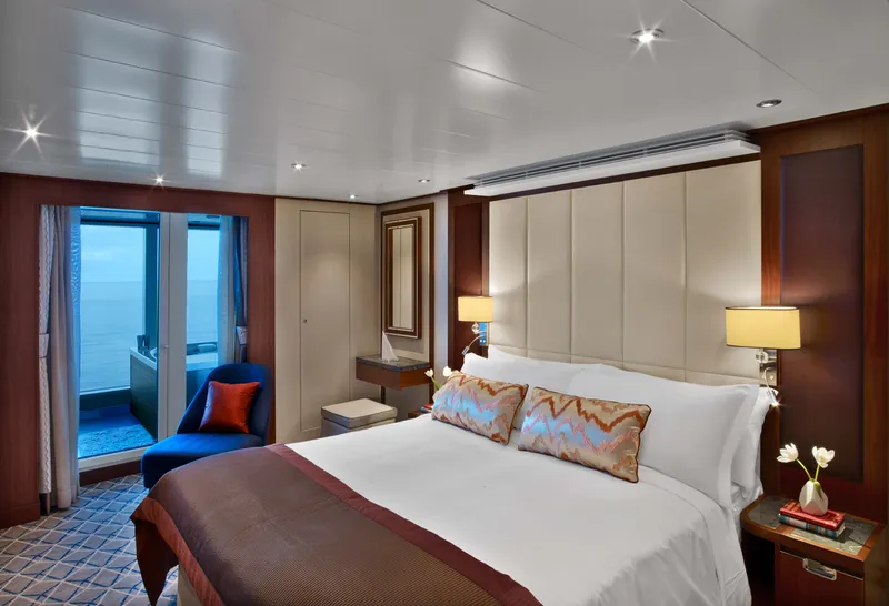
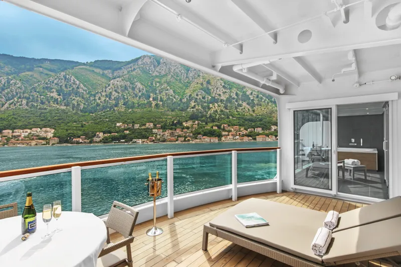

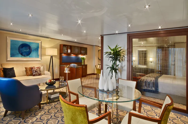
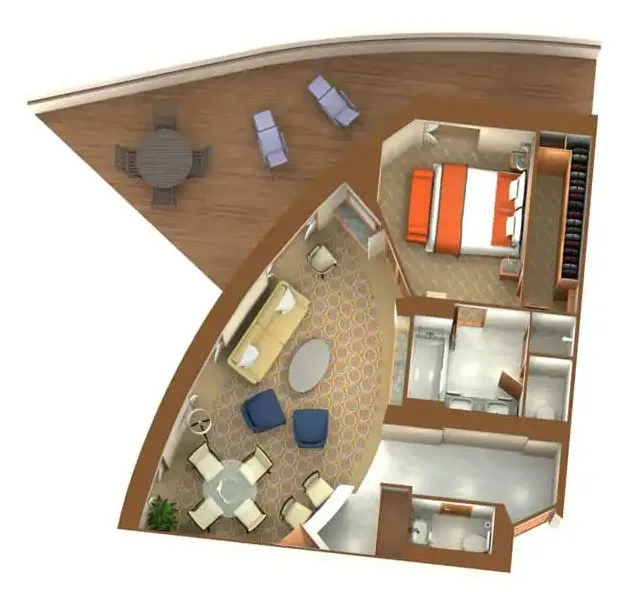
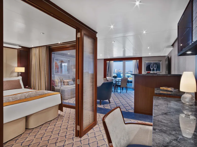


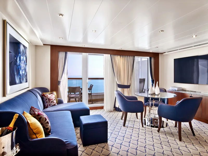

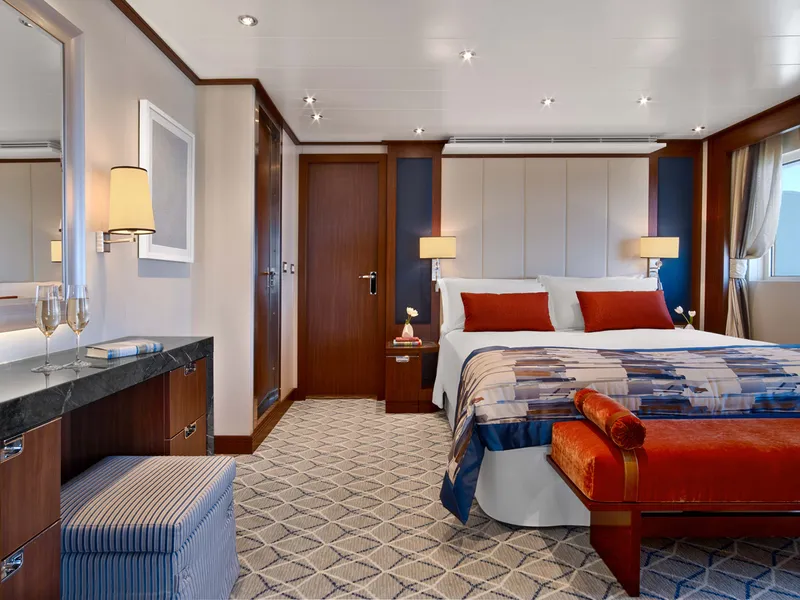
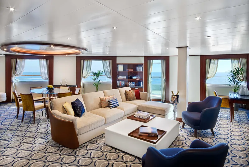
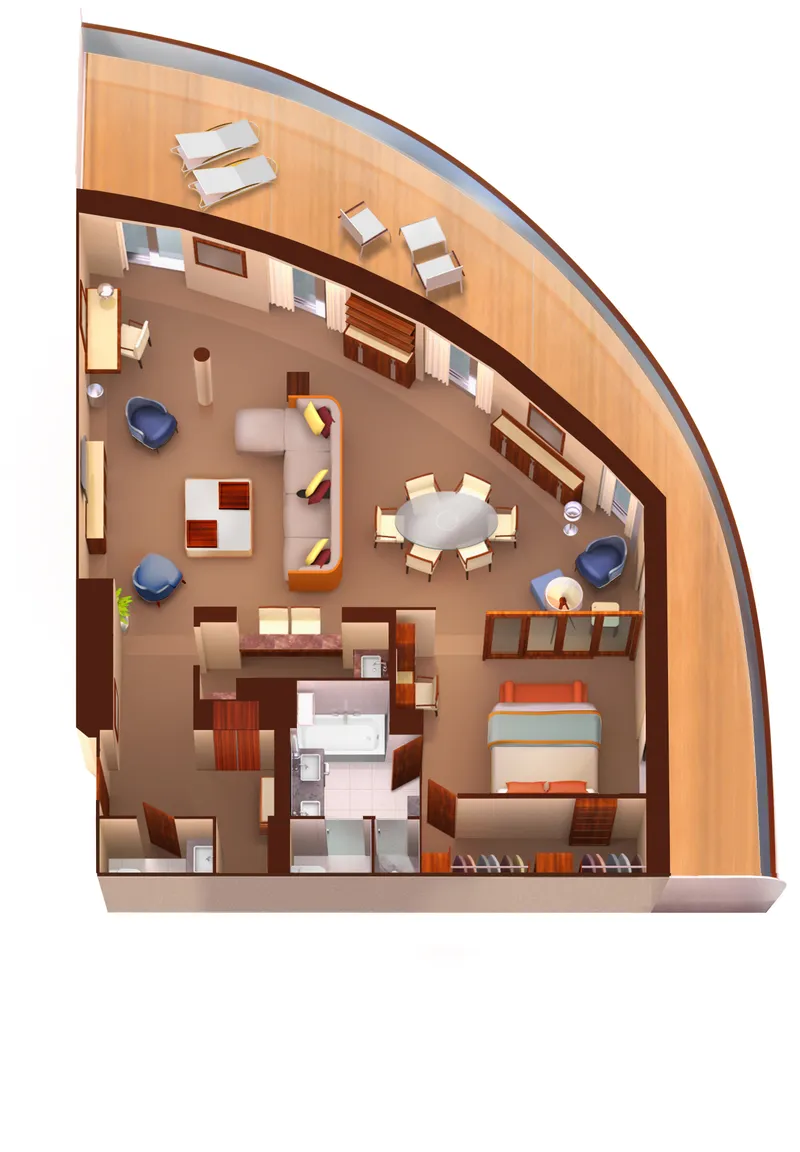
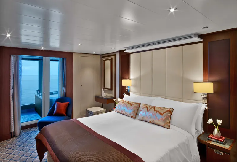
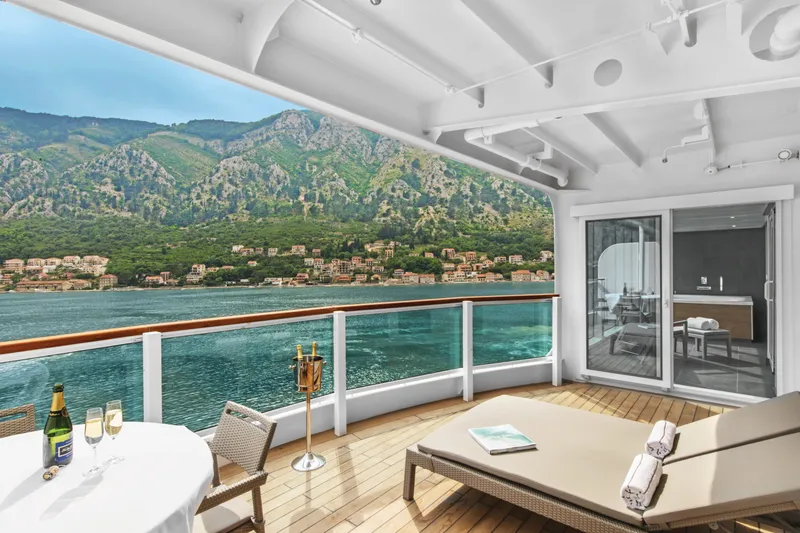

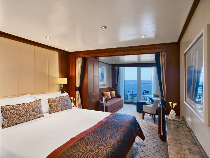
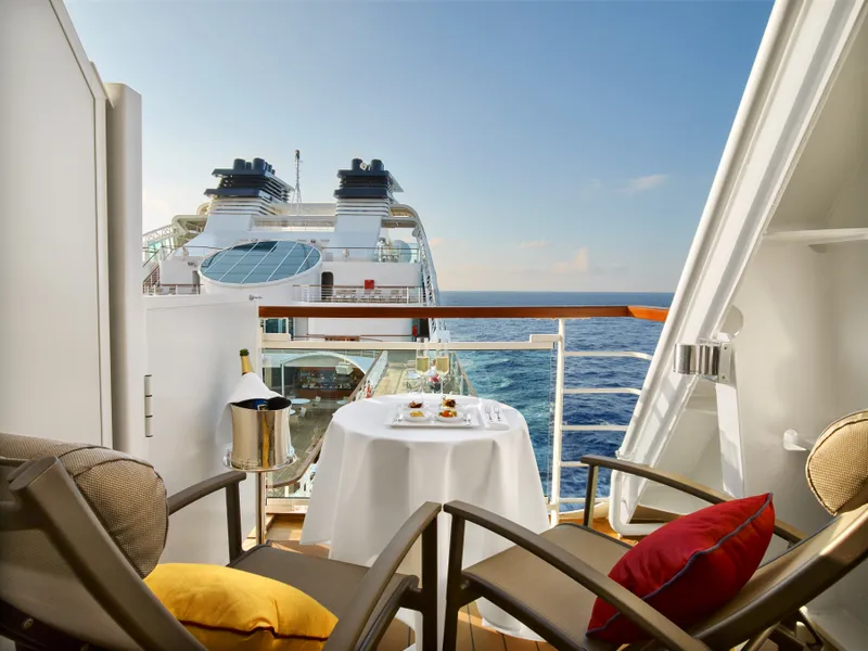



Our cruise specialists can help you find the perfect cabin and the best available pricing.
(+886) 02-2721-7300Contact Advisor