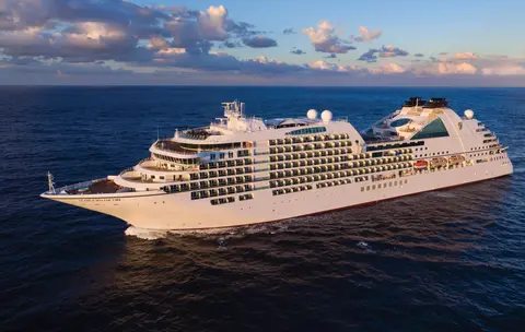
सीबोर्न7731A
14-दिन का अलास्का ग्लेशियर्स, फजॉर्ड और अंदरूनी मार्ग
Date
2027-05-28
Duration
14 nights
Departure Port
वैंकूवर
कनाडा
Arrival Port
वैंकूवर
कनाडा
Rating
Luxury
Theme
—
Date
2027-05-28
Duration
14 nights
Departure Port
वैंकूवर
कनाडा
Arrival Port
वैंकूवर
कनाडा
Rating
Luxury
Theme
—

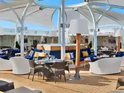




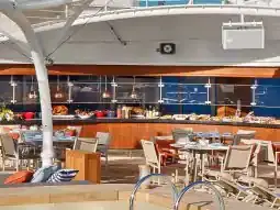
सीबोर्न
2016
—
40,350 GT
600
266
330
690 m
28 m
19 knots
No
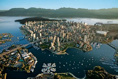
प्रशांत और कोस्ट पर्वतों के बीच दबा हुआ, वैंकूवर अलास्का के इनसाइड पासेज का प्राकृतिक द्वार है — एक ऐसा शहर जहाँ समशीतोष्ण वर्षावन कांच की टावरों से मिलता है और जहाँ डंजेनेस केकड़ा और जंगली सॉकेई सामन एक प्रशांत रिम व्यंजन को परिभाषित करते हैं जो उत्तरी अमेरिका में किसी भी चीज़ से मुकाबला करता है। 22 किलोमीटर स्टेनली पार्क सीवॉल पर चलें, ग्रैनविल द्वीप बाजार में खो जाएँ, फिर विक्टोरिया के एडवर्डियन वैभव के लिए फेरी लें। अलास्का क्रूज सीजन मई से सितंबर तक अपने चरम पर होता है, जिससे वैंकूवर दुनिया की महान महासागरीय यात्राओं में से एक के लिए एक आदर्श प्रारंभिक बिंदु बन जाता है।
The Seymour Narrows is a 3-mile/5 km stretch of the Discovery Channel north of Vancouver Island, British Columbia that is notorious for the strength of the tidal currents flowing through it. The average width of the narrows is just 750 meters. During extreme tides, the current through the narrows is subject to severe Venturi effect, resulting in an increased velocity that can reach 15 knots. For much of its modern history, there was an additional hazard in the narrows called Ripple Rock, a shallow obstruction that claimed no fewer than 119 ships and 114 lives. In 1958, after months of tunneling and preparation, Ripple Rock was blown up in the largest commercial, non-nuclear explosion ever recorded in North America. Still, the navigation of Seymour Narrows is dependent on tidal and other conditions, and requires skill and technical accomplishment.
The Queen Charlotte Sound lies between the Queen Charlotte Strait, which winds between Vancouver Island and the British Columbia mainland in the south, and Hecate Strait, which is northward, adjacent to the Haida Gwaii Islands off the Pacific coast of British Columbia. It is a broad reach in the long shipping route called the Inside Passage threading the myriad islands stretching from Washington’s Puget Sound to Alaska.
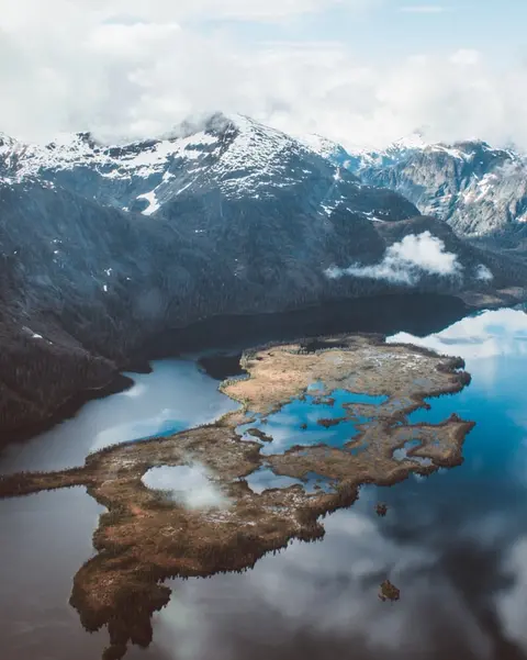
केचिकन अलास्का के दक्षिणपूर्वी पैनहैंडल में रेविलागिगेडो द्वीप के वनस्पति तट पर स्थित है — एक ऐसा नगर जो इतना संकरा है कि स्थानीय लोग मजाक करते हैं कि यह तीन मील लंबा और तीन ब्लॉक चौड़ा है। इसे त्लिंगित लोगों द्वारा सहस्त्राब्दियों से सामृद्ध सैल्मन के स्थान के रूप में पूजा जाता है, आज इसे विश्व के टोटेम पोल की राजधानी के रूप में मनाया जाता है: सैक्समैन नेटिव विलेज और टोटेम बाइट स्टेट हिस्टोरिकल पार्क में संग्रह इन स्मारकीय कलाकृतियों का सबसे महत्वपूर्ण संकेंद्रण संरक्षित करते हैं। क्रीक स्ट्रीट, केचिकन क्रीक के ऊपर बने रंगीन ऐतिहासिक घरों का एक बोर्डवाक, नहीं छोड़ना चाहिए। गर्मी (मई–सितंबर) सबसे अच्छे मौसम को लाती है, जब नीचे के नदियों में सैल्मन दौड़ते हैं।
In the passage between Sumner Strait and Clarence Strait in Southeast Alaska’s Alexander Archipelago, midway between Price of Wales Island on the west and Zarembo Island on the east, is a small cluster of islands with a picturesque passageway between them called Snow Pass. It makes a scenic up-close route for your Seabourn ship during the transit.
Decision Passage is the western end of the Sumner Strait, which runs through the Alexander Archipelago into the Pacific Ocean in Southeastern Alaska, bounded on the north by Kuiu Island and Cape Decision, the location of a 1932 lighthouse. This is the route your ship takes when coming from or going to the colorful historic community of Sitka on the west coast of Baranof Island, which was originally the Russian fortress town of New Archangel.
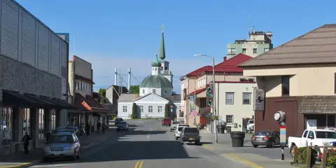
सिटका, दक्षिण-पूर्व अलास्का में बारानोफ द्वीप के जंगली पश्चिमी तट पर स्थित है, जो प्रशांत उत्तर-पश्चिम के सबसे ऐतिहासिक रूप से गूंजते बंदरगाहों में से एक है - एक ऐसा स्थान जहाँ रूसी ऑर्थोडॉक्स प्याज के गुंबद तोते के खंभों के ऊपर उठते हैं और महान समशीतोष्ण वर्षावन पानी के किनारे तक दबाते हैं। सिटका राष्ट्रीय ऐतिहासिक पार्क 1804 की लड़ाई के स्थल को संरक्षित करता है जो त्लिंगित योद्धाओं और रूसी उपनिवेशकों के बीच हुई थी, साथ ही एक शानदार संग्रह के साथ। व्हेल देखने, समुद्री ऊदबिलावों के बीच समुद्री कयाकिंग, और आसपास के वन्य जीवन में भूरे भालुओं की पहचान करना बाहरी अनुभव को परिभाषित करता है। मई से सितंबर के बीच सबसे अधिक सुलभ और उज्ज्वल परिस्थितियाँ होती हैं.
Yakutat Bay is 18 miles wide at its entry, and cuts from the Gulf of Alaska into Disenchantment Bay, the entryway to the huge Hubbard Glacier, North America’s largest tidewater glacier. As the bay narrows and the shorelines draw closer, the 400-foot face of the glacier exerts a luminous, ghostly presence, often from as much as 30 miles away. More and more floating ice dimples the surface of the water, and seals bob up and disappear again. The chilled air from the glacier flows in a downdraft of cold that gives rise to mists and gray clouds, through which the vivid blue of the ice wall shimmers. It is an impressive sight of nature’s immense raw workplace, shaping the earth itself as part of an endless cycle of water from the sea evaporating to the sky, falling as snow on the heights and inching over centuries back again to the sea.
The Hubbard Glacier is the largest, and one of the most spectacular tidewater glaciers in North America. Its ice cliffs, some 400’ (121 m) tall, calve icebergs into the fjord, which may frequently be larger than a five-story building. The glacier’s surface is creased and contorted, resembling the wrinkled skin of a giant elephant. Records show it has been growing in thickness and advancing since 1895. This stands in stark contrast to other glaciers around the world, most of which have been receding during the past century. In 2002, the glacier blocked Russell Fjord for two and a half months, raising water levels 61’ (18 m) and threatening local communities with flooding. Nutrient-rich waters along the glacier face attract many species. Gulls and kittiwake colonies adorn smaller islands and harbor seals patrol the icy waters. In 1890, Israel Russell explored the area of Yakutat Bay and Hubbard Glacier, naming it after Gardiner G. Hubbard, a financier of his expedition and a founder and the first president of the National Geographic Society. VIEW CRUISES
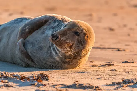
इनियन द्वीप अलास्का के क्रॉस साउंड के प्रवेश द्वार पर स्थित एक जंगली, निर्जन समूह है, जो असाधारण वन्यजीवों के अनुभवों के लिए प्रसिद्ध है, जिसमें हंपबैक व्हेल का बबल-नेट फीडिंग और विशाल स्टेलर समुद्री शेरों के उपनिवेश शामिल हैं। अवश्य करने योग्य गतिविधियों में द्वीपों के चट्टानी किनारों के साथ ज़ोडियाक भ्रमण, सहयोगी व्हेल फीडिंग देखना, और समुद्री जीवन से भरे ज्वारीय पूलों की खोज करना शामिल है। जुलाई से अगस्त का दौरा करें जब व्हेल गतिविधि अपने चरम पर होती है और समुद्र की सबसे अच्छी परिस्थितियाँ होती हैं।
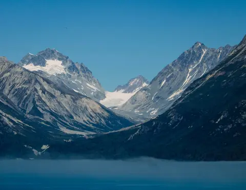
आइस स्ट्रेट पॉइंट एक अद्भुत अलास्कन बंदरगाह है, जो अपनी सांस लेने वाली प्राकृतिक सुंदरता और समृद्ध नेटिव ट्लिंगिट संस्कृति के लिए जाना जाता है। अनिवार्य अनुभवों में ताजा स्थानीय समुद्री भोजन का आनंद लेना और ग्लेशियर बे राष्ट्रीय उद्यान में वन्यजीव अभियानों पर जाना शामिल है। यात्रा करने का सबसे अच्छा मौसम गर्मियों के महीनों में होता है, जब मौसम हल्का होता है और वन्यजीव प्रचुर मात्रा में होते हैं।
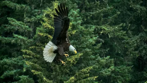
हैन्स, उत्तरी अमेरिका के सबसे गहरे फjord पर स्थित एक प्रामाणिक अलास्कन शहर है, जो दुनिया के सबसे बड़े गंजे ईगल के जमावड़े का घर है — चिलकट नदी के किनारे चार हजार तक के पक्षियों के साथ — और एक जीवंत कला समुदाय जो ट्लिंगिट सांस्कृतिक परंपराओं को संरक्षित करता है। जून से अगस्त तक क्यूनार्ड या लिंडब्लाड के माध्यम से ग्लेशियर हेलीकॉप्टर लैंडिंग और तटीय ट्रेकिंग के लिए यात्रा करें, या अक्टूबर से फरवरी तक असाधारण ईगल दृश्य के लिए जो हैन्स को अलास्का का सबसे बड़ा रहस्य बनाता है।
Lynn Canal is a 90-mile long inlet into Alaska’s coast running from the Chilkat River in the north to the Chatham Strait and Stephens Passage in the south. Because it connects the towns of Skagway and Haines to Juneau and the rest of the Inside Passage, it is an important shipping lane for ferries, cargo and cruise ships, and was a crucial passageway to the Klondike gold fields during the Gold Rush. It was discovered by Joseph Whidbey in 1794 and named by George Vancouver after his birthplace, King’s Lynn in Norfolk, England. More than 2,000 feet in depth, it is one of the deepest and longest fjords in the world, and the deepest in North America outside Greenland.
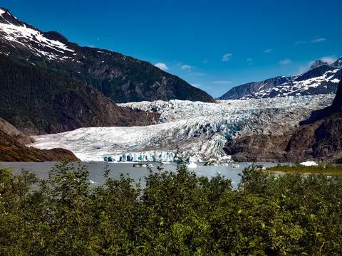
अमेरिका की एकमात्र राज्य राजधानी जो सड़क द्वारा पहुंच योग्य नहीं है, जूनौ यात्रा को एक वन्यजीव की भव्यता से पुरस्कृत करती है जो पृथ्वी के कुछ शहरों से मेल खाती है। मेनडेनहॉल ग्लेशियर — प्राचीन बर्फ की एक जीवित नदी — केवल पंद्रह मिनट की दूरी पर है, जहां फ्लोटप्लेन एक समुद्र तट के ऊपर उड़ते हैं जो स्प्रूस-लिपटे पहाड़ों से घिरा है जो सीधे समुद्र में गिरते हैं। अवश्य करने योग्य अनुभव बर्फ के क्षेत्र के शीर्ष पर हेलीकॉप्टर लैंडिंग या स्टीफेंस पासेज में व्हेल-देखने का भ्रमण है, जहां हम्पबैक आश्चर्यजनक निकटता में उछलते हैं। जूनौ जून से अगस्त तक सबसे गर्म रहता है, हालांकि गर्मियों के दिनों में भी प्रसिद्ध दक्षिण-पूर्व अलास्का की बारिश हो सकती है जो वर्षावनों को हमेशा चमकदार बनाए रखती है।
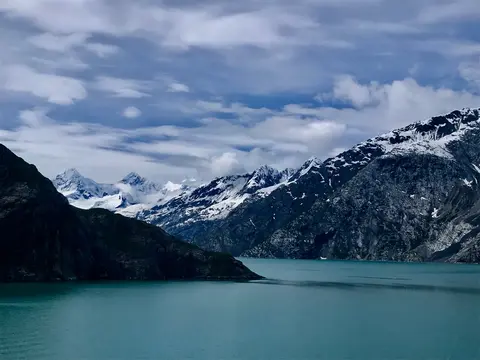
ग्लेशियर बे राष्ट्रीय उद्यान पृथ्वी पर सक्रिय ग्लेशियेशन के सबसे गहन परिदृश्यों में से एक है - दक्षिण-पूर्व अलास्का के 3.3 मिलियन एकड़ में जहाँ ज्वारीय ग्लेशियर कैथेड्रल के आकार के बर्फ के पहाड़ों को चमकीले नीले पानी के फजॉर्ड में गिराते हैं, और जहाँ भूमि अभी भी उठ रही है, उस बर्फ के वजन से मुक्त हो गई है जिसने इस पूरे क्षेत्र को केवल दो शताब्दियों पहले दबा दिया था। यह पार्क, जो केवल जहाज या छोटे विमान द्वारा पहुँचा जा सकता है, आगंतुकों को वन्यजीवों के साथ मुठभेड़ का अनुभव कराता है - हंपबैक व्हेल, भूरे भालू, समुद्री ऊदबिलाव, और पर्वतीय बकरियाँ - लगभग अभिभूत करने वाली भव्यता के परिदृश्य के खिलाफ। यह मौसम मई से सितंबर तक चलता है; देर से जून और जुलाई सबसे लंबे दिन और सबसे विश्वसनीय वन्यजीव गतिविधि प्रदान करते हैं।
Decision Passage is the western end of the Sumner Strait, which runs through the Alexander Archipelago into the Pacific Ocean in Southeastern Alaska, bounded on the north by Kuiu Island and Cape Decision, the location of a 1932 lighthouse. This is the route your ship takes when coming from or going to the colorful historic community of Sitka on the west coast of Baranof Island, which was originally the Russian fortress town of New Archangel.
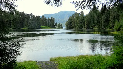
रैंगेल अलास्का के सबसे प्रामाणिक इनसाइड पैसिज़ बंदरगाहों में से एक है, जहाँ ट्लिंगित विरासत, प्राचीन पेट्रोग्लिफ्स और विश्व स्तरीय वन्यजीवों का संगम शक्तिशाली स्टिकिन नदी के मुहाने पर होता है। अनिवार्य अनुभवों में लेकोंटे ग्लेशियर तक जेट बोटिंग, अनान क्रीक पर भालुओं को मछली पकड़ते देखना और स्थानीय धूम्रपान की गई सामन का स्वाद लेना शामिल है। जुलाई और अगस्त सामन के प्रवाह और भालू देखने के लिए सर्वोत्तम समय प्रदान करते हैं।
Stikine Strait is a picturesque channel in the Alexander Archipelago of Alaska between Zarembo Island and Woronkofski and Etolin Islands near the mouth of the Stikine River south of Wrangell. It first appears on an 1848 Russian chart as Stakhin Strait and has been spelled variously on many charts since that time.
The 108-mile Behm Canal runs from the Clarence Strait through the Alexander Archipelago of Southeast Alaska, and into the channel separating Revillagigedo Island from the mainland. It forms part Inside Passage on the route between Ketchikan and the Misty Fjords National Monument. The canal was named by George Vancouver during his surveying expedition in 1793, in honor of Magnus von Behm, who had been governor of Kamchatka in the Russian Far East when Vancouver called at Petropavlovsk with Captain Cook’s expedition following the Cook’s murder in Hawaii.
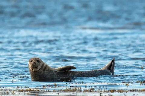
मिस्ट्री फजॉर्ड्स नेशनल मॉन्यूमेंट दक्षिण-पूर्व अलास्का में 930,000 हेक्टेयर का वन्य क्षेत्र है, जहाँ नंगे ग्रेनाइट चट्टानें स्थिर फजॉर्ड्स से उठती हैं, जो निरंतर धुंध और बादलों की परतों के माध्यम से होती हैं। यहाँ के अनिवार्य अनुभवों में शांत फजॉर्ड भुजाओं के माध्यम से कयाकिंग करना, झरनों और ज्वालामुखीय न्यू एडीस्टोन रॉक के पास ज़ोडियाक क्रूज़िंग करना, और स्वच्छ चैनलों में भालू, ईगल और ऑर्कास की खोज करना शामिल है। मई से सितंबर यात्रा का मौसम है, जिसमें बारिश इस स्मारक के अद्भुत वातावरण को बढ़ाती है।
Misty Fjords National Monument is a section of the Tongass National Forest in Alaska’s extreme southeastern Panhandle region. The monument consists of over two million acres of deeply cut fjords cradled in U-shaped valleys between mountain ranges rising 2,000 to 3,000 feet above sea level. The fjords themselves extend as much as 1,000 feet below the surface. These granite ranges are covered with virgin forest, and most of the monument is also a dedicated wilderness area. Misty Fjords inspired the explorer John Muir to proclaim them among the most beautiful places he had ever seen. Your ship will cruise among these spectacular forests, waterfalls and mountains. The onboard Ventures by Seabourn team will offer optional excursions including kayaking the fjords and a short sightseeing floatplane flight.
प्रिंस रूपर्ट, ब्रिटिश कोलंबिया के उत्तरी तट पर एक ऐतिहासिक रेलवे टर्मिनस, अपने गहरे त्सिम्शियन विरासत, विश्व स्तरीय हलिबूट मछली पकड़ने, और अंदरूनी मार्ग के साथ धुंधले वर्षावन के दृश्य के साथ आगंतुकों को मंत्रमुग्ध करता है। waterfront पर ताजा धूम्रपान सामन का स्वाद लें और उत्तरी प्रशांत कैनरी का अन्वेषण करें, जो कनाडा की सबसे पुरानी जीवित कैनरी है, ताकि बंदरगाह की समुद्री आत्मा के साथ एक जीवंत मुठभेड़ हो सके। यात्रा करने का सबसे अच्छा समय जून से अगस्त है, जब लंबे दिन प्रसिद्ध वर्षा को संतुलित करते हैं और तट पर वन्यजीवों की गतिविधि अपने चरम पर होती है।
Grenville Channel is a long, well-protected channel along the northern British Columbia coast between the large Pitt Island and the mainland. It is an important shipping lane, and you are likely to see ships of many different types and sizes as you pass through. The shores are mountainous on both sides, with two notable peaks about halfway through, Mt. Batchellor on the east side and Mt. Saunders on Pitt Island to the west. There are a number of Indian Reserves and Marine Parks in the mountains and narrow waterways off the channel.
Whale Channel is a picturesque waterway separating Gil Island from Princess Royal Island in British Columbia’s Inside Passage. Surrounded by snow-capped mountain ranges and teeming with marine life, It is a diversion from the main shipping lane, located roughly halfway between Prince Rupert and the First Nations village of Klemtu. VIEW CRUISES Skip Footer Content About Us
The Princess Royal Channel separates the largest island along British Columbia’s coast from the mainland. It is located roughly halfway between Bella Bella in the south and Prince Rupert in the north, in one of the province’s most remote areas. Princess Royal island was named in 1788 by Captain Charles Duncan, in honor of his ship, the Princess Royal. The island is uninhabited, although there are two small villages in the channel, the First Nations community of Klemtu on Swindle Island and Hartley Bay on the mainland. Wildlife, by contrast, is plentiful, including Kermode, black and grizzly bears, deer, wolves and foxes. Golden and bald eagles nest in the region, as well as the endangered marbled murrelet. In the waters, there are abundant salmon, elephant seals, whales, orcas and dolphins.
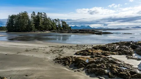
अलर्ट बे, कनाडा एक विशिष्ट बंदरगाह शहर है जहाँ गहरी सांस्कृतिक विरासत वास्तविक स्थानीय वातावरण से मिलती है, जिसे HX एक्सपेडिशंस द्वारा यात्रा कार्यक्रमों में शामिल किया गया है। अवश्य करने योग्य अनुभवों में ऐतिहासिक केंद्र में चलना शामिल है ताकि आप बहुस्तरीय वास्तुशिल्प विरासत का अनुभव कर सकें, और बंदरगाह क्षेत्र से दूर एक स्थानीय पसंदीदा प्रतिष्ठान में क्षेत्रीय पाक परंपराओं की खोज करना शामिल है। यात्रा करने का सर्वोत्तम समय जून से अगस्त है, जब गर्मियों के महीने सबसे गर्म तापमान और सबसे लंबे दिन लाते हैं।
Johnstone Strait is a well-protected shipping route passing 68 miles/110 km along the northeast shore of Vancouver Island between the island and the mainland of British Columbia. The strait is between 1 ½ miles and 3 miles wide, and leads from the broad Georgia Strait through a narrow channel called Discovery Passage. The strait was named by Vancouver in 1792 for James Johnstone, the master of one of his tenders during the survey expedition that revealed Vancouver Island to be an island. There are no cities or towns on the strait. The Johnstone Strait is the summer range of a large pod of seasonally resident orcas which are frequently seen in the area. VIEW CRUISES Skip Footer Content About Us Our Company News Careers Contact Us Video Gallery Accessibility Seabourn Club Seabourn Referral Program Travel Resources
The Seymour Narrows is a 3-mile/5 km stretch of the Discovery Channel north of Vancouver Island, British Columbia that is notorious for the strength of the tidal currents flowing through it. The average width of the narrows is just 750 meters. During extreme tides, the current through the narrows is subject to severe Venturi effect, resulting in an increased velocity that can reach 15 knots. For much of its modern history, there was an additional hazard in the narrows called Ripple Rock, a shallow obstruction that claimed no fewer than 119 ships and 114 lives. In 1958, after months of tunneling and preparation, Ripple Rock was blown up in the largest commercial, non-nuclear explosion ever recorded in North America. Still, the navigation of Seymour Narrows is dependent on tidal and other conditions, and requires skill and technical accomplishment.
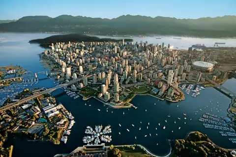
प्रशांत और कोस्ट पर्वतों के बीच दबा हुआ, वैंकूवर अलास्का के इनसाइड पासेज का प्राकृतिक द्वार है — एक ऐसा शहर जहाँ समशीतोष्ण वर्षावन कांच की टावरों से मिलता है और जहाँ डंजेनेस केकड़ा और जंगली सॉकेई सामन एक प्रशांत रिम व्यंजन को परिभाषित करते हैं जो उत्तरी अमेरिका में किसी भी चीज़ से मुकाबला करता है। 22 किलोमीटर स्टेनली पार्क सीवॉल पर चलें, ग्रैनविल द्वीप बाजार में खो जाएँ, फिर विक्टोरिया के एडवर्डियन वैभव के लिए फेरी लें। अलास्का क्रूज सीजन मई से सितंबर तक अपने चरम पर होता है, जिससे वैंकूवर दुनिया की महान महासागरीय यात्राओं में से एक के लिए एक आदर्श प्रारंभिक बिंदु बन जाता है।
Day 1
प्रशांत और कोस्ट पर्वतों के बीच दबा हुआ, वैंकूवर अलास्का के इनसाइड पासेज का प्राकृतिक द्वार है — एक ऐसा शहर जहाँ समशीतोष्ण वर्षावन कांच की टावरों से मिलता है और जहाँ डंजेनेस केकड़ा और जंगली सॉकेई सामन एक प्रशांत रिम व्यंजन को परिभाषित करते हैं जो उत्तरी अमेरिका में किसी भी चीज़ से मुकाबला करता है। 22 किलोमीटर स्टेनली पार्क सीवॉल पर चलें, ग्रैनविल द्वीप बाजार में खो जाएँ, फिर विक्टोरिया के एडवर्डियन वैभव के लिए फेरी लें। अलास्का क्रूज सीजन मई से सितंबर तक अपने चरम पर होता है, जिससे वैंकूवर दुनिया की महान महासागरीय यात्राओं में से एक के लिए एक आदर्श प्रारंभिक बिंदु बन जाता है।
The Seymour Narrows is a 3-mile/5 km stretch of the Discovery Channel north of Vancouver Island, British Columbia that is notorious for the strength of the tidal currents flowing through it. The average width of the narrows is just 750 meters. During extreme tides, the current through the narrows is subject to severe Venturi effect, resulting in an increased velocity that can reach 15 knots. For much of its modern history, there was an additional hazard in the narrows called Ripple Rock, a shallow obstruction that claimed no fewer than 119 ships and 114 lives. In 1958, after months of tunneling and preparation, Ripple Rock was blown up in the largest commercial, non-nuclear explosion ever recorded in North America. Still, the navigation of Seymour Narrows is dependent on tidal and other conditions, and requires skill and technical accomplishment.
Day 2
The Queen Charlotte Sound lies between the Queen Charlotte Strait, which winds between Vancouver Island and the British Columbia mainland in the south, and Hecate Strait, which is northward, adjacent to the Haida Gwaii Islands off the Pacific coast of British Columbia. It is a broad reach in the long shipping route called the Inside Passage threading the myriad islands stretching from Washington’s Puget Sound to Alaska.
Day 3
केचिकन अलास्का के दक्षिणपूर्वी पैनहैंडल में रेविलागिगेडो द्वीप के वनस्पति तट पर स्थित है — एक ऐसा नगर जो इतना संकरा है कि स्थानीय लोग मजाक करते हैं कि यह तीन मील लंबा और तीन ब्लॉक चौड़ा है। इसे त्लिंगित लोगों द्वारा सहस्त्राब्दियों से सामृद्ध सैल्मन के स्थान के रूप में पूजा जाता है, आज इसे विश्व के टोटेम पोल की राजधानी के रूप में मनाया जाता है: सैक्समैन नेटिव विलेज और टोटेम बाइट स्टेट हिस्टोरिकल पार्क में संग्रह इन स्मारकीय कलाकृतियों का सबसे महत्वपूर्ण संकेंद्रण संरक्षित करते हैं। क्रीक स्ट्रीट, केचिकन क्रीक के ऊपर बने रंगीन ऐतिहासिक घरों का एक बोर्डवाक, नहीं छोड़ना चाहिए। गर्मी (मई–सितंबर) सबसे अच्छे मौसम को लाती है, जब नीचे के नदियों में सैल्मन दौड़ते हैं।
In the passage between Sumner Strait and Clarence Strait in Southeast Alaska’s Alexander Archipelago, midway between Price of Wales Island on the west and Zarembo Island on the east, is a small cluster of islands with a picturesque passageway between them called Snow Pass. It makes a scenic up-close route for your Seabourn ship during the transit.
Decision Passage is the western end of the Sumner Strait, which runs through the Alexander Archipelago into the Pacific Ocean in Southeastern Alaska, bounded on the north by Kuiu Island and Cape Decision, the location of a 1932 lighthouse. This is the route your ship takes when coming from or going to the colorful historic community of Sitka on the west coast of Baranof Island, which was originally the Russian fortress town of New Archangel.
Day 4
सिटका, दक्षिण-पूर्व अलास्का में बारानोफ द्वीप के जंगली पश्चिमी तट पर स्थित है, जो प्रशांत उत्तर-पश्चिम के सबसे ऐतिहासिक रूप से गूंजते बंदरगाहों में से एक है - एक ऐसा स्थान जहाँ रूसी ऑर्थोडॉक्स प्याज के गुंबद तोते के खंभों के ऊपर उठते हैं और महान समशीतोष्ण वर्षावन पानी के किनारे तक दबाते हैं। सिटका राष्ट्रीय ऐतिहासिक पार्क 1804 की लड़ाई के स्थल को संरक्षित करता है जो त्लिंगित योद्धाओं और रूसी उपनिवेशकों के बीच हुई थी, साथ ही एक शानदार संग्रह के साथ। व्हेल देखने, समुद्री ऊदबिलावों के बीच समुद्री कयाकिंग, और आसपास के वन्य जीवन में भूरे भालुओं की पहचान करना बाहरी अनुभव को परिभाषित करता है। मई से सितंबर के बीच सबसे अधिक सुलभ और उज्ज्वल परिस्थितियाँ होती हैं.
Day 5
Yakutat Bay is 18 miles wide at its entry, and cuts from the Gulf of Alaska into Disenchantment Bay, the entryway to the huge Hubbard Glacier, North America’s largest tidewater glacier. As the bay narrows and the shorelines draw closer, the 400-foot face of the glacier exerts a luminous, ghostly presence, often from as much as 30 miles away. More and more floating ice dimples the surface of the water, and seals bob up and disappear again. The chilled air from the glacier flows in a downdraft of cold that gives rise to mists and gray clouds, through which the vivid blue of the ice wall shimmers. It is an impressive sight of nature’s immense raw workplace, shaping the earth itself as part of an endless cycle of water from the sea evaporating to the sky, falling as snow on the heights and inching over centuries back again to the sea.
The Hubbard Glacier is the largest, and one of the most spectacular tidewater glaciers in North America. Its ice cliffs, some 400’ (121 m) tall, calve icebergs into the fjord, which may frequently be larger than a five-story building. The glacier’s surface is creased and contorted, resembling the wrinkled skin of a giant elephant. Records show it has been growing in thickness and advancing since 1895. This stands in stark contrast to other glaciers around the world, most of which have been receding during the past century. In 2002, the glacier blocked Russell Fjord for two and a half months, raising water levels 61’ (18 m) and threatening local communities with flooding. Nutrient-rich waters along the glacier face attract many species. Gulls and kittiwake colonies adorn smaller islands and harbor seals patrol the icy waters. In 1890, Israel Russell explored the area of Yakutat Bay and Hubbard Glacier, naming it after Gardiner G. Hubbard, a financier of his expedition and a founder and the first president of the National Geographic Society. VIEW CRUISES
Day 6
इनियन द्वीप अलास्का के क्रॉस साउंड के प्रवेश द्वार पर स्थित एक जंगली, निर्जन समूह है, जो असाधारण वन्यजीवों के अनुभवों के लिए प्रसिद्ध है, जिसमें हंपबैक व्हेल का बबल-नेट फीडिंग और विशाल स्टेलर समुद्री शेरों के उपनिवेश शामिल हैं। अवश्य करने योग्य गतिविधियों में द्वीपों के चट्टानी किनारों के साथ ज़ोडियाक भ्रमण, सहयोगी व्हेल फीडिंग देखना, और समुद्री जीवन से भरे ज्वारीय पूलों की खोज करना शामिल है। जुलाई से अगस्त का दौरा करें जब व्हेल गतिविधि अपने चरम पर होती है और समुद्र की सबसे अच्छी परिस्थितियाँ होती हैं।
आइस स्ट्रेट पॉइंट एक अद्भुत अलास्कन बंदरगाह है, जो अपनी सांस लेने वाली प्राकृतिक सुंदरता और समृद्ध नेटिव ट्लिंगिट संस्कृति के लिए जाना जाता है। अनिवार्य अनुभवों में ताजा स्थानीय समुद्री भोजन का आनंद लेना और ग्लेशियर बे राष्ट्रीय उद्यान में वन्यजीव अभियानों पर जाना शामिल है। यात्रा करने का सबसे अच्छा मौसम गर्मियों के महीनों में होता है, जब मौसम हल्का होता है और वन्यजीव प्रचुर मात्रा में होते हैं।
Day 7
हैन्स, उत्तरी अमेरिका के सबसे गहरे फjord पर स्थित एक प्रामाणिक अलास्कन शहर है, जो दुनिया के सबसे बड़े गंजे ईगल के जमावड़े का घर है — चिलकट नदी के किनारे चार हजार तक के पक्षियों के साथ — और एक जीवंत कला समुदाय जो ट्लिंगिट सांस्कृतिक परंपराओं को संरक्षित करता है। जून से अगस्त तक क्यूनार्ड या लिंडब्लाड के माध्यम से ग्लेशियर हेलीकॉप्टर लैंडिंग और तटीय ट्रेकिंग के लिए यात्रा करें, या अक्टूबर से फरवरी तक असाधारण ईगल दृश्य के लिए जो हैन्स को अलास्का का सबसे बड़ा रहस्य बनाता है।
Lynn Canal is a 90-mile long inlet into Alaska’s coast running from the Chilkat River in the north to the Chatham Strait and Stephens Passage in the south. Because it connects the towns of Skagway and Haines to Juneau and the rest of the Inside Passage, it is an important shipping lane for ferries, cargo and cruise ships, and was a crucial passageway to the Klondike gold fields during the Gold Rush. It was discovered by Joseph Whidbey in 1794 and named by George Vancouver after his birthplace, King’s Lynn in Norfolk, England. More than 2,000 feet in depth, it is one of the deepest and longest fjords in the world, and the deepest in North America outside Greenland.
Day 8
अमेरिका की एकमात्र राज्य राजधानी जो सड़क द्वारा पहुंच योग्य नहीं है, जूनौ यात्रा को एक वन्यजीव की भव्यता से पुरस्कृत करती है जो पृथ्वी के कुछ शहरों से मेल खाती है। मेनडेनहॉल ग्लेशियर — प्राचीन बर्फ की एक जीवित नदी — केवल पंद्रह मिनट की दूरी पर है, जहां फ्लोटप्लेन एक समुद्र तट के ऊपर उड़ते हैं जो स्प्रूस-लिपटे पहाड़ों से घिरा है जो सीधे समुद्र में गिरते हैं। अवश्य करने योग्य अनुभव बर्फ के क्षेत्र के शीर्ष पर हेलीकॉप्टर लैंडिंग या स्टीफेंस पासेज में व्हेल-देखने का भ्रमण है, जहां हम्पबैक आश्चर्यजनक निकटता में उछलते हैं। जूनौ जून से अगस्त तक सबसे गर्म रहता है, हालांकि गर्मियों के दिनों में भी प्रसिद्ध दक्षिण-पूर्व अलास्का की बारिश हो सकती है जो वर्षावनों को हमेशा चमकदार बनाए रखती है।
Day 9
ग्लेशियर बे राष्ट्रीय उद्यान पृथ्वी पर सक्रिय ग्लेशियेशन के सबसे गहन परिदृश्यों में से एक है - दक्षिण-पूर्व अलास्का के 3.3 मिलियन एकड़ में जहाँ ज्वारीय ग्लेशियर कैथेड्रल के आकार के बर्फ के पहाड़ों को चमकीले नीले पानी के फजॉर्ड में गिराते हैं, और जहाँ भूमि अभी भी उठ रही है, उस बर्फ के वजन से मुक्त हो गई है जिसने इस पूरे क्षेत्र को केवल दो शताब्दियों पहले दबा दिया था। यह पार्क, जो केवल जहाज या छोटे विमान द्वारा पहुँचा जा सकता है, आगंतुकों को वन्यजीवों के साथ मुठभेड़ का अनुभव कराता है - हंपबैक व्हेल, भूरे भालू, समुद्री ऊदबिलाव, और पर्वतीय बकरियाँ - लगभग अभिभूत करने वाली भव्यता के परिदृश्य के खिलाफ। यह मौसम मई से सितंबर तक चलता है; देर से जून और जुलाई सबसे लंबे दिन और सबसे विश्वसनीय वन्यजीव गतिविधि प्रदान करते हैं।
Day 10
Decision Passage is the western end of the Sumner Strait, which runs through the Alexander Archipelago into the Pacific Ocean in Southeastern Alaska, bounded on the north by Kuiu Island and Cape Decision, the location of a 1932 lighthouse. This is the route your ship takes when coming from or going to the colorful historic community of Sitka on the west coast of Baranof Island, which was originally the Russian fortress town of New Archangel.
रैंगेल अलास्का के सबसे प्रामाणिक इनसाइड पैसिज़ बंदरगाहों में से एक है, जहाँ ट्लिंगित विरासत, प्राचीन पेट्रोग्लिफ्स और विश्व स्तरीय वन्यजीवों का संगम शक्तिशाली स्टिकिन नदी के मुहाने पर होता है। अनिवार्य अनुभवों में लेकोंटे ग्लेशियर तक जेट बोटिंग, अनान क्रीक पर भालुओं को मछली पकड़ते देखना और स्थानीय धूम्रपान की गई सामन का स्वाद लेना शामिल है। जुलाई और अगस्त सामन के प्रवाह और भालू देखने के लिए सर्वोत्तम समय प्रदान करते हैं।
Stikine Strait is a picturesque channel in the Alexander Archipelago of Alaska between Zarembo Island and Woronkofski and Etolin Islands near the mouth of the Stikine River south of Wrangell. It first appears on an 1848 Russian chart as Stakhin Strait and has been spelled variously on many charts since that time.
Day 11
The 108-mile Behm Canal runs from the Clarence Strait through the Alexander Archipelago of Southeast Alaska, and into the channel separating Revillagigedo Island from the mainland. It forms part Inside Passage on the route between Ketchikan and the Misty Fjords National Monument. The canal was named by George Vancouver during his surveying expedition in 1793, in honor of Magnus von Behm, who had been governor of Kamchatka in the Russian Far East when Vancouver called at Petropavlovsk with Captain Cook’s expedition following the Cook’s murder in Hawaii.
मिस्ट्री फजॉर्ड्स नेशनल मॉन्यूमेंट दक्षिण-पूर्व अलास्का में 930,000 हेक्टेयर का वन्य क्षेत्र है, जहाँ नंगे ग्रेनाइट चट्टानें स्थिर फजॉर्ड्स से उठती हैं, जो निरंतर धुंध और बादलों की परतों के माध्यम से होती हैं। यहाँ के अनिवार्य अनुभवों में शांत फजॉर्ड भुजाओं के माध्यम से कयाकिंग करना, झरनों और ज्वालामुखीय न्यू एडीस्टोन रॉक के पास ज़ोडियाक क्रूज़िंग करना, और स्वच्छ चैनलों में भालू, ईगल और ऑर्कास की खोज करना शामिल है। मई से सितंबर यात्रा का मौसम है, जिसमें बारिश इस स्मारक के अद्भुत वातावरण को बढ़ाती है।
Misty Fjords National Monument is a section of the Tongass National Forest in Alaska’s extreme southeastern Panhandle region. The monument consists of over two million acres of deeply cut fjords cradled in U-shaped valleys between mountain ranges rising 2,000 to 3,000 feet above sea level. The fjords themselves extend as much as 1,000 feet below the surface. These granite ranges are covered with virgin forest, and most of the monument is also a dedicated wilderness area. Misty Fjords inspired the explorer John Muir to proclaim them among the most beautiful places he had ever seen. Your ship will cruise among these spectacular forests, waterfalls and mountains. The onboard Ventures by Seabourn team will offer optional excursions including kayaking the fjords and a short sightseeing floatplane flight.
Day 12
प्रिंस रूपर्ट, ब्रिटिश कोलंबिया के उत्तरी तट पर एक ऐतिहासिक रेलवे टर्मिनस, अपने गहरे त्सिम्शियन विरासत, विश्व स्तरीय हलिबूट मछली पकड़ने, और अंदरूनी मार्ग के साथ धुंधले वर्षावन के दृश्य के साथ आगंतुकों को मंत्रमुग्ध करता है। waterfront पर ताजा धूम्रपान सामन का स्वाद लें और उत्तरी प्रशांत कैनरी का अन्वेषण करें, जो कनाडा की सबसे पुरानी जीवित कैनरी है, ताकि बंदरगाह की समुद्री आत्मा के साथ एक जीवंत मुठभेड़ हो सके। यात्रा करने का सबसे अच्छा समय जून से अगस्त है, जब लंबे दिन प्रसिद्ध वर्षा को संतुलित करते हैं और तट पर वन्यजीवों की गतिविधि अपने चरम पर होती है।
Day 13
Grenville Channel is a long, well-protected channel along the northern British Columbia coast between the large Pitt Island and the mainland. It is an important shipping lane, and you are likely to see ships of many different types and sizes as you pass through. The shores are mountainous on both sides, with two notable peaks about halfway through, Mt. Batchellor on the east side and Mt. Saunders on Pitt Island to the west. There are a number of Indian Reserves and Marine Parks in the mountains and narrow waterways off the channel.
Whale Channel is a picturesque waterway separating Gil Island from Princess Royal Island in British Columbia’s Inside Passage. Surrounded by snow-capped mountain ranges and teeming with marine life, It is a diversion from the main shipping lane, located roughly halfway between Prince Rupert and the First Nations village of Klemtu. VIEW CRUISES Skip Footer Content About Us
The Princess Royal Channel separates the largest island along British Columbia’s coast from the mainland. It is located roughly halfway between Bella Bella in the south and Prince Rupert in the north, in one of the province’s most remote areas. Princess Royal island was named in 1788 by Captain Charles Duncan, in honor of his ship, the Princess Royal. The island is uninhabited, although there are two small villages in the channel, the First Nations community of Klemtu on Swindle Island and Hartley Bay on the mainland. Wildlife, by contrast, is plentiful, including Kermode, black and grizzly bears, deer, wolves and foxes. Golden and bald eagles nest in the region, as well as the endangered marbled murrelet. In the waters, there are abundant salmon, elephant seals, whales, orcas and dolphins.
Day 14
अलर्ट बे, कनाडा एक विशिष्ट बंदरगाह शहर है जहाँ गहरी सांस्कृतिक विरासत वास्तविक स्थानीय वातावरण से मिलती है, जिसे HX एक्सपेडिशंस द्वारा यात्रा कार्यक्रमों में शामिल किया गया है। अवश्य करने योग्य अनुभवों में ऐतिहासिक केंद्र में चलना शामिल है ताकि आप बहुस्तरीय वास्तुशिल्प विरासत का अनुभव कर सकें, और बंदरगाह क्षेत्र से दूर एक स्थानीय पसंदीदा प्रतिष्ठान में क्षेत्रीय पाक परंपराओं की खोज करना शामिल है। यात्रा करने का सर्वोत्तम समय जून से अगस्त है, जब गर्मियों के महीने सबसे गर्म तापमान और सबसे लंबे दिन लाते हैं।
Johnstone Strait is a well-protected shipping route passing 68 miles/110 km along the northeast shore of Vancouver Island between the island and the mainland of British Columbia. The strait is between 1 ½ miles and 3 miles wide, and leads from the broad Georgia Strait through a narrow channel called Discovery Passage. The strait was named by Vancouver in 1792 for James Johnstone, the master of one of his tenders during the survey expedition that revealed Vancouver Island to be an island. There are no cities or towns on the strait. The Johnstone Strait is the summer range of a large pod of seasonally resident orcas which are frequently seen in the area. VIEW CRUISES Skip Footer Content About Us Our Company News Careers Contact Us Video Gallery Accessibility Seabourn Club Seabourn Referral Program Travel Resources
The Seymour Narrows is a 3-mile/5 km stretch of the Discovery Channel north of Vancouver Island, British Columbia that is notorious for the strength of the tidal currents flowing through it. The average width of the narrows is just 750 meters. During extreme tides, the current through the narrows is subject to severe Venturi effect, resulting in an increased velocity that can reach 15 knots. For much of its modern history, there was an additional hazard in the narrows called Ripple Rock, a shallow obstruction that claimed no fewer than 119 ships and 114 lives. In 1958, after months of tunneling and preparation, Ripple Rock was blown up in the largest commercial, non-nuclear explosion ever recorded in North America. Still, the navigation of Seymour Narrows is dependent on tidal and other conditions, and requires skill and technical accomplishment.
Day 15
प्रशांत और कोस्ट पर्वतों के बीच दबा हुआ, वैंकूवर अलास्का के इनसाइड पासेज का प्राकृतिक द्वार है — एक ऐसा शहर जहाँ समशीतोष्ण वर्षावन कांच की टावरों से मिलता है और जहाँ डंजेनेस केकड़ा और जंगली सॉकेई सामन एक प्रशांत रिम व्यंजन को परिभाषित करते हैं जो उत्तरी अमेरिका में किसी भी चीज़ से मुकाबला करता है। 22 किलोमीटर स्टेनली पार्क सीवॉल पर चलें, ग्रैनविल द्वीप बाजार में खो जाएँ, फिर विक्टोरिया के एडवर्डियन वैभव के लिए फेरी लें। अलास्का क्रूज सीजन मई से सितंबर तक अपने चरम पर होता है, जिससे वैंकूवर दुनिया की महान महासागरीय यात्राओं में से एक के लिए एक आदर्श प्रारंभिक बिंदु बन जाता है।
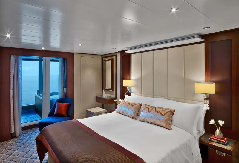

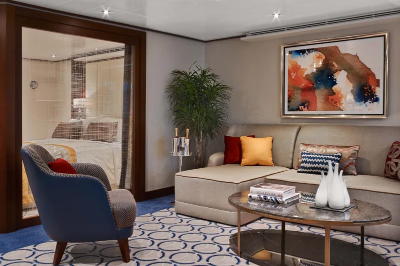

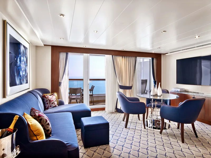

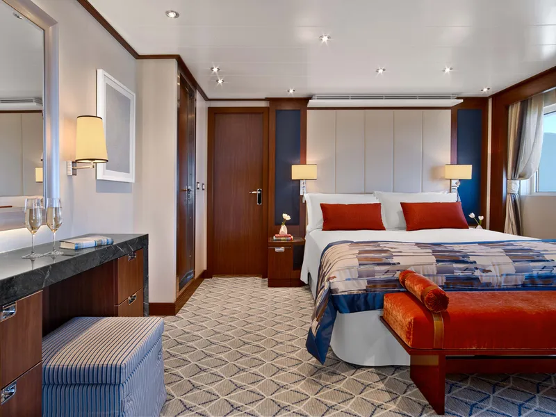
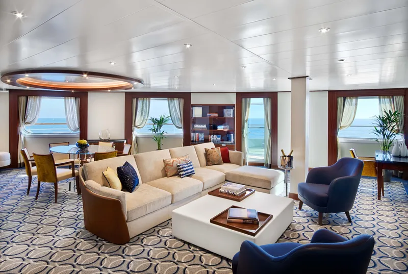
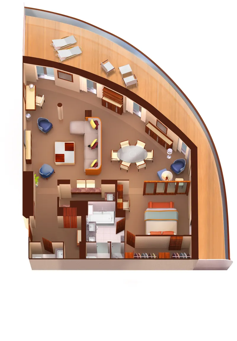
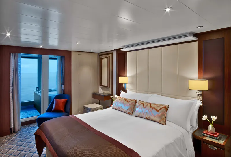
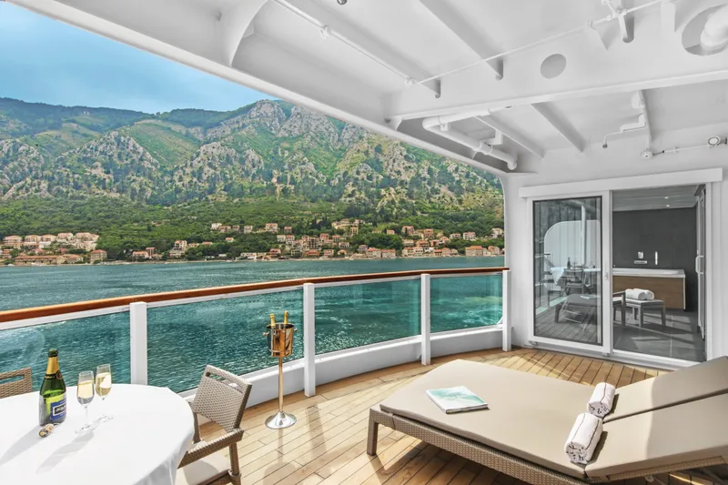

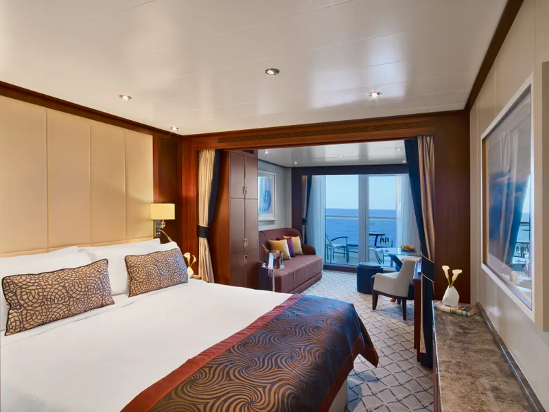


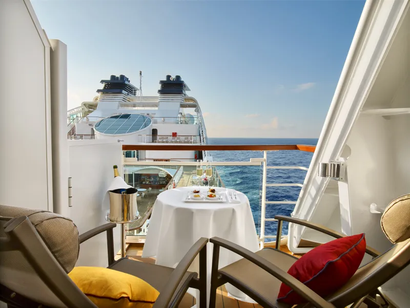

Our cruise specialists can help you find the perfect cabin and the best available pricing.
(+886) 02-2721-7300Contact Advisor