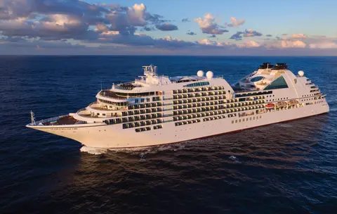
Seabourn7651
7 napos Alaszkai fjordok és kanadai belső átjáró
Date
2026-07-31
Duration
7 nights
Departure Port
Juneau
Egyesült Államok
Arrival Port
Vancouver
Kanada
Rating
Luxury
Theme
—
Date
2026-07-31
Duration
7 nights
Departure Port
Juneau
Egyesült Államok
Arrival Port
Vancouver
Kanada
Rating
Luxury
Theme
—

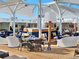




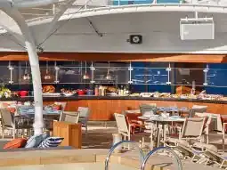
Seabourn
2016
—
40,350 GT
600
266
330
690 m
28 m
19 knots
No
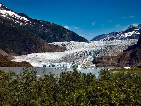
Amerika egyetlen olyan államfővárosa, amely út nélkül megközelíthetetlen, Juneau azonban a kalandot olyan vadregényes nagyszerűséggel hálálja meg, amelyet kevés város a világon képes felülmúlni. A Mendenhall-gleccser — egy ősi jég élő folyója — mindössze tizenöt percnyire fekszik a belvárostól, ahol a vízi repülők cikáznak a tengerparti sétány felett, melyet fenyőkkel borított hegyek szegélyeznek, meredeken a tengerbe zuhanva. A kihagyhatatlan élmény egy helikopterleszállás a jégtakarón vagy egy bálnales a Stephens-csatornában, ahol a púpos bálnák elképesztő közelségben ugrálnak ki a vízből. Juneau legmelegebb időszaka júniustól augusztusig tart, bár még a nyári napok is hozhatják a híres délkelet-alaszkai esőt, amely örökké ragyogóvá varázsolja az esőerdőt.
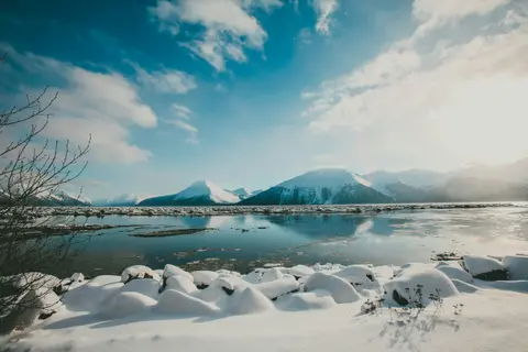
A Tracy Arm egy lélegzetelállító, 30 mérföld hosszú fjord Alaszka Tongass Nemzeti Erdőjében, amelyet drámai tájai és gazdag állatvilága miatt ünnepelnek. Kötelező élmények közé tartozik a fjordon való hajózás, ahol megcsodálhatjuk a jéghegyek hasadását, valamint a helyi tengeri finomságok, például a füstölt lazac élvezete. A legideálisabb időszak a látogatásra a nyári hónapok, amikor a terület élénk és könnyen megközelíthető.
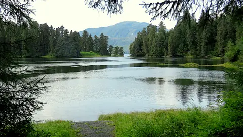
Wrangell Alaska egyik legautentikusabb Inside Passage kikötője, ahol a Tlingit örökség, az ősi sziklarajzok és a világklasszis vadvilág találkozik a hatalmas Stikine-folyó torkolatánál. Elengedhetetlen élmények közé tartozik a jetboatozás a LeConte-gleccserhez, a medvék halászatának megfigyelése az Anan-pataknál, valamint a helyben füstölt lazac kóstolása. Július és augusztus a lazacvándorlás és a medvenézés csúcspontját kínálják.
Stikine Strait is a picturesque channel in the Alexander Archipelago of Alaska between Zarembo Island and Woronkofski and Etolin Islands near the mouth of the Stikine River south of Wrangell. It first appears on an 1848 Russian chart as Stakhin Strait and has been spelled variously on many charts since that time.
The 108-mile Behm Canal runs from the Clarence Strait through the Alexander Archipelago of Southeast Alaska, and into the channel separating Revillagigedo Island from the mainland. It forms part Inside Passage on the route between Ketchikan and the Misty Fjords National Monument. The canal was named by George Vancouver during his surveying expedition in 1793, in honor of Magnus von Behm, who had been governor of Kamchatka in the Russian Far East when Vancouver called at Petropavlovsk with Captain Cook’s expedition following the Cook’s murder in Hawaii.
A Misty Fjords Nemzeti Emlékhely egy 930 000 hektáros vadon Kele-Alaszka szívében, ahol meredek gránitsziklák emelkednek ki a tükörsima fjordokból, örök ködfátyol és felhők között. Kötelező élmények közé tartozik a csendes fjordkarokban való kajakozás, zodiac hajózás vízesések és a vulkanikus New Eddystone Rock mellett, valamint medvék, sasok és orkák megfigyelése a kristálytiszta csatornákban. A látogatási időszak májustól szeptemberig tart, amikor az eső még inkább fokozza az emlékhely éteri hangulatát.
Misty Fjords National Monument is a section of the Tongass National Forest in Alaska’s extreme southeastern Panhandle region. The monument consists of over two million acres of deeply cut fjords cradled in U-shaped valleys between mountain ranges rising 2,000 to 3,000 feet above sea level. The fjords themselves extend as much as 1,000 feet below the surface. These granite ranges are covered with virgin forest, and most of the monument is also a dedicated wilderness area. Misty Fjords inspired the explorer John Muir to proclaim them among the most beautiful places he had ever seen. Your ship will cruise among these spectacular forests, waterfalls and mountains. The onboard Ventures by Seabourn team will offer optional excursions including kayaking the fjords and a short sightseeing floatplane flight.
Prince Rupert, Brit Columbia északi partjának történelmi vasútvégállomása, mély Tsimshian örökségével, világszínvonalú tőkehalhorgászatával és a ködös esőerdő tájaival varázsolja el a látogatókat az Inside Passage mentén. Kóstolja meg a frissen füstölt lazacot a vízparton, és fedezze fel a North Pacific Cannery-t, Kanada legrégebbi fennmaradt konzervgyárát, amely élénk találkozást kínál a kikötő tengeri lelkével. A legjobb időszak a látogatásra júniustól augusztusig tart, amikor a hosszabb nappalok enyhítik a híres esőzéseket, és a vadon élő állatok aktivitása csúcsra jár a partvidéken.
Grenville Channel is a long, well-protected channel along the northern British Columbia coast between the large Pitt Island and the mainland. It is an important shipping lane, and you are likely to see ships of many different types and sizes as you pass through. The shores are mountainous on both sides, with two notable peaks about halfway through, Mt. Batchellor on the east side and Mt. Saunders on Pitt Island to the west. There are a number of Indian Reserves and Marine Parks in the mountains and narrow waterways off the channel.
Whale Channel is a picturesque waterway separating Gil Island from Princess Royal Island in British Columbia’s Inside Passage. Surrounded by snow-capped mountain ranges and teeming with marine life, It is a diversion from the main shipping lane, located roughly halfway between Prince Rupert and the First Nations village of Klemtu. VIEW CRUISES Skip Footer Content About Us
The Princess Royal Channel separates the largest island along British Columbia’s coast from the mainland. It is located roughly halfway between Bella Bella in the south and Prince Rupert in the north, in one of the province’s most remote areas. Princess Royal island was named in 1788 by Captain Charles Duncan, in honor of his ship, the Princess Royal. The island is uninhabited, although there are two small villages in the channel, the First Nations community of Klemtu on Swindle Island and Hartley Bay on the mainland. Wildlife, by contrast, is plentiful, including Kermode, black and grizzly bears, deer, wolves and foxes. Golden and bald eagles nest in the region, as well as the endangered marbled murrelet. In the waters, there are abundant salmon, elephant seals, whales, orcas and dolphins.
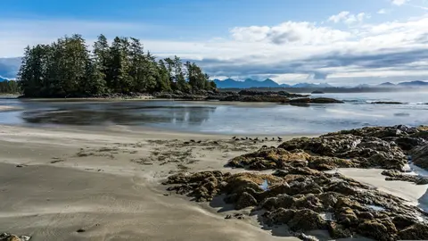
Alert Bay, Kanada egy különleges kikötőváros, ahol a mély kulturális örökség találkozik az autentikus helyi hangulattal, melyet az HX Expeditions útvonalai is felölelnek. Kötelező élmények közé tartozik a történelmi központ sétálása, hogy átéljük a rétegzett építészeti örökséget, valamint a regionális kulináris hagyományok felfedezése egy helyi kedvenc étteremben, távol a kikötőtől. A legideálisabb időszak a látogatásra júniustól augusztusig tart, amikor a nyári hónapok hozzák a legmelegebb hőmérsékletet és a leghosszabb nappalokat.
Johnstone Strait is a well-protected shipping route passing 68 miles/110 km along the northeast shore of Vancouver Island between the island and the mainland of British Columbia. The strait is between 1 ½ miles and 3 miles wide, and leads from the broad Georgia Strait through a narrow channel called Discovery Passage. The strait was named by Vancouver in 1792 for James Johnstone, the master of one of his tenders during the survey expedition that revealed Vancouver Island to be an island. There are no cities or towns on the strait. The Johnstone Strait is the summer range of a large pod of seasonally resident orcas which are frequently seen in the area. VIEW CRUISES Skip Footer Content About Us Our Company News Careers Contact Us Video Gallery Accessibility Seabourn Club Seabourn Referral Program Travel Resources
The Seymour Narrows is a 3-mile/5 km stretch of the Discovery Channel north of Vancouver Island, British Columbia that is notorious for the strength of the tidal currents flowing through it. The average width of the narrows is just 750 meters. During extreme tides, the current through the narrows is subject to severe Venturi effect, resulting in an increased velocity that can reach 15 knots. For much of its modern history, there was an additional hazard in the narrows called Ripple Rock, a shallow obstruction that claimed no fewer than 119 ships and 114 lives. In 1958, after months of tunneling and preparation, Ripple Rock was blown up in the largest commercial, non-nuclear explosion ever recorded in North America. Still, the navigation of Seymour Narrows is dependent on tidal and other conditions, and requires skill and technical accomplishment.
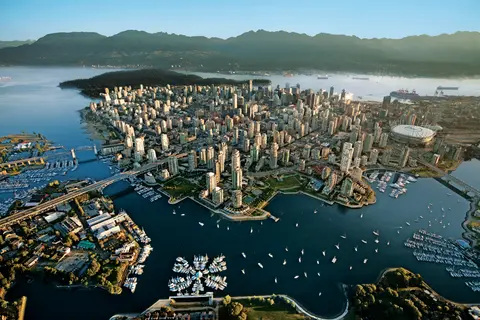
A Csendes-óceán és a Coast-hegység között szorult Vancouver az alaszkai Inside Passage természetes kapuja — egy olyan város, ahol a mérsékelt övi esőerdő találkozik az üvegtornyokkal, és ahol a Dungeness rák és a vad sockeye lazac határozza meg a Csendes-óceán partvidékének konyháját, amely vetekszik Észak-Amerika bármely más régiójával. Sétáljon végig a 22 kilométer hosszú Stanley Park tengerparti sétányán, merüljön el a Granville-szigeti piacon, majd hajózzon át Victoria edwardi pompájához. Az alaszkai hajózási szezon májustól szeptemberig tetőzik, így Vancouver ideális kiindulópontja az egyik legnagyszerűbb óceáni utazásnak a világon.
Day 1
Amerika egyetlen olyan államfővárosa, amely út nélkül megközelíthetetlen, Juneau azonban a kalandot olyan vadregényes nagyszerűséggel hálálja meg, amelyet kevés város a világon képes felülmúlni. A Mendenhall-gleccser — egy ősi jég élő folyója — mindössze tizenöt percnyire fekszik a belvárostól, ahol a vízi repülők cikáznak a tengerparti sétány felett, melyet fenyőkkel borított hegyek szegélyeznek, meredeken a tengerbe zuhanva. A kihagyhatatlan élmény egy helikopterleszállás a jégtakarón vagy egy bálnales a Stephens-csatornában, ahol a púpos bálnák elképesztő közelségben ugrálnak ki a vízből. Juneau legmelegebb időszaka júniustól augusztusig tart, bár még a nyári napok is hozhatják a híres délkelet-alaszkai esőt, amely örökké ragyogóvá varázsolja az esőerdőt.
Day 2
A Tracy Arm egy lélegzetelállító, 30 mérföld hosszú fjord Alaszka Tongass Nemzeti Erdőjében, amelyet drámai tájai és gazdag állatvilága miatt ünnepelnek. Kötelező élmények közé tartozik a fjordon való hajózás, ahol megcsodálhatjuk a jéghegyek hasadását, valamint a helyi tengeri finomságok, például a füstölt lazac élvezete. A legideálisabb időszak a látogatásra a nyári hónapok, amikor a terület élénk és könnyen megközelíthető.
Day 3
Wrangell Alaska egyik legautentikusabb Inside Passage kikötője, ahol a Tlingit örökség, az ősi sziklarajzok és a világklasszis vadvilág találkozik a hatalmas Stikine-folyó torkolatánál. Elengedhetetlen élmények közé tartozik a jetboatozás a LeConte-gleccserhez, a medvék halászatának megfigyelése az Anan-pataknál, valamint a helyben füstölt lazac kóstolása. Július és augusztus a lazacvándorlás és a medvenézés csúcspontját kínálják.
Stikine Strait is a picturesque channel in the Alexander Archipelago of Alaska between Zarembo Island and Woronkofski and Etolin Islands near the mouth of the Stikine River south of Wrangell. It first appears on an 1848 Russian chart as Stakhin Strait and has been spelled variously on many charts since that time.
Day 4
The 108-mile Behm Canal runs from the Clarence Strait through the Alexander Archipelago of Southeast Alaska, and into the channel separating Revillagigedo Island from the mainland. It forms part Inside Passage on the route between Ketchikan and the Misty Fjords National Monument. The canal was named by George Vancouver during his surveying expedition in 1793, in honor of Magnus von Behm, who had been governor of Kamchatka in the Russian Far East when Vancouver called at Petropavlovsk with Captain Cook’s expedition following the Cook’s murder in Hawaii.
A Misty Fjords Nemzeti Emlékhely egy 930 000 hektáros vadon Kele-Alaszka szívében, ahol meredek gránitsziklák emelkednek ki a tükörsima fjordokból, örök ködfátyol és felhők között. Kötelező élmények közé tartozik a csendes fjordkarokban való kajakozás, zodiac hajózás vízesések és a vulkanikus New Eddystone Rock mellett, valamint medvék, sasok és orkák megfigyelése a kristálytiszta csatornákban. A látogatási időszak májustól szeptemberig tart, amikor az eső még inkább fokozza az emlékhely éteri hangulatát.
Misty Fjords National Monument is a section of the Tongass National Forest in Alaska’s extreme southeastern Panhandle region. The monument consists of over two million acres of deeply cut fjords cradled in U-shaped valleys between mountain ranges rising 2,000 to 3,000 feet above sea level. The fjords themselves extend as much as 1,000 feet below the surface. These granite ranges are covered with virgin forest, and most of the monument is also a dedicated wilderness area. Misty Fjords inspired the explorer John Muir to proclaim them among the most beautiful places he had ever seen. Your ship will cruise among these spectacular forests, waterfalls and mountains. The onboard Ventures by Seabourn team will offer optional excursions including kayaking the fjords and a short sightseeing floatplane flight.
Day 5
Prince Rupert, Brit Columbia északi partjának történelmi vasútvégállomása, mély Tsimshian örökségével, világszínvonalú tőkehalhorgászatával és a ködös esőerdő tájaival varázsolja el a látogatókat az Inside Passage mentén. Kóstolja meg a frissen füstölt lazacot a vízparton, és fedezze fel a North Pacific Cannery-t, Kanada legrégebbi fennmaradt konzervgyárát, amely élénk találkozást kínál a kikötő tengeri lelkével. A legjobb időszak a látogatásra júniustól augusztusig tart, amikor a hosszabb nappalok enyhítik a híres esőzéseket, és a vadon élő állatok aktivitása csúcsra jár a partvidéken.
Day 6
Grenville Channel is a long, well-protected channel along the northern British Columbia coast between the large Pitt Island and the mainland. It is an important shipping lane, and you are likely to see ships of many different types and sizes as you pass through. The shores are mountainous on both sides, with two notable peaks about halfway through, Mt. Batchellor on the east side and Mt. Saunders on Pitt Island to the west. There are a number of Indian Reserves and Marine Parks in the mountains and narrow waterways off the channel.
Whale Channel is a picturesque waterway separating Gil Island from Princess Royal Island in British Columbia’s Inside Passage. Surrounded by snow-capped mountain ranges and teeming with marine life, It is a diversion from the main shipping lane, located roughly halfway between Prince Rupert and the First Nations village of Klemtu. VIEW CRUISES Skip Footer Content About Us
The Princess Royal Channel separates the largest island along British Columbia’s coast from the mainland. It is located roughly halfway between Bella Bella in the south and Prince Rupert in the north, in one of the province’s most remote areas. Princess Royal island was named in 1788 by Captain Charles Duncan, in honor of his ship, the Princess Royal. The island is uninhabited, although there are two small villages in the channel, the First Nations community of Klemtu on Swindle Island and Hartley Bay on the mainland. Wildlife, by contrast, is plentiful, including Kermode, black and grizzly bears, deer, wolves and foxes. Golden and bald eagles nest in the region, as well as the endangered marbled murrelet. In the waters, there are abundant salmon, elephant seals, whales, orcas and dolphins.
Day 7
Alert Bay, Kanada egy különleges kikötőváros, ahol a mély kulturális örökség találkozik az autentikus helyi hangulattal, melyet az HX Expeditions útvonalai is felölelnek. Kötelező élmények közé tartozik a történelmi központ sétálása, hogy átéljük a rétegzett építészeti örökséget, valamint a regionális kulináris hagyományok felfedezése egy helyi kedvenc étteremben, távol a kikötőtől. A legideálisabb időszak a látogatásra júniustól augusztusig tart, amikor a nyári hónapok hozzák a legmelegebb hőmérsékletet és a leghosszabb nappalokat.
Johnstone Strait is a well-protected shipping route passing 68 miles/110 km along the northeast shore of Vancouver Island between the island and the mainland of British Columbia. The strait is between 1 ½ miles and 3 miles wide, and leads from the broad Georgia Strait through a narrow channel called Discovery Passage. The strait was named by Vancouver in 1792 for James Johnstone, the master of one of his tenders during the survey expedition that revealed Vancouver Island to be an island. There are no cities or towns on the strait. The Johnstone Strait is the summer range of a large pod of seasonally resident orcas which are frequently seen in the area. VIEW CRUISES Skip Footer Content About Us Our Company News Careers Contact Us Video Gallery Accessibility Seabourn Club Seabourn Referral Program Travel Resources
The Seymour Narrows is a 3-mile/5 km stretch of the Discovery Channel north of Vancouver Island, British Columbia that is notorious for the strength of the tidal currents flowing through it. The average width of the narrows is just 750 meters. During extreme tides, the current through the narrows is subject to severe Venturi effect, resulting in an increased velocity that can reach 15 knots. For much of its modern history, there was an additional hazard in the narrows called Ripple Rock, a shallow obstruction that claimed no fewer than 119 ships and 114 lives. In 1958, after months of tunneling and preparation, Ripple Rock was blown up in the largest commercial, non-nuclear explosion ever recorded in North America. Still, the navigation of Seymour Narrows is dependent on tidal and other conditions, and requires skill and technical accomplishment.
Day 8
A Csendes-óceán és a Coast-hegység között szorult Vancouver az alaszkai Inside Passage természetes kapuja — egy olyan város, ahol a mérsékelt övi esőerdő találkozik az üvegtornyokkal, és ahol a Dungeness rák és a vad sockeye lazac határozza meg a Csendes-óceán partvidékének konyháját, amely vetekszik Észak-Amerika bármely más régiójával. Sétáljon végig a 22 kilométer hosszú Stanley Park tengerparti sétányán, merüljön el a Granville-szigeti piacon, majd hajózzon át Victoria edwardi pompájához. Az alaszkai hajózási szezon májustól szeptemberig tetőzik, így Vancouver ideális kiindulópontja az egyik legnagyszerűbb óceáni utazásnak a világon.
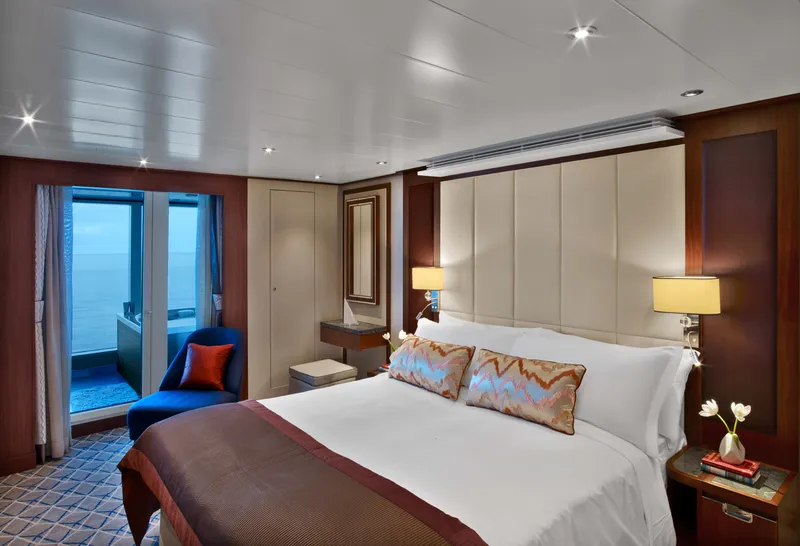
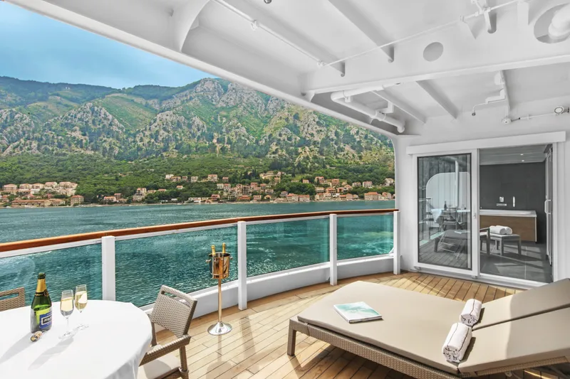

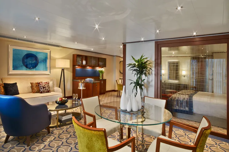









Our cruise specialists can help you find the perfect cabin and the best available pricing.
(+886) 02-2721-7300Contact Advisor