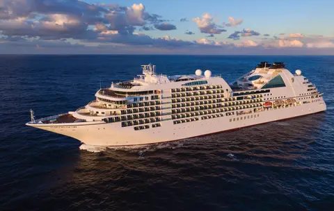
Seabourn7655
7-dagers Alaska-fjorder & kanadisk indre passasje
Date
2026-08-14
Duration
7 nights
Departure Port
Juneau
De forente stater
Arrival Port
Vancouver
Canada
Rating
Luxury
Theme
—
Date
2026-08-14
Duration
7 nights
Departure Port
Juneau
De forente stater
Arrival Port
Vancouver
Canada
Rating
Luxury
Theme
—

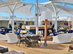




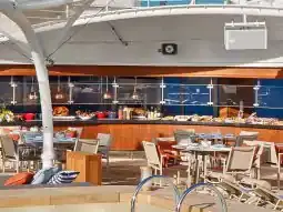
Seabourn
2016
—
40,350 GT
600
266
330
690 m
28 m
19 knots
No
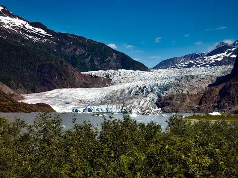
Amerikas eneste delstatshovedstad som ikke kan nås med vei, Juneau belønner reisen med en villmarksglans som få byer på jorden kan matche. Mendenhall-breen — en levende elv av gammel is — ligger bare femten minutter fra sentrum, hvor flytefly suser over en vannfront flankert av grantrær som dykker rett ned i havet. Den må-gjøre opplevelsen er en helikopterlanding på isfeltet eller en hvalsafari i Stephens Passage, hvor knølhvaler bryter overflaten i imponerende nærhet. Juneau er varmest fra juni til august, selv om selv sommerdager kan bringe den berømte regnet fra Sørøst-Alaska som holder regnskogen evig lysende.
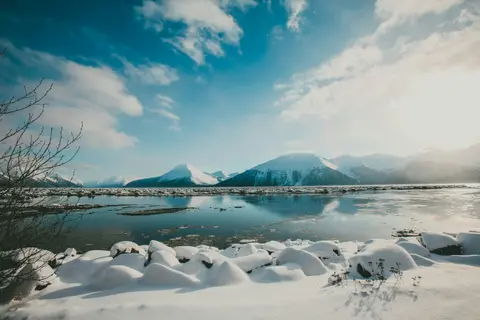
Tracy Arm er en fantastisk 30 miles lang fjord i Alaskas Tongass nasjonalpark, kjent for sine dramatiske landskap og rike dyreliv. Må-se opplevelser inkluderer å cruise gjennom fjorden for å se kalvende isbreer og nyte lokal sjømat som røkt laks. Den beste sesongen å besøke er om sommeren når området er livlig og tilgjengelig.
One of the straightest stretches of the Inside Passage is the Stephens Passage just south of Juneau, a 105-mile channel between 5,000-foot peaks that cuts through the Alexander Archipelago between Admiralty Island on the west and the mainland and Douglas Island on the east. It is a good place to be on deck, because Admiralty boasts more bears than people, and the spruce and hemlock forests come right down to the water. The Passage is generally considered some of the best whale-watching water in Alaska, and also holds plentiful populations of huge Steller sea lions, as well as flocks of gulls and guillemots that clatter aloft as the ship passes. The passage was named by George Vancouver in 1794 after being charted by Joseph Whidbey.
Decision Passage is the western end of the Sumner Strait, which runs through the Alexander Archipelago into the Pacific Ocean in Southeastern Alaska, bounded on the north by Kuiu Island and Cape Decision, the location of a 1932 lighthouse. This is the route your ship takes when coming from or going to the colorful historic community of Sitka on the west coast of Baranof Island, which was originally the Russian fortress town of New Archangel.
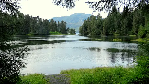
Wrangell er en av Alaskas mest autentiske havner i Inside Passage, hvor Tlingit-arv, gamle petroglyfer og verdensklasse dyreliv møtes ved munningen av den mektige Stikine-elven. Essensielle opplevelser inkluderer å ta jetbåt til LeConte-breen, se bjørner fiske ved Anan Creek, og smake på lokalt røkt laks. Juli og august tilbyr topp laksestimer og bjørnesyn.
Stikine Strait is a picturesque channel in the Alexander Archipelago of Alaska between Zarembo Island and Woronkofski and Etolin Islands near the mouth of the Stikine River south of Wrangell. It first appears on an 1848 Russian chart as Stakhin Strait and has been spelled variously on many charts since that time.
The 108-mile Behm Canal runs from the Clarence Strait through the Alexander Archipelago of Southeast Alaska, and into the channel separating Revillagigedo Island from the mainland. It forms part Inside Passage on the route between Ketchikan and the Misty Fjords National Monument. The canal was named by George Vancouver during his surveying expedition in 1793, in honor of Magnus von Behm, who had been governor of Kamchatka in the Russian Far East when Vancouver called at Petropavlovsk with Captain Cook’s expedition following the Cook’s murder in Hawaii.
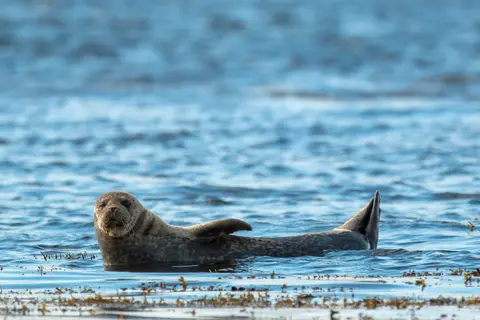
Misty Fjords National Monument er et 930 000 hektar stort villmarksområde i Sørøst-Alaska, hvor bratte granittklipper stiger opp fra speilklare fjorder gjennom evige slør av tåke og skyer. Must-dos inkluderer å padle kajakk gjennom stille fjordarmer, cruise med zodiac forbi fossefall og den vulkanske New Eddystone Rock, og å se etter bjørner, ørner og spekkhoggere i de uberørte kanalene. Mai til september tilbyr besøkssesongen, med regn som tilfører monumentets eteriske atmosfære.
Misty Fjords National Monument is a section of the Tongass National Forest in Alaska’s extreme southeastern Panhandle region. The monument consists of over two million acres of deeply cut fjords cradled in U-shaped valleys between mountain ranges rising 2,000 to 3,000 feet above sea level. The fjords themselves extend as much as 1,000 feet below the surface. These granite ranges are covered with virgin forest, and most of the monument is also a dedicated wilderness area. Misty Fjords inspired the explorer John Muir to proclaim them among the most beautiful places he had ever seen. Your ship will cruise among these spectacular forests, waterfalls and mountains. The onboard Ventures by Seabourn team will offer optional excursions including kayaking the fjords and a short sightseeing floatplane flight.
Prince Rupert, et historisk jernbaneterminal på Britisk Columbias nordkyst, fortryller besøkende med sin dype Tsimshian-arv, verdensklasse kveitefiske, og tåkete regnskoglandskap langs Inside Passage. Smak på fersk røkt laks ved vannkanten og utforsk North Pacific Cannery, Canadas eldste overlevende hermetikkfabrikk, for et levende møte med havnens maritime sjel. Den beste tiden å besøke er fra juni til august, når lengre dager demper den berømte nedbøren og dyrelivsaktiviteten når sitt høydepunkt langs kysten.
Grenville Channel is a long, well-protected channel along the northern British Columbia coast between the large Pitt Island and the mainland. It is an important shipping lane, and you are likely to see ships of many different types and sizes as you pass through. The shores are mountainous on both sides, with two notable peaks about halfway through, Mt. Batchellor on the east side and Mt. Saunders on Pitt Island to the west. There are a number of Indian Reserves and Marine Parks in the mountains and narrow waterways off the channel.
Whale Channel is a picturesque waterway separating Gil Island from Princess Royal Island in British Columbia’s Inside Passage. Surrounded by snow-capped mountain ranges and teeming with marine life, It is a diversion from the main shipping lane, located roughly halfway between Prince Rupert and the First Nations village of Klemtu. VIEW CRUISES Skip Footer Content About Us
The Princess Royal Channel separates the largest island along British Columbia’s coast from the mainland. It is located roughly halfway between Bella Bella in the south and Prince Rupert in the north, in one of the province’s most remote areas. Princess Royal island was named in 1788 by Captain Charles Duncan, in honor of his ship, the Princess Royal. The island is uninhabited, although there are two small villages in the channel, the First Nations community of Klemtu on Swindle Island and Hartley Bay on the mainland. Wildlife, by contrast, is plentiful, including Kermode, black and grizzly bears, deer, wolves and foxes. Golden and bald eagles nest in the region, as well as the endangered marbled murrelet. In the waters, there are abundant salmon, elephant seals, whales, orcas and dolphins.
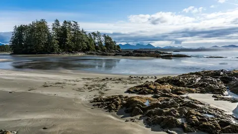
Alert Bay, Canada er en distinkt havneby hvor dyp kulturell arv møter autentisk lokal atmosfære, omtalt på reiseruter av HX Expeditions. Opplevelser du må få med deg inkluderer å gå gjennom det historiske sentrum for å oppleve det lagdelte arkitektoniske arven, og å oppsøke de regionale kulinariske tradisjonene på et lokalt favorisert sted borte fra havneområdet. Den optimale tiden for å besøke er fra juni til august, når sommermånedene bringer de varmeste temperaturene og de lengste dagene.
Johnstone Strait is a well-protected shipping route passing 68 miles/110 km along the northeast shore of Vancouver Island between the island and the mainland of British Columbia. The strait is between 1 ½ miles and 3 miles wide, and leads from the broad Georgia Strait through a narrow channel called Discovery Passage. The strait was named by Vancouver in 1792 for James Johnstone, the master of one of his tenders during the survey expedition that revealed Vancouver Island to be an island. There are no cities or towns on the strait. The Johnstone Strait is the summer range of a large pod of seasonally resident orcas which are frequently seen in the area. VIEW CRUISES Skip Footer Content About Us Our Company News Careers Contact Us Video Gallery Accessibility Seabourn Club Seabourn Referral Program Travel Resources
The Seymour Narrows is a 3-mile/5 km stretch of the Discovery Channel north of Vancouver Island, British Columbia that is notorious for the strength of the tidal currents flowing through it. The average width of the narrows is just 750 meters. During extreme tides, the current through the narrows is subject to severe Venturi effect, resulting in an increased velocity that can reach 15 knots. For much of its modern history, there was an additional hazard in the narrows called Ripple Rock, a shallow obstruction that claimed no fewer than 119 ships and 114 lives. In 1958, after months of tunneling and preparation, Ripple Rock was blown up in the largest commercial, non-nuclear explosion ever recorded in North America. Still, the navigation of Seymour Narrows is dependent on tidal and other conditions, and requires skill and technical accomplishment.
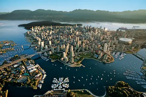
Presset mellom Stillehavet og Coast Mountains, er Vancouver den naturlige porten til Alaskas Inside Passage — en by hvor temperert regnskog møter glassbygninger og hvor Dungeness-krabbe og vill sockeye-laks definerer en Pacific Rim-kjøkken som kan konkurrere med enhver i Nord-Amerika. Gå den 22 kilometer lange Stanley Park-kystlinjen, mist deg selv i Granville Island-markedet, og ta deretter ferge over til Victorias edvardianske prakt. Alaskas cruisesesong når sitt høydepunkt fra mai til september, noe som gjør Vancouver til et ideelt utgangspunkt for en av verdens store havreiser.
Day 1
Amerikas eneste delstatshovedstad som ikke kan nås med vei, Juneau belønner reisen med en villmarksglans som få byer på jorden kan matche. Mendenhall-breen — en levende elv av gammel is — ligger bare femten minutter fra sentrum, hvor flytefly suser over en vannfront flankert av grantrær som dykker rett ned i havet. Den må-gjøre opplevelsen er en helikopterlanding på isfeltet eller en hvalsafari i Stephens Passage, hvor knølhvaler bryter overflaten i imponerende nærhet. Juneau er varmest fra juni til august, selv om selv sommerdager kan bringe den berømte regnet fra Sørøst-Alaska som holder regnskogen evig lysende.
Day 2
Tracy Arm er en fantastisk 30 miles lang fjord i Alaskas Tongass nasjonalpark, kjent for sine dramatiske landskap og rike dyreliv. Må-se opplevelser inkluderer å cruise gjennom fjorden for å se kalvende isbreer og nyte lokal sjømat som røkt laks. Den beste sesongen å besøke er om sommeren når området er livlig og tilgjengelig.
One of the straightest stretches of the Inside Passage is the Stephens Passage just south of Juneau, a 105-mile channel between 5,000-foot peaks that cuts through the Alexander Archipelago between Admiralty Island on the west and the mainland and Douglas Island on the east. It is a good place to be on deck, because Admiralty boasts more bears than people, and the spruce and hemlock forests come right down to the water. The Passage is generally considered some of the best whale-watching water in Alaska, and also holds plentiful populations of huge Steller sea lions, as well as flocks of gulls and guillemots that clatter aloft as the ship passes. The passage was named by George Vancouver in 1794 after being charted by Joseph Whidbey.
Day 3
Decision Passage is the western end of the Sumner Strait, which runs through the Alexander Archipelago into the Pacific Ocean in Southeastern Alaska, bounded on the north by Kuiu Island and Cape Decision, the location of a 1932 lighthouse. This is the route your ship takes when coming from or going to the colorful historic community of Sitka on the west coast of Baranof Island, which was originally the Russian fortress town of New Archangel.
Wrangell er en av Alaskas mest autentiske havner i Inside Passage, hvor Tlingit-arv, gamle petroglyfer og verdensklasse dyreliv møtes ved munningen av den mektige Stikine-elven. Essensielle opplevelser inkluderer å ta jetbåt til LeConte-breen, se bjørner fiske ved Anan Creek, og smake på lokalt røkt laks. Juli og august tilbyr topp laksestimer og bjørnesyn.
Stikine Strait is a picturesque channel in the Alexander Archipelago of Alaska between Zarembo Island and Woronkofski and Etolin Islands near the mouth of the Stikine River south of Wrangell. It first appears on an 1848 Russian chart as Stakhin Strait and has been spelled variously on many charts since that time.
Day 4
The 108-mile Behm Canal runs from the Clarence Strait through the Alexander Archipelago of Southeast Alaska, and into the channel separating Revillagigedo Island from the mainland. It forms part Inside Passage on the route between Ketchikan and the Misty Fjords National Monument. The canal was named by George Vancouver during his surveying expedition in 1793, in honor of Magnus von Behm, who had been governor of Kamchatka in the Russian Far East when Vancouver called at Petropavlovsk with Captain Cook’s expedition following the Cook’s murder in Hawaii.
Misty Fjords National Monument er et 930 000 hektar stort villmarksområde i Sørøst-Alaska, hvor bratte granittklipper stiger opp fra speilklare fjorder gjennom evige slør av tåke og skyer. Must-dos inkluderer å padle kajakk gjennom stille fjordarmer, cruise med zodiac forbi fossefall og den vulkanske New Eddystone Rock, og å se etter bjørner, ørner og spekkhoggere i de uberørte kanalene. Mai til september tilbyr besøkssesongen, med regn som tilfører monumentets eteriske atmosfære.
Misty Fjords National Monument is a section of the Tongass National Forest in Alaska’s extreme southeastern Panhandle region. The monument consists of over two million acres of deeply cut fjords cradled in U-shaped valleys between mountain ranges rising 2,000 to 3,000 feet above sea level. The fjords themselves extend as much as 1,000 feet below the surface. These granite ranges are covered with virgin forest, and most of the monument is also a dedicated wilderness area. Misty Fjords inspired the explorer John Muir to proclaim them among the most beautiful places he had ever seen. Your ship will cruise among these spectacular forests, waterfalls and mountains. The onboard Ventures by Seabourn team will offer optional excursions including kayaking the fjords and a short sightseeing floatplane flight.
Day 5
Prince Rupert, et historisk jernbaneterminal på Britisk Columbias nordkyst, fortryller besøkende med sin dype Tsimshian-arv, verdensklasse kveitefiske, og tåkete regnskoglandskap langs Inside Passage. Smak på fersk røkt laks ved vannkanten og utforsk North Pacific Cannery, Canadas eldste overlevende hermetikkfabrikk, for et levende møte med havnens maritime sjel. Den beste tiden å besøke er fra juni til august, når lengre dager demper den berømte nedbøren og dyrelivsaktiviteten når sitt høydepunkt langs kysten.
Day 6
Grenville Channel is a long, well-protected channel along the northern British Columbia coast between the large Pitt Island and the mainland. It is an important shipping lane, and you are likely to see ships of many different types and sizes as you pass through. The shores are mountainous on both sides, with two notable peaks about halfway through, Mt. Batchellor on the east side and Mt. Saunders on Pitt Island to the west. There are a number of Indian Reserves and Marine Parks in the mountains and narrow waterways off the channel.
Whale Channel is a picturesque waterway separating Gil Island from Princess Royal Island in British Columbia’s Inside Passage. Surrounded by snow-capped mountain ranges and teeming with marine life, It is a diversion from the main shipping lane, located roughly halfway between Prince Rupert and the First Nations village of Klemtu. VIEW CRUISES Skip Footer Content About Us
The Princess Royal Channel separates the largest island along British Columbia’s coast from the mainland. It is located roughly halfway between Bella Bella in the south and Prince Rupert in the north, in one of the province’s most remote areas. Princess Royal island was named in 1788 by Captain Charles Duncan, in honor of his ship, the Princess Royal. The island is uninhabited, although there are two small villages in the channel, the First Nations community of Klemtu on Swindle Island and Hartley Bay on the mainland. Wildlife, by contrast, is plentiful, including Kermode, black and grizzly bears, deer, wolves and foxes. Golden and bald eagles nest in the region, as well as the endangered marbled murrelet. In the waters, there are abundant salmon, elephant seals, whales, orcas and dolphins.
Day 7
Alert Bay, Canada er en distinkt havneby hvor dyp kulturell arv møter autentisk lokal atmosfære, omtalt på reiseruter av HX Expeditions. Opplevelser du må få med deg inkluderer å gå gjennom det historiske sentrum for å oppleve det lagdelte arkitektoniske arven, og å oppsøke de regionale kulinariske tradisjonene på et lokalt favorisert sted borte fra havneområdet. Den optimale tiden for å besøke er fra juni til august, når sommermånedene bringer de varmeste temperaturene og de lengste dagene.
Johnstone Strait is a well-protected shipping route passing 68 miles/110 km along the northeast shore of Vancouver Island between the island and the mainland of British Columbia. The strait is between 1 ½ miles and 3 miles wide, and leads from the broad Georgia Strait through a narrow channel called Discovery Passage. The strait was named by Vancouver in 1792 for James Johnstone, the master of one of his tenders during the survey expedition that revealed Vancouver Island to be an island. There are no cities or towns on the strait. The Johnstone Strait is the summer range of a large pod of seasonally resident orcas which are frequently seen in the area. VIEW CRUISES Skip Footer Content About Us Our Company News Careers Contact Us Video Gallery Accessibility Seabourn Club Seabourn Referral Program Travel Resources
The Seymour Narrows is a 3-mile/5 km stretch of the Discovery Channel north of Vancouver Island, British Columbia that is notorious for the strength of the tidal currents flowing through it. The average width of the narrows is just 750 meters. During extreme tides, the current through the narrows is subject to severe Venturi effect, resulting in an increased velocity that can reach 15 knots. For much of its modern history, there was an additional hazard in the narrows called Ripple Rock, a shallow obstruction that claimed no fewer than 119 ships and 114 lives. In 1958, after months of tunneling and preparation, Ripple Rock was blown up in the largest commercial, non-nuclear explosion ever recorded in North America. Still, the navigation of Seymour Narrows is dependent on tidal and other conditions, and requires skill and technical accomplishment.
Day 8
Presset mellom Stillehavet og Coast Mountains, er Vancouver den naturlige porten til Alaskas Inside Passage — en by hvor temperert regnskog møter glassbygninger og hvor Dungeness-krabbe og vill sockeye-laks definerer en Pacific Rim-kjøkken som kan konkurrere med enhver i Nord-Amerika. Gå den 22 kilometer lange Stanley Park-kystlinjen, mist deg selv i Granville Island-markedet, og ta deretter ferge over til Victorias edvardianske prakt. Alaskas cruisesesong når sitt høydepunkt fra mai til september, noe som gjør Vancouver til et ideelt utgangspunkt for en av verdens store havreiser.
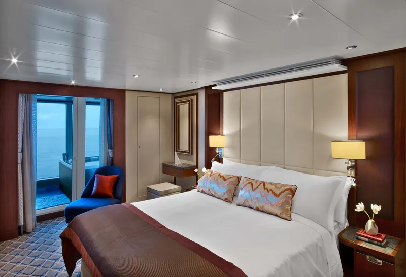
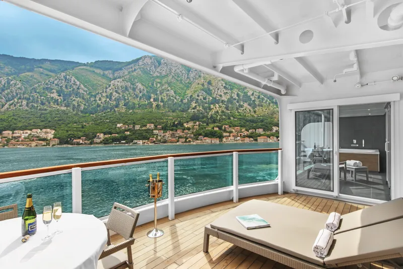

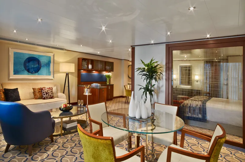

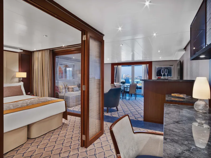


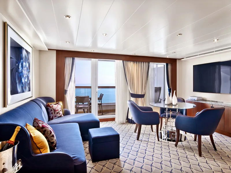

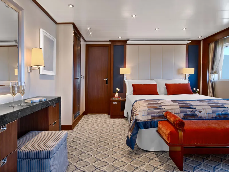
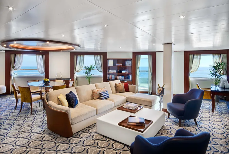

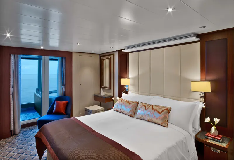
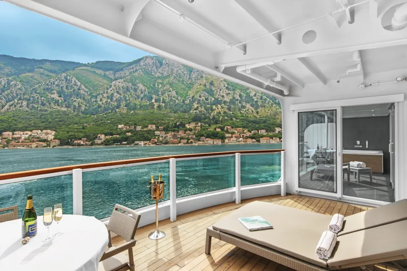

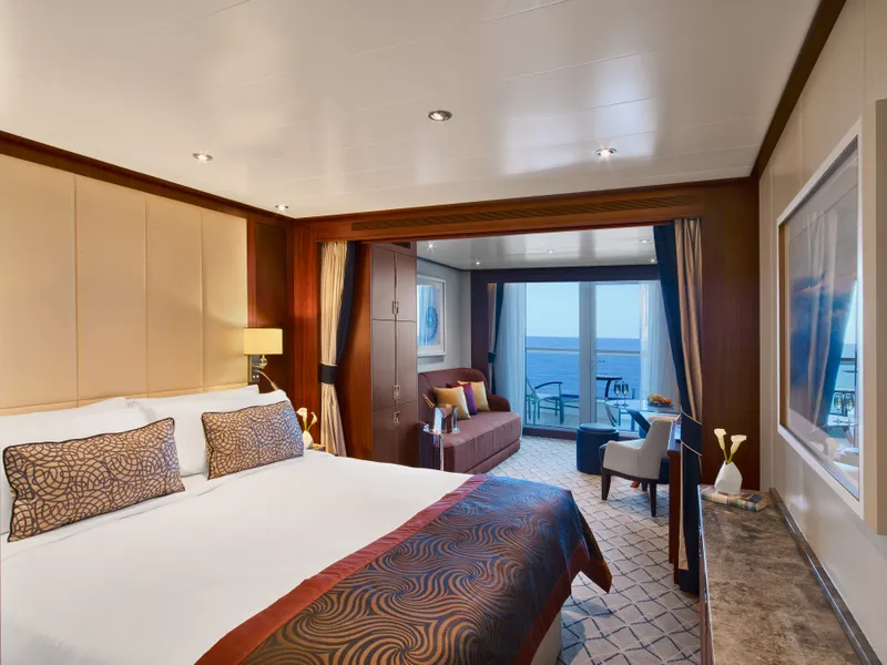
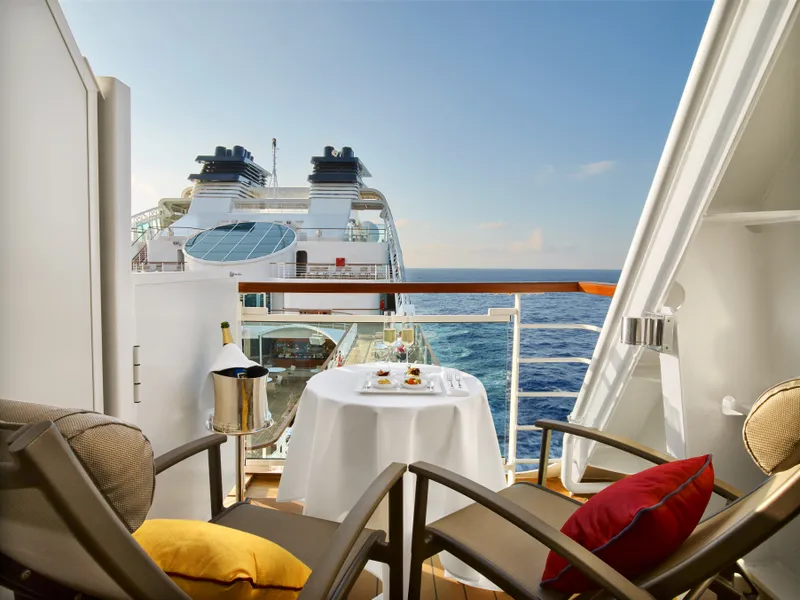

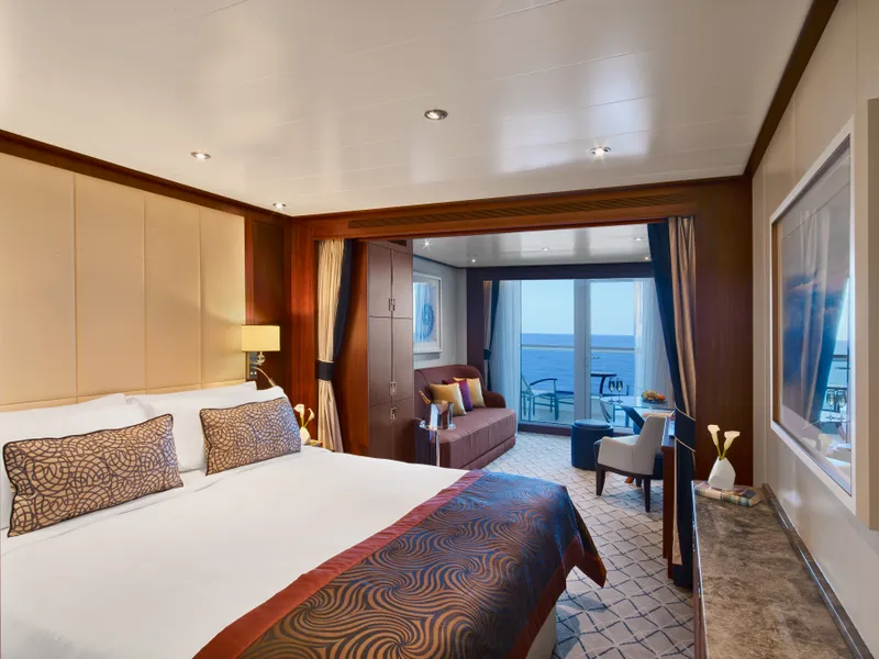
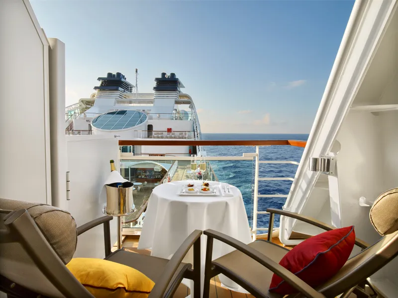


Our cruise specialists can help you find the perfect cabin and the best available pricing.
(+886) 02-2721-7300Contact Advisor