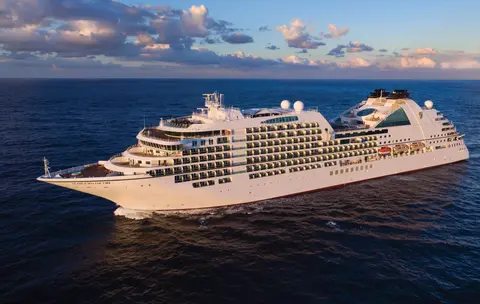
Seabourn7651
Croazieră de 7 zile în fiordurile din Alaska și Pasajul Interior Canadian
Date
2026-07-31
Duration
7 nights
Departure Port
Juneau
Statele Unite
Arrival Port
Vancouver
Canada
Rating
Luxury
Theme
—
Date
2026-07-31
Duration
7 nights
Departure Port
Juneau
Statele Unite
Arrival Port
Vancouver
Canada
Rating
Luxury
Theme
—





Seabourn
2016
—
40,350 GT
600
266
330
690 m
28 m
19 knots
No
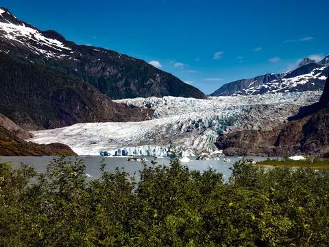
Singura capitală de stat din America inaccesibilă pe cale rutieră, Juneau răsplătește călătoria cu o măreție sălbatică pe care puține orașe din lume o pot egala. Ghețarul Mendenhall — un râu viu de gheață străveche — se află la doar cincisprezece minute de centrul orașului, unde hidroavioanele zboară deasupra unei faleze mărginită de munți acoperiți cu molizi, ce se prăvălesc direct în mare. Experiența obligatorie este o aterizare cu elicopterul pe câmpul de gheață sau o excursie de observare a balenelor în Pasajul Stephens, unde balenele cu cocoașă sar în apropiere uimitoare. Juneau este cel mai cald între iunie și august, deși chiar și zilele de vară pot aduce faimoasa ploaie din sud-estul Alaskăi, care menține pădurea tropicală mereu luminată.
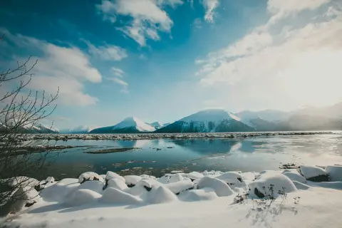
Tracy Arm este un fiord impresionant de 30 de mile situat în Pădurea Națională Tongass din Alaska, renumit pentru peisajele sale dramatice și fauna sălbatică abundentă. Experiențele de neratat includ o croazieră prin fiord pentru a admira ghețarii care se desprind și savurarea fructelor de mare locale, precum somonul afumat. Cea mai bună perioadă pentru a vizita este în lunile de vară, când zona este vibrantă și accesibilă.
One of the straightest stretches of the Inside Passage is the Stephens Passage just south of Juneau, a 105-mile channel between 5,000-foot peaks that cuts through the Alexander Archipelago between Admiralty Island on the west and the mainland and Douglas Island on the east. It is a good place to be on deck, because Admiralty boasts more bears than people, and the spruce and hemlock forests come right down to the water. The Passage is generally considered some of the best whale-watching water in Alaska, and also holds plentiful populations of huge Steller sea lions, as well as flocks of gulls and guillemots that clatter aloft as the ship passes. The passage was named by George Vancouver in 1794 after being charted by Joseph Whidbey.
Decision Passage is the western end of the Sumner Strait, which runs through the Alexander Archipelago into the Pacific Ocean in Southeastern Alaska, bounded on the north by Kuiu Island and Cape Decision, the location of a 1932 lighthouse. This is the route your ship takes when coming from or going to the colorful historic community of Sitka on the west coast of Baranof Island, which was originally the Russian fortress town of New Archangel.
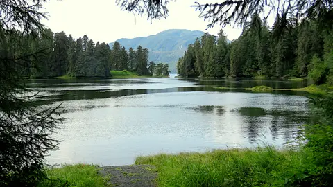
Wrangell este unul dintre cele mai autentice porturi din Inside Passage-ul Alaskăi, unde moștenirea Tlingit, petroglifele străvechi și fauna sălbatică de clasă mondială se întâlnesc la gura mărețului râu Stikine. Experiențele esențiale includ plimbările cu barca cu motor până la ghețarul LeConte, observarea urșilor care pescuiesc la pârâul Anan și degustarea somonului afumat local. Lunile iulie și august oferă apogeul migrației somonilor și al observației urșilor.
Stikine Strait is a picturesque channel in the Alexander Archipelago of Alaska between Zarembo Island and Woronkofski and Etolin Islands near the mouth of the Stikine River south of Wrangell. It first appears on an 1848 Russian chart as Stakhin Strait and has been spelled variously on many charts since that time.
The 108-mile Behm Canal runs from the Clarence Strait through the Alexander Archipelago of Southeast Alaska, and into the channel separating Revillagigedo Island from the mainland. It forms part Inside Passage on the route between Ketchikan and the Misty Fjords National Monument. The canal was named by George Vancouver during his surveying expedition in 1793, in honor of Magnus von Behm, who had been governor of Kamchatka in the Russian Far East when Vancouver called at Petropavlovsk with Captain Cook’s expedition following the Cook’s murder in Hawaii.
Monumentul Național Misty Fjords este o întindere sălbatică de 930.000 de hectare în sud-estul Alaskăi, unde stâncile abrupte de granit se ridică din fiorduri oglindă, învăluite în văluri perpetue de ceață și nori. Experiențele de neratat includ plimbările cu caiacul prin brațele tăcute ale fiordului, croazierele cu zodiacul pe lângă cascade și stânca vulcanică New Eddystone, precum și observarea urșilor, vulturilor și orcilor în canalele neatinse. Sezonul ideal pentru vizitare este între mai și septembrie, când ploaia adaugă o notă eterică atmosferei monumentului.
Misty Fjords National Monument is a section of the Tongass National Forest in Alaska’s extreme southeastern Panhandle region. The monument consists of over two million acres of deeply cut fjords cradled in U-shaped valleys between mountain ranges rising 2,000 to 3,000 feet above sea level. The fjords themselves extend as much as 1,000 feet below the surface. These granite ranges are covered with virgin forest, and most of the monument is also a dedicated wilderness area. Misty Fjords inspired the explorer John Muir to proclaim them among the most beautiful places he had ever seen. Your ship will cruise among these spectacular forests, waterfalls and mountains. The onboard Ventures by Seabourn team will offer optional excursions including kayaking the fjords and a short sightseeing floatplane flight.
Prince Rupert, un terminus feroviar istoric situat pe coasta de nord a Columbiei Britanice, încântă vizitatorii prin bogata sa moștenire Tsimshian, pescuitul de halibut de clasă mondială și peisajele de pădure tropicală învăluită în ceață de-a lungul Pasajului Interior. Savurați somon proaspăt afumat pe malul apei și explorați North Pacific Cannery, cea mai veche fabrică de conserve din Canada care încă funcționează, pentru o întâlnire vie cu sufletul maritim al portului. Perioada ideală pentru vizitare este între iunie și august, când zilele mai lungi domolesc ploaia renumită, iar activitatea faunei sălbatice atinge apogeul de-a lungul coastei.
Grenville Channel is a long, well-protected channel along the northern British Columbia coast between the large Pitt Island and the mainland. It is an important shipping lane, and you are likely to see ships of many different types and sizes as you pass through. The shores are mountainous on both sides, with two notable peaks about halfway through, Mt. Batchellor on the east side and Mt. Saunders on Pitt Island to the west. There are a number of Indian Reserves and Marine Parks in the mountains and narrow waterways off the channel.
Whale Channel is a picturesque waterway separating Gil Island from Princess Royal Island in British Columbia’s Inside Passage. Surrounded by snow-capped mountain ranges and teeming with marine life, It is a diversion from the main shipping lane, located roughly halfway between Prince Rupert and the First Nations village of Klemtu. VIEW CRUISES Skip Footer Content About Us
The Princess Royal Channel separates the largest island along British Columbia’s coast from the mainland. It is located roughly halfway between Bella Bella in the south and Prince Rupert in the north, in one of the province’s most remote areas. Princess Royal island was named in 1788 by Captain Charles Duncan, in honor of his ship, the Princess Royal. The island is uninhabited, although there are two small villages in the channel, the First Nations community of Klemtu on Swindle Island and Hartley Bay on the mainland. Wildlife, by contrast, is plentiful, including Kermode, black and grizzly bears, deer, wolves and foxes. Golden and bald eagles nest in the region, as well as the endangered marbled murrelet. In the waters, there are abundant salmon, elephant seals, whales, orcas and dolphins.
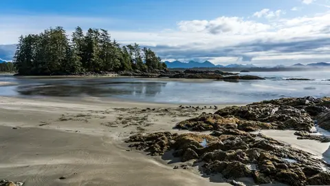
Alert Bay, Canada este un oraș-port distinctiv unde patrimoniul cultural profund se îmbină cu o atmosferă locală autentică, fiind inclus în itinerariile HX Expeditions. Experiențele de neratat includ plimbarea prin centrul istoric pentru a descoperi patrimoniul arhitectural stratificat și explorarea tradițiilor culinare regionale într-un local apreciat de localnici, situat departe de zona portuară. Perioada optimă pentru vizitare este între iunie și august, când lunile de vară aduc cele mai calde temperaturi și cele mai lungi zile.
Johnstone Strait is a well-protected shipping route passing 68 miles/110 km along the northeast shore of Vancouver Island between the island and the mainland of British Columbia. The strait is between 1 ½ miles and 3 miles wide, and leads from the broad Georgia Strait through a narrow channel called Discovery Passage. The strait was named by Vancouver in 1792 for James Johnstone, the master of one of his tenders during the survey expedition that revealed Vancouver Island to be an island. There are no cities or towns on the strait. The Johnstone Strait is the summer range of a large pod of seasonally resident orcas which are frequently seen in the area. VIEW CRUISES Skip Footer Content About Us Our Company News Careers Contact Us Video Gallery Accessibility Seabourn Club Seabourn Referral Program Travel Resources
The Seymour Narrows is a 3-mile/5 km stretch of the Discovery Channel north of Vancouver Island, British Columbia that is notorious for the strength of the tidal currents flowing through it. The average width of the narrows is just 750 meters. During extreme tides, the current through the narrows is subject to severe Venturi effect, resulting in an increased velocity that can reach 15 knots. For much of its modern history, there was an additional hazard in the narrows called Ripple Rock, a shallow obstruction that claimed no fewer than 119 ships and 114 lives. In 1958, after months of tunneling and preparation, Ripple Rock was blown up in the largest commercial, non-nuclear explosion ever recorded in North America. Still, the navigation of Seymour Narrows is dependent on tidal and other conditions, and requires skill and technical accomplishment.
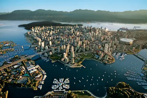
Între Pacific și Munții Coastelor, Vancouver este poarta naturală către Pasajul Interior al Alaskăi — un oraș unde pădurea tropicală temperată întâlnește turnurile de sticlă și unde crabii Dungeness și somonul sălbatic sockeye definesc o bucătărie a Rimului Pacificului care rivalizează cu orice altă din America de Nord. Parcurgeți cele 22 de kilometri ai digului din Stanley Park, pierdeți-vă în piața Granville Island, apoi traversați cu feribotul spre splendoarea edwardiană a Victoriei. Sezonul croazierelor în Alaska atinge apogeul între mai și septembrie, făcând din Vancouver un punct de plecare ideal pentru una dintre cele mai grandioase călătorii oceanice din lume.
Day 1
Singura capitală de stat din America inaccesibilă pe cale rutieră, Juneau răsplătește călătoria cu o măreție sălbatică pe care puține orașe din lume o pot egala. Ghețarul Mendenhall — un râu viu de gheață străveche — se află la doar cincisprezece minute de centrul orașului, unde hidroavioanele zboară deasupra unei faleze mărginită de munți acoperiți cu molizi, ce se prăvălesc direct în mare. Experiența obligatorie este o aterizare cu elicopterul pe câmpul de gheață sau o excursie de observare a balenelor în Pasajul Stephens, unde balenele cu cocoașă sar în apropiere uimitoare. Juneau este cel mai cald între iunie și august, deși chiar și zilele de vară pot aduce faimoasa ploaie din sud-estul Alaskăi, care menține pădurea tropicală mereu luminată.
Day 2
Tracy Arm este un fiord impresionant de 30 de mile situat în Pădurea Națională Tongass din Alaska, renumit pentru peisajele sale dramatice și fauna sălbatică abundentă. Experiențele de neratat includ o croazieră prin fiord pentru a admira ghețarii care se desprind și savurarea fructelor de mare locale, precum somonul afumat. Cea mai bună perioadă pentru a vizita este în lunile de vară, când zona este vibrantă și accesibilă.
One of the straightest stretches of the Inside Passage is the Stephens Passage just south of Juneau, a 105-mile channel between 5,000-foot peaks that cuts through the Alexander Archipelago between Admiralty Island on the west and the mainland and Douglas Island on the east. It is a good place to be on deck, because Admiralty boasts more bears than people, and the spruce and hemlock forests come right down to the water. The Passage is generally considered some of the best whale-watching water in Alaska, and also holds plentiful populations of huge Steller sea lions, as well as flocks of gulls and guillemots that clatter aloft as the ship passes. The passage was named by George Vancouver in 1794 after being charted by Joseph Whidbey.
Day 3
Decision Passage is the western end of the Sumner Strait, which runs through the Alexander Archipelago into the Pacific Ocean in Southeastern Alaska, bounded on the north by Kuiu Island and Cape Decision, the location of a 1932 lighthouse. This is the route your ship takes when coming from or going to the colorful historic community of Sitka on the west coast of Baranof Island, which was originally the Russian fortress town of New Archangel.
Wrangell este unul dintre cele mai autentice porturi din Inside Passage-ul Alaskăi, unde moștenirea Tlingit, petroglifele străvechi și fauna sălbatică de clasă mondială se întâlnesc la gura mărețului râu Stikine. Experiențele esențiale includ plimbările cu barca cu motor până la ghețarul LeConte, observarea urșilor care pescuiesc la pârâul Anan și degustarea somonului afumat local. Lunile iulie și august oferă apogeul migrației somonilor și al observației urșilor.
Stikine Strait is a picturesque channel in the Alexander Archipelago of Alaska between Zarembo Island and Woronkofski and Etolin Islands near the mouth of the Stikine River south of Wrangell. It first appears on an 1848 Russian chart as Stakhin Strait and has been spelled variously on many charts since that time.
Day 4
The 108-mile Behm Canal runs from the Clarence Strait through the Alexander Archipelago of Southeast Alaska, and into the channel separating Revillagigedo Island from the mainland. It forms part Inside Passage on the route between Ketchikan and the Misty Fjords National Monument. The canal was named by George Vancouver during his surveying expedition in 1793, in honor of Magnus von Behm, who had been governor of Kamchatka in the Russian Far East when Vancouver called at Petropavlovsk with Captain Cook’s expedition following the Cook’s murder in Hawaii.
Monumentul Național Misty Fjords este o întindere sălbatică de 930.000 de hectare în sud-estul Alaskăi, unde stâncile abrupte de granit se ridică din fiorduri oglindă, învăluite în văluri perpetue de ceață și nori. Experiențele de neratat includ plimbările cu caiacul prin brațele tăcute ale fiordului, croazierele cu zodiacul pe lângă cascade și stânca vulcanică New Eddystone, precum și observarea urșilor, vulturilor și orcilor în canalele neatinse. Sezonul ideal pentru vizitare este între mai și septembrie, când ploaia adaugă o notă eterică atmosferei monumentului.
Misty Fjords National Monument is a section of the Tongass National Forest in Alaska’s extreme southeastern Panhandle region. The monument consists of over two million acres of deeply cut fjords cradled in U-shaped valleys between mountain ranges rising 2,000 to 3,000 feet above sea level. The fjords themselves extend as much as 1,000 feet below the surface. These granite ranges are covered with virgin forest, and most of the monument is also a dedicated wilderness area. Misty Fjords inspired the explorer John Muir to proclaim them among the most beautiful places he had ever seen. Your ship will cruise among these spectacular forests, waterfalls and mountains. The onboard Ventures by Seabourn team will offer optional excursions including kayaking the fjords and a short sightseeing floatplane flight.
Day 5
Prince Rupert, un terminus feroviar istoric situat pe coasta de nord a Columbiei Britanice, încântă vizitatorii prin bogata sa moștenire Tsimshian, pescuitul de halibut de clasă mondială și peisajele de pădure tropicală învăluită în ceață de-a lungul Pasajului Interior. Savurați somon proaspăt afumat pe malul apei și explorați North Pacific Cannery, cea mai veche fabrică de conserve din Canada care încă funcționează, pentru o întâlnire vie cu sufletul maritim al portului. Perioada ideală pentru vizitare este între iunie și august, când zilele mai lungi domolesc ploaia renumită, iar activitatea faunei sălbatice atinge apogeul de-a lungul coastei.
Day 6
Grenville Channel is a long, well-protected channel along the northern British Columbia coast between the large Pitt Island and the mainland. It is an important shipping lane, and you are likely to see ships of many different types and sizes as you pass through. The shores are mountainous on both sides, with two notable peaks about halfway through, Mt. Batchellor on the east side and Mt. Saunders on Pitt Island to the west. There are a number of Indian Reserves and Marine Parks in the mountains and narrow waterways off the channel.
Whale Channel is a picturesque waterway separating Gil Island from Princess Royal Island in British Columbia’s Inside Passage. Surrounded by snow-capped mountain ranges and teeming with marine life, It is a diversion from the main shipping lane, located roughly halfway between Prince Rupert and the First Nations village of Klemtu. VIEW CRUISES Skip Footer Content About Us
The Princess Royal Channel separates the largest island along British Columbia’s coast from the mainland. It is located roughly halfway between Bella Bella in the south and Prince Rupert in the north, in one of the province’s most remote areas. Princess Royal island was named in 1788 by Captain Charles Duncan, in honor of his ship, the Princess Royal. The island is uninhabited, although there are two small villages in the channel, the First Nations community of Klemtu on Swindle Island and Hartley Bay on the mainland. Wildlife, by contrast, is plentiful, including Kermode, black and grizzly bears, deer, wolves and foxes. Golden and bald eagles nest in the region, as well as the endangered marbled murrelet. In the waters, there are abundant salmon, elephant seals, whales, orcas and dolphins.
Day 7
Alert Bay, Canada este un oraș-port distinctiv unde patrimoniul cultural profund se îmbină cu o atmosferă locală autentică, fiind inclus în itinerariile HX Expeditions. Experiențele de neratat includ plimbarea prin centrul istoric pentru a descoperi patrimoniul arhitectural stratificat și explorarea tradițiilor culinare regionale într-un local apreciat de localnici, situat departe de zona portuară. Perioada optimă pentru vizitare este între iunie și august, când lunile de vară aduc cele mai calde temperaturi și cele mai lungi zile.
Johnstone Strait is a well-protected shipping route passing 68 miles/110 km along the northeast shore of Vancouver Island between the island and the mainland of British Columbia. The strait is between 1 ½ miles and 3 miles wide, and leads from the broad Georgia Strait through a narrow channel called Discovery Passage. The strait was named by Vancouver in 1792 for James Johnstone, the master of one of his tenders during the survey expedition that revealed Vancouver Island to be an island. There are no cities or towns on the strait. The Johnstone Strait is the summer range of a large pod of seasonally resident orcas which are frequently seen in the area. VIEW CRUISES Skip Footer Content About Us Our Company News Careers Contact Us Video Gallery Accessibility Seabourn Club Seabourn Referral Program Travel Resources
The Seymour Narrows is a 3-mile/5 km stretch of the Discovery Channel north of Vancouver Island, British Columbia that is notorious for the strength of the tidal currents flowing through it. The average width of the narrows is just 750 meters. During extreme tides, the current through the narrows is subject to severe Venturi effect, resulting in an increased velocity that can reach 15 knots. For much of its modern history, there was an additional hazard in the narrows called Ripple Rock, a shallow obstruction that claimed no fewer than 119 ships and 114 lives. In 1958, after months of tunneling and preparation, Ripple Rock was blown up in the largest commercial, non-nuclear explosion ever recorded in North America. Still, the navigation of Seymour Narrows is dependent on tidal and other conditions, and requires skill and technical accomplishment.
Day 8
Între Pacific și Munții Coastelor, Vancouver este poarta naturală către Pasajul Interior al Alaskăi — un oraș unde pădurea tropicală temperată întâlnește turnurile de sticlă și unde crabii Dungeness și somonul sălbatic sockeye definesc o bucătărie a Rimului Pacificului care rivalizează cu orice altă din America de Nord. Parcurgeți cele 22 de kilometri ai digului din Stanley Park, pierdeți-vă în piața Granville Island, apoi traversați cu feribotul spre splendoarea edwardiană a Victoriei. Sezonul croazierelor în Alaska atinge apogeul între mai și septembrie, făcând din Vancouver un punct de plecare ideal pentru una dintre cele mai grandioase călătorii oceanice din lume.
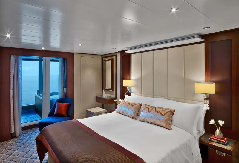
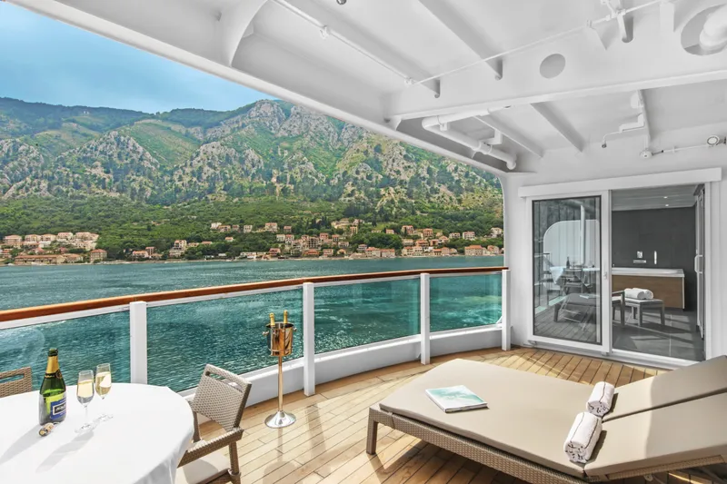

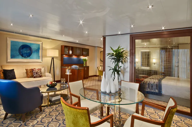
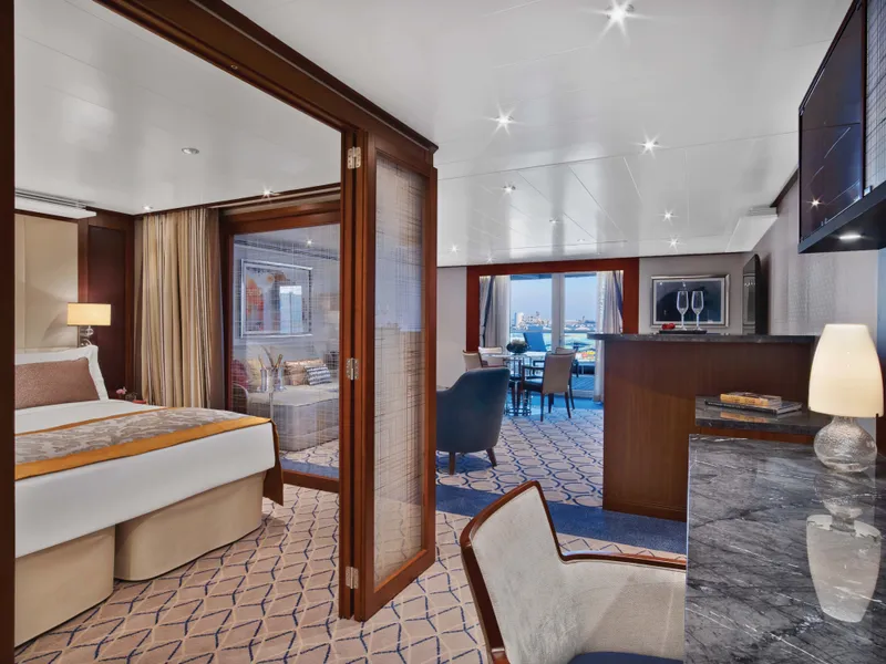
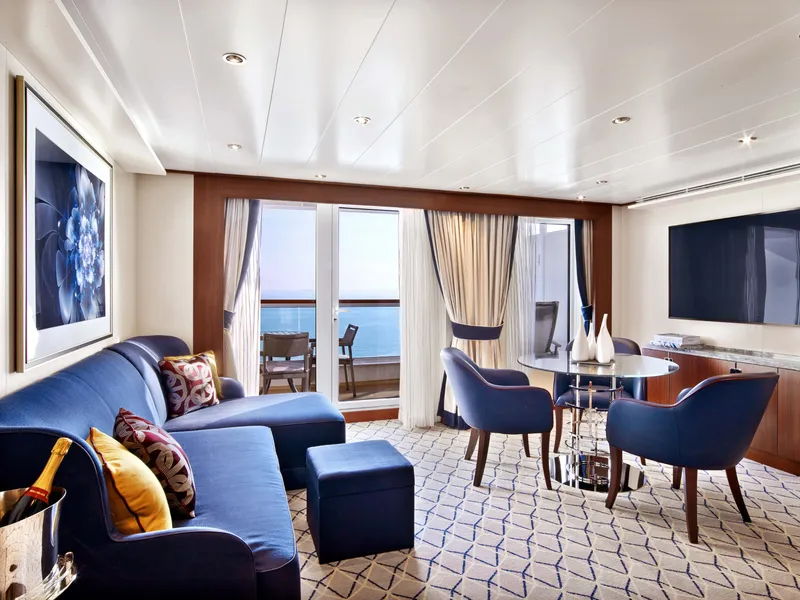
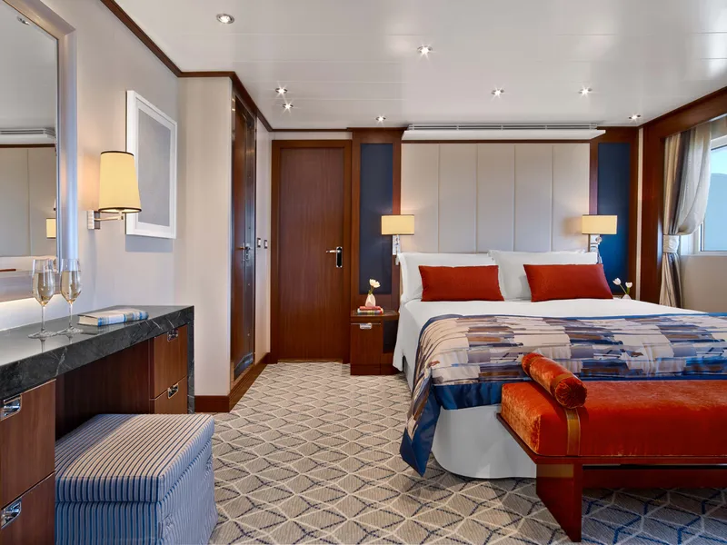
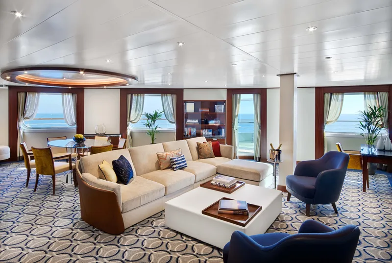
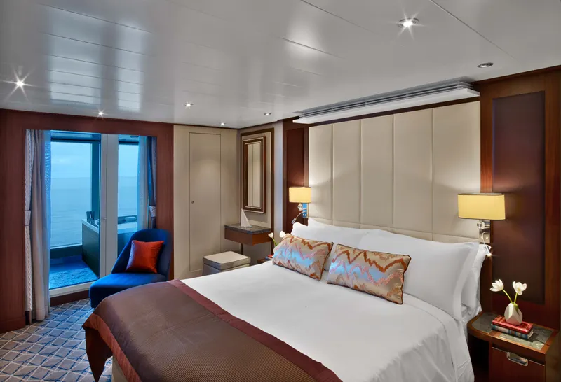
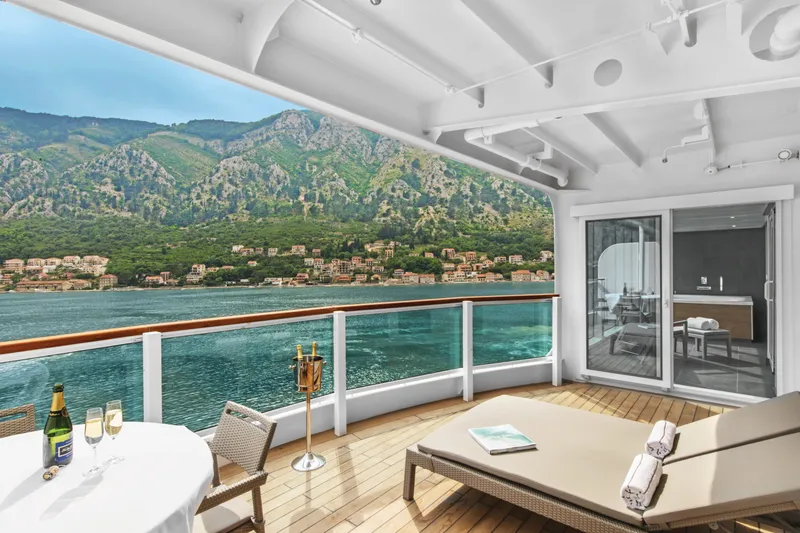
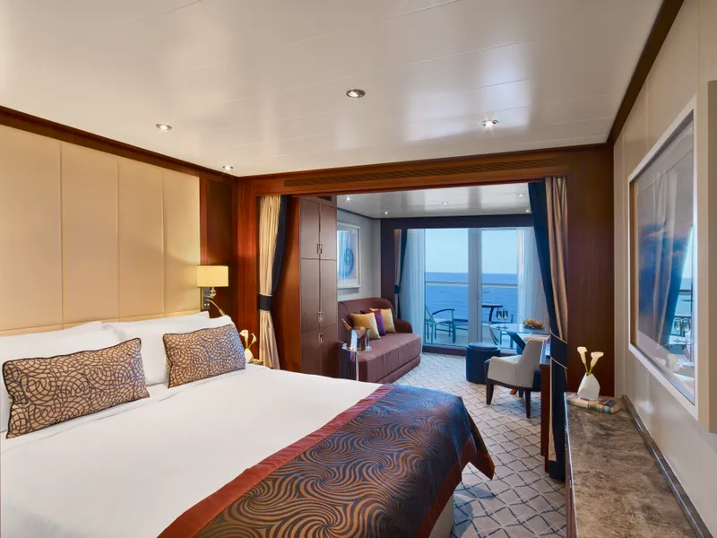
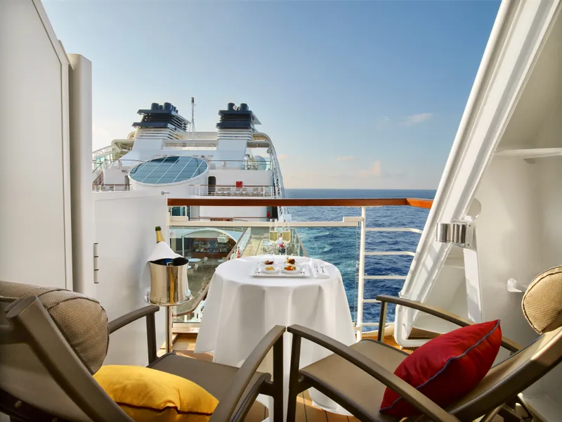
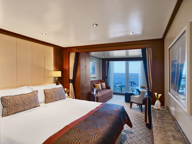
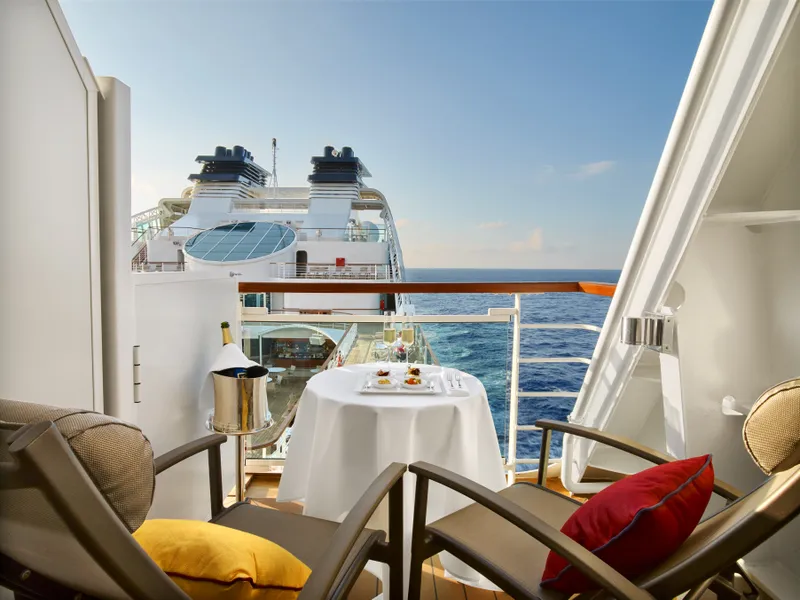
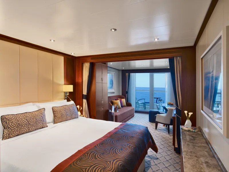
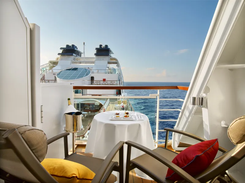
Located on Deck 8; Combine mid-ship suites 849 and 851 for suite 8491 or suites 846 and 848 for suite 8468 for a total inside space of 1,292 square feet (120 square meters) plus two verandas totaling 244 square feet (23 square meters)
Grand Wintergarden Suites feature
Large windows
Dining for six
Glass-enclosed solarium with tub and day bed
Two bedrooms
Two bathrooms (one whirlpool)
Convertible sofa bed for one
Pantry with wet bar
Two flat-screen TVs
Complimentary Internet/Wi-Fi service









Our cruise specialists can help you find the perfect cabin and the best available pricing.
(+886) 02-2721-7300Contact Advisor