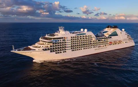
Seabourn7663
7-Daagse Alaska Fjorden, Canadese Inside Passage & Glacier Bay
Date
2026-09-11
Duration
7 nights
Departure Port
Juneau
Verenigde Staten
Arrival Port
Vancouver
Canada
Rating
Luxury
Theme
—
Date
2026-09-11
Duration
7 nights
Departure Port
Juneau
Verenigde Staten
Arrival Port
Vancouver
Canada
Rating
Luxury
Theme
—





Seabourn
2016
—
40,350 GT
600
266
330
690 m
28 m
19 knots
No
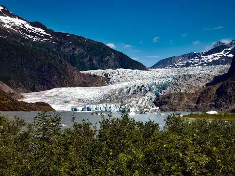
De enige staatshoofdstad van Amerika die niet per weg bereikbaar is, Juneau beloont de reis met een wildernisgrootheid die weinige steden op aarde kunnen evenaren. De Mendenhall-gletsjer — een levende rivier van oude ijs — ligt op slechts vijftien minuten van het centrum, waar watervliegtuigen boven een waterfront dartelen dat wordt geflankeerd door met sparren bedekte bergen die recht in de zee duiken. De must-do ervaring is een helikopterlanding op de ijsveld of een walvisspot-excursie in Stephens Passage, waar bultruggen in verbazingwekkende nabijheid breken. Juneau is het warmst van juni tot augustus, hoewel zelfs zomerse dagen de beroemde regen van Zuidoost-Alaska kunnen brengen die het regenwoud perpetueel stralend houdt.
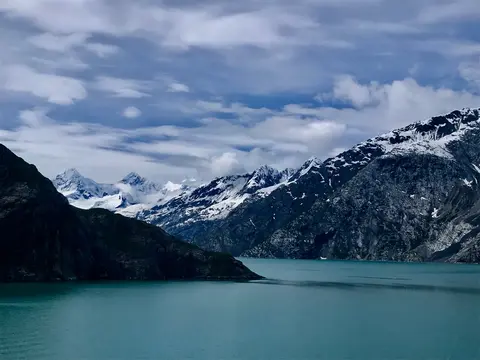
Glacier Bay National Park is een van de meest indrukwekkende landschappen van actieve gletsjerwerking op aarde — 3,3 miljoen acres in het zuidoosten van Alaska waar gletsjers ijsbergen ter grootte van kathedralen in fjorden van luminescent blauw water afkalven, en waar het land zelf nog steeds stijgt, bevrijd van het gewicht van ijs dat deze hele regio slechts twee eeuwen geleden bedekte. Het park, alleen bereikbaar per schip of klein vliegtuig, beloont bezoekers met ontmoetingen met wilde dieren — bultruggen, bruine beren, zeeotters en berggeiten — tegen een achtergrond van bijna overweldigende grandeur. Het seizoen loopt van mei tot september; eind juni en juli bieden de langste dagen en de meest betrouwbare wilde dierenactiviteit.
Decision Passage is the western end of the Sumner Strait, which runs through the Alexander Archipelago into the Pacific Ocean in Southeastern Alaska, bounded on the north by Kuiu Island and Cape Decision, the location of a 1932 lighthouse. This is the route your ship takes when coming from or going to the colorful historic community of Sitka on the west coast of Baranof Island, which was originally the Russian fortress town of New Archangel.
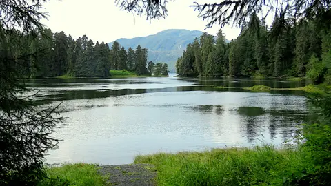
Wrangell is een van de meest authentieke havens in de Inside Passage van Alaska, waar Tlingit-erfgoed, oude petroglyphen en wereldklasse wildlife samenkomen bij de monding van de machtige Stikine-rivier. Essentiële ervaringen zijn het jetbootvaren naar de LeConte-gletsjer, het kijken naar beren die vissen bij Anan Creek, en het proeven van lokaal gerookte zalm. Juli en augustus bieden de beste zalmloop en berenobservatie.
Stikine Strait is a picturesque channel in the Alexander Archipelago of Alaska between Zarembo Island and Woronkofski and Etolin Islands near the mouth of the Stikine River south of Wrangell. It first appears on an 1848 Russian chart as Stakhin Strait and has been spelled variously on many charts since that time.
The 108-mile Behm Canal runs from the Clarence Strait through the Alexander Archipelago of Southeast Alaska, and into the channel separating Revillagigedo Island from the mainland. It forms part Inside Passage on the route between Ketchikan and the Misty Fjords National Monument. The canal was named by George Vancouver during his surveying expedition in 1793, in honor of Magnus von Behm, who had been governor of Kamchatka in the Russian Far East when Vancouver called at Petropavlovsk with Captain Cook’s expedition following the Cook’s murder in Hawaii.
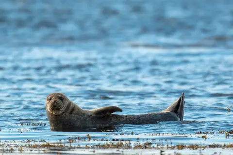
Misty Fjords National Monument is een 930.000 hectare groot wildernisgebied in Zuidoost-Alaska, waar steile granieten kliffen oprijzen uit spiegelgladde fjorden door eeuwige sluiers van mist en wolken. Must-dos zijn onder andere kajakken door stille fjordarmen, zodiac-cruisen langs watervallen en de vulkanische New Eddystone Rock, en het spotten van beren, adelaars en orka's in de ongerepte kanalen. Van mei tot september is het bezoekseizoen, met regen die bijdraagt aan de etherische sfeer van het monument.
Misty Fjords National Monument is a section of the Tongass National Forest in Alaska’s extreme southeastern Panhandle region. The monument consists of over two million acres of deeply cut fjords cradled in U-shaped valleys between mountain ranges rising 2,000 to 3,000 feet above sea level. The fjords themselves extend as much as 1,000 feet below the surface. These granite ranges are covered with virgin forest, and most of the monument is also a dedicated wilderness area. Misty Fjords inspired the explorer John Muir to proclaim them among the most beautiful places he had ever seen. Your ship will cruise among these spectacular forests, waterfalls and mountains. The onboard Ventures by Seabourn team will offer optional excursions including kayaking the fjords and a short sightseeing floatplane flight.
Prince Rupert, een historische spoorwegterminus aan de noordkust van British Columbia, betovert bezoekers met zijn diepe Tsimshian-erfgoed, wereldklasse heilbotvisserij en mistige regenwoudscenery langs de Inside Passage. Proef vers gerookte zalm aan de waterkant en verken de North Pacific Cannery, de oudste nog bestaande conservenfabriek van Canada, voor een levendige ontmoeting met de maritieme ziel van de haven. De beste tijd om te bezoeken is van juni tot augustus, wanneer langere dagen de beroemde regenval temperen en de activiteit van wildlife langs de kust op zijn hoogtepunt is.
Grenville Channel is a long, well-protected channel along the northern British Columbia coast between the large Pitt Island and the mainland. It is an important shipping lane, and you are likely to see ships of many different types and sizes as you pass through. The shores are mountainous on both sides, with two notable peaks about halfway through, Mt. Batchellor on the east side and Mt. Saunders on Pitt Island to the west. There are a number of Indian Reserves and Marine Parks in the mountains and narrow waterways off the channel.
Whale Channel is a picturesque waterway separating Gil Island from Princess Royal Island in British Columbia’s Inside Passage. Surrounded by snow-capped mountain ranges and teeming with marine life, It is a diversion from the main shipping lane, located roughly halfway between Prince Rupert and the First Nations village of Klemtu. VIEW CRUISES Skip Footer Content About Us
The Princess Royal Channel separates the largest island along British Columbia’s coast from the mainland. It is located roughly halfway between Bella Bella in the south and Prince Rupert in the north, in one of the province’s most remote areas. Princess Royal island was named in 1788 by Captain Charles Duncan, in honor of his ship, the Princess Royal. The island is uninhabited, although there are two small villages in the channel, the First Nations community of Klemtu on Swindle Island and Hartley Bay on the mainland. Wildlife, by contrast, is plentiful, including Kermode, black and grizzly bears, deer, wolves and foxes. Golden and bald eagles nest in the region, as well as the endangered marbled murrelet. In the waters, there are abundant salmon, elephant seals, whales, orcas and dolphins.
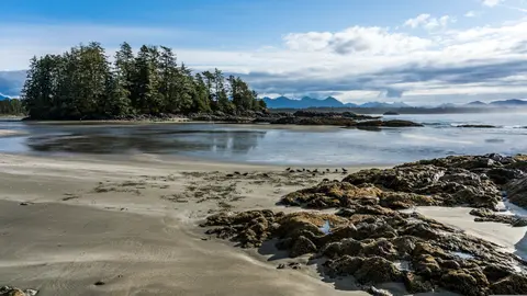
Alert Bay, Canada is een unieke havenstad waar een diep cultureel erfgoed samenkomt met een authentieke lokale sfeer, opgenomen in de reisroutes van HX Expeditions. Must-do ervaringen zijn onder andere een wandeling door het historische centrum om het gelaagde architectonische erfgoed te ervaren, en het ontdekken van de regionale culinaire tradities in een lokaal favoriet etablissement buiten het havengebied. De beste tijd om te bezoeken is van juni tot augustus, wanneer de zomermaanden de warmste temperaturen en de langste dagen met zich meebrengen.
Johnstone Strait is a well-protected shipping route passing 68 miles/110 km along the northeast shore of Vancouver Island between the island and the mainland of British Columbia. The strait is between 1 ½ miles and 3 miles wide, and leads from the broad Georgia Strait through a narrow channel called Discovery Passage. The strait was named by Vancouver in 1792 for James Johnstone, the master of one of his tenders during the survey expedition that revealed Vancouver Island to be an island. There are no cities or towns on the strait. The Johnstone Strait is the summer range of a large pod of seasonally resident orcas which are frequently seen in the area. VIEW CRUISES Skip Footer Content About Us Our Company News Careers Contact Us Video Gallery Accessibility Seabourn Club Seabourn Referral Program Travel Resources
The Seymour Narrows is a 3-mile/5 km stretch of the Discovery Channel north of Vancouver Island, British Columbia that is notorious for the strength of the tidal currents flowing through it. The average width of the narrows is just 750 meters. During extreme tides, the current through the narrows is subject to severe Venturi effect, resulting in an increased velocity that can reach 15 knots. For much of its modern history, there was an additional hazard in the narrows called Ripple Rock, a shallow obstruction that claimed no fewer than 119 ships and 114 lives. In 1958, after months of tunneling and preparation, Ripple Rock was blown up in the largest commercial, non-nuclear explosion ever recorded in North America. Still, the navigation of Seymour Narrows is dependent on tidal and other conditions, and requires skill and technical accomplishment.
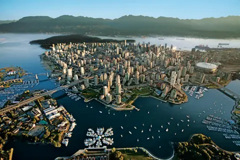
Geperst tussen de Stille Oceaan en de Coast Mountains, is Vancouver de natuurlijke toegangspoort tot de Inside Passage van Alaska — een stad waar gematigd regenwoud ontmoet glazen torens en waar Dungeness-kreeft en wilde sockeye-zalm een Pacific Rim-keuken definiëren die met elke in Noord-Amerika kan concurreren. Wandel over de 22 kilometer lange zeewering van Stanley Park, verdwaal in de markt van Granville Island en neem de veerboot naar de Edwardiaanse pracht van Victoria. Het cruiseseizoen naar Alaska bereikt zijn hoogtepunt van mei tot september, waardoor Vancouver een ideaal startpunt is voor een van de grootste oceaanreizen ter wereld.
Day 1
De enige staatshoofdstad van Amerika die niet per weg bereikbaar is, Juneau beloont de reis met een wildernisgrootheid die weinige steden op aarde kunnen evenaren. De Mendenhall-gletsjer — een levende rivier van oude ijs — ligt op slechts vijftien minuten van het centrum, waar watervliegtuigen boven een waterfront dartelen dat wordt geflankeerd door met sparren bedekte bergen die recht in de zee duiken. De must-do ervaring is een helikopterlanding op de ijsveld of een walvisspot-excursie in Stephens Passage, waar bultruggen in verbazingwekkende nabijheid breken. Juneau is het warmst van juni tot augustus, hoewel zelfs zomerse dagen de beroemde regen van Zuidoost-Alaska kunnen brengen die het regenwoud perpetueel stralend houdt.
Day 2
Glacier Bay National Park is een van de meest indrukwekkende landschappen van actieve gletsjerwerking op aarde — 3,3 miljoen acres in het zuidoosten van Alaska waar gletsjers ijsbergen ter grootte van kathedralen in fjorden van luminescent blauw water afkalven, en waar het land zelf nog steeds stijgt, bevrijd van het gewicht van ijs dat deze hele regio slechts twee eeuwen geleden bedekte. Het park, alleen bereikbaar per schip of klein vliegtuig, beloont bezoekers met ontmoetingen met wilde dieren — bultruggen, bruine beren, zeeotters en berggeiten — tegen een achtergrond van bijna overweldigende grandeur. Het seizoen loopt van mei tot september; eind juni en juli bieden de langste dagen en de meest betrouwbare wilde dierenactiviteit.
Day 3
Decision Passage is the western end of the Sumner Strait, which runs through the Alexander Archipelago into the Pacific Ocean in Southeastern Alaska, bounded on the north by Kuiu Island and Cape Decision, the location of a 1932 lighthouse. This is the route your ship takes when coming from or going to the colorful historic community of Sitka on the west coast of Baranof Island, which was originally the Russian fortress town of New Archangel.
Wrangell is een van de meest authentieke havens in de Inside Passage van Alaska, waar Tlingit-erfgoed, oude petroglyphen en wereldklasse wildlife samenkomen bij de monding van de machtige Stikine-rivier. Essentiële ervaringen zijn het jetbootvaren naar de LeConte-gletsjer, het kijken naar beren die vissen bij Anan Creek, en het proeven van lokaal gerookte zalm. Juli en augustus bieden de beste zalmloop en berenobservatie.
Stikine Strait is a picturesque channel in the Alexander Archipelago of Alaska between Zarembo Island and Woronkofski and Etolin Islands near the mouth of the Stikine River south of Wrangell. It first appears on an 1848 Russian chart as Stakhin Strait and has been spelled variously on many charts since that time.
Day 4
The 108-mile Behm Canal runs from the Clarence Strait through the Alexander Archipelago of Southeast Alaska, and into the channel separating Revillagigedo Island from the mainland. It forms part Inside Passage on the route between Ketchikan and the Misty Fjords National Monument. The canal was named by George Vancouver during his surveying expedition in 1793, in honor of Magnus von Behm, who had been governor of Kamchatka in the Russian Far East when Vancouver called at Petropavlovsk with Captain Cook’s expedition following the Cook’s murder in Hawaii.
Misty Fjords National Monument is een 930.000 hectare groot wildernisgebied in Zuidoost-Alaska, waar steile granieten kliffen oprijzen uit spiegelgladde fjorden door eeuwige sluiers van mist en wolken. Must-dos zijn onder andere kajakken door stille fjordarmen, zodiac-cruisen langs watervallen en de vulkanische New Eddystone Rock, en het spotten van beren, adelaars en orka's in de ongerepte kanalen. Van mei tot september is het bezoekseizoen, met regen die bijdraagt aan de etherische sfeer van het monument.
Misty Fjords National Monument is a section of the Tongass National Forest in Alaska’s extreme southeastern Panhandle region. The monument consists of over two million acres of deeply cut fjords cradled in U-shaped valleys between mountain ranges rising 2,000 to 3,000 feet above sea level. The fjords themselves extend as much as 1,000 feet below the surface. These granite ranges are covered with virgin forest, and most of the monument is also a dedicated wilderness area. Misty Fjords inspired the explorer John Muir to proclaim them among the most beautiful places he had ever seen. Your ship will cruise among these spectacular forests, waterfalls and mountains. The onboard Ventures by Seabourn team will offer optional excursions including kayaking the fjords and a short sightseeing floatplane flight.
Day 5
Prince Rupert, een historische spoorwegterminus aan de noordkust van British Columbia, betovert bezoekers met zijn diepe Tsimshian-erfgoed, wereldklasse heilbotvisserij en mistige regenwoudscenery langs de Inside Passage. Proef vers gerookte zalm aan de waterkant en verken de North Pacific Cannery, de oudste nog bestaande conservenfabriek van Canada, voor een levendige ontmoeting met de maritieme ziel van de haven. De beste tijd om te bezoeken is van juni tot augustus, wanneer langere dagen de beroemde regenval temperen en de activiteit van wildlife langs de kust op zijn hoogtepunt is.
Day 6
Grenville Channel is a long, well-protected channel along the northern British Columbia coast between the large Pitt Island and the mainland. It is an important shipping lane, and you are likely to see ships of many different types and sizes as you pass through. The shores are mountainous on both sides, with two notable peaks about halfway through, Mt. Batchellor on the east side and Mt. Saunders on Pitt Island to the west. There are a number of Indian Reserves and Marine Parks in the mountains and narrow waterways off the channel.
Whale Channel is a picturesque waterway separating Gil Island from Princess Royal Island in British Columbia’s Inside Passage. Surrounded by snow-capped mountain ranges and teeming with marine life, It is a diversion from the main shipping lane, located roughly halfway between Prince Rupert and the First Nations village of Klemtu. VIEW CRUISES Skip Footer Content About Us
The Princess Royal Channel separates the largest island along British Columbia’s coast from the mainland. It is located roughly halfway between Bella Bella in the south and Prince Rupert in the north, in one of the province’s most remote areas. Princess Royal island was named in 1788 by Captain Charles Duncan, in honor of his ship, the Princess Royal. The island is uninhabited, although there are two small villages in the channel, the First Nations community of Klemtu on Swindle Island and Hartley Bay on the mainland. Wildlife, by contrast, is plentiful, including Kermode, black and grizzly bears, deer, wolves and foxes. Golden and bald eagles nest in the region, as well as the endangered marbled murrelet. In the waters, there are abundant salmon, elephant seals, whales, orcas and dolphins.
Day 7
Alert Bay, Canada is een unieke havenstad waar een diep cultureel erfgoed samenkomt met een authentieke lokale sfeer, opgenomen in de reisroutes van HX Expeditions. Must-do ervaringen zijn onder andere een wandeling door het historische centrum om het gelaagde architectonische erfgoed te ervaren, en het ontdekken van de regionale culinaire tradities in een lokaal favoriet etablissement buiten het havengebied. De beste tijd om te bezoeken is van juni tot augustus, wanneer de zomermaanden de warmste temperaturen en de langste dagen met zich meebrengen.
Johnstone Strait is a well-protected shipping route passing 68 miles/110 km along the northeast shore of Vancouver Island between the island and the mainland of British Columbia. The strait is between 1 ½ miles and 3 miles wide, and leads from the broad Georgia Strait through a narrow channel called Discovery Passage. The strait was named by Vancouver in 1792 for James Johnstone, the master of one of his tenders during the survey expedition that revealed Vancouver Island to be an island. There are no cities or towns on the strait. The Johnstone Strait is the summer range of a large pod of seasonally resident orcas which are frequently seen in the area. VIEW CRUISES Skip Footer Content About Us Our Company News Careers Contact Us Video Gallery Accessibility Seabourn Club Seabourn Referral Program Travel Resources
The Seymour Narrows is a 3-mile/5 km stretch of the Discovery Channel north of Vancouver Island, British Columbia that is notorious for the strength of the tidal currents flowing through it. The average width of the narrows is just 750 meters. During extreme tides, the current through the narrows is subject to severe Venturi effect, resulting in an increased velocity that can reach 15 knots. For much of its modern history, there was an additional hazard in the narrows called Ripple Rock, a shallow obstruction that claimed no fewer than 119 ships and 114 lives. In 1958, after months of tunneling and preparation, Ripple Rock was blown up in the largest commercial, non-nuclear explosion ever recorded in North America. Still, the navigation of Seymour Narrows is dependent on tidal and other conditions, and requires skill and technical accomplishment.
Day 8
Geperst tussen de Stille Oceaan en de Coast Mountains, is Vancouver de natuurlijke toegangspoort tot de Inside Passage van Alaska — een stad waar gematigd regenwoud ontmoet glazen torens en waar Dungeness-kreeft en wilde sockeye-zalm een Pacific Rim-keuken definiëren die met elke in Noord-Amerika kan concurreren. Wandel over de 22 kilometer lange zeewering van Stanley Park, verdwaal in de markt van Granville Island en neem de veerboot naar de Edwardiaanse pracht van Victoria. Het cruiseseizoen naar Alaska bereikt zijn hoogtepunt van mei tot september, waardoor Vancouver een ideaal startpunt is voor een van de grootste oceaanreizen ter wereld.
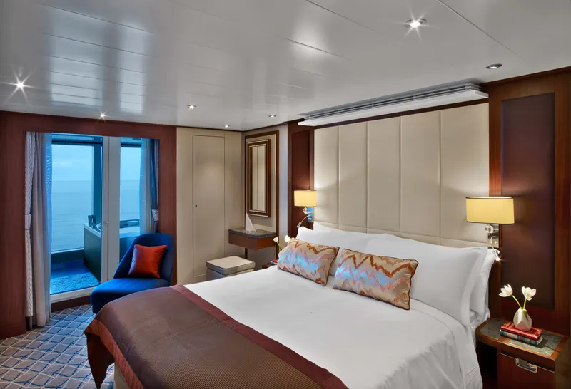
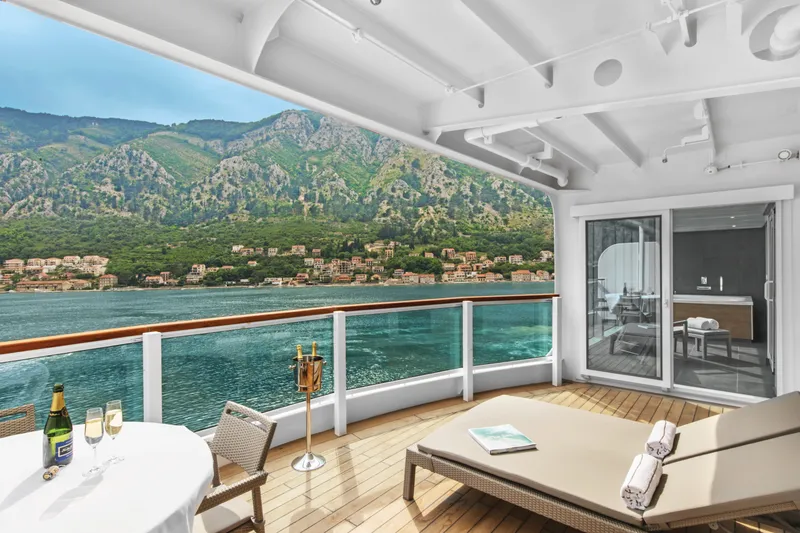

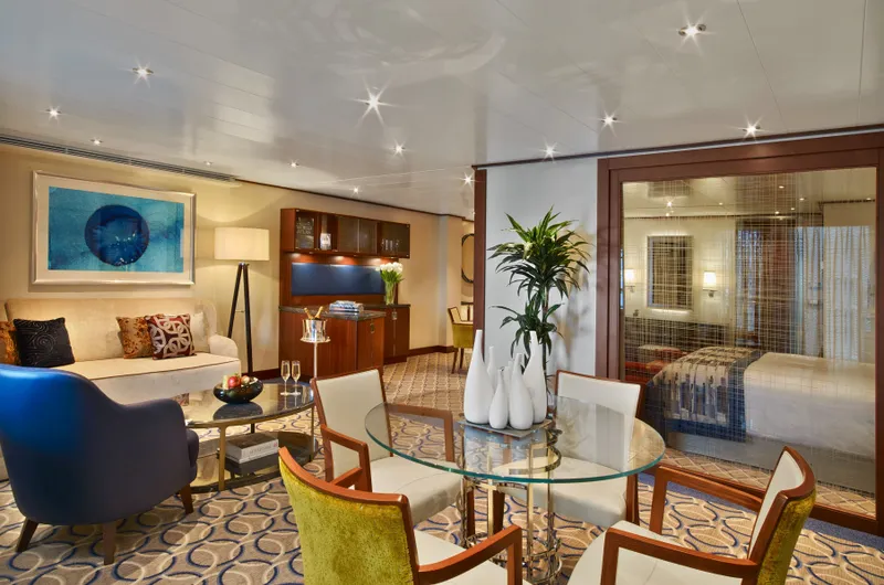





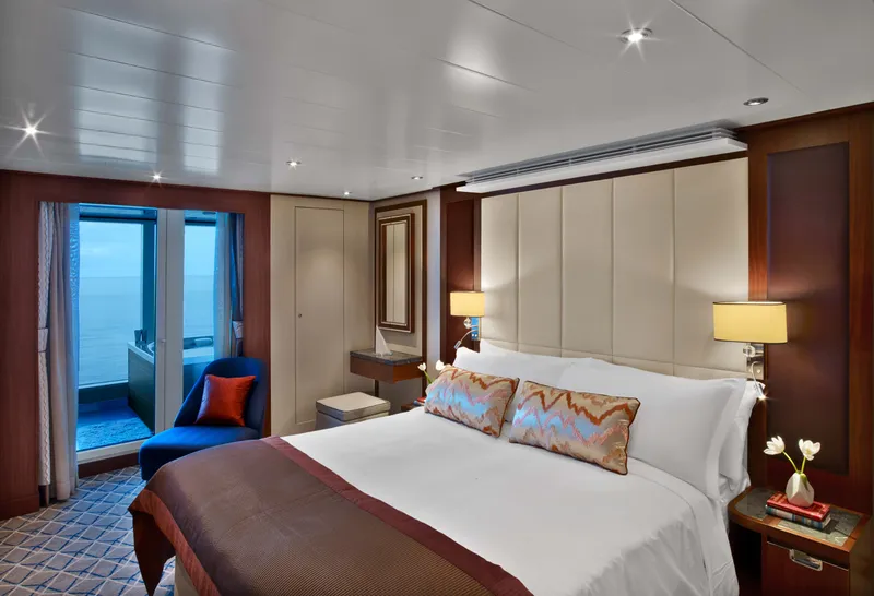
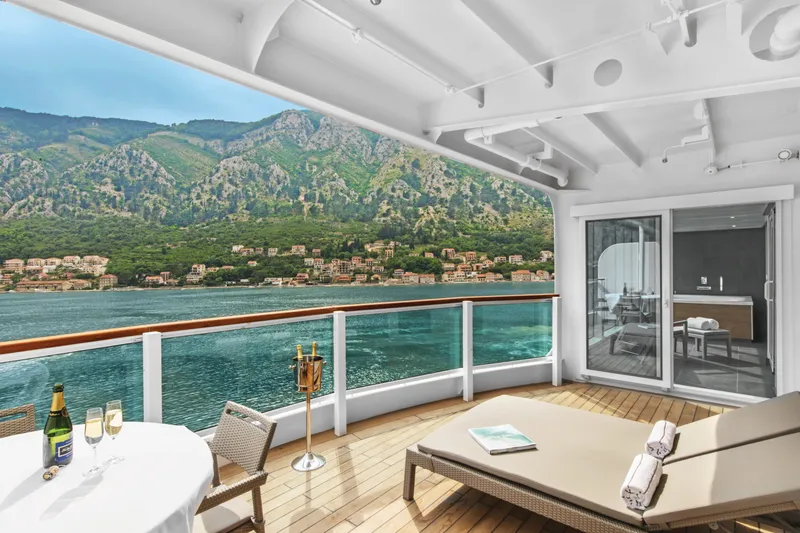

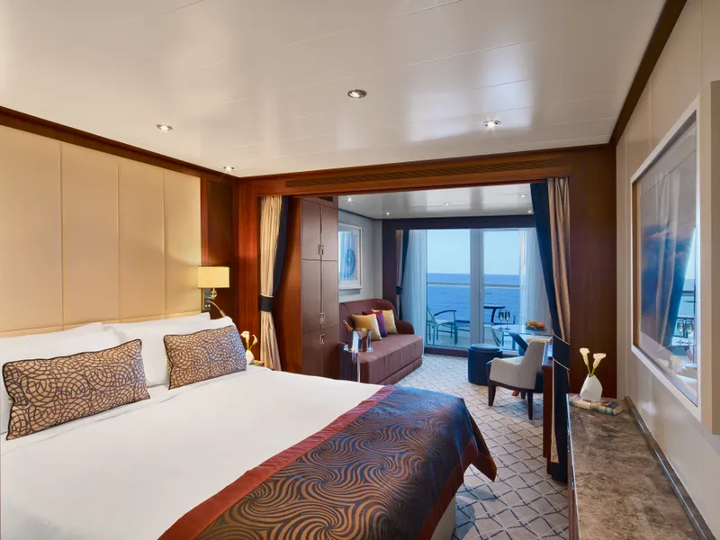
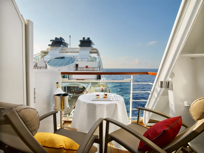

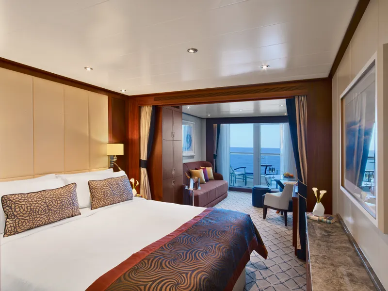
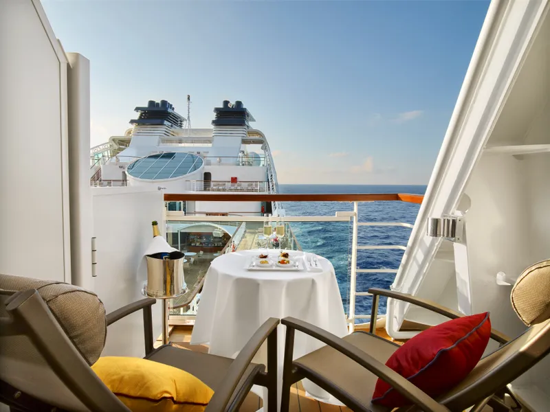


Our cruise specialists can help you find the perfect cabin and the best available pricing.
(+886) 02-2721-7300Contact Advisor