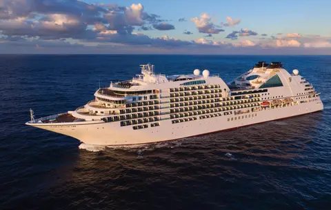
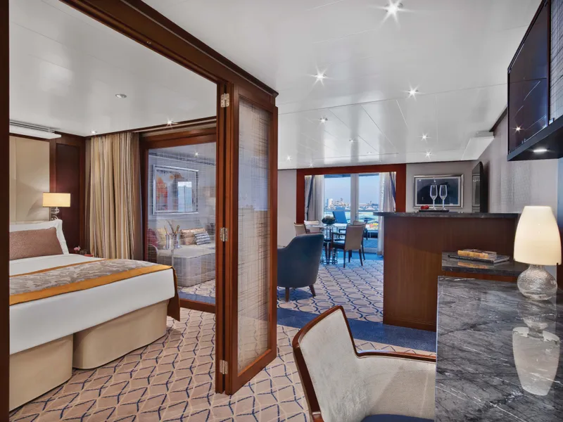
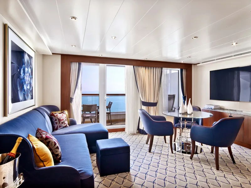
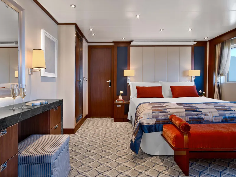
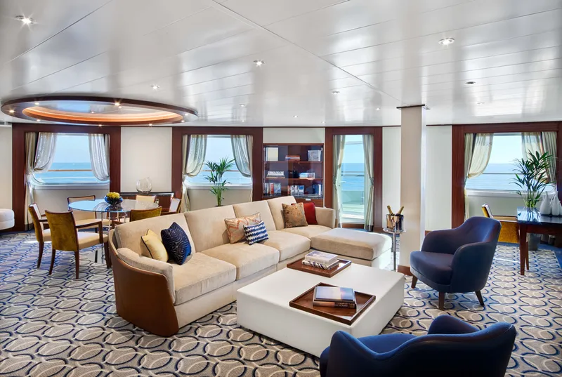
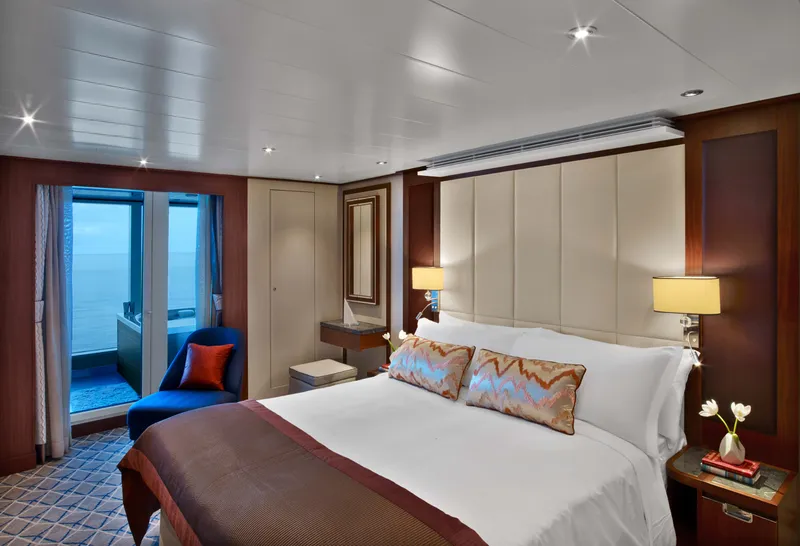
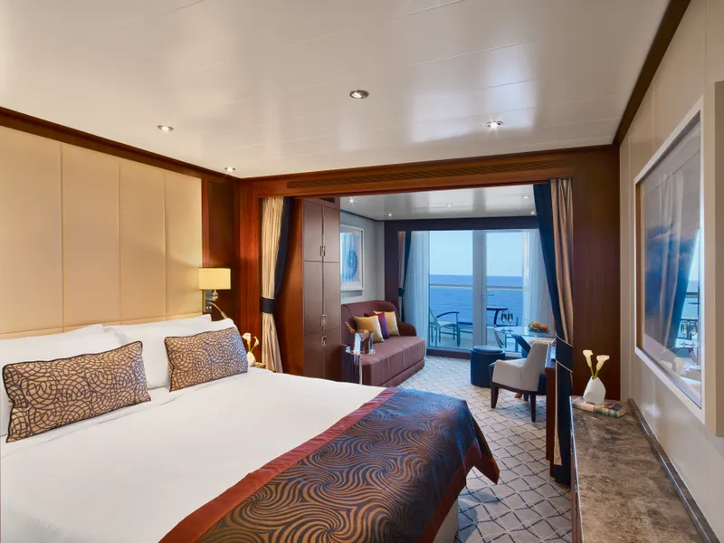
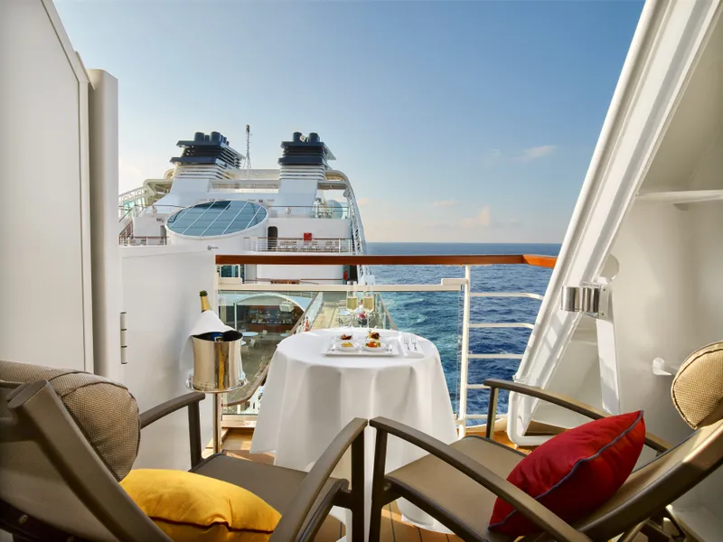
Seabourn7654A
الاسکا گلیشیئرز، فیورڈز اور اندرونی راستہ
Date
2026-08-07
Duration
14 nights
Departure Port
وینکوور
کینیڈا
Arrival Port
وینکوور
کینیڈا
Rating
Luxury
Theme
—
Date
2026-08-07
Duration
14 nights
Departure Port
وینکوور
کینیڈا
Arrival Port
وینکوور
کینیڈا
Rating
Luxury
Theme
—


Seabourn
2016
—
40,350 GT
600
266
330
690 m
28 m
19 knots
No

پیسیفک اور کوسٹ پہاڑوں کے درمیان دبا ہوا، وینکوور الاسکا کے اندرونی گزرگاہ کا قدرتی دروازہ ہے — ایک شہر جہاں معتدل بارش کا جنگل شیشے کی عمارتوں سے ملتا ہے اور جہاں ڈنجن کریب اور جنگلی ساکائے سالمن ایک ایسا پیسیفک ریم کا کھانا بناتے ہیں جو شمالی امریکہ میں کسی بھی چیز کا مقابلہ کرتا ہے۔ 22 کلومیٹر اسٹینلے پارک سمندر کی دیوار پر چلیں، گرینول آئی لینڈ مارکیٹ میں خود کو کھو دیں، پھر وکٹوریا کی ایڈورڈین شان کی طرف فیری کریں۔ الاسکا کے کروز سیزن کا عروج مئی سے ستمبر تک ہوتا ہے، جس سے وینکوور دنیا کے عظیم سمندری سفر کے لیے ایک مثالی آغاز بناتا ہے۔
The Queen Charlotte Sound lies between the Queen Charlotte Strait, which winds between Vancouver Island and the British Columbia mainland in the south, and Hecate Strait, which is northward, adjacent to the Haida Gwaii Islands off the Pacific coast of British Columbia. It is a broad reach in the long shipping route called the Inside Passage threading the myriad islands stretching from Washington’s Puget Sound to Alaska.
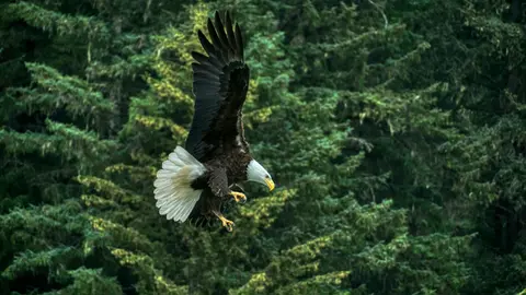
کیچیکن الاسکا کے جنوب مشرقی پین ہینڈل میں ریولیاگیگیدو جزیرے کے جنگلاتی ساحل پر واقع ہے — ایک ایسا شہر جو اتنا تنگ ہے کہ مقامی لوگ مذاق کرتے ہیں کہ یہ تین میل لمبا اور تین بلاک چوڑا ہے۔ یہ ہزاروں سالوں سے ٹلنگٹ لوگوں کے لیے سالمن کی فراوانی کی جگہ کے طور پر محترم ہے، آج اسے دنیا کے توتم پول کیپیٹل کے طور پر منایا جاتا ہے: سیکسمن نیٹو ولیج اور توتم بائٹ اسٹیٹ ہسٹوریکل پارک میں ان یادگار فن پاروں کا سب سے اہم مجموعہ محفوظ کیا گیا ہے۔ کریک اسٹریٹ، کیچیکن کریک کے اوپر بنے رنگین تاریخی گھروں کی ایک بورڈ واک، کو نظر انداز نہیں کیا جانا چاہیے۔ موسم گرما (مئی–ستمبر) بہترین موسم لاتا ہے، جب نیچے کی ندیوں میں سالمن دوڑتے ہیں۔

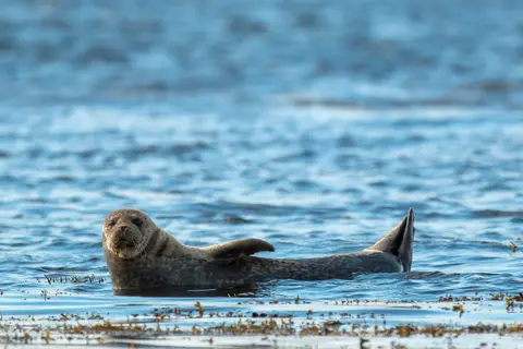
سِٹکا، بارانووف جزیرے کے جنگلی مغربی ساحل پر واقع ہے، پیسیفک شمال مغرب کے سب سے تاریخی بندرگاہوں میں سے ایک ہے — ایک ایسا مقام جہاں روسی آرتھوڈوکس پیاز کی گنبدیں توتم پولز کے اوپر بلند ہوتی ہیں اور عظیم معتدل بارش کے جنگلات پانی کی سطح تک دبا دیتے ہیں۔ سِٹکا نیشنل ہسٹوریکل پارک 1804 کی لڑائی کی جگہ کو محفوظ رکھتا ہے جو ٹلنگٹ جنگجوؤں اور روسی نوآبادیات کے درمیان ہوئی تھی، ساتھ ہی ایک شاندار یادگاری پولز کا مجموعہ بھی ہے۔ وہیل دیکھنا، سمندری آٹروں کے درمیان سمندری کایاکنگ، اور ارد گرد کی وائلڈنیس میں بھورے ریچھوں کی تلاش باہر کے تجربے کی وضاحت کرتی ہے۔ مئی سے ستمبر کے دوران سب سے زیادہ قابل رسائی اور چمکدار حالات فراہم کیے جاتے ہیں۔
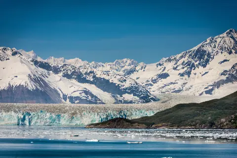
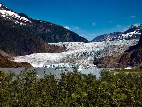
ہبّارڈ گلیشیر، جسے "گالاپنگ گلیشیر" کے نام سے جانا جاتا ہے، مشرقی الاسکا میں ایک دلکش قدرتی عجوبہ ہے، جو اپنے شاندار برف کے ڈھانچوں اور جنگلی حیات کے ساتھ زائرین کو مسحور کرتا ہے۔ لازمی تجربات میں گلیشیر کے ٹوٹنے کا مشاہدہ کرنا اور قریبی اسکاگ وے میں مقامی لذیذ کھانے جیسے ڈنجینیس کیکڑے اور رینڈیئر ساسیج کا لطف اٹھانا شامل ہیں۔ یہاں آنے کا بہترین موسم گرمیوں کے مہینے ہیں جب موسم ہلکا پھلکا ہوتا ہے اور جنگلی حیات وافر ہوتی ہے۔
The Hubbard Glacier is the largest, and one of the most spectacular tidewater glaciers in North America. Its ice cliffs, some 400’ (121 m) tall, calve icebergs into the fjord, which may frequently be larger than a five-story building. The glacier’s surface is creased and contorted, resembling the wrinkled skin of a giant elephant. Records show it has been growing in thickness and advancing since 1895. This stands in stark contrast to other glaciers around the world, most of which have been receding during the past century. In 2002, the glacier blocked Russell Fjord for two and a half months, raising water levels 61’ (18 m) and threatening local communities with flooding. Nutrient-rich waters along the glacier face attract many species. Gulls and kittiwake colonies adorn smaller islands and harbor seals patrol the icy waters. In 1890, Israel Russell explored the area of Yakutat Bay and Hubbard Glacier, naming it after Gardiner G. Hubbard, a financier of his expedition and a founder and the first president of the National Geographic Society. VIEW CRUISES
اینیان جزائر ایک ویران، بے آب و گیاہ جزیرہ گروپ ہیں جو الاسکا کے کراس ساؤنڈ کے دروازے پر واقع ہیں، جو غیر معمولی جنگلی حیات کے تجربات کے لیے مشہور ہیں، جن میں ہیمپ بیک وہیل کا بلبلہ نیٹ کھانا اور بڑے اسٹیلر سمندری شیر کی کالونیاں شامل ہیں۔ لازمی سرگرمیوں میں جزائر کے پتھریلے ساحلوں کے ساتھ زوڈیک سیر کرنا، تعاون سے وہیل کھانا دیکھنا، اور سمندری حیات سے بھرپور جزر و مد کے تالابوں کی کھوج کرنا شامل ہیں۔ جولائی سے اگست تک کا دورہ کریں جب وہیل کی سرگرمی عروج پر ہوتی ہے اور سمندری حالات بہترین ہوتے ہیں۔
ہینس ایک حقیقی الاسکائی شہر ہے جو شمالی امریکہ کے سب سے گہرے فیورڈ پر واقع ہے، جہاں دنیا کی سب سے بڑی عقابی جماعت موجود ہے — چِلکَٹ دریا کے ساتھ چار ہزار پرندے تک — اور ایک ترقی پذیر فنون کی کمیونٹی ہے جو ٹلنگٹ ثقافتی روایات کو محفوظ رکھتی ہے۔ جون سے اگست تک کنارڈ یا لنڈبلاد کے ذریعے آئیں، جہاں آپ گلیشیئر ہیلی کاپٹر لینڈنگ اور ساحلی ہائیکنگ کا تجربہ کر سکتے ہیں، یا اکتوبر سے فروری تک اس غیر معمولی عقابی منظر کو دیکھنے کے لیے آئیں جو ہینس کو الاسکا کا بہترین راز بناتا ہے۔
امریکہ کا واحد ریاستی دارالحکومت جو سڑک کے ذریعے نہیں پہنچا جا سکتا، جوناؤ اس سفر کا انعام ایک ایسی جنگلی خوبصورتی ہے جس کا مقابلہ زمین پر چند شہر کر سکتے ہیں۔ مینڈن ہال گلیشیر — قدیم برف کا ایک زندہ دریا — شہر کے مرکز سے صرف پندرہ منٹ کی دوری پر ہے، جہاں فلورٹ طیارے ایک سمندری کنارے کے اوپر اڑتے ہیں جو سپروس سے ڈھکے پہاڑوں کے ساتھ سمندر میں گرتے ہیں۔ لازمی تجربہ یہ ہے کہ ہیلی کاپٹر برف کے میدان پر اترنا یا اسٹیفنز پاسج میں وہیل دیکھنے کا دورہ کرنا، جہاں ہیمپ بیک انتہائی قریب سے چھلانگ لگاتے ہیں۔ جوناؤ جون سے اگست تک سب سے گرم ہوتا ہے، حالانکہ یہاں تک کہ گرمیوں کے دن بھی مشہور جنوب مشرقی الاسکا کی بارش لا سکتے ہیں جو بارش کے جنگل کو ہمیشہ چمکدار رکھتا ہے.
ٹریسی آرم ایک شاندار 30 میل کا فیورڈ ہے جو الاسکا کے ٹونگاس نیشنل فاریسٹ میں واقع ہے، جو اپنے ڈرامائی مناظر اور وافر جنگلی حیات کے لیے مشہور ہے۔ ضروری تجربات میں فیورڈ کے ذریعے کشتی چلانا شامل ہے تاکہ گلیشیئرز کے ٹکڑے دیکھے جا سکیں اور مقامی سمندری غذا جیسے دھوئیں دار سالمن کا لطف اٹھایا جا سکے۔ بہترین موسم گرما کے مہینوں میں دورہ کرنا ہے جب یہ علاقہ متحرک اور قابل رسائی ہوتا ہے۔
رانگل الاسکا کی سب سے مستند اندرونی گزرگاہوں میں سے ایک ہے، جہاں ٹلنگٹ ورثہ، قدیم پتھر کے نقوش، اور عالمی معیار کی جنگلی حیات طاقتور اسٹکین دریا کے منہ پر ملتے ہیں۔ ضروری تجربات میں لیکونٹے گلیشئر تک جیٹ بوٹنگ، انان کریک پر ریچھوں کو مچھلی پکڑتے دیکھنا، اور مقامی طور پر دھوئیں میں پکائے گئے سالمن کا ذائقہ چکھنا شامل ہیں۔ جولائی اور اگست میں سالمن کی بہترین دوڑ اور ریچھوں کی دیکھنے کی سہولت ہوتی ہے۔
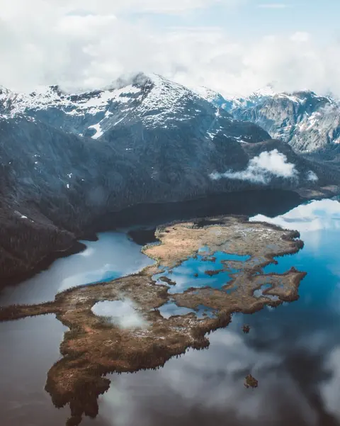
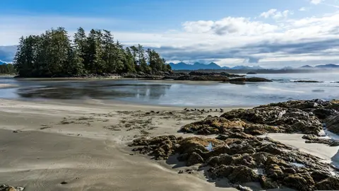
مسٹی فیورڈز قومی یادگار ایک 930,000 ہیکٹر کا جنگلی علاقہ ہے جو جنوب مشرقی الاسکا میں واقع ہے، جہاں خالص گرانائٹ کی چٹانیں آئینے کی طرح پرسکون فیورڈز سے بلند ہوتی ہیں جو ہمیشہ کی دھند اور بادلوں کی پردوں میں چھپی ہوتی ہیں۔ یہاں کرنے کی چیزوں میں خاموش فیورڈ کی شاخوں میں کایاکنگ کرنا، زوڈیک کشتیوں کے ذریعے آبشاروں اور آتش فشاں نیو ایڈسٹون راک کے پاس کشتی چلانا، اور بے آب و گیاہ چینلز میں ریچھ، عقاب، اور اورکا دیکھنا شامل ہیں۔ مئی سے ستمبر دورے کا موسم پیش کرتا ہے، بارش یادگار کی روحانی فضاء میں اضافہ کرتی ہے۔
پرنس روپرٹ، برطانوی کولمبیا کے شمالی ساحل پر ایک تاریخی ریلوے ٹرمینس، زائرین کو اپنی گہری ٹسمشیان وراثت، عالمی معیار کی ہالی بٹ مچھلی کے شکار، اور اندرونی راستے کے ساتھ دھندلا بارش کے جنگل کے منظرنامے سے مسحور کرتا ہے۔ سمندر کے کنارے تازہ دھوئیں دار سالمن کا ذائقہ لیں اور شمالی پیسیفک کینری، کینیڈا کی سب سے قدیم زندہ کینری کی کھوج کریں، تاکہ بندرگاہ کی سمندری روح کے ساتھ ایک زندہ دل ملاقات ہو۔ دورہ کرنے کا بہترین وقت جون سے اگست تک ہے، جب طویل دن مشہور بارش کو کم کرتے ہیں اور ساحل کے ساتھ جنگلی حیات کی سرگرمی عروج پر ہوتی ہے۔
Grenville Channel is a long, well-protected channel along the northern British Columbia coast between the large Pitt Island and the mainland. It is an important shipping lane, and you are likely to see ships of many different types and sizes as you pass through. The shores are mountainous on both sides, with two notable peaks about halfway through, Mt. Batchellor on the east side and Mt. Saunders on Pitt Island to the west. There are a number of Indian Reserves and Marine Parks in the mountains and narrow waterways off the channel.
Whale Channel is a picturesque waterway separating Gil Island from Princess Royal Island in British Columbia’s Inside Passage. Surrounded by snow-capped mountain ranges and teeming with marine life, It is a diversion from the main shipping lane, located roughly halfway between Prince Rupert and the First Nations village of Klemtu. VIEW CRUISES Skip Footer Content About Us
The Princess Royal Channel separates the largest island along British Columbia’s coast from the mainland. It is located roughly halfway between Bella Bella in the south and Prince Rupert in the north, in one of the province’s most remote areas. Princess Royal island was named in 1788 by Captain Charles Duncan, in honor of his ship, the Princess Royal. The island is uninhabited, although there are two small villages in the channel, the First Nations community of Klemtu on Swindle Island and Hartley Bay on the mainland. Wildlife, by contrast, is plentiful, including Kermode, black and grizzly bears, deer, wolves and foxes. Golden and bald eagles nest in the region, as well as the endangered marbled murrelet. In the waters, there are abundant salmon, elephant seals, whales, orcas and dolphins.
کینیڈا کا الرٹ بے ایک منفرد بندرگاہی شہر ہے جہاں گہری ثقافتی ورثہ اور حقیقی مقامی ماحول ملتے ہیں، جو HX Expeditions کے سفرناموں میں شامل ہے۔ لازمی تجربات میں تاریخی مرکز کی سیر کرنا شامل ہے تاکہ تہہ دار تعمیراتی ورثہ کا تجربہ کیا جا سکے، اور بندرگاہ کے علاقے سے دور ایک مقامی پسندیدہ ادارے میں علاقائی کھانے کی روایات کو تلاش کرنا۔ دورے کا بہترین وقت جون سے اگست ہے، جب گرمیوں کے مہینے سب سے زیادہ درجہ حرارت اور طویل دن لاتے ہیں۔
Johnstone Strait is a well-protected shipping route passing 68 miles/110 km along the northeast shore of Vancouver Island between the island and the mainland of British Columbia. The strait is between 1 ½ miles and 3 miles wide, and leads from the broad Georgia Strait through a narrow channel called Discovery Passage. The strait was named by Vancouver in 1792 for James Johnstone, the master of one of his tenders during the survey expedition that revealed Vancouver Island to be an island. There are no cities or towns on the strait. The Johnstone Strait is the summer range of a large pod of seasonally resident orcas which are frequently seen in the area. VIEW CRUISES Skip Footer Content About Us Our Company News Careers Contact Us Video Gallery Accessibility Seabourn Club Seabourn Referral Program Travel Resources

پیسیفک اور کوسٹ پہاڑوں کے درمیان دبا ہوا، وینکوور الاسکا کے اندرونی گزرگاہ کا قدرتی دروازہ ہے — ایک شہر جہاں معتدل بارش کا جنگل شیشے کی عمارتوں سے ملتا ہے اور جہاں ڈنجن کریب اور جنگلی ساکائے سالمن ایک ایسا پیسیفک ریم کا کھانا بناتے ہیں جو شمالی امریکہ میں کسی بھی چیز کا مقابلہ کرتا ہے۔ 22 کلومیٹر اسٹینلے پارک سمندر کی دیوار پر چلیں، گرینول آئی لینڈ مارکیٹ میں خود کو کھو دیں، پھر وکٹوریا کی ایڈورڈین شان کی طرف فیری کریں۔ الاسکا کے کروز سیزن کا عروج مئی سے ستمبر تک ہوتا ہے، جس سے وینکوور دنیا کے عظیم سمندری سفر کے لیے ایک مثالی آغاز بناتا ہے۔
Day 1
پیسیفک اور کوسٹ پہاڑوں کے درمیان دبا ہوا، وینکوور الاسکا کے اندرونی گزرگاہ کا قدرتی دروازہ ہے — ایک شہر جہاں معتدل بارش کا جنگل شیشے کی عمارتوں سے ملتا ہے اور جہاں ڈنجن کریب اور جنگلی ساکائے سالمن ایک ایسا پیسیفک ریم کا کھانا بناتے ہیں جو شمالی امریکہ میں کسی بھی چیز کا مقابلہ کرتا ہے۔ 22 کلومیٹر اسٹینلے پارک سمندر کی دیوار پر چلیں، گرینول آئی لینڈ مارکیٹ میں خود کو کھو دیں، پھر وکٹوریا کی ایڈورڈین شان کی طرف فیری کریں۔ الاسکا کے کروز سیزن کا عروج مئی سے ستمبر تک ہوتا ہے، جس سے وینکوور دنیا کے عظیم سمندری سفر کے لیے ایک مثالی آغاز بناتا ہے۔
Day 2
The Queen Charlotte Sound lies between the Queen Charlotte Strait, which winds between Vancouver Island and the British Columbia mainland in the south, and Hecate Strait, which is northward, adjacent to the Haida Gwaii Islands off the Pacific coast of British Columbia. It is a broad reach in the long shipping route called the Inside Passage threading the myriad islands stretching from Washington’s Puget Sound to Alaska.
Day 3
کیچیکن الاسکا کے جنوب مشرقی پین ہینڈل میں ریولیاگیگیدو جزیرے کے جنگلاتی ساحل پر واقع ہے — ایک ایسا شہر جو اتنا تنگ ہے کہ مقامی لوگ مذاق کرتے ہیں کہ یہ تین میل لمبا اور تین بلاک چوڑا ہے۔ یہ ہزاروں سالوں سے ٹلنگٹ لوگوں کے لیے سالمن کی فراوانی کی جگہ کے طور پر محترم ہے، آج اسے دنیا کے توتم پول کیپیٹل کے طور پر منایا جاتا ہے: سیکسمن نیٹو ولیج اور توتم بائٹ اسٹیٹ ہسٹوریکل پارک میں ان یادگار فن پاروں کا سب سے اہم مجموعہ محفوظ کیا گیا ہے۔ کریک اسٹریٹ، کیچیکن کریک کے اوپر بنے رنگین تاریخی گھروں کی ایک بورڈ واک، کو نظر انداز نہیں کیا جانا چاہیے۔ موسم گرما (مئی–ستمبر) بہترین موسم لاتا ہے، جب نیچے کی ندیوں میں سالمن دوڑتے ہیں۔
Day 4
سِٹکا، بارانووف جزیرے کے جنگلی مغربی ساحل پر واقع ہے، پیسیفک شمال مغرب کے سب سے تاریخی بندرگاہوں میں سے ایک ہے — ایک ایسا مقام جہاں روسی آرتھوڈوکس پیاز کی گنبدیں توتم پولز کے اوپر بلند ہوتی ہیں اور عظیم معتدل بارش کے جنگلات پانی کی سطح تک دبا دیتے ہیں۔ سِٹکا نیشنل ہسٹوریکل پارک 1804 کی لڑائی کی جگہ کو محفوظ رکھتا ہے جو ٹلنگٹ جنگجوؤں اور روسی نوآبادیات کے درمیان ہوئی تھی، ساتھ ہی ایک شاندار یادگاری پولز کا مجموعہ بھی ہے۔ وہیل دیکھنا، سمندری آٹروں کے درمیان سمندری کایاکنگ، اور ارد گرد کی وائلڈنیس میں بھورے ریچھوں کی تلاش باہر کے تجربے کی وضاحت کرتی ہے۔ مئی سے ستمبر کے دوران سب سے زیادہ قابل رسائی اور چمکدار حالات فراہم کیے جاتے ہیں۔
Day 5
ہبّارڈ گلیشیر، جسے "گالاپنگ گلیشیر" کے نام سے جانا جاتا ہے، مشرقی الاسکا میں ایک دلکش قدرتی عجوبہ ہے، جو اپنے شاندار برف کے ڈھانچوں اور جنگلی حیات کے ساتھ زائرین کو مسحور کرتا ہے۔ لازمی تجربات میں گلیشیر کے ٹوٹنے کا مشاہدہ کرنا اور قریبی اسکاگ وے میں مقامی لذیذ کھانے جیسے ڈنجینیس کیکڑے اور رینڈیئر ساسیج کا لطف اٹھانا شامل ہیں۔ یہاں آنے کا بہترین موسم گرمیوں کے مہینے ہیں جب موسم ہلکا پھلکا ہوتا ہے اور جنگلی حیات وافر ہوتی ہے۔
The Hubbard Glacier is the largest, and one of the most spectacular tidewater glaciers in North America. Its ice cliffs, some 400’ (121 m) tall, calve icebergs into the fjord, which may frequently be larger than a five-story building. The glacier’s surface is creased and contorted, resembling the wrinkled skin of a giant elephant. Records show it has been growing in thickness and advancing since 1895. This stands in stark contrast to other glaciers around the world, most of which have been receding during the past century. In 2002, the glacier blocked Russell Fjord for two and a half months, raising water levels 61’ (18 m) and threatening local communities with flooding. Nutrient-rich waters along the glacier face attract many species. Gulls and kittiwake colonies adorn smaller islands and harbor seals patrol the icy waters. In 1890, Israel Russell explored the area of Yakutat Bay and Hubbard Glacier, naming it after Gardiner G. Hubbard, a financier of his expedition and a founder and the first president of the National Geographic Society. VIEW CRUISES
Day 6
اینیان جزائر ایک ویران، بے آب و گیاہ جزیرہ گروپ ہیں جو الاسکا کے کراس ساؤنڈ کے دروازے پر واقع ہیں، جو غیر معمولی جنگلی حیات کے تجربات کے لیے مشہور ہیں، جن میں ہیمپ بیک وہیل کا بلبلہ نیٹ کھانا اور بڑے اسٹیلر سمندری شیر کی کالونیاں شامل ہیں۔ لازمی سرگرمیوں میں جزائر کے پتھریلے ساحلوں کے ساتھ زوڈیک سیر کرنا، تعاون سے وہیل کھانا دیکھنا، اور سمندری حیات سے بھرپور جزر و مد کے تالابوں کی کھوج کرنا شامل ہیں۔ جولائی سے اگست تک کا دورہ کریں جب وہیل کی سرگرمی عروج پر ہوتی ہے اور سمندری حالات بہترین ہوتے ہیں۔
Day 7
ہینس ایک حقیقی الاسکائی شہر ہے جو شمالی امریکہ کے سب سے گہرے فیورڈ پر واقع ہے، جہاں دنیا کی سب سے بڑی عقابی جماعت موجود ہے — چِلکَٹ دریا کے ساتھ چار ہزار پرندے تک — اور ایک ترقی پذیر فنون کی کمیونٹی ہے جو ٹلنگٹ ثقافتی روایات کو محفوظ رکھتی ہے۔ جون سے اگست تک کنارڈ یا لنڈبلاد کے ذریعے آئیں، جہاں آپ گلیشیئر ہیلی کاپٹر لینڈنگ اور ساحلی ہائیکنگ کا تجربہ کر سکتے ہیں، یا اکتوبر سے فروری تک اس غیر معمولی عقابی منظر کو دیکھنے کے لیے آئیں جو ہینس کو الاسکا کا بہترین راز بناتا ہے۔
Day 8
امریکہ کا واحد ریاستی دارالحکومت جو سڑک کے ذریعے نہیں پہنچا جا سکتا، جوناؤ اس سفر کا انعام ایک ایسی جنگلی خوبصورتی ہے جس کا مقابلہ زمین پر چند شہر کر سکتے ہیں۔ مینڈن ہال گلیشیر — قدیم برف کا ایک زندہ دریا — شہر کے مرکز سے صرف پندرہ منٹ کی دوری پر ہے، جہاں فلورٹ طیارے ایک سمندری کنارے کے اوپر اڑتے ہیں جو سپروس سے ڈھکے پہاڑوں کے ساتھ سمندر میں گرتے ہیں۔ لازمی تجربہ یہ ہے کہ ہیلی کاپٹر برف کے میدان پر اترنا یا اسٹیفنز پاسج میں وہیل دیکھنے کا دورہ کرنا، جہاں ہیمپ بیک انتہائی قریب سے چھلانگ لگاتے ہیں۔ جوناؤ جون سے اگست تک سب سے گرم ہوتا ہے، حالانکہ یہاں تک کہ گرمیوں کے دن بھی مشہور جنوب مشرقی الاسکا کی بارش لا سکتے ہیں جو بارش کے جنگل کو ہمیشہ چمکدار رکھتا ہے.
Day 9
ٹریسی آرم ایک شاندار 30 میل کا فیورڈ ہے جو الاسکا کے ٹونگاس نیشنل فاریسٹ میں واقع ہے، جو اپنے ڈرامائی مناظر اور وافر جنگلی حیات کے لیے مشہور ہے۔ ضروری تجربات میں فیورڈ کے ذریعے کشتی چلانا شامل ہے تاکہ گلیشیئرز کے ٹکڑے دیکھے جا سکیں اور مقامی سمندری غذا جیسے دھوئیں دار سالمن کا لطف اٹھایا جا سکے۔ بہترین موسم گرما کے مہینوں میں دورہ کرنا ہے جب یہ علاقہ متحرک اور قابل رسائی ہوتا ہے۔
Day 10
رانگل الاسکا کی سب سے مستند اندرونی گزرگاہوں میں سے ایک ہے، جہاں ٹلنگٹ ورثہ، قدیم پتھر کے نقوش، اور عالمی معیار کی جنگلی حیات طاقتور اسٹکین دریا کے منہ پر ملتے ہیں۔ ضروری تجربات میں لیکونٹے گلیشئر تک جیٹ بوٹنگ، انان کریک پر ریچھوں کو مچھلی پکڑتے دیکھنا، اور مقامی طور پر دھوئیں میں پکائے گئے سالمن کا ذائقہ چکھنا شامل ہیں۔ جولائی اور اگست میں سالمن کی بہترین دوڑ اور ریچھوں کی دیکھنے کی سہولت ہوتی ہے۔
Day 11
مسٹی فیورڈز قومی یادگار ایک 930,000 ہیکٹر کا جنگلی علاقہ ہے جو جنوب مشرقی الاسکا میں واقع ہے، جہاں خالص گرانائٹ کی چٹانیں آئینے کی طرح پرسکون فیورڈز سے بلند ہوتی ہیں جو ہمیشہ کی دھند اور بادلوں کی پردوں میں چھپی ہوتی ہیں۔ یہاں کرنے کی چیزوں میں خاموش فیورڈ کی شاخوں میں کایاکنگ کرنا، زوڈیک کشتیوں کے ذریعے آبشاروں اور آتش فشاں نیو ایڈسٹون راک کے پاس کشتی چلانا، اور بے آب و گیاہ چینلز میں ریچھ، عقاب، اور اورکا دیکھنا شامل ہیں۔ مئی سے ستمبر دورے کا موسم پیش کرتا ہے، بارش یادگار کی روحانی فضاء میں اضافہ کرتی ہے۔
Day 12
پرنس روپرٹ، برطانوی کولمبیا کے شمالی ساحل پر ایک تاریخی ریلوے ٹرمینس، زائرین کو اپنی گہری ٹسمشیان وراثت، عالمی معیار کی ہالی بٹ مچھلی کے شکار، اور اندرونی راستے کے ساتھ دھندلا بارش کے جنگل کے منظرنامے سے مسحور کرتا ہے۔ سمندر کے کنارے تازہ دھوئیں دار سالمن کا ذائقہ لیں اور شمالی پیسیفک کینری، کینیڈا کی سب سے قدیم زندہ کینری کی کھوج کریں، تاکہ بندرگاہ کی سمندری روح کے ساتھ ایک زندہ دل ملاقات ہو۔ دورہ کرنے کا بہترین وقت جون سے اگست تک ہے، جب طویل دن مشہور بارش کو کم کرتے ہیں اور ساحل کے ساتھ جنگلی حیات کی سرگرمی عروج پر ہوتی ہے۔
Day 13
Grenville Channel is a long, well-protected channel along the northern British Columbia coast between the large Pitt Island and the mainland. It is an important shipping lane, and you are likely to see ships of many different types and sizes as you pass through. The shores are mountainous on both sides, with two notable peaks about halfway through, Mt. Batchellor on the east side and Mt. Saunders on Pitt Island to the west. There are a number of Indian Reserves and Marine Parks in the mountains and narrow waterways off the channel.
Whale Channel is a picturesque waterway separating Gil Island from Princess Royal Island in British Columbia’s Inside Passage. Surrounded by snow-capped mountain ranges and teeming with marine life, It is a diversion from the main shipping lane, located roughly halfway between Prince Rupert and the First Nations village of Klemtu. VIEW CRUISES Skip Footer Content About Us
The Princess Royal Channel separates the largest island along British Columbia’s coast from the mainland. It is located roughly halfway between Bella Bella in the south and Prince Rupert in the north, in one of the province’s most remote areas. Princess Royal island was named in 1788 by Captain Charles Duncan, in honor of his ship, the Princess Royal. The island is uninhabited, although there are two small villages in the channel, the First Nations community of Klemtu on Swindle Island and Hartley Bay on the mainland. Wildlife, by contrast, is plentiful, including Kermode, black and grizzly bears, deer, wolves and foxes. Golden and bald eagles nest in the region, as well as the endangered marbled murrelet. In the waters, there are abundant salmon, elephant seals, whales, orcas and dolphins.
Day 14
کینیڈا کا الرٹ بے ایک منفرد بندرگاہی شہر ہے جہاں گہری ثقافتی ورثہ اور حقیقی مقامی ماحول ملتے ہیں، جو HX Expeditions کے سفرناموں میں شامل ہے۔ لازمی تجربات میں تاریخی مرکز کی سیر کرنا شامل ہے تاکہ تہہ دار تعمیراتی ورثہ کا تجربہ کیا جا سکے، اور بندرگاہ کے علاقے سے دور ایک مقامی پسندیدہ ادارے میں علاقائی کھانے کی روایات کو تلاش کرنا۔ دورے کا بہترین وقت جون سے اگست ہے، جب گرمیوں کے مہینے سب سے زیادہ درجہ حرارت اور طویل دن لاتے ہیں۔
Johnstone Strait is a well-protected shipping route passing 68 miles/110 km along the northeast shore of Vancouver Island between the island and the mainland of British Columbia. The strait is between 1 ½ miles and 3 miles wide, and leads from the broad Georgia Strait through a narrow channel called Discovery Passage. The strait was named by Vancouver in 1792 for James Johnstone, the master of one of his tenders during the survey expedition that revealed Vancouver Island to be an island. There are no cities or towns on the strait. The Johnstone Strait is the summer range of a large pod of seasonally resident orcas which are frequently seen in the area. VIEW CRUISES Skip Footer Content About Us Our Company News Careers Contact Us Video Gallery Accessibility Seabourn Club Seabourn Referral Program Travel Resources
Day 15
پیسیفک اور کوسٹ پہاڑوں کے درمیان دبا ہوا، وینکوور الاسکا کے اندرونی گزرگاہ کا قدرتی دروازہ ہے — ایک شہر جہاں معتدل بارش کا جنگل شیشے کی عمارتوں سے ملتا ہے اور جہاں ڈنجن کریب اور جنگلی ساکائے سالمن ایک ایسا پیسیفک ریم کا کھانا بناتے ہیں جو شمالی امریکہ میں کسی بھی چیز کا مقابلہ کرتا ہے۔ 22 کلومیٹر اسٹینلے پارک سمندر کی دیوار پر چلیں، گرینول آئی لینڈ مارکیٹ میں خود کو کھو دیں، پھر وکٹوریا کی ایڈورڈین شان کی طرف فیری کریں۔ الاسکا کے کروز سیزن کا عروج مئی سے ستمبر تک ہوتا ہے، جس سے وینکوور دنیا کے عظیم سمندری سفر کے لیے ایک مثالی آغاز بناتا ہے۔


Our cruise specialists can help you find the perfect cabin and the best available pricing.
(+886) 02-2721-7300Contact Advisor