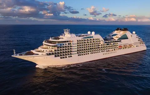
Seabourn7731
7 Ngày Băng & Đường Vào Alaska
Date
2027-05-28
Duration
7 nights
Departure Port
Vancouver
Canada
Arrival Port
Juneau
Hoa Kỳ
Rating
—
Theme
—
Date
2027-05-28
Duration
7 nights
Departure Port
Vancouver
Canada
Arrival Port
Juneau
Hoa Kỳ
Rating
—
Theme
—

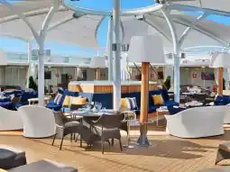




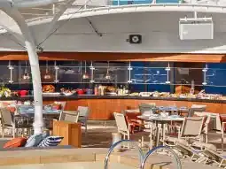
Seabourn
2016
—
40,350 GT
600
266
330
690 m
28 m
19 knots
No
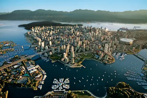
Bị ép giữa Thái Bình Dương và Dãy núi Coast, Vancouver là cánh cửa tự nhiên đến Inside Passage của Alaska — một thành phố nơi rừng mưa ôn đới gặp các tòa tháp kính và nơi cua Dungeness và cá hồi sockeye hoang dã định hình một nền ẩm thực Thái Bình Dương cạnh tranh với bất kỳ nơi nào ở Bắc Mỹ. Đi bộ trên con đường ven biển Stanley Park dài 22 km, lạc vào chợ Granville Island, sau đó đi phà đến vẻ đẹp Edwardian của Victoria. Mùa du thuyền Alaska đạt đỉnh từ tháng Năm đến tháng Chín, khiến Vancouver trở thành điểm khởi đầu lý tưởng cho một trong những hành trình đại dương vĩ đại nhất thế giới.
The Seymour Narrows is a 3-mile/5 km stretch of the Discovery Channel north of Vancouver Island, British Columbia that is notorious for the strength of the tidal currents flowing through it. The average width of the narrows is just 750 meters. During extreme tides, the current through the narrows is subject to severe Venturi effect, resulting in an increased velocity that can reach 15 knots. For much of its modern history, there was an additional hazard in the narrows called Ripple Rock, a shallow obstruction that claimed no fewer than 119 ships and 114 lives. In 1958, after months of tunneling and preparation, Ripple Rock was blown up in the largest commercial, non-nuclear explosion ever recorded in North America. Still, the navigation of Seymour Narrows is dependent on tidal and other conditions, and requires skill and technical accomplishment.
The Queen Charlotte Sound lies between the Queen Charlotte Strait, which winds between Vancouver Island and the British Columbia mainland in the south, and Hecate Strait, which is northward, adjacent to the Haida Gwaii Islands off the Pacific coast of British Columbia. It is a broad reach in the long shipping route called the Inside Passage threading the myriad islands stretching from Washington’s Puget Sound to Alaska.
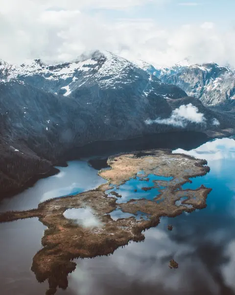
Ketchikan bám vào bờ rừng của Đảo Revillagigedo trong vùng đông nam Alaska — một thị trấn hẹp đến nỗi người dân địa phương đùa rằng nó dài ba dặm và rộng ba khối. Được người Tlingit tôn kính trong hàng thiên niên kỷ như một nơi có cá hồi phong phú, ngày nay nó được biết đến như Thủ đô Cột Tốp Thế Giới: các bộ sưu tập tại Làng Bản địa Saxman và Công viên Lịch sử Bang Totem Bight bảo tồn sự tập trung quan trọng nhất của những tác phẩm nghệ thuật khổng lồ này ở bất kỳ đâu. Creek Street, một lối đi bộ với những ngôi nhà lịch sử đầy màu sắc được xây dựng trên Ketchikan Creek, không nên bị bỏ lỡ. Mùa hè (tháng Năm–tháng Chín) mang đến thời tiết tốt nhất, với cá hồi di chuyển trong các dòng suối bên dưới.
In the passage between Sumner Strait and Clarence Strait in Southeast Alaska’s Alexander Archipelago, midway between Price of Wales Island on the west and Zarembo Island on the east, is a small cluster of islands with a picturesque passageway between them called Snow Pass. It makes a scenic up-close route for your Seabourn ship during the transit.
Decision Passage is the western end of the Sumner Strait, which runs through the Alexander Archipelago into the Pacific Ocean in Southeastern Alaska, bounded on the north by Kuiu Island and Cape Decision, the location of a 1932 lighthouse. This is the route your ship takes when coming from or going to the colorful historic community of Sitka on the west coast of Baranof Island, which was originally the Russian fortress town of New Archangel.
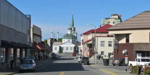
Sitka, nằm trên bờ biển hoang dã phía tây của Đảo Baranof ở Đông Nam Alaska, là một trong những cảng có ý nghĩa lịch sử nhất của Thái Bình Dương Northwest — nơi mà những mái vòm hành giáo Chính thống Nga vươn lên trên các cột totem và khu rừng ôn đới lớn đè nặng xuống mép nước. Công viên Lịch sử Quốc gia Sitka bảo tồn địa điểm của trận chiến năm 1804 giữa các chiến binh Tlingit và các thực dân Nga bên cạnh một bộ sưu tập các cột kỷ niệm tuyệt đẹp. Ngắm cá voi, chèo thuyền giữa những con rái cá biển, và theo dõi gấu nâu trong vùng hoang dã xung quanh định nghĩa trải nghiệm ngoài trời. Thời gian từ tháng Năm đến tháng Chín mang đến điều kiện dễ tiếp cận và ánh sáng rực rỡ nhất.
Yakutat Bay is 18 miles wide at its entry, and cuts from the Gulf of Alaska into Disenchantment Bay, the entryway to the huge Hubbard Glacier, North America’s largest tidewater glacier. As the bay narrows and the shorelines draw closer, the 400-foot face of the glacier exerts a luminous, ghostly presence, often from as much as 30 miles away. More and more floating ice dimples the surface of the water, and seals bob up and disappear again. The chilled air from the glacier flows in a downdraft of cold that gives rise to mists and gray clouds, through which the vivid blue of the ice wall shimmers. It is an impressive sight of nature’s immense raw workplace, shaping the earth itself as part of an endless cycle of water from the sea evaporating to the sky, falling as snow on the heights and inching over centuries back again to the sea.
The Hubbard Glacier is the largest, and one of the most spectacular tidewater glaciers in North America. Its ice cliffs, some 400’ (121 m) tall, calve icebergs into the fjord, which may frequently be larger than a five-story building. The glacier’s surface is creased and contorted, resembling the wrinkled skin of a giant elephant. Records show it has been growing in thickness and advancing since 1895. This stands in stark contrast to other glaciers around the world, most of which have been receding during the past century. In 2002, the glacier blocked Russell Fjord for two and a half months, raising water levels 61’ (18 m) and threatening local communities with flooding. Nutrient-rich waters along the glacier face attract many species. Gulls and kittiwake colonies adorn smaller islands and harbor seals patrol the icy waters. In 1890, Israel Russell explored the area of Yakutat Bay and Hubbard Glacier, naming it after Gardiner G. Hubbard, a financier of his expedition and a founder and the first president of the National Geographic Society. VIEW CRUISES
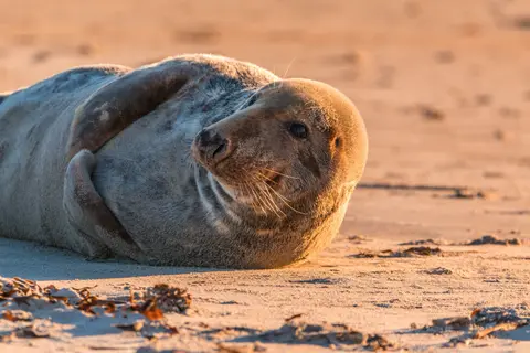
Quần đảo Inian là một cụm đảo hoang dã, không có người ở tại lối vào của Sound Cross, Alaska, nổi tiếng với những cuộc gặp gỡ động vật hoang dã phi thường bao gồm cá voi lưng gù ăn theo bọt và các thuộc địa sư tử biển Steller khổng lồ. Những điều cần làm bao gồm các chuyến tham quan bằng Zodiac dọc theo bờ biển đá của các hòn đảo, quan sát cá voi hợp tác trong việc kiếm ăn, và khám phá các hồ thủy triều đầy sinh vật biển. Hãy đến thăm vào tháng 7-8 để trải nghiệm hoạt động cá voi cao điểm và điều kiện biển tốt nhất.
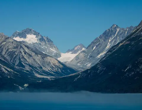
Icy Strait Point là một cảng Alaskan tuyệt đẹp nổi tiếng với vẻ đẹp tự nhiên ngoạn mục và văn hóa bản địa Tlingit phong phú. Những trải nghiệm không thể bỏ qua bao gồm thưởng thức hải sản tươi ngon và tham gia các chuyến tham quan động vật hoang dã trong Vườn Quốc gia Glacier Bay. Mùa tốt nhất để thăm quan là trong những tháng mùa hè, khi thời tiết dễ chịu và động vật hoang dã phong phú.
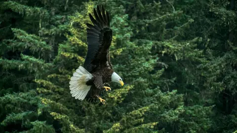
Haines là một thị trấn Alaskan chính thống nằm trên fjord sâu nhất Bắc Mỹ, nơi có sự tụ tập của loài đại bàng đầu trọc lớn nhất thế giới — lên đến bốn nghìn con dọc theo sông Chilkat — và một cộng đồng nghệ thuật phát triển bảo tồn các truyền thống văn hóa Tlingit. Hãy đến thăm từ tháng Sáu đến tháng Tám qua Cunard hoặc Lindblad để trải nghiệm hạ cánh trực thăng trên băng và đi bộ ven biển, hoặc từ tháng Mười đến tháng Hai để chiêm ngưỡng cảnh tượng đại bàng tuyệt vời khiến Haines trở thành bí mật được giữ kín nhất của Alaska.
Lynn Canal is a 90-mile long inlet into Alaska’s coast running from the Chilkat River in the north to the Chatham Strait and Stephens Passage in the south. Because it connects the towns of Skagway and Haines to Juneau and the rest of the Inside Passage, it is an important shipping lane for ferries, cargo and cruise ships, and was a crucial passageway to the Klondike gold fields during the Gold Rush. It was discovered by Joseph Whidbey in 1794 and named by George Vancouver after his birthplace, King’s Lynn in Norfolk, England. More than 2,000 feet in depth, it is one of the deepest and longest fjords in the world, and the deepest in North America outside Greenland.
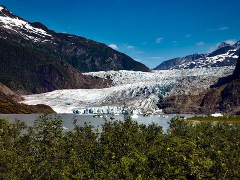
Juneau, thủ phủ duy nhất của tiểu bang Mỹ không thể tiếp cận bằng đường bộ, thưởng thức hành trình với vẻ đẹp hoang dã mà ít thành phố nào trên thế giới có thể sánh kịp. Sông băng Mendenhall — một dòng sông băng sống động — chỉ cách trung tâm thành phố mười lăm phút, nơi những chiếc máy bay thủy bay lướt qua một bờ biển được bao quanh bởi những ngọn núi phủ đầy thông, chìm thẳng xuống biển. Trải nghiệm không thể bỏ qua là hạ cánh bằng trực thăng trên bãi băng hoặc chuyến tham quan ngắm cá voi ở Stephens Passage, nơi cá voi lưng gù nhảy lên gần kề. Juneau ấm áp nhất từ tháng 6 đến tháng 8, mặc dù ngay cả những ngày hè cũng có thể mang đến cơn mưa nổi tiếng của Đông Nam Alaska, giữ cho rừng mưa luôn rực rỡ.
Day 1
Bị ép giữa Thái Bình Dương và Dãy núi Coast, Vancouver là cánh cửa tự nhiên đến Inside Passage của Alaska — một thành phố nơi rừng mưa ôn đới gặp các tòa tháp kính và nơi cua Dungeness và cá hồi sockeye hoang dã định hình một nền ẩm thực Thái Bình Dương cạnh tranh với bất kỳ nơi nào ở Bắc Mỹ. Đi bộ trên con đường ven biển Stanley Park dài 22 km, lạc vào chợ Granville Island, sau đó đi phà đến vẻ đẹp Edwardian của Victoria. Mùa du thuyền Alaska đạt đỉnh từ tháng Năm đến tháng Chín, khiến Vancouver trở thành điểm khởi đầu lý tưởng cho một trong những hành trình đại dương vĩ đại nhất thế giới.
The Seymour Narrows is a 3-mile/5 km stretch of the Discovery Channel north of Vancouver Island, British Columbia that is notorious for the strength of the tidal currents flowing through it. The average width of the narrows is just 750 meters. During extreme tides, the current through the narrows is subject to severe Venturi effect, resulting in an increased velocity that can reach 15 knots. For much of its modern history, there was an additional hazard in the narrows called Ripple Rock, a shallow obstruction that claimed no fewer than 119 ships and 114 lives. In 1958, after months of tunneling and preparation, Ripple Rock was blown up in the largest commercial, non-nuclear explosion ever recorded in North America. Still, the navigation of Seymour Narrows is dependent on tidal and other conditions, and requires skill and technical accomplishment.
Day 2
The Queen Charlotte Sound lies between the Queen Charlotte Strait, which winds between Vancouver Island and the British Columbia mainland in the south, and Hecate Strait, which is northward, adjacent to the Haida Gwaii Islands off the Pacific coast of British Columbia. It is a broad reach in the long shipping route called the Inside Passage threading the myriad islands stretching from Washington’s Puget Sound to Alaska.
Day 3
Ketchikan bám vào bờ rừng của Đảo Revillagigedo trong vùng đông nam Alaska — một thị trấn hẹp đến nỗi người dân địa phương đùa rằng nó dài ba dặm và rộng ba khối. Được người Tlingit tôn kính trong hàng thiên niên kỷ như một nơi có cá hồi phong phú, ngày nay nó được biết đến như Thủ đô Cột Tốp Thế Giới: các bộ sưu tập tại Làng Bản địa Saxman và Công viên Lịch sử Bang Totem Bight bảo tồn sự tập trung quan trọng nhất của những tác phẩm nghệ thuật khổng lồ này ở bất kỳ đâu. Creek Street, một lối đi bộ với những ngôi nhà lịch sử đầy màu sắc được xây dựng trên Ketchikan Creek, không nên bị bỏ lỡ. Mùa hè (tháng Năm–tháng Chín) mang đến thời tiết tốt nhất, với cá hồi di chuyển trong các dòng suối bên dưới.
In the passage between Sumner Strait and Clarence Strait in Southeast Alaska’s Alexander Archipelago, midway between Price of Wales Island on the west and Zarembo Island on the east, is a small cluster of islands with a picturesque passageway between them called Snow Pass. It makes a scenic up-close route for your Seabourn ship during the transit.
Decision Passage is the western end of the Sumner Strait, which runs through the Alexander Archipelago into the Pacific Ocean in Southeastern Alaska, bounded on the north by Kuiu Island and Cape Decision, the location of a 1932 lighthouse. This is the route your ship takes when coming from or going to the colorful historic community of Sitka on the west coast of Baranof Island, which was originally the Russian fortress town of New Archangel.
Day 4
Sitka, nằm trên bờ biển hoang dã phía tây của Đảo Baranof ở Đông Nam Alaska, là một trong những cảng có ý nghĩa lịch sử nhất của Thái Bình Dương Northwest — nơi mà những mái vòm hành giáo Chính thống Nga vươn lên trên các cột totem và khu rừng ôn đới lớn đè nặng xuống mép nước. Công viên Lịch sử Quốc gia Sitka bảo tồn địa điểm của trận chiến năm 1804 giữa các chiến binh Tlingit và các thực dân Nga bên cạnh một bộ sưu tập các cột kỷ niệm tuyệt đẹp. Ngắm cá voi, chèo thuyền giữa những con rái cá biển, và theo dõi gấu nâu trong vùng hoang dã xung quanh định nghĩa trải nghiệm ngoài trời. Thời gian từ tháng Năm đến tháng Chín mang đến điều kiện dễ tiếp cận và ánh sáng rực rỡ nhất.
Day 5
Yakutat Bay is 18 miles wide at its entry, and cuts from the Gulf of Alaska into Disenchantment Bay, the entryway to the huge Hubbard Glacier, North America’s largest tidewater glacier. As the bay narrows and the shorelines draw closer, the 400-foot face of the glacier exerts a luminous, ghostly presence, often from as much as 30 miles away. More and more floating ice dimples the surface of the water, and seals bob up and disappear again. The chilled air from the glacier flows in a downdraft of cold that gives rise to mists and gray clouds, through which the vivid blue of the ice wall shimmers. It is an impressive sight of nature’s immense raw workplace, shaping the earth itself as part of an endless cycle of water from the sea evaporating to the sky, falling as snow on the heights and inching over centuries back again to the sea.
The Hubbard Glacier is the largest, and one of the most spectacular tidewater glaciers in North America. Its ice cliffs, some 400’ (121 m) tall, calve icebergs into the fjord, which may frequently be larger than a five-story building. The glacier’s surface is creased and contorted, resembling the wrinkled skin of a giant elephant. Records show it has been growing in thickness and advancing since 1895. This stands in stark contrast to other glaciers around the world, most of which have been receding during the past century. In 2002, the glacier blocked Russell Fjord for two and a half months, raising water levels 61’ (18 m) and threatening local communities with flooding. Nutrient-rich waters along the glacier face attract many species. Gulls and kittiwake colonies adorn smaller islands and harbor seals patrol the icy waters. In 1890, Israel Russell explored the area of Yakutat Bay and Hubbard Glacier, naming it after Gardiner G. Hubbard, a financier of his expedition and a founder and the first president of the National Geographic Society. VIEW CRUISES
Day 6
Quần đảo Inian là một cụm đảo hoang dã, không có người ở tại lối vào của Sound Cross, Alaska, nổi tiếng với những cuộc gặp gỡ động vật hoang dã phi thường bao gồm cá voi lưng gù ăn theo bọt và các thuộc địa sư tử biển Steller khổng lồ. Những điều cần làm bao gồm các chuyến tham quan bằng Zodiac dọc theo bờ biển đá của các hòn đảo, quan sát cá voi hợp tác trong việc kiếm ăn, và khám phá các hồ thủy triều đầy sinh vật biển. Hãy đến thăm vào tháng 7-8 để trải nghiệm hoạt động cá voi cao điểm và điều kiện biển tốt nhất.
Icy Strait Point là một cảng Alaskan tuyệt đẹp nổi tiếng với vẻ đẹp tự nhiên ngoạn mục và văn hóa bản địa Tlingit phong phú. Những trải nghiệm không thể bỏ qua bao gồm thưởng thức hải sản tươi ngon và tham gia các chuyến tham quan động vật hoang dã trong Vườn Quốc gia Glacier Bay. Mùa tốt nhất để thăm quan là trong những tháng mùa hè, khi thời tiết dễ chịu và động vật hoang dã phong phú.
Day 7
Haines là một thị trấn Alaskan chính thống nằm trên fjord sâu nhất Bắc Mỹ, nơi có sự tụ tập của loài đại bàng đầu trọc lớn nhất thế giới — lên đến bốn nghìn con dọc theo sông Chilkat — và một cộng đồng nghệ thuật phát triển bảo tồn các truyền thống văn hóa Tlingit. Hãy đến thăm từ tháng Sáu đến tháng Tám qua Cunard hoặc Lindblad để trải nghiệm hạ cánh trực thăng trên băng và đi bộ ven biển, hoặc từ tháng Mười đến tháng Hai để chiêm ngưỡng cảnh tượng đại bàng tuyệt vời khiến Haines trở thành bí mật được giữ kín nhất của Alaska.
Lynn Canal is a 90-mile long inlet into Alaska’s coast running from the Chilkat River in the north to the Chatham Strait and Stephens Passage in the south. Because it connects the towns of Skagway and Haines to Juneau and the rest of the Inside Passage, it is an important shipping lane for ferries, cargo and cruise ships, and was a crucial passageway to the Klondike gold fields during the Gold Rush. It was discovered by Joseph Whidbey in 1794 and named by George Vancouver after his birthplace, King’s Lynn in Norfolk, England. More than 2,000 feet in depth, it is one of the deepest and longest fjords in the world, and the deepest in North America outside Greenland.
Day 8
Juneau, thủ phủ duy nhất của tiểu bang Mỹ không thể tiếp cận bằng đường bộ, thưởng thức hành trình với vẻ đẹp hoang dã mà ít thành phố nào trên thế giới có thể sánh kịp. Sông băng Mendenhall — một dòng sông băng sống động — chỉ cách trung tâm thành phố mười lăm phút, nơi những chiếc máy bay thủy bay lướt qua một bờ biển được bao quanh bởi những ngọn núi phủ đầy thông, chìm thẳng xuống biển. Trải nghiệm không thể bỏ qua là hạ cánh bằng trực thăng trên bãi băng hoặc chuyến tham quan ngắm cá voi ở Stephens Passage, nơi cá voi lưng gù nhảy lên gần kề. Juneau ấm áp nhất từ tháng 6 đến tháng 8, mặc dù ngay cả những ngày hè cũng có thể mang đến cơn mưa nổi tiếng của Đông Nam Alaska, giữ cho rừng mưa luôn rực rỡ.

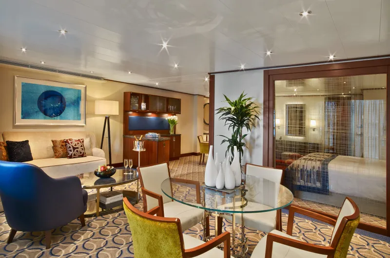
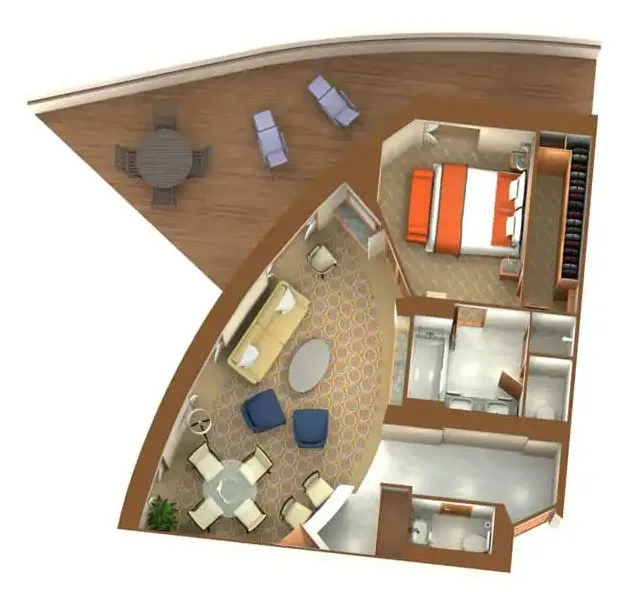
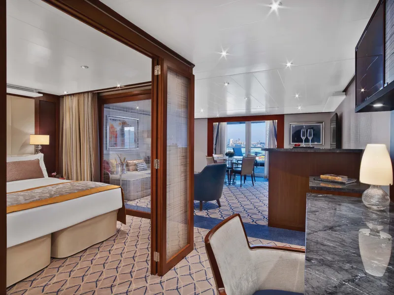


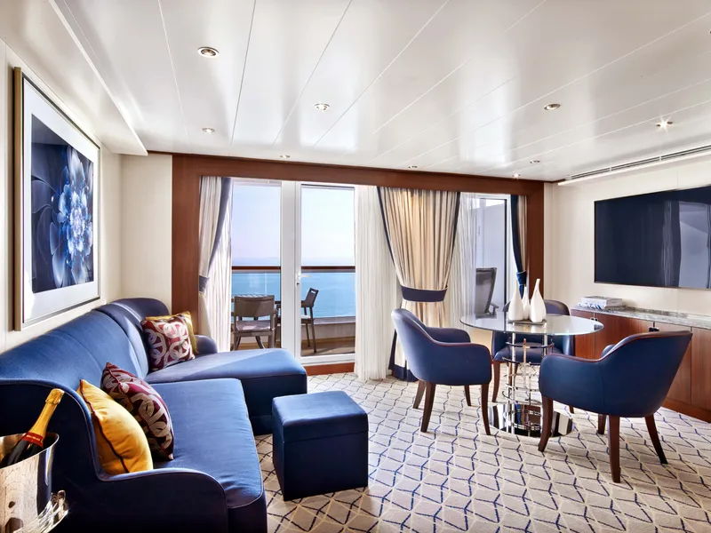

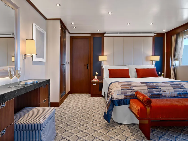
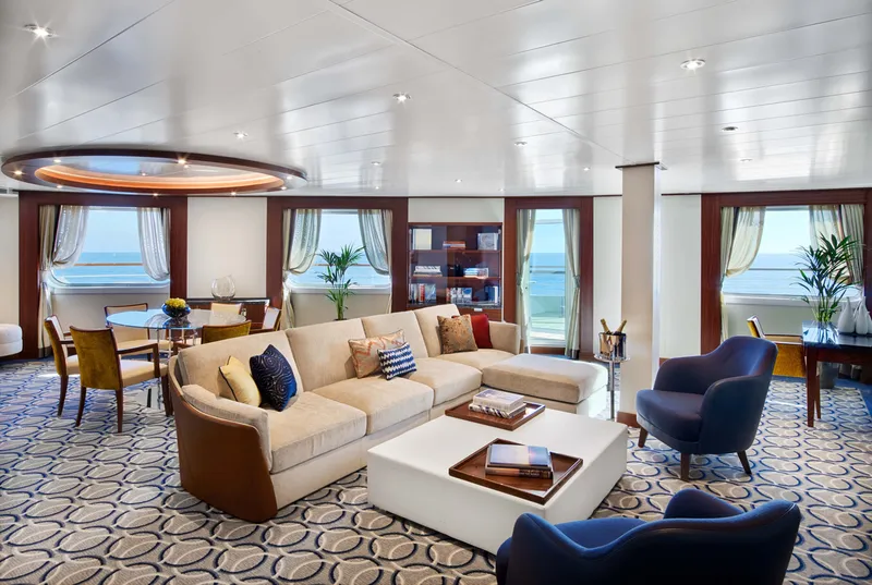
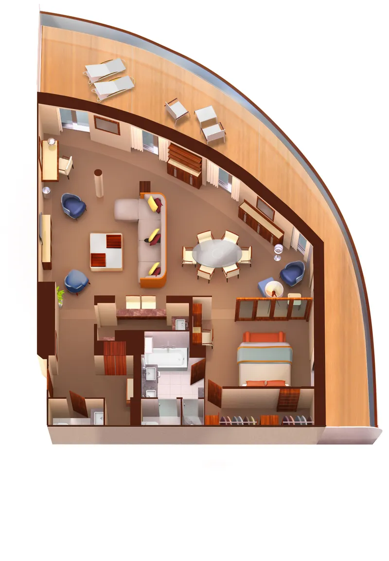
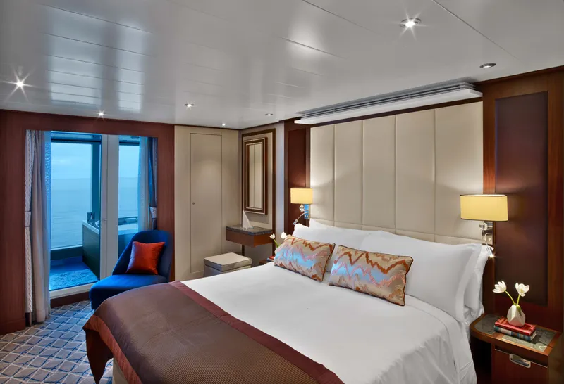


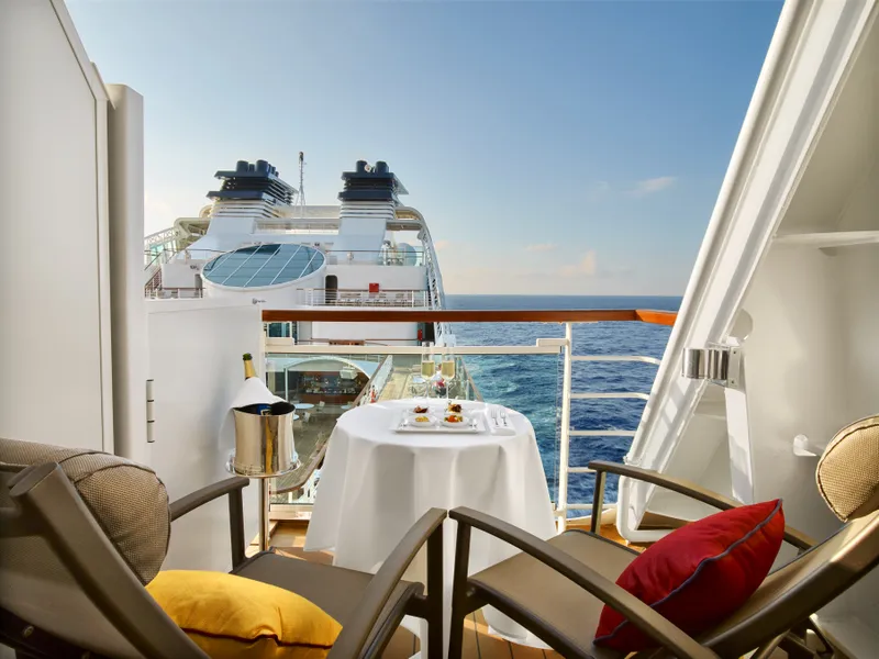

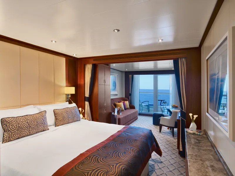

Our cruise specialists can help you find the perfect cabin and the best available pricing.
(+886) 02-2721-7300Contact Advisor