तारीख़
2026-06-26
अवधि
7 रातें
प्रस्थान बंदरगाह
वैंकूवर
कनाडा
आगमन बंदरगाह
जूनो
संयुक्त राज्य अमेरिका
श्रेणी
लक्ज़री
विषय
—
तारीख़
2026-06-26
अवधि
7 रातें
प्रस्थान बंदरगाह
वैंकूवर
कनाडा
आगमन बंदरगाह
जूनो
संयुक्त राज्य अमेरिका
श्रेणी
लक्ज़री
विषय
—


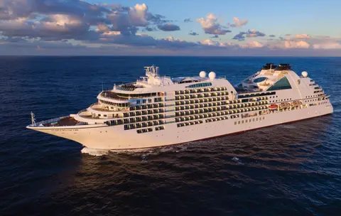
सीबोर्न
2016
—
40,350 GT
600
266
330
690 m
28 m
19 knots
नहीं
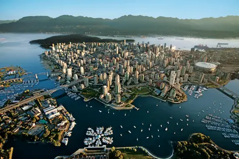
प्रशांत और कोस्ट पर्वतों के बीच दबा हुआ, वैंकूवर अलास्का के इनसाइड पासेज का प्राकृतिक द्वार है — एक ऐसा शहर जहाँ समशीतोष्ण वर्षावन कांच की टावरों से मिलता है और जहाँ डंजेनेस केकड़ा और जंगली सॉकेई सामन एक प्रशांत रिम व्यंजन को परिभाषित करते हैं जो उत्तरी अमेरिका में किसी भी चीज़ से मुकाबला करता है। 22 किलोमीटर स्टेनली पार्क सीवॉल पर चलें, ग्रैनविल द्वीप बाजार में खो जाएँ, फिर विक्टोरिया के एडवर्डियन वैभव के लिए फेरी लें। अलास्का क्रूज सीजन मई से सितंबर तक अपने चरम पर होता है, जिससे वैंकूवर दुनिया की महान महासागरीय यात्राओं में से एक के लिए एक आदर्श प्रारंभिक बिंदु बन जाता है।
The Seymour Narrows is a 3-mile/5 km stretch of the Discovery Channel north of Vancouver Island, British Columbia that is notorious for the strength of the tidal currents flowing through it. The average width of the narrows is just 750 meters. During extreme tides, the current through the narrows is subject to severe Venturi effect, resulting in an increased velocity that can reach 15 knots. For much of its modern history, there was an additional hazard in the narrows called Ripple Rock, a shallow obstruction that claimed no fewer than 119 ships and 114 lives. In 1958, after months of tunneling and preparation, Ripple Rock was blown up in the largest commercial, non-nuclear explosion ever recorded in North America. Still, the navigation of Seymour Narrows is dependent on tidal and other conditions, and requires skill and technical accomplishment.
The Queen Charlotte Sound lies between the Queen Charlotte Strait, which winds between Vancouver Island and the British Columbia mainland in the south, and Hecate Strait, which is northward, adjacent to the Haida Gwaii Islands off the Pacific coast of British Columbia. It is a broad reach in the long shipping route called the Inside Passage threading the myriad islands stretching from Washington’s Puget Sound to Alaska.
केचिकन अलास्का के दक्षिणपूर्वी पैनहैंडल में रेविलागिगेडो द्वीप के वनस्पति तट पर स्थित है — एक ऐसा नगर जो इतना संकरा है कि स्थानीय लोग मजाक करते हैं कि यह तीन मील लंबा और तीन ब्लॉक चौड़ा है। इसे त्लिंगित लोगों द्वारा सहस्त्राब्दियों से सामृद्ध सैल्मन के स्थान के रूप में पूजा जाता है, आज इसे विश्व के टोटेम पोल की राजधानी के रूप में मनाया जाता है: सैक्समैन नेटिव विलेज और टोटेम बाइट स्टेट हिस्टोरिकल पार्क में संग्रह इन स्मारकीय कलाकृतियों का सबसे महत्वपूर्ण संकेंद्रण संरक्षित करते हैं। क्रीक स्ट्रीट, केचिकन क्रीक के ऊपर बने रंगीन ऐतिहासिक घरों का एक बोर्डवाक, नहीं छोड़ना चाहिए। गर्मी (मई–सितंबर) सबसे अच्छे मौसम को लाती है, जब नीचे के नदियों में सैल्मन दौड़ते हैं।
In the passage between Sumner Strait and Clarence Strait in Southeast Alaska’s Alexander Archipelago, midway between Price of Wales Island on the west and Zarembo Island on the east, is a small cluster of islands with a picturesque passageway between them called Snow Pass. It makes a scenic up-close route for your Seabourn ship during the transit.
Decision Passage is the western end of the Sumner Strait, which runs through the Alexander Archipelago into the Pacific Ocean in Southeastern Alaska, bounded on the north by Kuiu Island and Cape Decision, the location of a 1932 lighthouse. This is the route your ship takes when coming from or going to the colorful historic community of Sitka on the west coast of Baranof Island, which was originally the Russian fortress town of New Archangel.
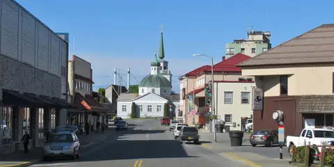
सिटका, दक्षिण-पूर्व अलास्का में बारानोफ द्वीप के जंगली पश्चिमी तट पर स्थित है, जो प्रशांत उत्तर-पश्चिम के सबसे ऐतिहासिक रूप से गूंजते बंदरगाहों में से एक है - एक ऐसा स्थान जहाँ रूसी ऑर्थोडॉक्स प्याज के गुंबद तोते के खंभों के ऊपर उठते हैं और महान समशीतोष्ण वर्षावन पानी के किनारे तक दबाते हैं। सिटका राष्ट्रीय ऐतिहासिक पार्क 1804 की लड़ाई के स्थल को संरक्षित करता है जो त्लिंगित योद्धाओं और रूसी उपनिवेशकों के बीच हुई थी, साथ ही एक शानदार संग्रह के साथ। व्हेल देखने, समुद्री ऊदबिलावों के बीच समुद्री कयाकिंग, और आसपास के वन्य जीवन में भूरे भालुओं की पहचान करना बाहरी अनुभव को परिभाषित करता है। मई से सितंबर के बीच सबसे अधिक सुलभ और उज्ज्वल परिस्थितियाँ होती हैं.
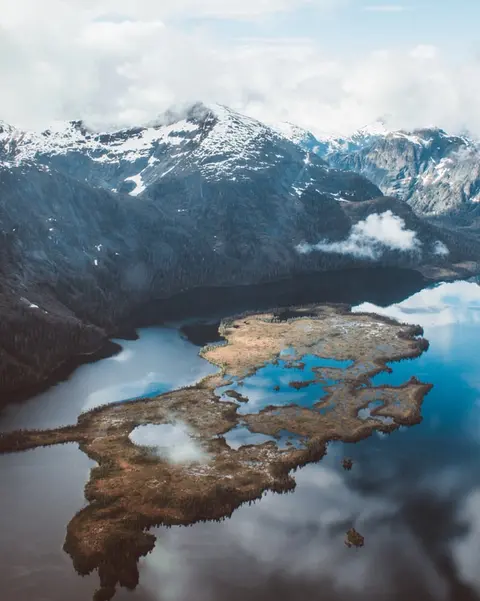
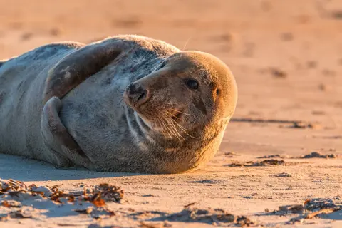
Yakutat Bay is 18 miles wide at its entry, and cuts from the Gulf of Alaska into Disenchantment Bay, the entryway to the huge Hubbard Glacier, North America’s largest tidewater glacier. As the bay narrows and the shorelines draw closer, the 400-foot face of the glacier exerts a luminous, ghostly presence, often from as much as 30 miles away. More and more floating ice dimples the surface of the water, and seals bob up and disappear again. The chilled air from the glacier flows in a downdraft of cold that gives rise to mists and gray clouds, through which the vivid blue of the ice wall shimmers. It is an impressive sight of nature’s immense raw workplace, shaping the earth itself as part of an endless cycle of water from the sea evaporating to the sky, falling as snow on the heights and inching over centuries back again to the sea.
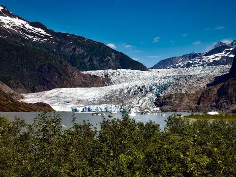
The Hubbard Glacier is the largest, and one of the most spectacular tidewater glaciers in North America. Its ice cliffs, some 400’ (121 m) tall, calve icebergs into the fjord, which may frequently be larger than a five-story building. The glacier’s surface is creased and contorted, resembling the wrinkled skin of a giant elephant. Records show it has been growing in thickness and advancing since 1895. This stands in stark contrast to other glaciers around the world, most of which have been receding during the past century. In 2002, the glacier blocked Russell Fjord for two and a half months, raising water levels 61’ (18 m) and threatening local communities with flooding. Nutrient-rich waters along the glacier face attract many species. Gulls and kittiwake colonies adorn smaller islands and harbor seals patrol the icy waters. In 1890, Israel Russell explored the area of Yakutat Bay and Hubbard Glacier, naming it after Gardiner G. Hubbard, a financier of his expedition and a founder and the first president of the National Geographic Society. VIEW CRUISES
इनियन द्वीप अलास्का के क्रॉस साउंड के प्रवेश द्वार पर स्थित एक जंगली, निर्जन समूह है, जो असाधारण वन्यजीवों के अनुभवों के लिए प्रसिद्ध है, जिसमें हंपबैक व्हेल का बबल-नेट फीडिंग और विशाल स्टेलर समुद्री शेरों के उपनिवेश शामिल हैं। अवश्य करने योग्य गतिविधियों में द्वीपों के चट्टानी किनारों के साथ ज़ोडियाक भ्रमण, सहयोगी व्हेल फीडिंग देखना, और समुद्री जीवन से भरे ज्वारीय पूलों की खोज करना शामिल है। जुलाई से अगस्त का दौरा करें जब व्हेल गतिविधि अपने चरम पर होती है और समुद्र की सबसे अच्छी परिस्थितियाँ होती हैं।
आइस स्ट्रेट पॉइंट एक अद्भुत अलास्कन बंदरगाह है, जो अपनी सांस लेने वाली प्राकृतिक सुंदरता और समृद्ध नेटिव ट्लिंगिट संस्कृति के लिए जाना जाता है। अनिवार्य अनुभवों में ताजा स्थानीय समुद्री भोजन का आनंद लेना और ग्लेशियर बे राष्ट्रीय उद्यान में वन्यजीव अभियानों पर जाना शामिल है। यात्रा करने का सबसे अच्छा मौसम गर्मियों के महीनों में होता है, जब मौसम हल्का होता है और वन्यजीव प्रचुर मात्रा में होते हैं।
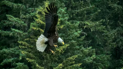
हैन्स, उत्तरी अमेरिका के सबसे गहरे फjord पर स्थित एक प्रामाणिक अलास्कन शहर है, जो दुनिया के सबसे बड़े गंजे ईगल के जमावड़े का घर है — चिलकट नदी के किनारे चार हजार तक के पक्षियों के साथ — और एक जीवंत कला समुदाय जो ट्लिंगिट सांस्कृतिक परंपराओं को संरक्षित करता है। जून से अगस्त तक क्यूनार्ड या लिंडब्लाड के माध्यम से ग्लेशियर हेलीकॉप्टर लैंडिंग और तटीय ट्रेकिंग के लिए यात्रा करें, या अक्टूबर से फरवरी तक असाधारण ईगल दृश्य के लिए जो हैन्स को अलास्का का सबसे बड़ा रहस्य बनाता है।
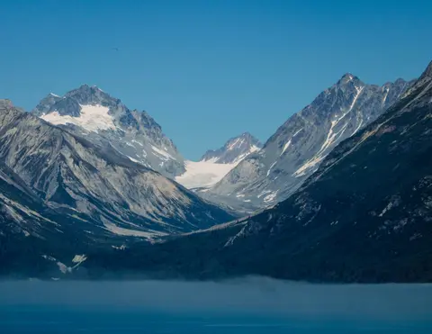
Lynn Canal is a 90-mile long inlet into Alaska’s coast running from the Chilkat River in the north to the Chatham Strait and Stephens Passage in the south. Because it connects the towns of Skagway and Haines to Juneau and the rest of the Inside Passage, it is an important shipping lane for ferries, cargo and cruise ships, and was a crucial passageway to the Klondike gold fields during the Gold Rush. It was discovered by Joseph Whidbey in 1794 and named by George Vancouver after his birthplace, King’s Lynn in Norfolk, England. More than 2,000 feet in depth, it is one of the deepest and longest fjords in the world, and the deepest in North America outside Greenland.
अमेरिका की एकमात्र राज्य राजधानी जो सड़क द्वारा पहुंच योग्य नहीं है, जूनौ यात्रा को एक वन्यजीव की भव्यता से पुरस्कृत करती है जो पृथ्वी के कुछ शहरों से मेल खाती है। मेनडेनहॉल ग्लेशियर — प्राचीन बर्फ की एक जीवित नदी — केवल पंद्रह मिनट की दूरी पर है, जहां फ्लोटप्लेन एक समुद्र तट के ऊपर उड़ते हैं जो स्प्रूस-लिपटे पहाड़ों से घिरा है जो सीधे समुद्र में गिरते हैं। अवश्य करने योग्य अनुभव बर्फ के क्षेत्र के शीर्ष पर हेलीकॉप्टर लैंडिंग या स्टीफेंस पासेज में व्हेल-देखने का भ्रमण है, जहां हम्पबैक आश्चर्यजनक निकटता में उछलते हैं। जूनौ जून से अगस्त तक सबसे गर्म रहता है, हालांकि गर्मियों के दिनों में भी प्रसिद्ध दक्षिण-पूर्व अलास्का की बारिश हो सकती है जो वर्षावनों को हमेशा चमकदार बनाए रखती है।
दिन 1
प्रशांत और कोस्ट पर्वतों के बीच दबा हुआ, वैंकूवर अलास्का के इनसाइड पासेज का प्राकृतिक द्वार है — एक ऐसा शहर जहाँ समशीतोष्ण वर्षावन कांच की टावरों से मिलता है और जहाँ डंजेनेस केकड़ा और जंगली सॉकेई सामन एक प्रशांत रिम व्यंजन को परिभाषित करते हैं जो उत्तरी अमेरिका में किसी भी चीज़ से मुकाबला करता है। 22 किलोमीटर स्टेनली पार्क सीवॉल पर चलें, ग्रैनविल द्वीप बाजार में खो जाएँ, फिर विक्टोरिया के एडवर्डियन वैभव के लिए फेरी लें। अलास्का क्रूज सीजन मई से सितंबर तक अपने चरम पर होता है, जिससे वैंकूवर दुनिया की महान महासागरीय यात्राओं में से एक के लिए एक आदर्श प्रारंभिक बिंदु बन जाता है।
The Seymour Narrows is a 3-mile/5 km stretch of the Discovery Channel north of Vancouver Island, British Columbia that is notorious for the strength of the tidal currents flowing through it. The average width of the narrows is just 750 meters. During extreme tides, the current through the narrows is subject to severe Venturi effect, resulting in an increased velocity that can reach 15 knots. For much of its modern history, there was an additional hazard in the narrows called Ripple Rock, a shallow obstruction that claimed no fewer than 119 ships and 114 lives. In 1958, after months of tunneling and preparation, Ripple Rock was blown up in the largest commercial, non-nuclear explosion ever recorded in North America. Still, the navigation of Seymour Narrows is dependent on tidal and other conditions, and requires skill and technical accomplishment.
दिन 2
The Queen Charlotte Sound lies between the Queen Charlotte Strait, which winds between Vancouver Island and the British Columbia mainland in the south, and Hecate Strait, which is northward, adjacent to the Haida Gwaii Islands off the Pacific coast of British Columbia. It is a broad reach in the long shipping route called the Inside Passage threading the myriad islands stretching from Washington’s Puget Sound to Alaska.
दिन 3
केचिकन अलास्का के दक्षिणपूर्वी पैनहैंडल में रेविलागिगेडो द्वीप के वनस्पति तट पर स्थित है — एक ऐसा नगर जो इतना संकरा है कि स्थानीय लोग मजाक करते हैं कि यह तीन मील लंबा और तीन ब्लॉक चौड़ा है। इसे त्लिंगित लोगों द्वारा सहस्त्राब्दियों से सामृद्ध सैल्मन के स्थान के रूप में पूजा जाता है, आज इसे विश्व के टोटेम पोल की राजधानी के रूप में मनाया जाता है: सैक्समैन नेटिव विलेज और टोटेम बाइट स्टेट हिस्टोरिकल पार्क में संग्रह इन स्मारकीय कलाकृतियों का सबसे महत्वपूर्ण संकेंद्रण संरक्षित करते हैं। क्रीक स्ट्रीट, केचिकन क्रीक के ऊपर बने रंगीन ऐतिहासिक घरों का एक बोर्डवाक, नहीं छोड़ना चाहिए। गर्मी (मई–सितंबर) सबसे अच्छे मौसम को लाती है, जब नीचे के नदियों में सैल्मन दौड़ते हैं।
In the passage between Sumner Strait and Clarence Strait in Southeast Alaska’s Alexander Archipelago, midway between Price of Wales Island on the west and Zarembo Island on the east, is a small cluster of islands with a picturesque passageway between them called Snow Pass. It makes a scenic up-close route for your Seabourn ship during the transit.
Decision Passage is the western end of the Sumner Strait, which runs through the Alexander Archipelago into the Pacific Ocean in Southeastern Alaska, bounded on the north by Kuiu Island and Cape Decision, the location of a 1932 lighthouse. This is the route your ship takes when coming from or going to the colorful historic community of Sitka on the west coast of Baranof Island, which was originally the Russian fortress town of New Archangel.
दिन 4
सिटका, दक्षिण-पूर्व अलास्का में बारानोफ द्वीप के जंगली पश्चिमी तट पर स्थित है, जो प्रशांत उत्तर-पश्चिम के सबसे ऐतिहासिक रूप से गूंजते बंदरगाहों में से एक है - एक ऐसा स्थान जहाँ रूसी ऑर्थोडॉक्स प्याज के गुंबद तोते के खंभों के ऊपर उठते हैं और महान समशीतोष्ण वर्षावन पानी के किनारे तक दबाते हैं। सिटका राष्ट्रीय ऐतिहासिक पार्क 1804 की लड़ाई के स्थल को संरक्षित करता है जो त्लिंगित योद्धाओं और रूसी उपनिवेशकों के बीच हुई थी, साथ ही एक शानदार संग्रह के साथ। व्हेल देखने, समुद्री ऊदबिलावों के बीच समुद्री कयाकिंग, और आसपास के वन्य जीवन में भूरे भालुओं की पहचान करना बाहरी अनुभव को परिभाषित करता है। मई से सितंबर के बीच सबसे अधिक सुलभ और उज्ज्वल परिस्थितियाँ होती हैं.
दिन 5
Yakutat Bay is 18 miles wide at its entry, and cuts from the Gulf of Alaska into Disenchantment Bay, the entryway to the huge Hubbard Glacier, North America’s largest tidewater glacier. As the bay narrows and the shorelines draw closer, the 400-foot face of the glacier exerts a luminous, ghostly presence, often from as much as 30 miles away. More and more floating ice dimples the surface of the water, and seals bob up and disappear again. The chilled air from the glacier flows in a downdraft of cold that gives rise to mists and gray clouds, through which the vivid blue of the ice wall shimmers. It is an impressive sight of nature’s immense raw workplace, shaping the earth itself as part of an endless cycle of water from the sea evaporating to the sky, falling as snow on the heights and inching over centuries back again to the sea.
The Hubbard Glacier is the largest, and one of the most spectacular tidewater glaciers in North America. Its ice cliffs, some 400’ (121 m) tall, calve icebergs into the fjord, which may frequently be larger than a five-story building. The glacier’s surface is creased and contorted, resembling the wrinkled skin of a giant elephant. Records show it has been growing in thickness and advancing since 1895. This stands in stark contrast to other glaciers around the world, most of which have been receding during the past century. In 2002, the glacier blocked Russell Fjord for two and a half months, raising water levels 61’ (18 m) and threatening local communities with flooding. Nutrient-rich waters along the glacier face attract many species. Gulls and kittiwake colonies adorn smaller islands and harbor seals patrol the icy waters. In 1890, Israel Russell explored the area of Yakutat Bay and Hubbard Glacier, naming it after Gardiner G. Hubbard, a financier of his expedition and a founder and the first president of the National Geographic Society. VIEW CRUISES
दिन 6
इनियन द्वीप अलास्का के क्रॉस साउंड के प्रवेश द्वार पर स्थित एक जंगली, निर्जन समूह है, जो असाधारण वन्यजीवों के अनुभवों के लिए प्रसिद्ध है, जिसमें हंपबैक व्हेल का बबल-नेट फीडिंग और विशाल स्टेलर समुद्री शेरों के उपनिवेश शामिल हैं। अवश्य करने योग्य गतिविधियों में द्वीपों के चट्टानी किनारों के साथ ज़ोडियाक भ्रमण, सहयोगी व्हेल फीडिंग देखना, और समुद्री जीवन से भरे ज्वारीय पूलों की खोज करना शामिल है। जुलाई से अगस्त का दौरा करें जब व्हेल गतिविधि अपने चरम पर होती है और समुद्र की सबसे अच्छी परिस्थितियाँ होती हैं।
आइस स्ट्रेट पॉइंट एक अद्भुत अलास्कन बंदरगाह है, जो अपनी सांस लेने वाली प्राकृतिक सुंदरता और समृद्ध नेटिव ट्लिंगिट संस्कृति के लिए जाना जाता है। अनिवार्य अनुभवों में ताजा स्थानीय समुद्री भोजन का आनंद लेना और ग्लेशियर बे राष्ट्रीय उद्यान में वन्यजीव अभियानों पर जाना शामिल है। यात्रा करने का सबसे अच्छा मौसम गर्मियों के महीनों में होता है, जब मौसम हल्का होता है और वन्यजीव प्रचुर मात्रा में होते हैं।
दिन 7
हैन्स, उत्तरी अमेरिका के सबसे गहरे फjord पर स्थित एक प्रामाणिक अलास्कन शहर है, जो दुनिया के सबसे बड़े गंजे ईगल के जमावड़े का घर है — चिलकट नदी के किनारे चार हजार तक के पक्षियों के साथ — और एक जीवंत कला समुदाय जो ट्लिंगिट सांस्कृतिक परंपराओं को संरक्षित करता है। जून से अगस्त तक क्यूनार्ड या लिंडब्लाड के माध्यम से ग्लेशियर हेलीकॉप्टर लैंडिंग और तटीय ट्रेकिंग के लिए यात्रा करें, या अक्टूबर से फरवरी तक असाधारण ईगल दृश्य के लिए जो हैन्स को अलास्का का सबसे बड़ा रहस्य बनाता है।
Lynn Canal is a 90-mile long inlet into Alaska’s coast running from the Chilkat River in the north to the Chatham Strait and Stephens Passage in the south. Because it connects the towns of Skagway and Haines to Juneau and the rest of the Inside Passage, it is an important shipping lane for ferries, cargo and cruise ships, and was a crucial passageway to the Klondike gold fields during the Gold Rush. It was discovered by Joseph Whidbey in 1794 and named by George Vancouver after his birthplace, King’s Lynn in Norfolk, England. More than 2,000 feet in depth, it is one of the deepest and longest fjords in the world, and the deepest in North America outside Greenland.
दिन 8
अमेरिका की एकमात्र राज्य राजधानी जो सड़क द्वारा पहुंच योग्य नहीं है, जूनौ यात्रा को एक वन्यजीव की भव्यता से पुरस्कृत करती है जो पृथ्वी के कुछ शहरों से मेल खाती है। मेनडेनहॉल ग्लेशियर — प्राचीन बर्फ की एक जीवित नदी — केवल पंद्रह मिनट की दूरी पर है, जहां फ्लोटप्लेन एक समुद्र तट के ऊपर उड़ते हैं जो स्प्रूस-लिपटे पहाड़ों से घिरा है जो सीधे समुद्र में गिरते हैं। अवश्य करने योग्य अनुभव बर्फ के क्षेत्र के शीर्ष पर हेलीकॉप्टर लैंडिंग या स्टीफेंस पासेज में व्हेल-देखने का भ्रमण है, जहां हम्पबैक आश्चर्यजनक निकटता में उछलते हैं। जूनौ जून से अगस्त तक सबसे गर्म रहता है, हालांकि गर्मियों के दिनों में भी प्रसिद्ध दक्षिण-पूर्व अलास्का की बारिश हो सकती है जो वर्षावनों को हमेशा चमकदार बनाए रखती है।

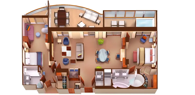
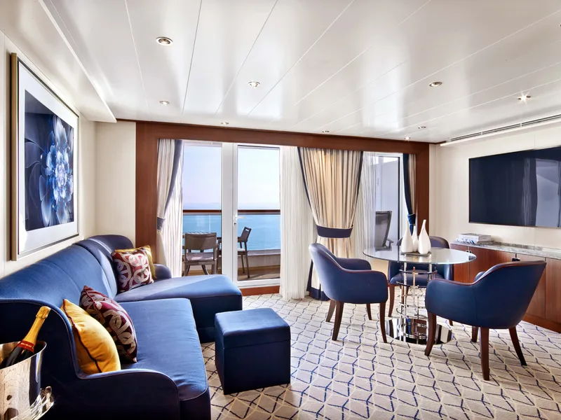
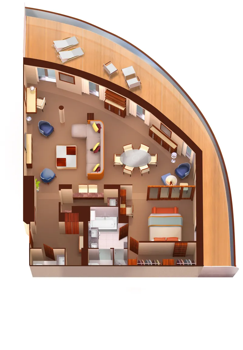
Grand Wintergarden Suite
डेक 8 पर स्थित; आप मध्य-जहाज सुइट 849 और 851 को सुइट 8491 के लिए या सुइट 846 और 848 को सुइट 8468 के लिए जोड़ सकते हैं, जिसमें कुल अंदरूनी स्थान 1,292 वर्ग फुट (120 वर्ग मीटर) है, साथ ही दो वेरांडा जिनका कुल क्षेत्रफल 244 वर्ग फुट (23 वर्ग मीटर) है।
ग्रैंड विंटरगार्डन सुइट्स में शामिल हैं:
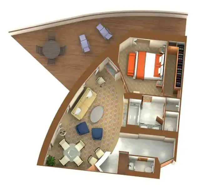
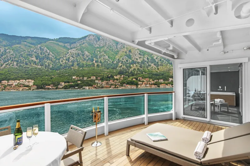
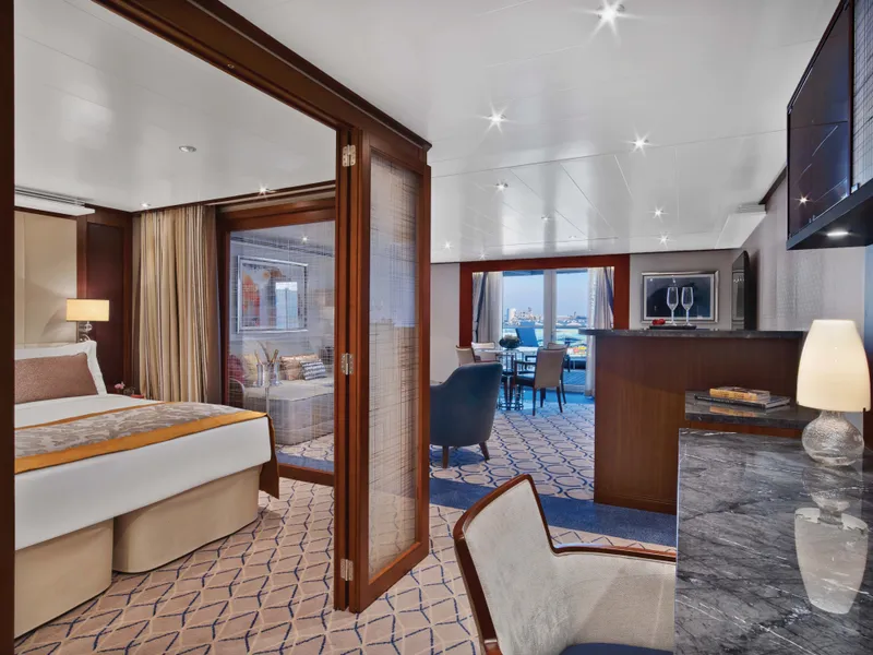
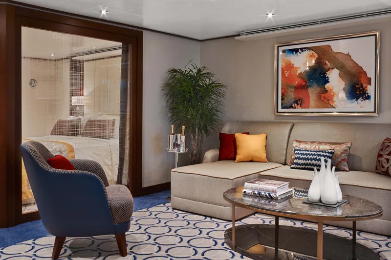
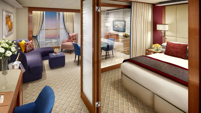
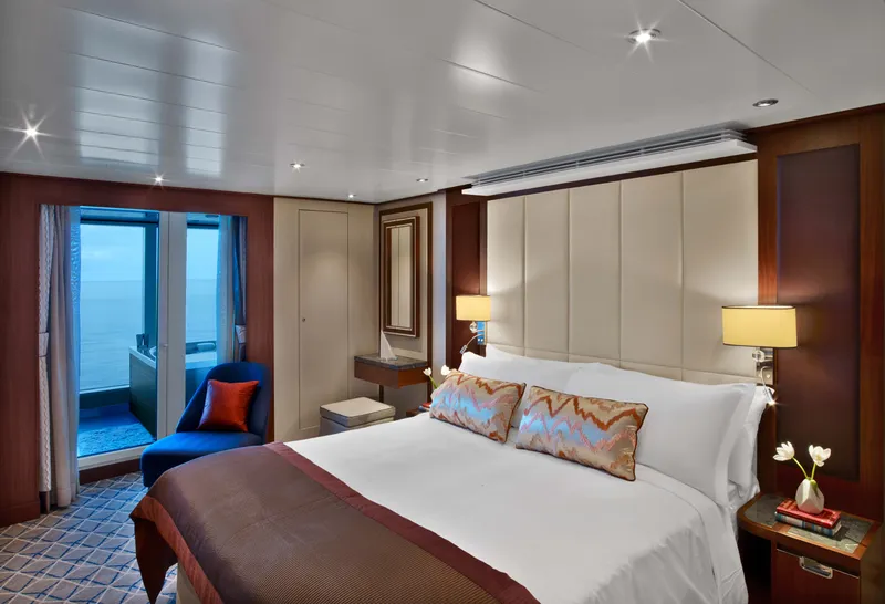
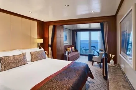
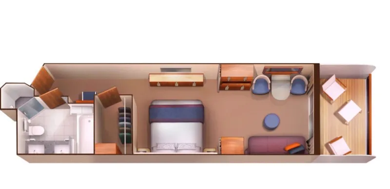
Owners Suite
स्वामी की सुइट डेक 7, 8, 9 और 10 पर स्थित हैं; कुल अंदरूनी स्थान 576 से 597 वर्ग फुट (54 से 55 वर्ग मीटर) के बीच है, इसके अलावा बालकनी 142 से 778 वर्ग फुट (13 से 72 वर्ग मीटर) के बीच है।
स्वामी की सुइट में शामिल हैं:
Penthouse Spa Suite
पेंटहाउस स्पा सुइट
डेक 11 पर स्थित; कुल अंदरूनी स्थान 639 से 677 वर्ग फुट (59 से 63 वर्ग मीटर) के बीच और बालकनी 254 से 288 वर्ग फुट (24 से 27 वर्ग मीटर) के बीच
सभी पेंटहाउस स्पा सुइट में शामिल हैं
दो से चार लोगों के लिए खाने की मेज
अलग बेडरूम
बालकनी के लिए कांच का दरवाजा
दो फ्लैट-स्क्रीन टीवी
पूर्ण स्टॉक बार
बड़े वैनिटी के साथ विशाल बाथरूम जिसमें बाथटब और शॉवर शामिल हैं

Penthouse Suite
पेंटहाउस सुइट्स डेक 10 और 11 पर स्थित हैं; कुल अंदरूनी स्थान 449 से 450 वर्ग फुट (42 वर्ग मीटर) के बीच है, इसके अलावा एक बरामदा 93 से 103 वर्ग फुट (9 और 10 वर्ग मीटर) के बीच है।
सभी पेंटहाउस सुइट्स में शामिल हैं:
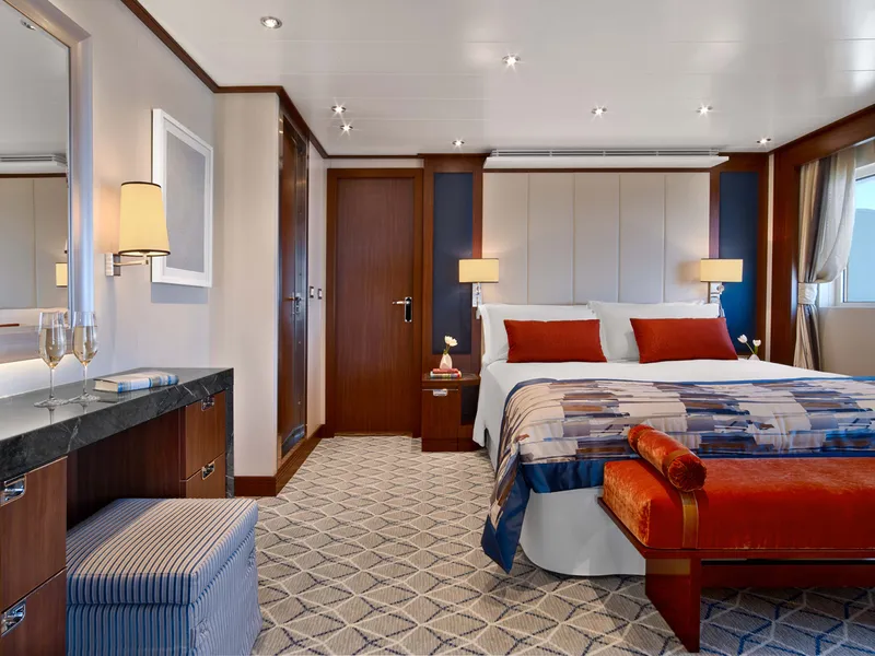
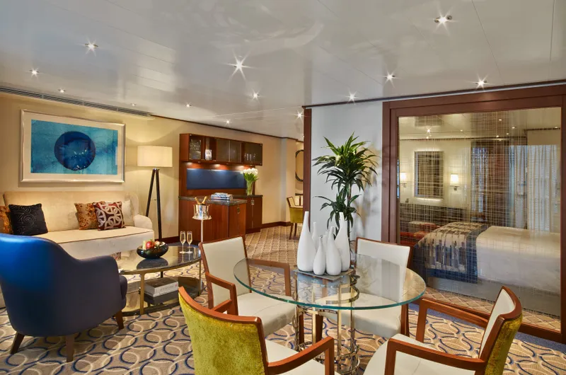
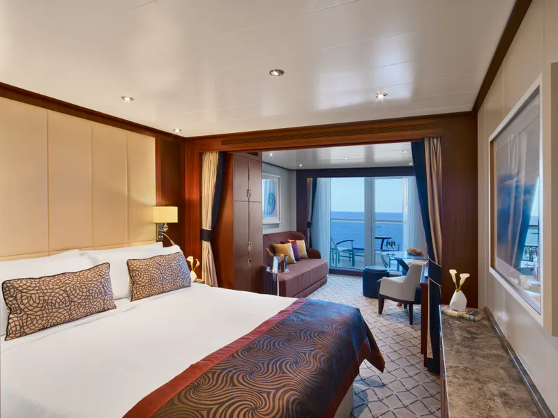
Signature Suite
डेक 8 पर स्थित; आगे की सुइट 800 और 801 के अंदर लगभग 977 वर्ग फुट (90 वर्ग मीटर) का अंदरूनी स्थान है, इसके अलावा 960 वर्ग फुट (89 वर्ग मीटर) का एक वेरांडा है।
सिग्नेचर सुइट्स में शामिल हैं:

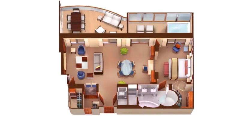
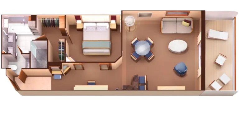
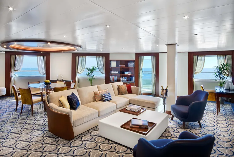
Wintergarden Suite
डेक 8 पर स्थित; मध्य-जहाज सुइट 846 और 849 के अंदर का क्षेत्र 989 वर्ग फीट (92 वर्ग मीटर) है, इसके अलावा एक वेरांडा 197 वर्ग फीट (18 वर्ग मीटर) है।
Wintergarden सुइट्स में शामिल हैं:
Single Veranda Suite Guarantee
एकल बालकनी सुइट गारंटी


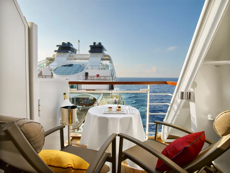
Veranda Suite
वेरांडा सुइट्स डेक 8, 9, 10, 11 पर स्थित हैं; कुल अंदरूनी स्थान 246 से 302 वर्ग फुट (23 से 28 वर्ग मीटर) के बीच है, साथ ही एक वेरांडा 68 से 83 वर्ग फुट (6 से 7 वर्ग मीटर) के बीच है।
सभी वेरांडा सुइट्स में शामिल हैं:


Veranda Suite Guarantee
वेरांडा सुइट गारंटी
हमारे विशेषज्ञ आपको सर्वोत्तम मूल्य पर उपयुक्त केबिन खोजने में मदद करेंगे।
(+886) 02-2721-7300सलाहकार से संपर्क करें