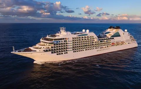
奇寶郵輪7731
7天冰川與阿拉斯加內海
Date
2027-05-28
Duration
7 nights
Departure Port
溫哥華
加拿大
Arrival Port
朱諾
美國
Rating
—
Theme
—






奇寶郵輪
2016
—
40,350 GT
600
266
330
690 m
28 m
19 knots
No
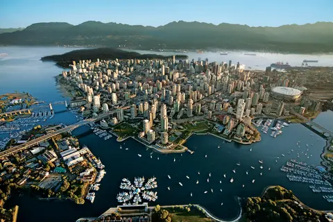
夾嵌在太平洋與海岸山脈之間,溫哥華是通往阿拉斯加內灣航道的天然門戶——一座溫帶雨林與玻璃高樓比鄰的城市,珍寶蟹和野生紅鮭定義了足以媲美北美任何城市的太平洋沿岸料理。漫步二十二公里的史丹利公園海堤、在格蘭維爾島市場迷失自我,然後搭渡輪前往維多利亞的愛德華時代風華。阿拉斯加郵輪季節在五月至九月達到高峰,使溫哥華成為世界上最壯麗海洋旅程之一的理想起點。
The Seymour Narrows is a 3-mile/5 km stretch of the Discovery Channel north of Vancouver Island, British Columbia that is notorious for the strength of the tidal currents flowing through it. The average width of the narrows is just 750 meters. During extreme tides, the current through the narrows is subject to severe Venturi effect, resulting in an increased velocity that can reach 15 knots. For much of its modern history, there was an additional hazard in the narrows called Ripple Rock, a shallow obstruction that claimed no fewer than 119 ships and 114 lives. In 1958, after months of tunneling and preparation, Ripple Rock was blown up in the largest commercial, non-nuclear explosion ever recorded in North America. Still, the navigation of Seymour Narrows is dependent on tidal and other conditions, and requires skill and technical accomplishment.
The Queen Charlotte Sound lies between the Queen Charlotte Strait, which winds between Vancouver Island and the British Columbia mainland in the south, and Hecate Strait, which is northward, adjacent to the Haida Gwaii Islands off the Pacific coast of British Columbia. It is a broad reach in the long shipping route called the Inside Passage threading the myriad islands stretching from Washington’s Puget Sound to Alaska.
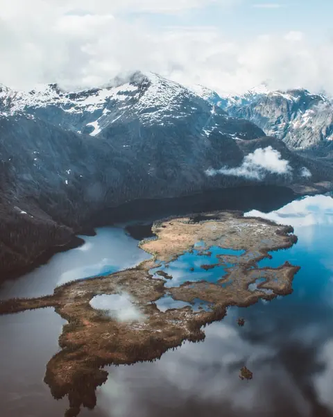
凱奇坎緊貼著阿拉斯加東南狹長地帶雷維亞希赫多島的森林海岸——這座小鎮如此狹長,當地人打趣說它「三英里長、三個街區寬」。千年以來受特林吉特族人推崇為鮭魚豐饒之地,如今它被譽為世界圖騰柱之都:薩克斯曼原住民村與圖騰灣州立歷史公園收藏了這些紀念碑式藝術品全球最重要的集合。溪街——一條建在凱奇坎溪上方的彩色歷史木棧道——是不容錯過的散步去處。夏季(五至九月)天氣最佳,鮭魚在腳下溪流中逆流而上。
In the passage between Sumner Strait and Clarence Strait in Southeast Alaska’s Alexander Archipelago, midway between Price of Wales Island on the west and Zarembo Island on the east, is a small cluster of islands with a picturesque passageway between them called Snow Pass. It makes a scenic up-close route for your Seabourn ship during the transit.
Decision Passage is the western end of the Sumner Strait, which runs through the Alexander Archipelago into the Pacific Ocean in Southeastern Alaska, bounded on the north by Kuiu Island and Cape Decision, the location of a 1932 lighthouse. This is the route your ship takes when coming from or going to the colorful historic community of Sitka on the west coast of Baranof Island, which was originally the Russian fortress town of New Archangel.
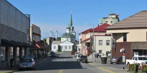
錫特卡坐落在東南阿拉斯加巴拉諾夫島狂野的西海岸,是太平洋西北地區歷史最厚重的港口之一——俄羅斯東正教的洋蔥圓頂在圖騰柱上方升起,古老的溫帶雨林延伸至水邊。錫特卡國家歷史公園保存了一八〇四年特林吉特戰士與俄羅斯殖民者之間的戰場遺址,以及一批壯觀的紀念柱群。賞鯨、海上皮艇穿梭於海獺群間,以及在周圍荒野中尋覓棕熊,構成了戶外體驗的核心。五月至九月提供最宜人且光線最充沛的造訪條件。
Yakutat Bay is 18 miles wide at its entry, and cuts from the Gulf of Alaska into Disenchantment Bay, the entryway to the huge Hubbard Glacier, North America’s largest tidewater glacier. As the bay narrows and the shorelines draw closer, the 400-foot face of the glacier exerts a luminous, ghostly presence, often from as much as 30 miles away. More and more floating ice dimples the surface of the water, and seals bob up and disappear again. The chilled air from the glacier flows in a downdraft of cold that gives rise to mists and gray clouds, through which the vivid blue of the ice wall shimmers. It is an impressive sight of nature’s immense raw workplace, shaping the earth itself as part of an endless cycle of water from the sea evaporating to the sky, falling as snow on the heights and inching over centuries back again to the sea.
The Hubbard Glacier is the largest, and one of the most spectacular tidewater glaciers in North America. Its ice cliffs, some 400’ (121 m) tall, calve icebergs into the fjord, which may frequently be larger than a five-story building. The glacier’s surface is creased and contorted, resembling the wrinkled skin of a giant elephant. Records show it has been growing in thickness and advancing since 1895. This stands in stark contrast to other glaciers around the world, most of which have been receding during the past century. In 2002, the glacier blocked Russell Fjord for two and a half months, raising water levels 61’ (18 m) and threatening local communities with flooding. Nutrient-rich waters along the glacier face attract many species. Gulls and kittiwake colonies adorn smaller islands and harbor seals patrol the icy waters. In 1890, Israel Russell explored the area of Yakutat Bay and Hubbard Glacier, naming it after Gardiner G. Hubbard, a financier of his expedition and a founder and the first president of the National Geographic Society. VIEW CRUISES
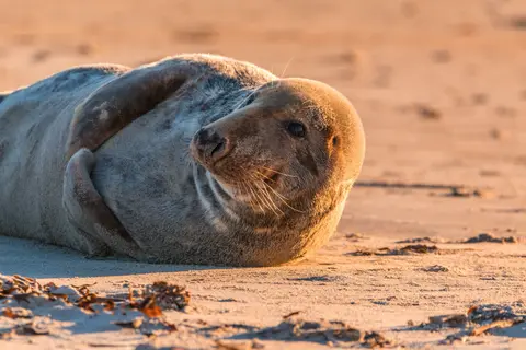
伊尼安群島是阿拉斯加十字灣入口處一簇荒野無人的島嶼,以非凡的野生動物邂逅聞名,包括座頭鯨泡泡網餵食與龐大的史特拉海獅群落。必做體驗包括沿島嶼岩岸的橡皮艇遊覽、觀看鯨魚合作捕食,以及探索充滿海洋生物的潮池。七月至八月鯨魚活動高峰期,海況也最理想。
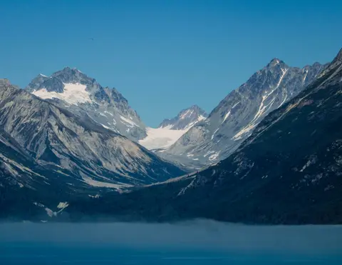
冰峽角是阿拉斯加一座以令人嘆為觀止的自然之美和豐富的特林吉特原住民文化聞名的港口。必訪體驗包括品嚐新鮮的當地海鮮和前往冰河灣國家公園的野生動物觀光行程。最佳造訪季節為夏季月份,天氣溫和、野生動物豐富。
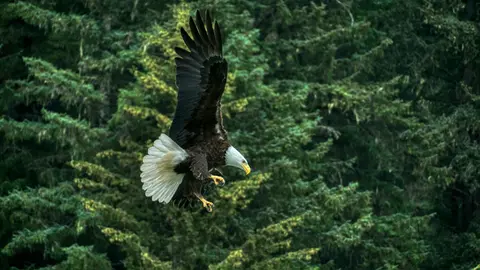
海恩斯是北美最深峽灣上的一座真實阿拉斯加小鎮,擁有世界上最大的白頭海鵰聚集——多達四千隻鳥兒沿著奇爾卡特河棲息——以及保存特林吉特文化傳統的蓬勃藝術社區。六月至八月經由冠達或林德布拉德造訪,體驗直升機冰川降落和海岸健行,或十月至二月前來見證讓海恩斯成為阿拉斯加保守得最好的秘密的非凡海鵰奇觀。
Lynn Canal is a 90-mile long inlet into Alaska’s coast running from the Chilkat River in the north to the Chatham Strait and Stephens Passage in the south. Because it connects the towns of Skagway and Haines to Juneau and the rest of the Inside Passage, it is an important shipping lane for ferries, cargo and cruise ships, and was a crucial passageway to the Klondike gold fields during the Gold Rush. It was discovered by Joseph Whidbey in 1794 and named by George Vancouver after his birthplace, King’s Lynn in Norfolk, England. More than 2,000 feet in depth, it is one of the deepest and longest fjords in the world, and the deepest in North America outside Greenland.
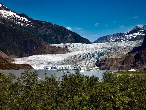
朱諾是美國唯一一座無法以公路抵達的州首府,以令人屏息的荒野壯麗回報每一位長途跋涉的旅人。門登霍爾冰川——一條活生生的古冰之河——距市中心僅十五分鐘車程,而水上飛機基地與漁具店就在港邊交錯。不可錯過的體驗包括搭直升機降落在冰川上、在特雷西灣近距離觀賞冰山崩解,以及品嘗剛捕撈的帝王蟹。五月至九月的航季中,座頭鯨在水道中噴水躍出。
Day 1
夾嵌在太平洋與海岸山脈之間,溫哥華是通往阿拉斯加內灣航道的天然門戶——一座溫帶雨林與玻璃高樓比鄰的城市,珍寶蟹和野生紅鮭定義了足以媲美北美任何城市的太平洋沿岸料理。漫步二十二公里的史丹利公園海堤、在格蘭維爾島市場迷失自我,然後搭渡輪前往維多利亞的愛德華時代風華。阿拉斯加郵輪季節在五月至九月達到高峰,使溫哥華成為世界上最壯麗海洋旅程之一的理想起點。
The Seymour Narrows is a 3-mile/5 km stretch of the Discovery Channel north of Vancouver Island, British Columbia that is notorious for the strength of the tidal currents flowing through it. The average width of the narrows is just 750 meters. During extreme tides, the current through the narrows is subject to severe Venturi effect, resulting in an increased velocity that can reach 15 knots. For much of its modern history, there was an additional hazard in the narrows called Ripple Rock, a shallow obstruction that claimed no fewer than 119 ships and 114 lives. In 1958, after months of tunneling and preparation, Ripple Rock was blown up in the largest commercial, non-nuclear explosion ever recorded in North America. Still, the navigation of Seymour Narrows is dependent on tidal and other conditions, and requires skill and technical accomplishment.
Day 2
The Queen Charlotte Sound lies between the Queen Charlotte Strait, which winds between Vancouver Island and the British Columbia mainland in the south, and Hecate Strait, which is northward, adjacent to the Haida Gwaii Islands off the Pacific coast of British Columbia. It is a broad reach in the long shipping route called the Inside Passage threading the myriad islands stretching from Washington’s Puget Sound to Alaska.
Day 3
凱奇坎緊貼著阿拉斯加東南狹長地帶雷維亞希赫多島的森林海岸——這座小鎮如此狹長,當地人打趣說它「三英里長、三個街區寬」。千年以來受特林吉特族人推崇為鮭魚豐饒之地,如今它被譽為世界圖騰柱之都:薩克斯曼原住民村與圖騰灣州立歷史公園收藏了這些紀念碑式藝術品全球最重要的集合。溪街——一條建在凱奇坎溪上方的彩色歷史木棧道——是不容錯過的散步去處。夏季(五至九月)天氣最佳,鮭魚在腳下溪流中逆流而上。
In the passage between Sumner Strait and Clarence Strait in Southeast Alaska’s Alexander Archipelago, midway between Price of Wales Island on the west and Zarembo Island on the east, is a small cluster of islands with a picturesque passageway between them called Snow Pass. It makes a scenic up-close route for your Seabourn ship during the transit.
Decision Passage is the western end of the Sumner Strait, which runs through the Alexander Archipelago into the Pacific Ocean in Southeastern Alaska, bounded on the north by Kuiu Island and Cape Decision, the location of a 1932 lighthouse. This is the route your ship takes when coming from or going to the colorful historic community of Sitka on the west coast of Baranof Island, which was originally the Russian fortress town of New Archangel.
Day 4
錫特卡坐落在東南阿拉斯加巴拉諾夫島狂野的西海岸,是太平洋西北地區歷史最厚重的港口之一——俄羅斯東正教的洋蔥圓頂在圖騰柱上方升起,古老的溫帶雨林延伸至水邊。錫特卡國家歷史公園保存了一八〇四年特林吉特戰士與俄羅斯殖民者之間的戰場遺址,以及一批壯觀的紀念柱群。賞鯨、海上皮艇穿梭於海獺群間,以及在周圍荒野中尋覓棕熊,構成了戶外體驗的核心。五月至九月提供最宜人且光線最充沛的造訪條件。
Day 5
Yakutat Bay is 18 miles wide at its entry, and cuts from the Gulf of Alaska into Disenchantment Bay, the entryway to the huge Hubbard Glacier, North America’s largest tidewater glacier. As the bay narrows and the shorelines draw closer, the 400-foot face of the glacier exerts a luminous, ghostly presence, often from as much as 30 miles away. More and more floating ice dimples the surface of the water, and seals bob up and disappear again. The chilled air from the glacier flows in a downdraft of cold that gives rise to mists and gray clouds, through which the vivid blue of the ice wall shimmers. It is an impressive sight of nature’s immense raw workplace, shaping the earth itself as part of an endless cycle of water from the sea evaporating to the sky, falling as snow on the heights and inching over centuries back again to the sea.
The Hubbard Glacier is the largest, and one of the most spectacular tidewater glaciers in North America. Its ice cliffs, some 400’ (121 m) tall, calve icebergs into the fjord, which may frequently be larger than a five-story building. The glacier’s surface is creased and contorted, resembling the wrinkled skin of a giant elephant. Records show it has been growing in thickness and advancing since 1895. This stands in stark contrast to other glaciers around the world, most of which have been receding during the past century. In 2002, the glacier blocked Russell Fjord for two and a half months, raising water levels 61’ (18 m) and threatening local communities with flooding. Nutrient-rich waters along the glacier face attract many species. Gulls and kittiwake colonies adorn smaller islands and harbor seals patrol the icy waters. In 1890, Israel Russell explored the area of Yakutat Bay and Hubbard Glacier, naming it after Gardiner G. Hubbard, a financier of his expedition and a founder and the first president of the National Geographic Society. VIEW CRUISES
Day 6
伊尼安群島是阿拉斯加十字灣入口處一簇荒野無人的島嶼,以非凡的野生動物邂逅聞名,包括座頭鯨泡泡網餵食與龐大的史特拉海獅群落。必做體驗包括沿島嶼岩岸的橡皮艇遊覽、觀看鯨魚合作捕食,以及探索充滿海洋生物的潮池。七月至八月鯨魚活動高峰期,海況也最理想。
冰峽角是阿拉斯加一座以令人嘆為觀止的自然之美和豐富的特林吉特原住民文化聞名的港口。必訪體驗包括品嚐新鮮的當地海鮮和前往冰河灣國家公園的野生動物觀光行程。最佳造訪季節為夏季月份,天氣溫和、野生動物豐富。
Day 7
海恩斯是北美最深峽灣上的一座真實阿拉斯加小鎮,擁有世界上最大的白頭海鵰聚集——多達四千隻鳥兒沿著奇爾卡特河棲息——以及保存特林吉特文化傳統的蓬勃藝術社區。六月至八月經由冠達或林德布拉德造訪,體驗直升機冰川降落和海岸健行,或十月至二月前來見證讓海恩斯成為阿拉斯加保守得最好的秘密的非凡海鵰奇觀。
Lynn Canal is a 90-mile long inlet into Alaska’s coast running from the Chilkat River in the north to the Chatham Strait and Stephens Passage in the south. Because it connects the towns of Skagway and Haines to Juneau and the rest of the Inside Passage, it is an important shipping lane for ferries, cargo and cruise ships, and was a crucial passageway to the Klondike gold fields during the Gold Rush. It was discovered by Joseph Whidbey in 1794 and named by George Vancouver after his birthplace, King’s Lynn in Norfolk, England. More than 2,000 feet in depth, it is one of the deepest and longest fjords in the world, and the deepest in North America outside Greenland.
Day 8
朱諾是美國唯一一座無法以公路抵達的州首府,以令人屏息的荒野壯麗回報每一位長途跋涉的旅人。門登霍爾冰川——一條活生生的古冰之河——距市中心僅十五分鐘車程,而水上飛機基地與漁具店就在港邊交錯。不可錯過的體驗包括搭直升機降落在冰川上、在特雷西灣近距離觀賞冰山崩解,以及品嘗剛捕撈的帝王蟹。五月至九月的航季中,座頭鯨在水道中噴水躍出。
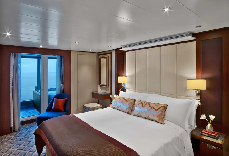
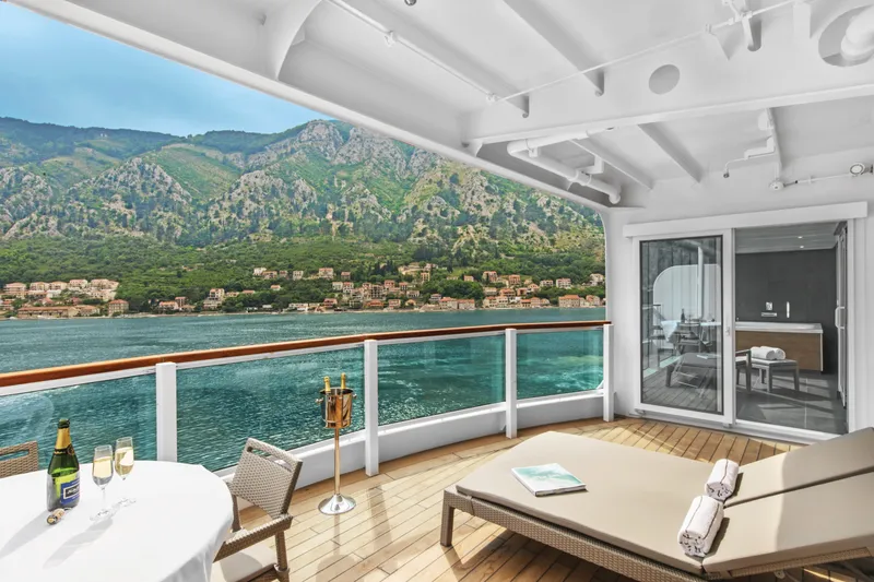

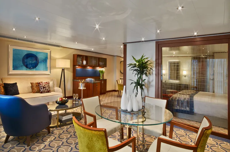
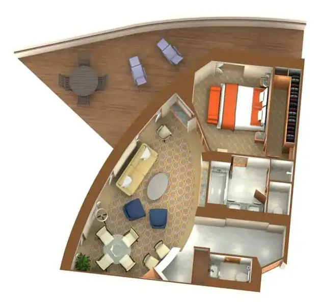
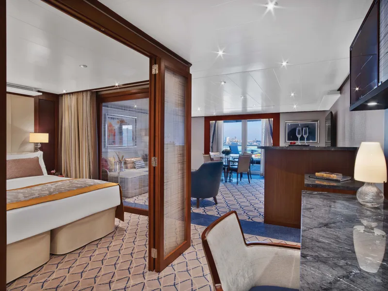


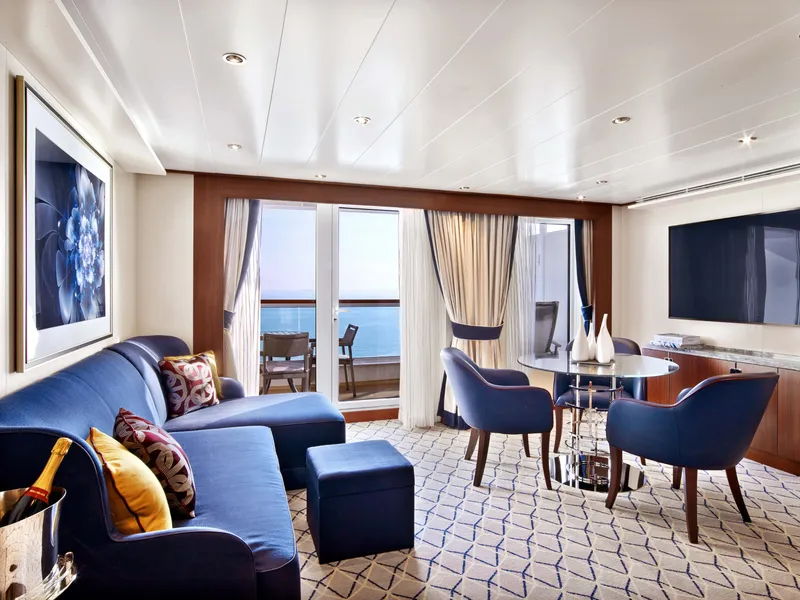

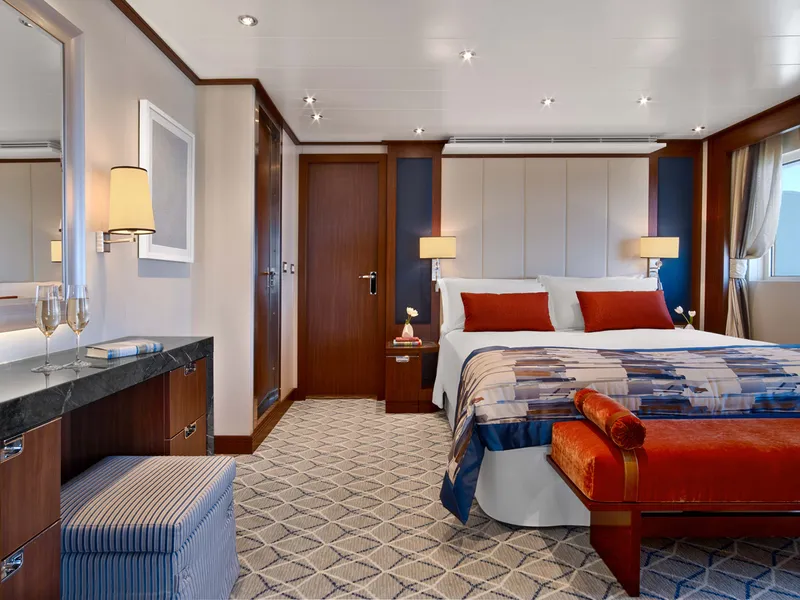
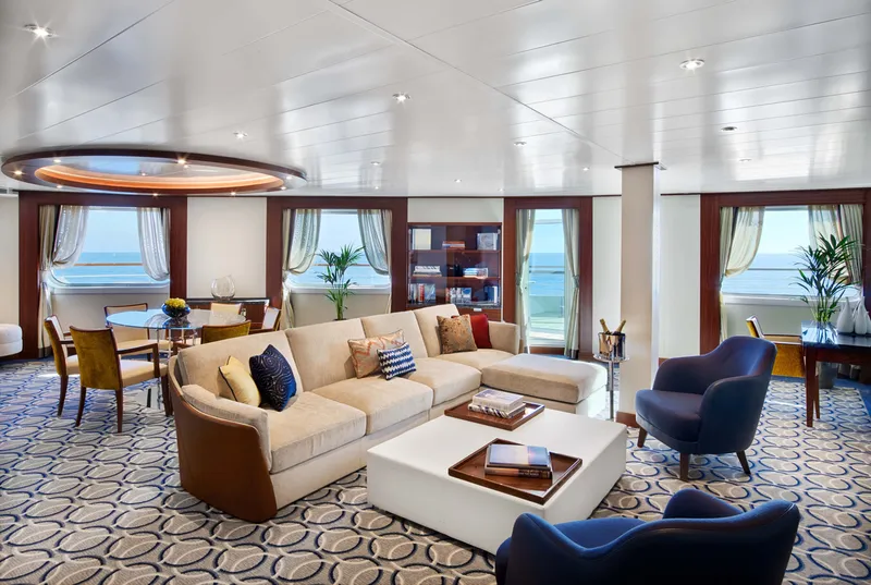

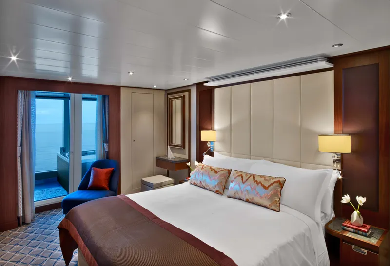
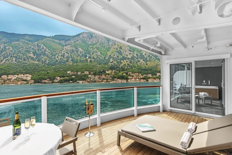

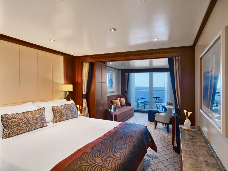
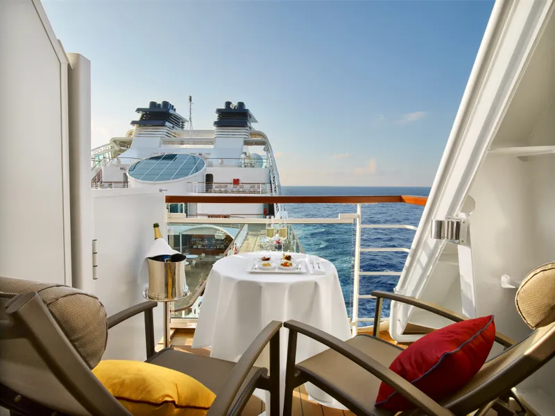

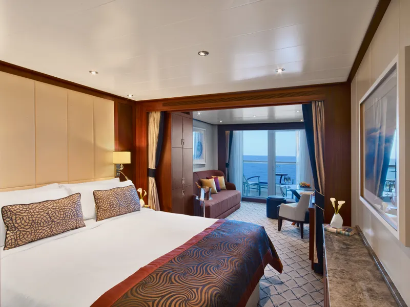
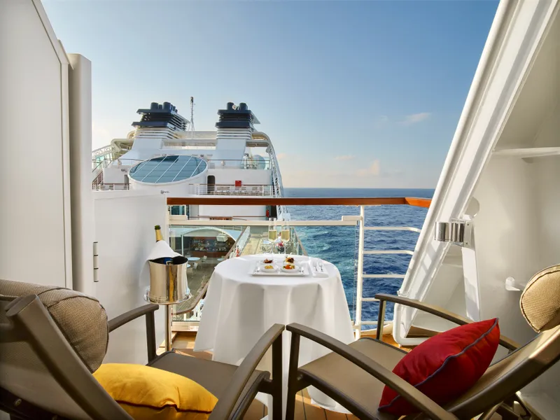

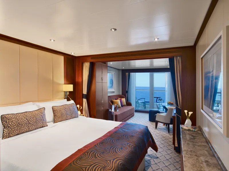

Our cruise specialists can help you find the perfect cabin and the best available pricing.
(+886) 02-2721-7300Contact Advisor